Loopysue
Loopysue
About
- Username
- Loopysue
- Joined
- Visits
- 10,412
- Last Active
- Roles
- Member, ProFantasy
- Points
- 10,161
- Birthday
- June 29, 1966
- Location
- Dorset, England, UK
- Real Name
- Sue Daniel (aka 'Mouse')
- Rank
- Cartographer
- Badges
- 27
Latest Images


-
Banners
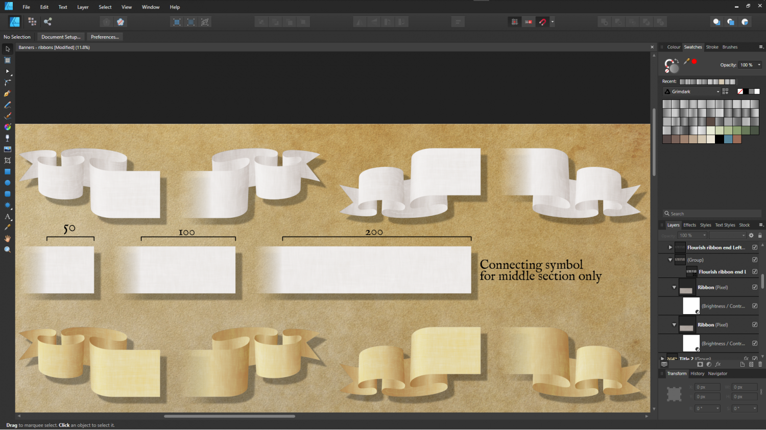
Are these long enough for everyone? :D
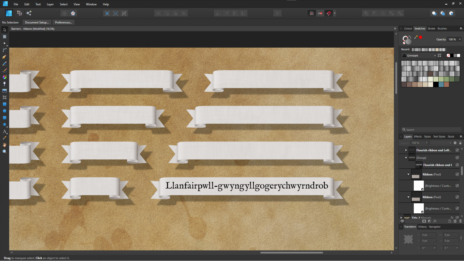
And will a simple middle section connecting symbol bit work for you? The ends of these title bars are still manual, I'm afraid.
![[Deleted User]](https://secure.gravatar.com/avatar/c75d9a245b74d9c59be0999ea81ca541/?default=https%3A%2F%2Fvanillicon.com%2F92add7f8c954488718110edc4896ad39_200.png&rating=g&size=200)


-
Grimdark Fantasy (renamed "Darklands") - development thread
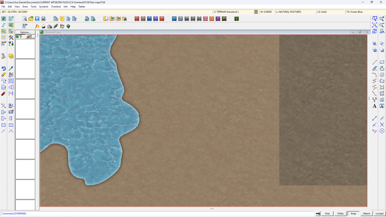
This is how the sheets lie (please ignore the Effects Presets, which refer to the base template I used to build this on and not the style I'm making):
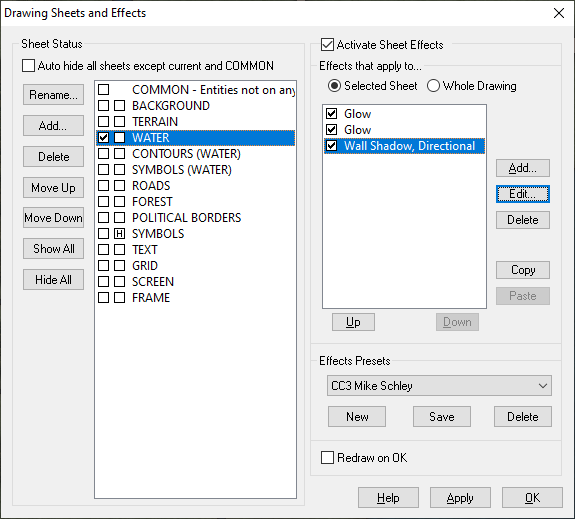
The WATER sheet lies above the land, not underneath it. The BACKGROUND is a parchment texture, the TERRAIN is a sheet with lots of green and brown patches blurred and blended into the parchment.
These are the 3 sheet effects on the WATER sheet. Please bear in mind that all these effects are set to map units, and that you might have to adjust them to suit your own map. This is more about the balance between the second glow and the directional shadow - they need to balance for the effect to work.
Also bear in mind that this will only work over relatively narrow bands because it is only an illusion - a fake bevel.
First I have a thin dark line to properly define the coast
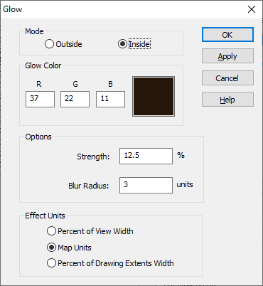
Then I have a pale glow set to Outside. I'm using a pale yellow here so that it hopefully matches any of the set terrain colours that might come to the coast.
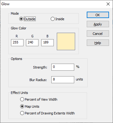
And finally a dark directional shadow set in opposition to the default sun direction (which is 315 degrees)
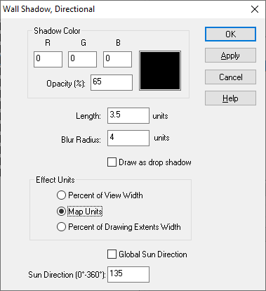
If it doesn't work immediately on your map remember that this is not a true bevel. You may have to fiddle around with the numbers quite a bit to get it to look right.


-
Project Spectrum - Part 2
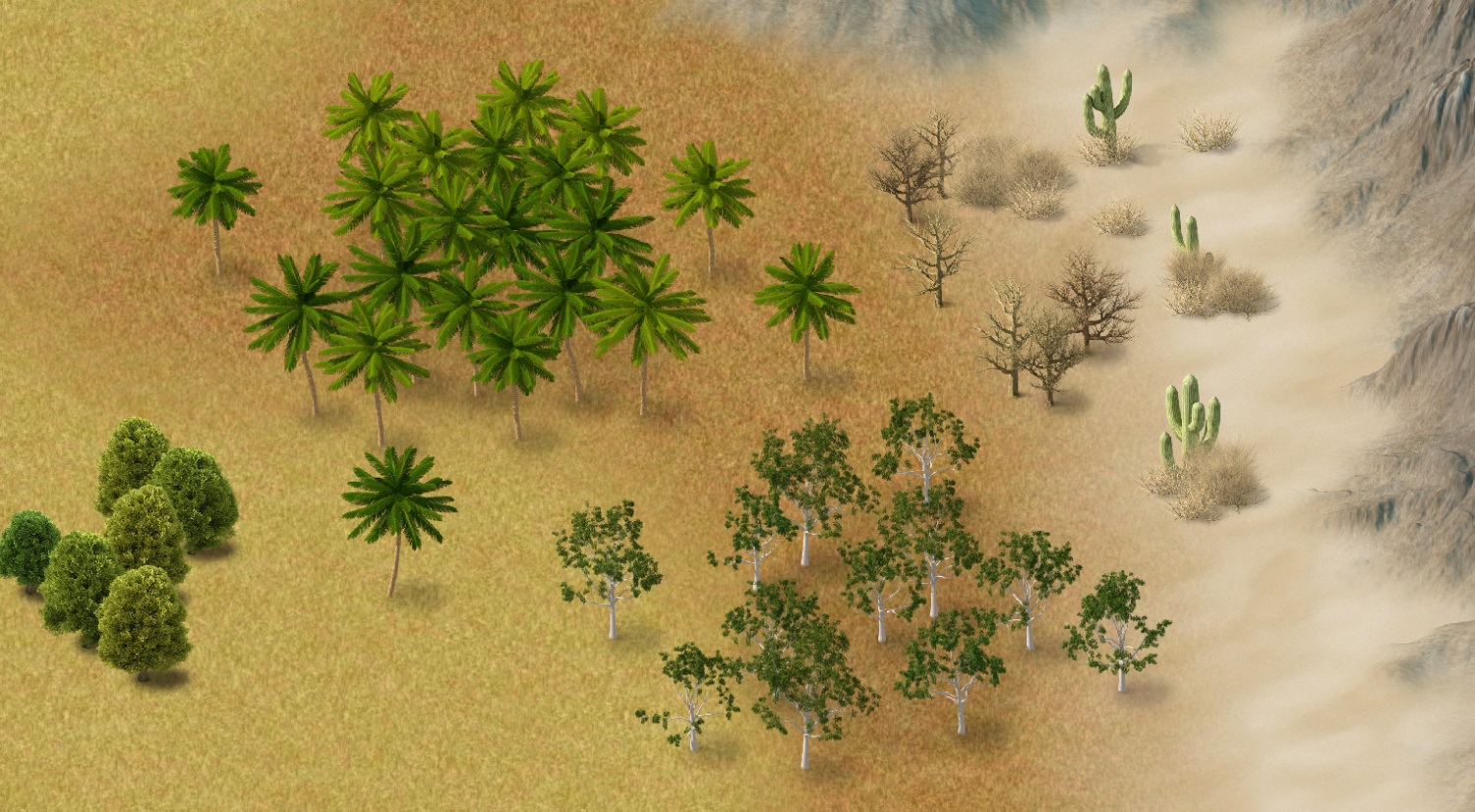
Not sure if they would double for birch because the leaves are quite dark, but you could scale them differentially to make them slimmer.
Been working on everything I've done so far together today - to get things like relative contrast and shadows right. The Joshua trees are in the pipeline, but not yet finished.


-
CC4 Overland Development Thread
I just remembered I hadn't shown the new mesas and buttes. Also 2 new fills - volcanic and wasteland. I think you've seen the red desert before.
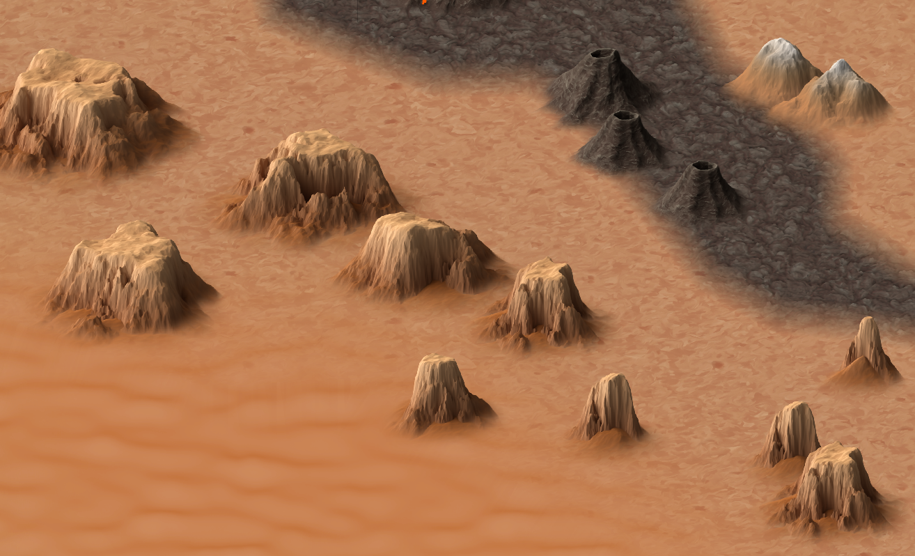
The two small mountains top right in this shot are the varicolour versions, matched with the wasteland fill.


-
CC4 Overland Development Thread
Thank you for sharing all your favourite overland styles and giving me a little information about why they are your favourites. This was a very enlightening thread for me. I hope it was for you too.
This thread is to show the development of CC4 Overland, or as much as might be interesting to you. It's also an opportunity for you to express your thoughts on how it's going and make suggestions about improvements. Not all suggestions will necessarily be incorporated, but they will all be seriously considered.
So far, I've started with the textures. The initial Land texture I showed a glimpse of in the thread linked above ended up being too busy for it's own good, so it was dumbed down quite considerably to be more of a subtle blotchy background for the more important stuff - the terrain textures and symbols to come. There's also a draft ocean texture.
I usually start by doing all the textures first, but I've also been thinking about the mountains, hills, mesas, craters, etc. I needed good reference material and a way to keep my drawings consistent, so I used Blender to create models for myself.
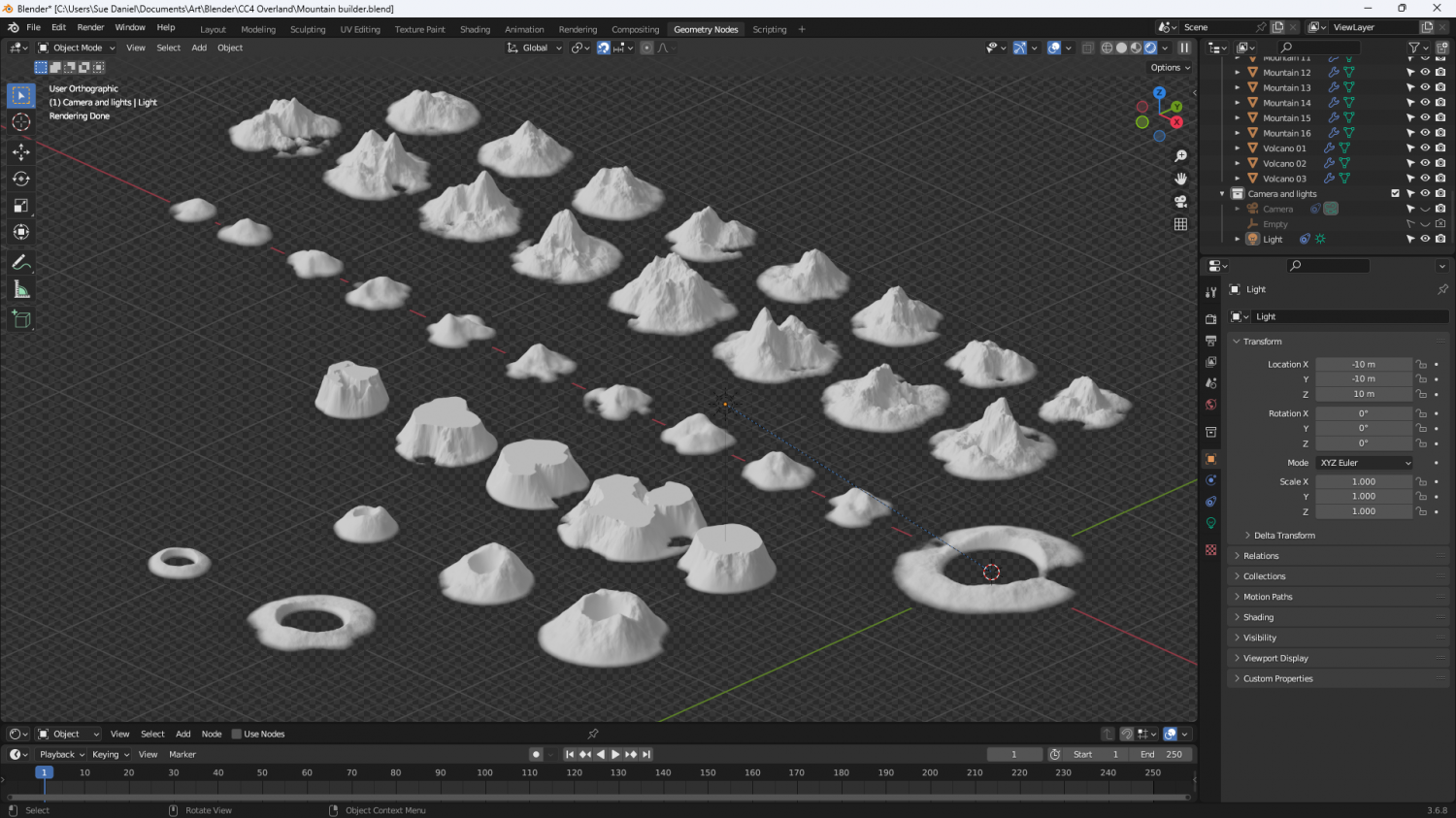
There is a landscape add on available in Blender, but it doesn't provide the right options for me to get what I wanted, so I made my own set of geometry nodes. I know there are other Blender enthusiasts among you, so here are the nodes for the mountains if you want to have a go at making one of your own. I've scrunched them all up as close as I can so you can read them.
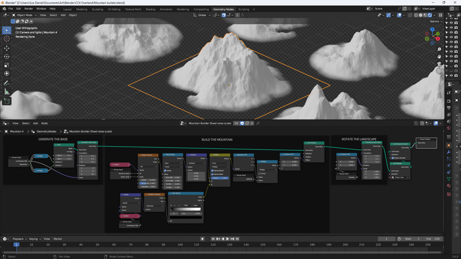
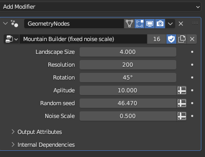
And here are the variables for the active mountain (outlined orange above). My spelling is still really bad. 'Aplitude' is meant to be 'Amplitude'.
Now begins the long process of hand drawing the mountains based on the models I've just made.
Please feel free to comment and make suggestions.


-
God, what a newb...
Hi McCrakan :)
There is a favoured basic order of doing things which can be modified to suit individual preferences. It might be a good idea to work through the example in the CC3+ manual (written by Remy Monsen) to get a practical feel of everything, but basically its:
- Land
- Mountains
- Rivers
- Terrain textures and Forests
- Structures
- Ocean details
Everything has it's own designated sheet, so even if rivers are normally drawn before the terrain textures are laid down the textures will end up underneath the rivers.
There are drawing tools for placing whole forests available in most styles which fall into 2 categories. There's the super dense forest fills and the more scattered result of using a drawing tool based on a Symbols in Area macro. These are easy to tell apart from the thumbnail image in the drawing tool list. There are also drawing tools available for placing mountain chains, though these are mostly in the Mike Schley Overland style and may even be only available in an annual issue (I can't remember now off the top of my head). Speaking of Annuals they are also a great way to learn since every issue of an annual that is a new mapping style (not all issues are new mapping styles) comes with it's own mapping guide. Here is a wall of links to the individual annual issues. The annuals are sold in bundles of years, so if you want one in particular you need that year's annual.
As for suggestions and solutions for issues you might find along the way, that is what the forum and the Facebook Group are for. There are lots of people (most of the real experts are here on the forum) who enjoy helping to solve these things.


-
Free Assets by Sue Daniel
Connecting Hedges (dungeon scale)
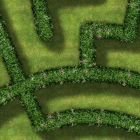
These connecting hedge symbols were created as a fast and functional solution for making dungeon scale hedge mazes in a standard DD3 map. As with all connecting symbols you select the symbol from the catalogue and click at the end of the line you wish to draw your hedge on, then proceed to click along the line as if you are tracing it. A right click at the end of the line completes the process.
Download ZIP file File size: 12MB
The catalogue contains 2 versions of the symbols. The first two are the 3 foot wide hedge and its associated round bush ends intended for use in imperial DD3 maps, and the second two are the 75cm wide metric hedge version of the same thing for metric DD3 maps. The catalogue can be accessed via the Walls button|DD2TILES| in DD3.
Alternatively, if you are navigating to find the catalogue file from any other template it can be found here: @Symbols\User\Sue\Dungeon\Connecting Hedges.FSC


-
Free Assets by Sue Daniel
This thread contains the download files and folders for the smaller sets of symbols and fills I have created over time.
Each set comes in the form of a zip file. Unzip it into your CC3+ data directory (C:\ProgramData\ProFantasy\CC3Plus if you installed it to the default location).
Note that it is the content of the zip files that goes into your data folder, make sure your unzip software does not create any extra directories based on the name of the archive. If you end up with unintended subdirectories, the resources will not work properly.
If you run into problems installing any of these sets, each comment below contains a link to a dedicated More Info thread where you can ask for help if you need to.
Any specific instructions about how to access a set once you have unzipped the folder are given with each download link.
All the following asset packs can be used in maps for the Community Atlas providing you install them as directed.


-
Winter Trail Project
I think I'm done with the heather and grass.
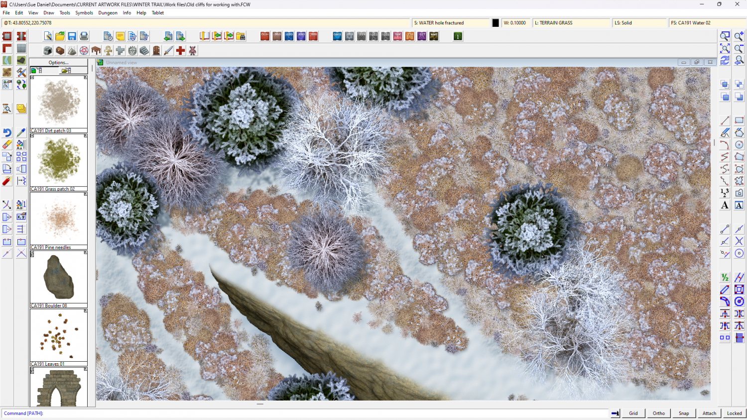
I've also done some ice effects with existing fills from Winter Village last year.
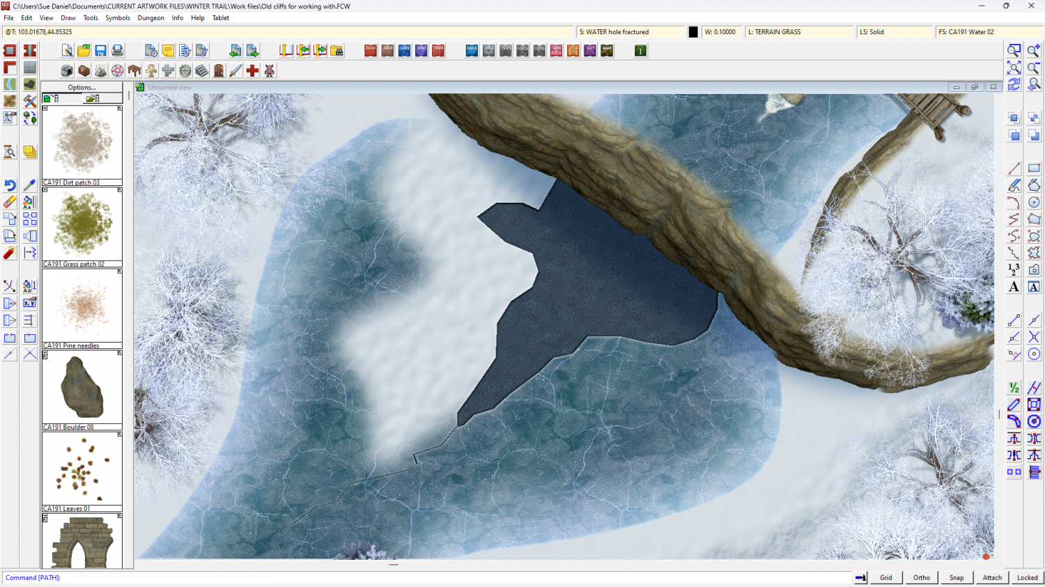
Not much time left to finish this now, so there may not be everything in this one part style that there was in both parts of Forest Trail.
-
Forest Trail project - part 1
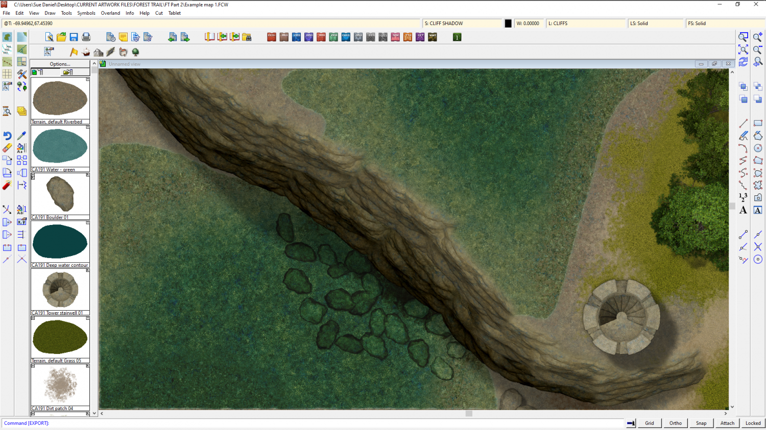
I think I solved the partly wet stepping stone problem ;)
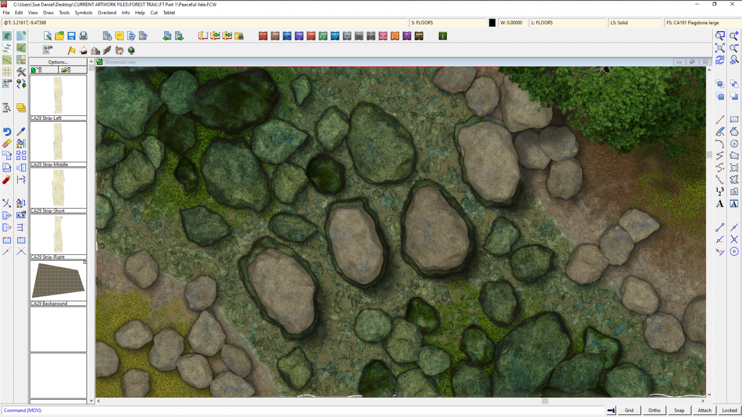
Part 1 has been handed over now and is due to be published as the November issue. Part 2 is all about waterfalls, so I've started with a handful of cliff symbols.