Loopysue
Loopysue
About
- Username
- Loopysue
- Joined
- Visits
- 10,411
- Last Active
- Roles
- Member, ProFantasy
- Points
- 10,161
- Birthday
- June 29, 1966
- Location
- Dorset, England, UK
- Real Name
- Sue Daniel (aka 'Mouse')
- Rank
- Cartographer
- Badges
- 27
Latest Images


-
CA style development - "Darklands City" (issues for September and December 2021)
Ok. The first part is kind of finished, give or take a bit of polishing and file size reduction.
I know a lot of the things that were discussed haven't been included, but that's why there is a part 2 ;)


![[Deleted User]](https://secure.gravatar.com/avatar/c75d9a245b74d9c59be0999ea81ca541/?default=https%3A%2F%2Fvanillicon.com%2F92add7f8c954488718110edc4896ad39_200.png&rating=g&size=200)


-
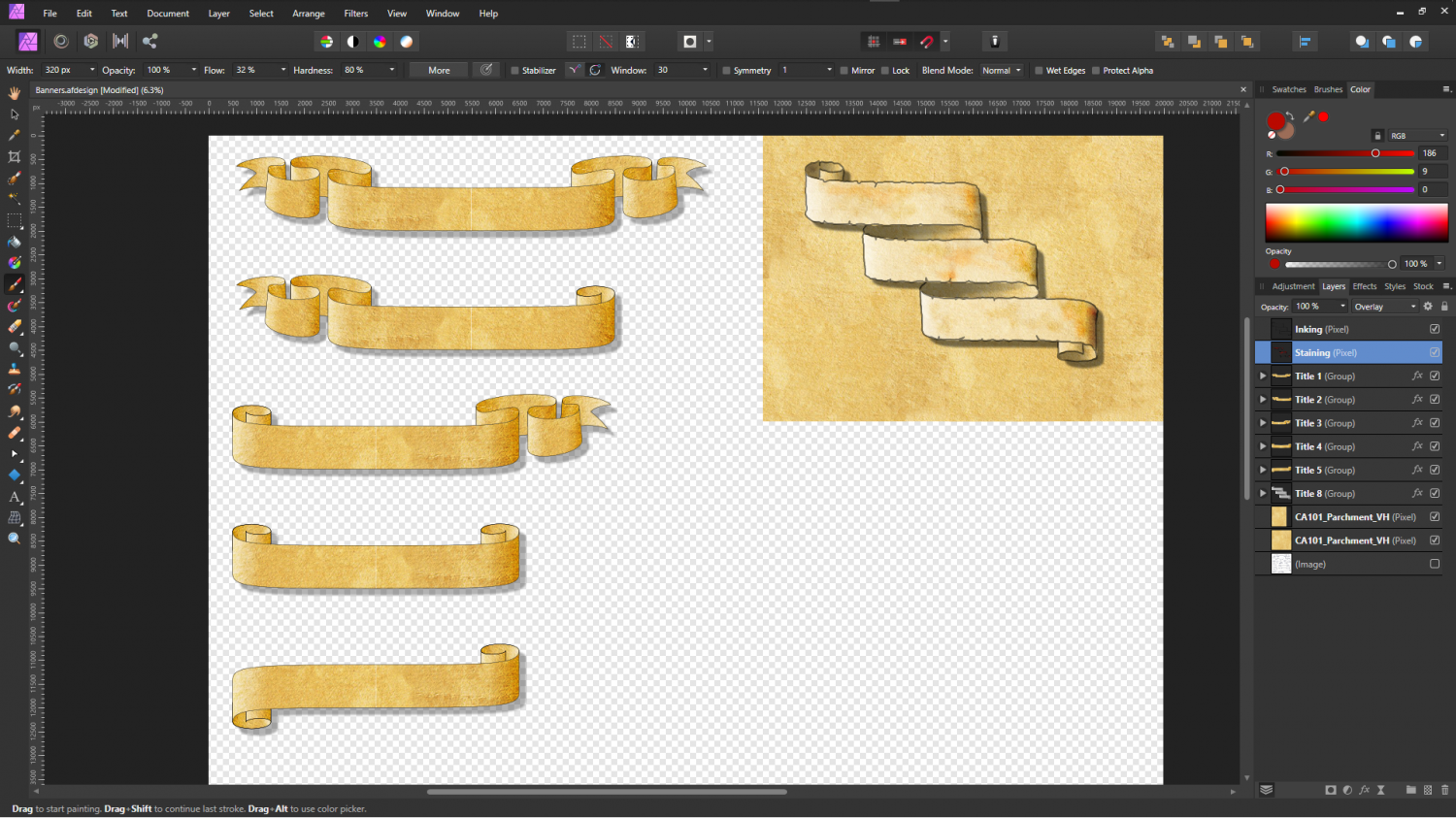
Banners
Thank you :)
I've done a bit more - a few ideas.


-
The Lakes of Michigami (Jerry's Map) - WIP thread
Hi Everyone :)
This is a WIP thread showing the completion of a map that was started a while back by Jerry Thiel. Jerry has done a vast amount of work for the Community Atlas, but sadly owing to Motor Neurone Disease is no longer able to map. I offered to finish a map of his choice for him, and Jerry sent me the FCW for a map based on the Michigan area south of the Great Lakes where he grew up. I also asked if Jerry wanted this to be a private thing, or if he wished me to do a WIP thread. Jerry chose the WIP thread option, so here we go...
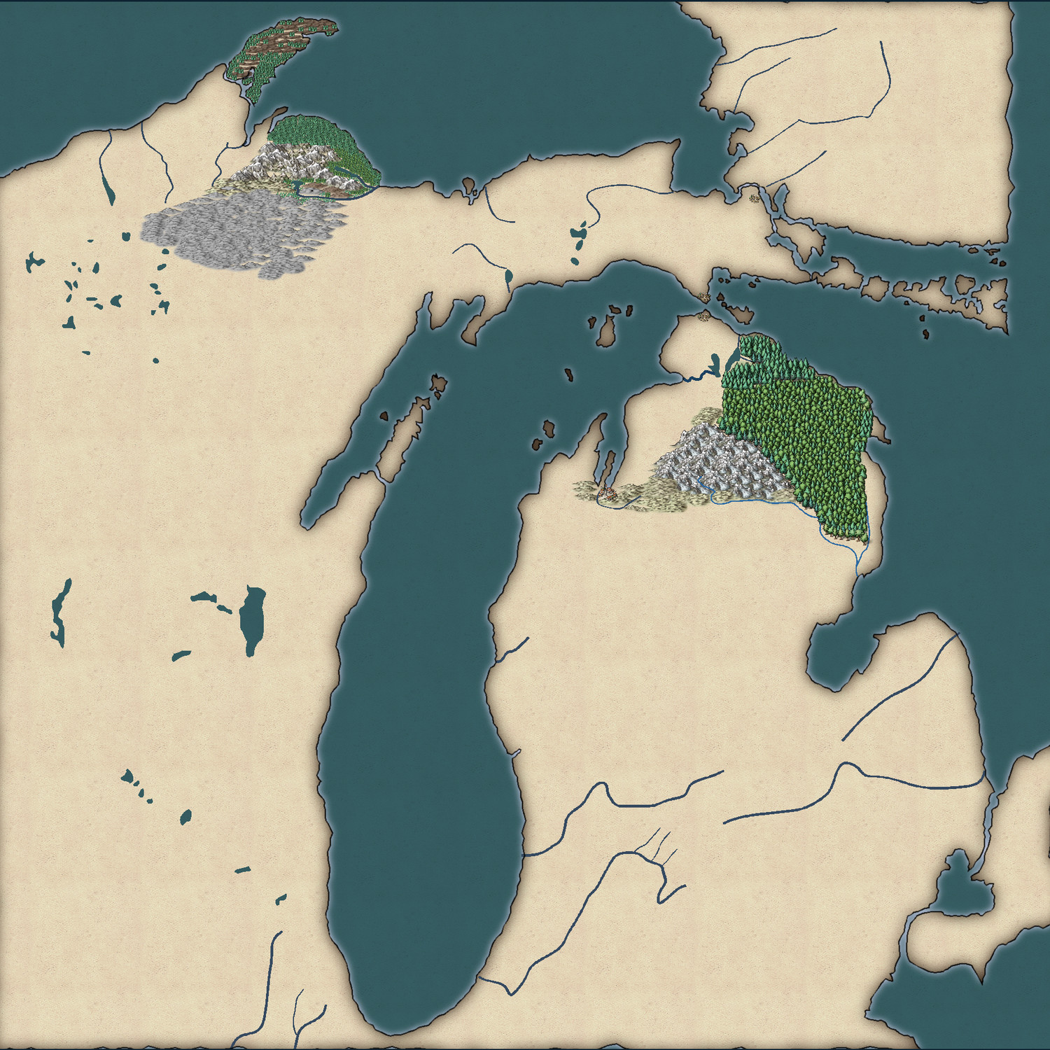
The map (which I have temporarily named "Jerry's Map") is based on the Michigan area around the Great Lakes of North America.
This is what Jerry had to say about the continuation of his map:
"Use any style you want. I was planning on a fantasy world. The big village would have been called "City of the Grand Traverse." The early French explorers called the passage across the large bay from the peninsula tip east, the Grand Traverse, as it shortened their canoe voyage significantly.
The two villages facing each other on the Upper and Lower Peninsulas I pictured as the capitols of two antagonistic city-states.
The narrow peninsula running north from GT Is called Old Mission Peninsula after a small mission church built to service the local Indian reservation. The northern tip of the on the 45 latitude and there is an Indian legend that warriors would gather there on the summer solstice to shoot at the sun to cause it to turn back to the south so that it couldn't escape to leave the world in eternal darkness."
Jerry - please feel free to comment and guide as we go. It is, after all, your map I'm working on :)


-
October challenge: Drummond Street WIP
I think I'm more or less done with this map now.
I'm open to suggestions if you have any :)
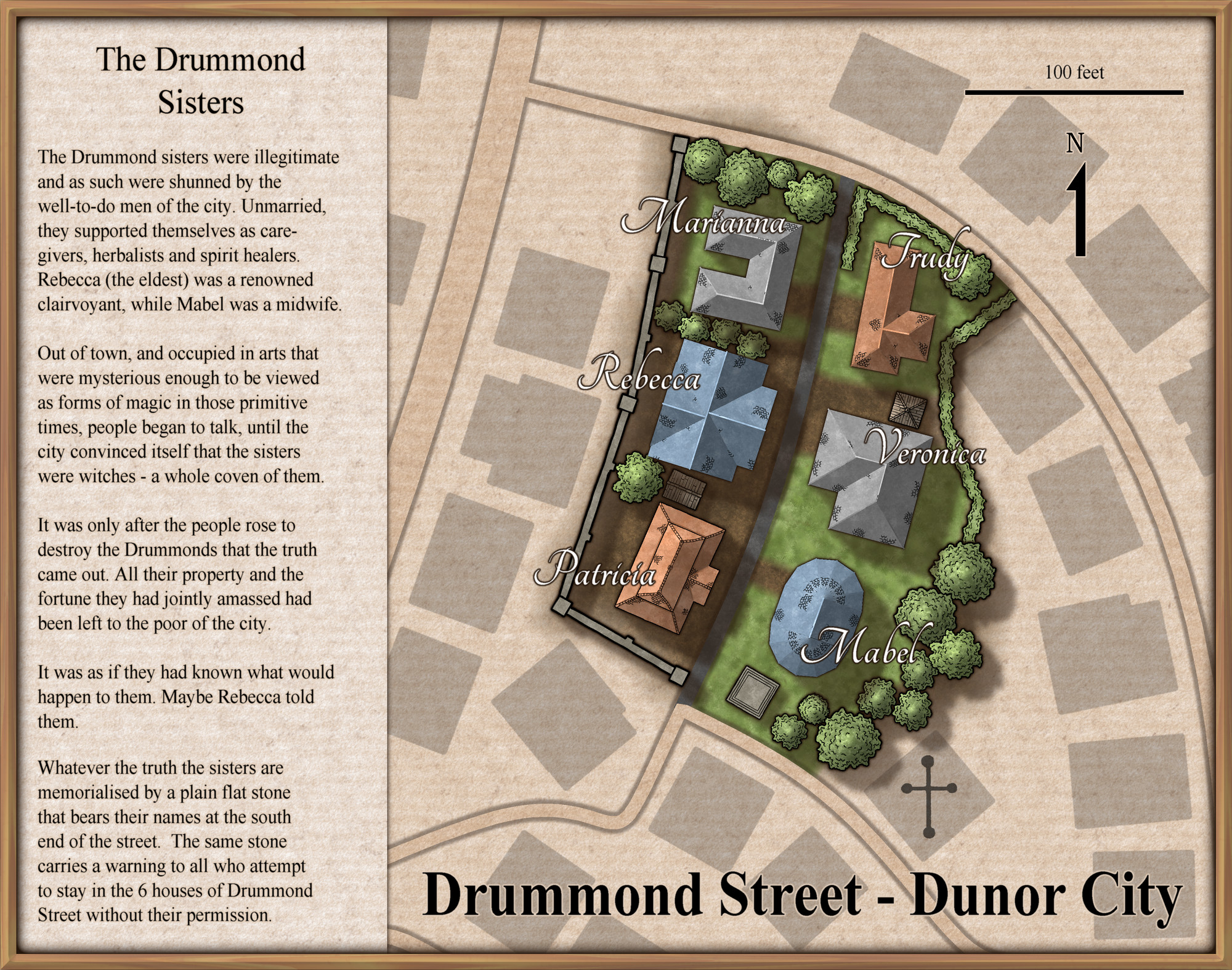
@Monsen Should I do anything special to the FCW before I put this on your main thread?


-
Project Spectrum - Part 2
No, it's not just you, Medio. It does look better zoomed in. I think this is probably one of those styles that suit small regional maps more than world maps, but you can use it either way.
Here are the last few symbols for part 2. There are a few more in progress, but the completion date is today/tomorrow, so these are (officially at least) the last ones shown with a few of the existing trees and hills for scale. It might be worth noting that I have reduced the inner opacity on the edge fade of the farmland to 80 from 100. That makes it easier to see the symbols.


-
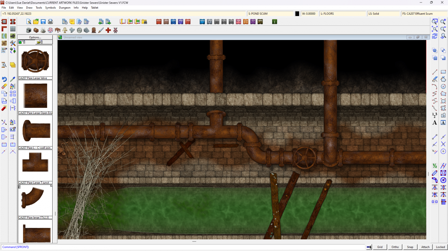
Sinister Sewers - Style Development Thread (CA207)
Thanks for all your comments, everyone. Your thoughts trigger my thoughts, as always.
While I was thinking about all of that, however, I did some rusty old pipes for the set.


-
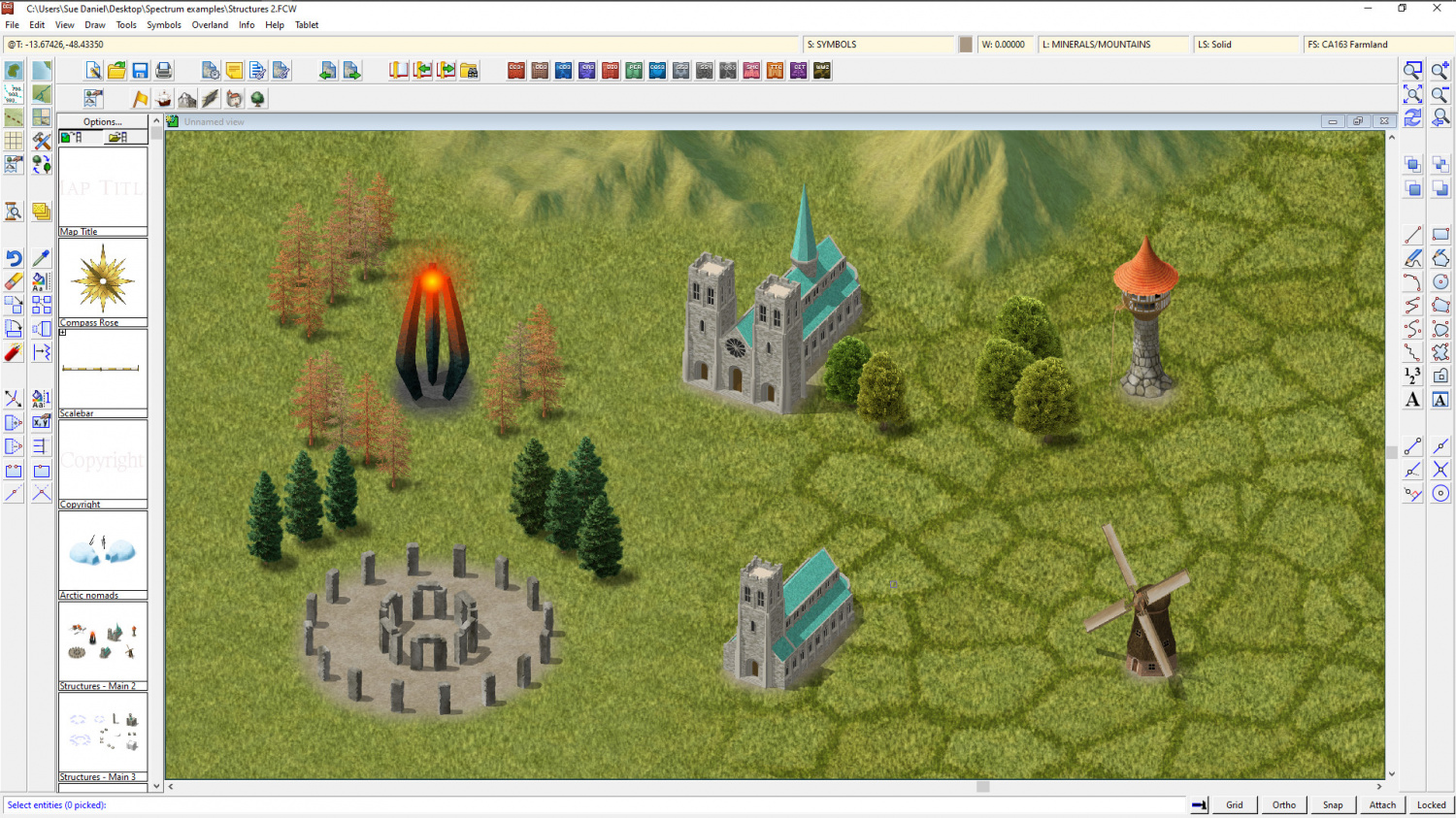
Project Spectrum - Part 2
Well, I've still not done the swamp trees, but I've added a few more bits and bobs to the temperate zone vegetation.
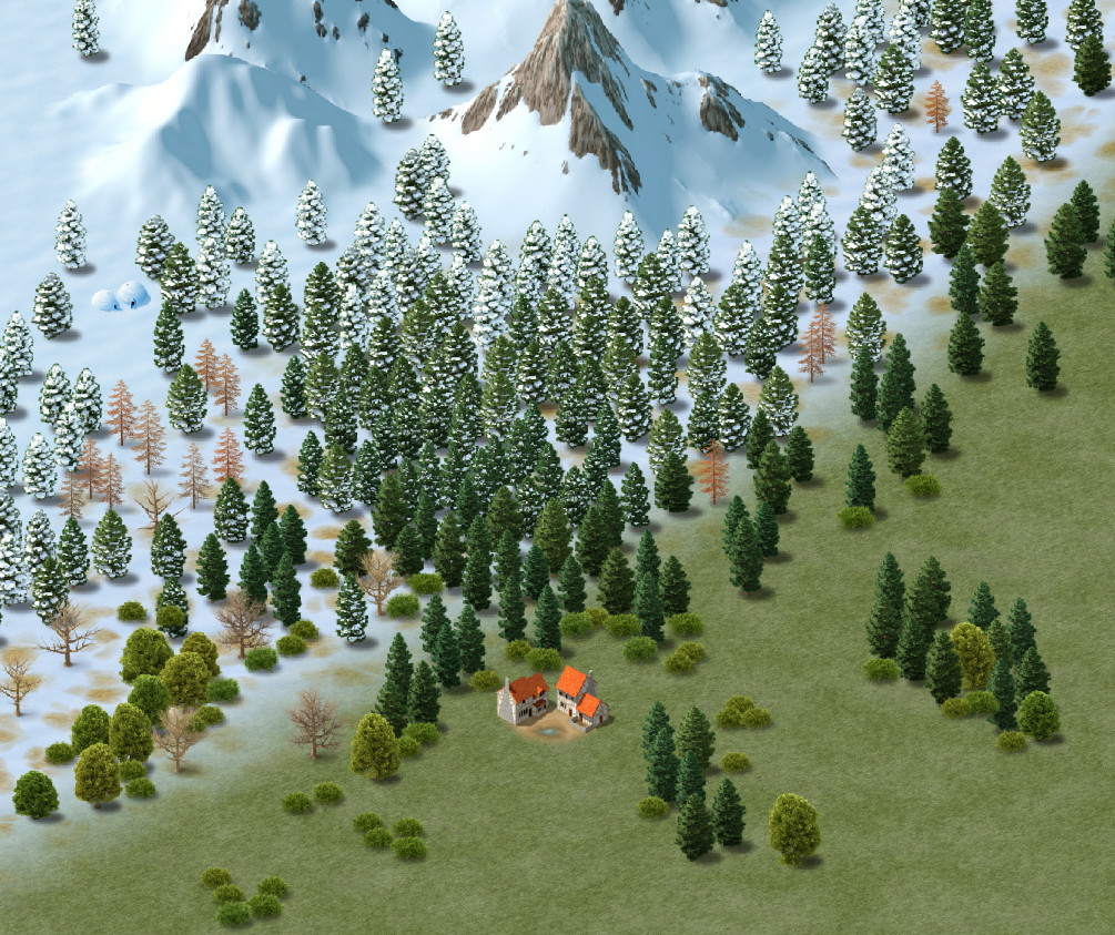
This could be a bit of a game for you. There are actually 2 structures in this shot. I bet you can't spot the new one ?


-
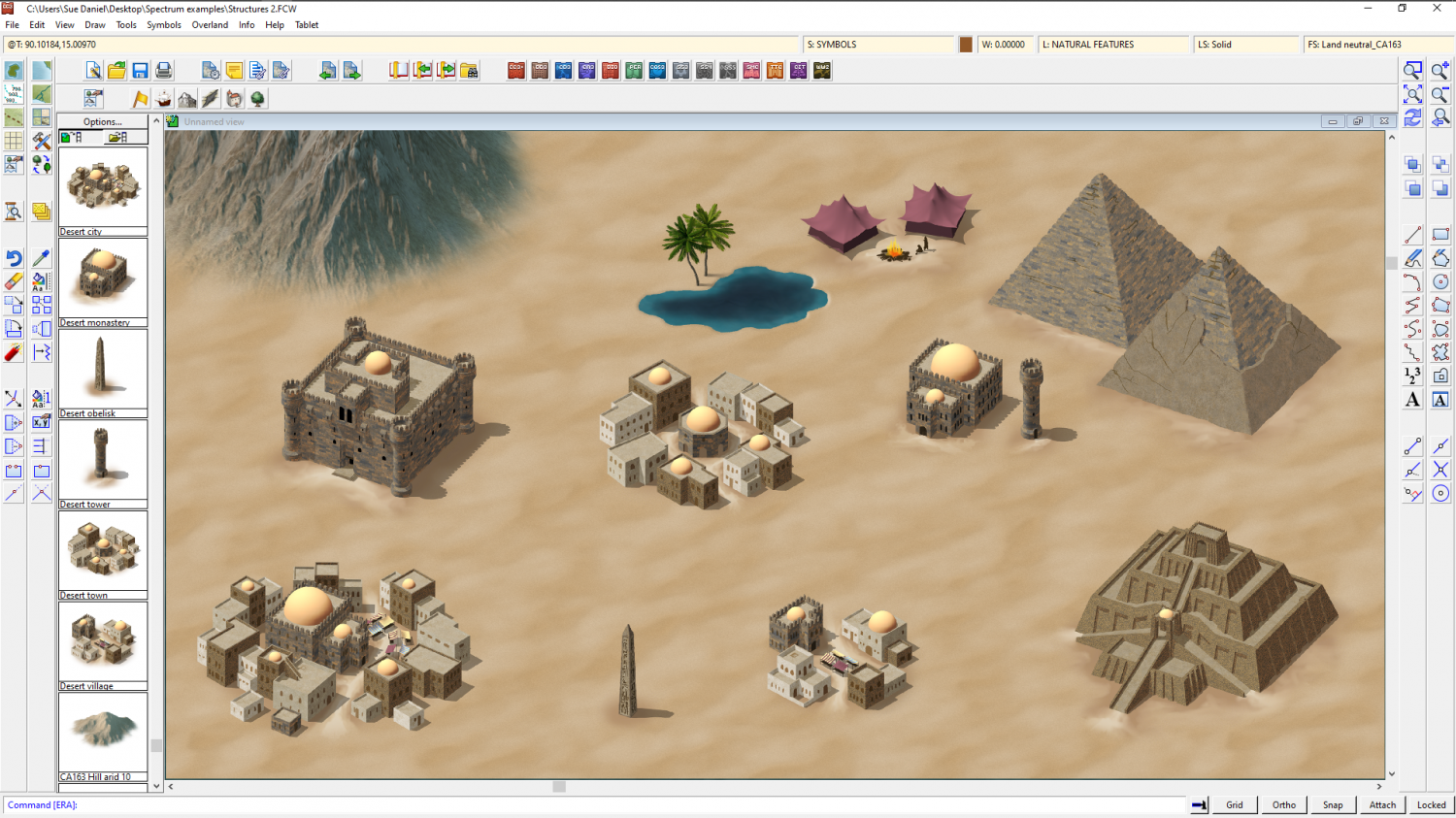
Project Spectrum - Part 2
Here are the desert symbols all done up.

-
Free symbol pack - Dungeon scale connecting hedges
I made these connecting symbols 4 years ago back in 2019. It was the first connecting symbol I ever made, so it isn't drawn to the same standard I prefer to use today. However, it still works well enough if all you want is a really fast maze map. The connecting hedge doesn't officially match any particular dungeon style, but it works reasonably well in a DD3 dungeon map as shown below.
The pack contains one set of connecting hedge symbols and a symbol catalog with two options. The first pair of symbols in the catalog are the original imperial hedge that is 3 feet wide with it's associated 3ft diameter end bushes. The second pair of symbols is a metric conversion of the same, where the hedge is 75cm wide. If you have problems with hedges looking broken or sticking out too far at the corners the most likely cause is that you are using the metric hedges in an imperial map, or the imperial hedges in a metric map.
The connecting hedge pack can be downloaded here
Here is an example of the hedge used to make a maze map in DD3.
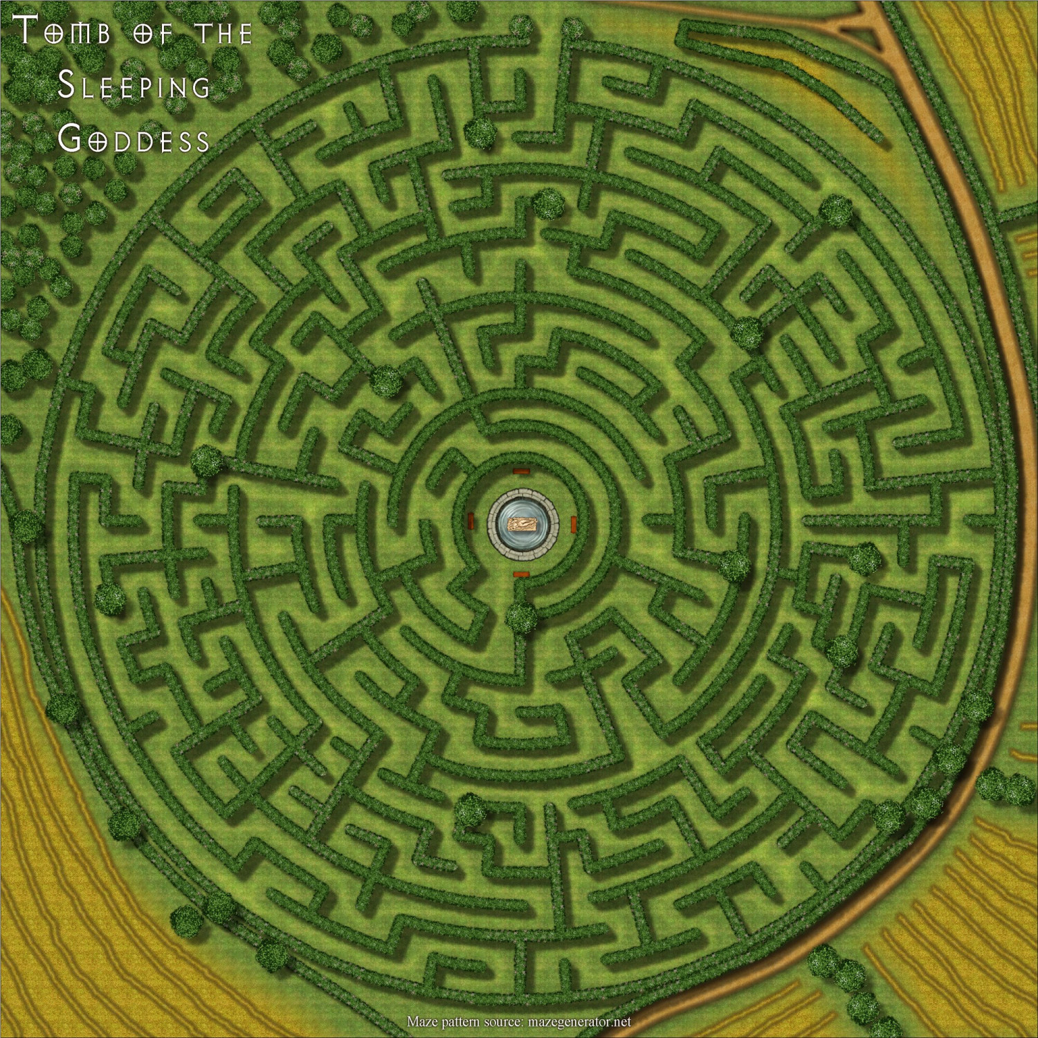
Maze pattern source: mazegenerator.net (licence required for commercial use)
Useful tip: When you have finished drawing your maze, use the round hedges to cover any visible joins at the corners.


-
Forest Trail project - part 1
I've added a button to show and hide the trees for ease of use as a battlemap.
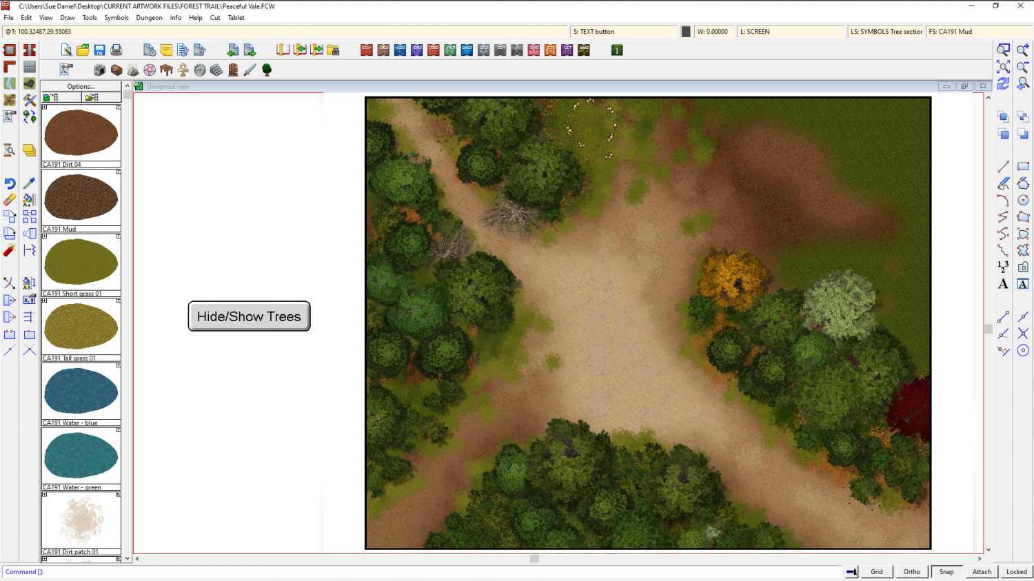
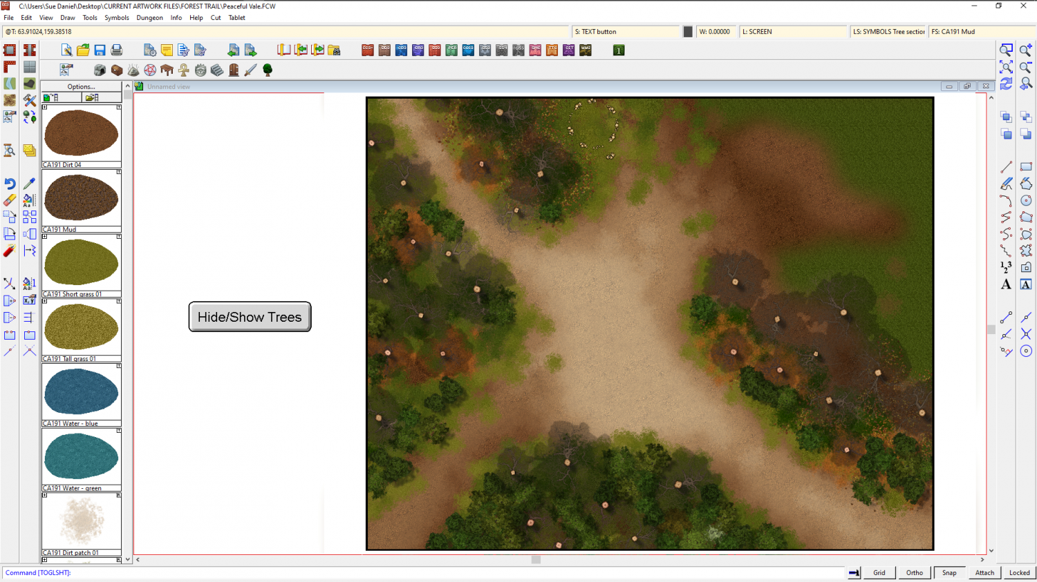
I'd be interested to know what you think of the tree shadow idea to mark the presence of 'cover'.