Loopysue
Loopysue
About
- Username
- Loopysue
- Joined
- Visits
- 10,413
- Last Active
- Roles
- Member, ProFantasy
- Points
- 10,161
- Birthday
- June 29, 1966
- Location
- Dorset, England, UK
- Real Name
- Sue Daniel (aka 'Mouse')
- Rank
- Cartographer
- Badges
- 27
Latest Images


-
Map Blanking Out When Moving From Last Entry
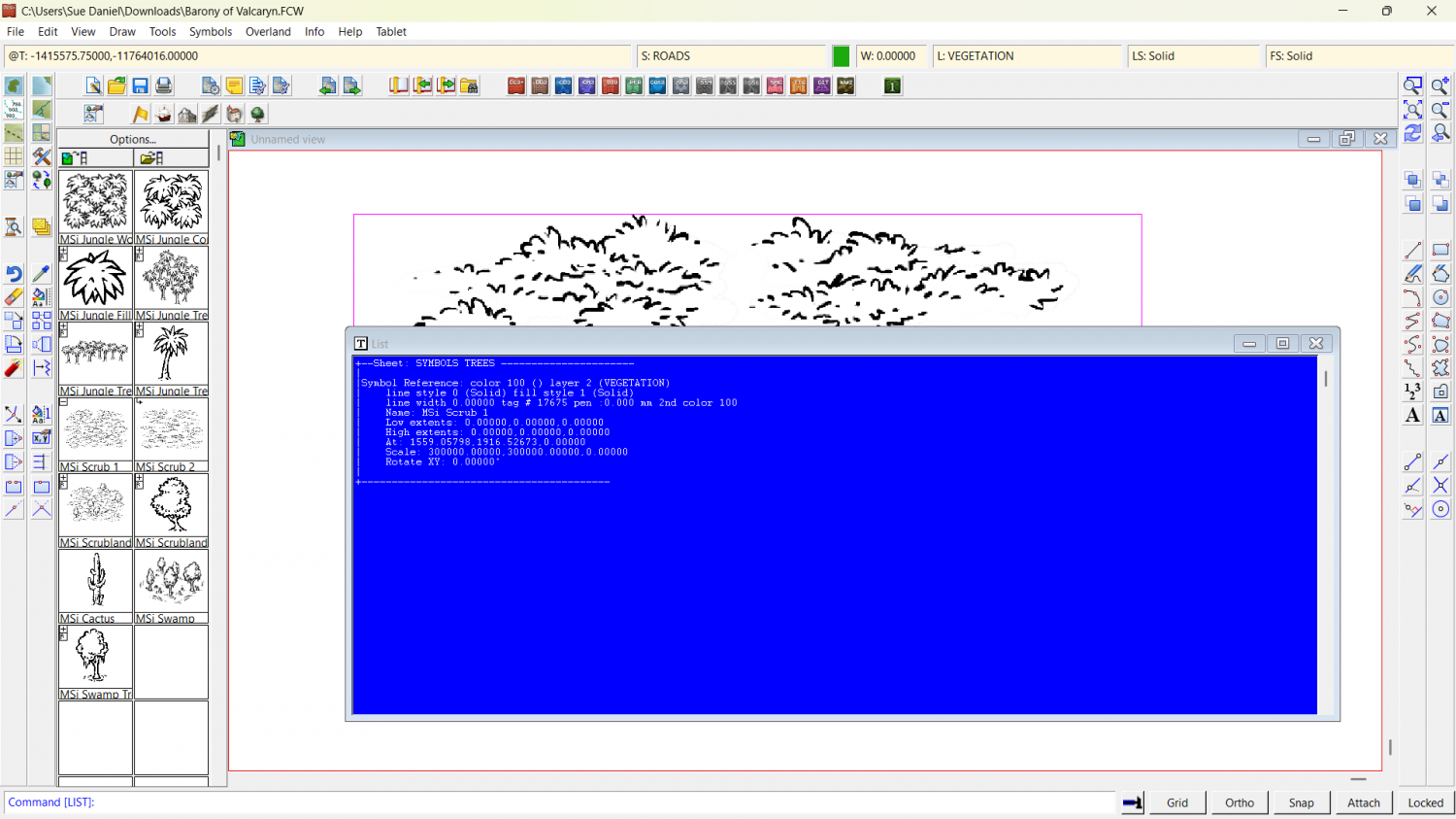
Hi Mike :)
For some reason there is a humungously gigantic copy of that very same symbol pasted in the drawing that completely dwarfs the entire map to the relative size of a pinhead. What you see is the one symbol that is 300,000 x the default scale. I have deleted it in the attached copy of your map.
If it happens again, check what scale you are pasting symbols at (right click while you have a symbol on the crosshair), and hit the Set Normal button if necessary.
I discovered the size by using List in the Info menu on that one symbol.


-
Change Default Sea Colour
Do you mean something like this?
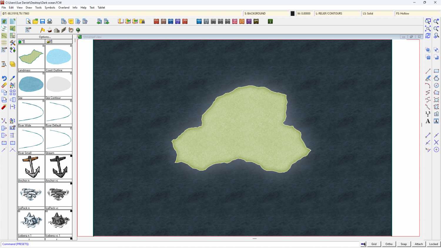
I notice that the land in that image is also very dark. I can see a potential problem arising if you want to remake this map with everything darker than this relatively pale style, since it's very difficult to make the symbols darker. If that's where you are going with this map it might be better to chose a darker style to start with. However, no other overland style has such an extensive range of symbols as the Mike Schley Overland style.
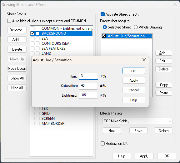
I hid the COASTLINE sheet and added effects to the BACKGROUND sheet and the LAND sheet. I haven't deleted any existing effects.
Here is the FCW if you want to look at what I've done.


-
CC4?
We are working hard on it. However, since my part in the whole thing is creating new assets for just a bit of it I can't really throw much light on anything else.


-
Middan'ord: The Realmdom of Thwendar
Why should I hate you?
They look good :)
I have to be very careful not to use AI generated art in my work. There are too many foggy areas around copyright. Everything I make for Profantasy has to be squeaky clean, for obvious reasons.


-
Live Mapping: Cosmographer Satellite
In this week's Live Mapping, and inspired by last week's Birdseye Continental style, Ralf will be tackling another texture-based style with Satellite Overland from Cosmographer 3.
Come along and join in the chat on Youtube here:
https://www.youtube.com/watch?v=2mTNHKgjQ6g
Or watch it on the forum here*
*This thread isn't monitored during the show, but is a place where you can continue the discussion afterwards if you want.

-
CC4 Overland Development Thread
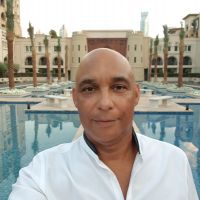
Here's an idea I had the other day - to paint everything in Artrage. First I tried a grass texture, which unfortunately will have to be redone because the paint was too thick and left odd lumps.
I've added a couple of Mike Schley mountains for scale, and the previous unpainted and very draft mountain I did a couple of weeks ago. If I go down the oil painting route for the whole style, the resulting maps will look like detailed oil paintings.
Please ignore the funny lumps that look like I threw a bucket of dust at the canvas, and let me know what you think?


-
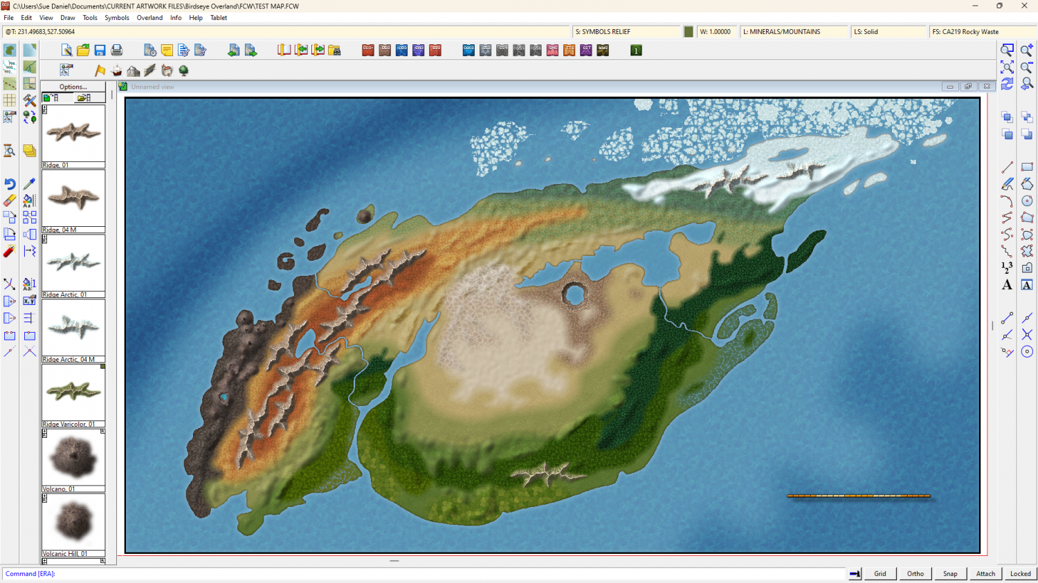
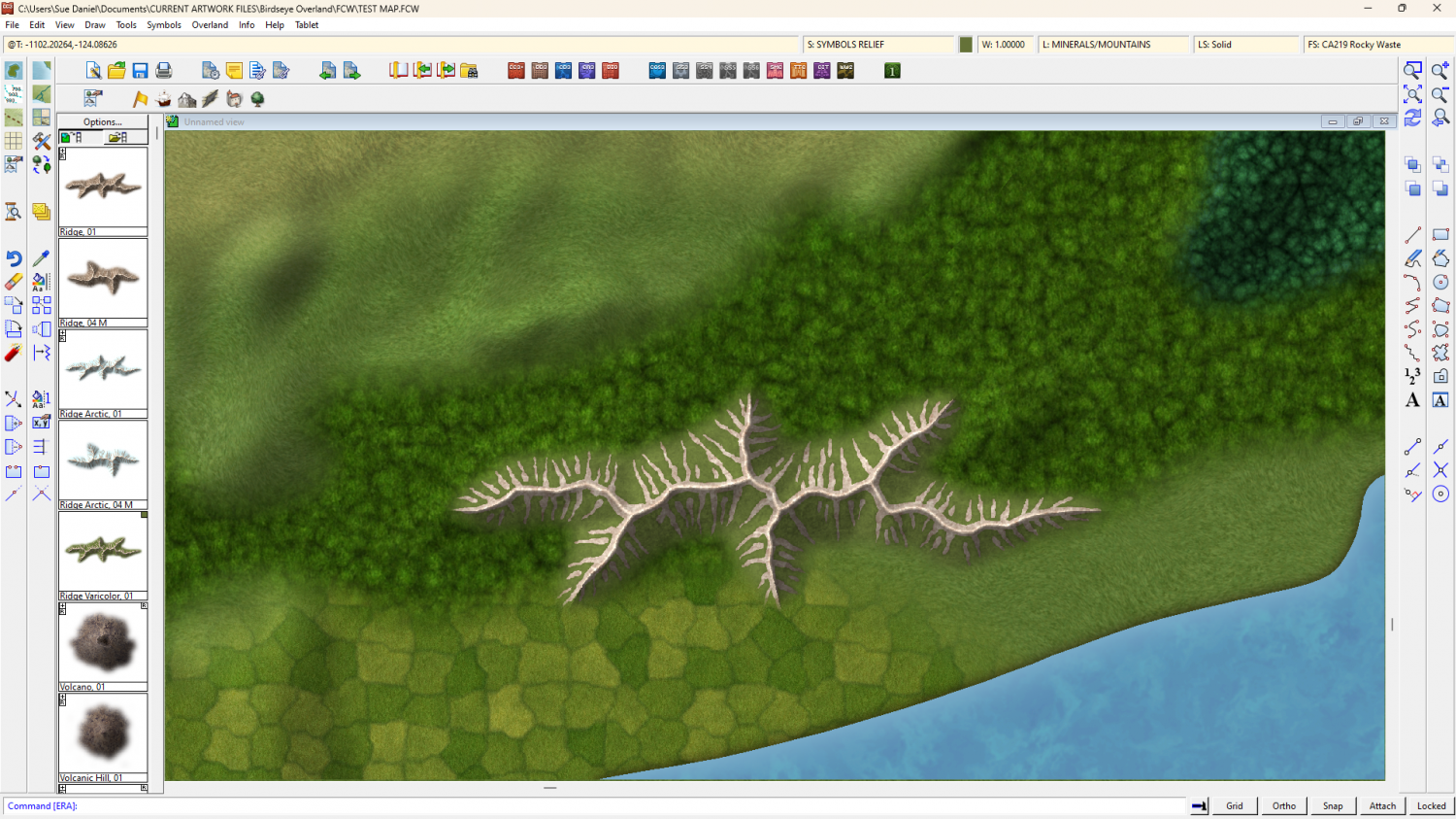
Birdseye Continental - style development thread
Do you think this is enough craters?
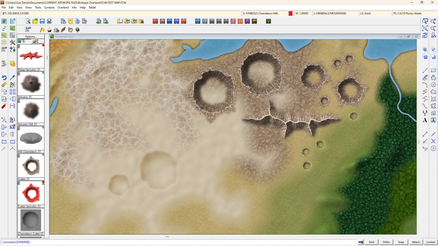
I still have a few more things on the list. These are: mesas, cliffs, ravines, and ripples. A ripple is a more slender ridge that has no side spurs - a kind of rock topped hill.
Which of these would you prefer to see done first, given that the clock is ticking.
Or maybe something else is more important to you than these geographical features?

-
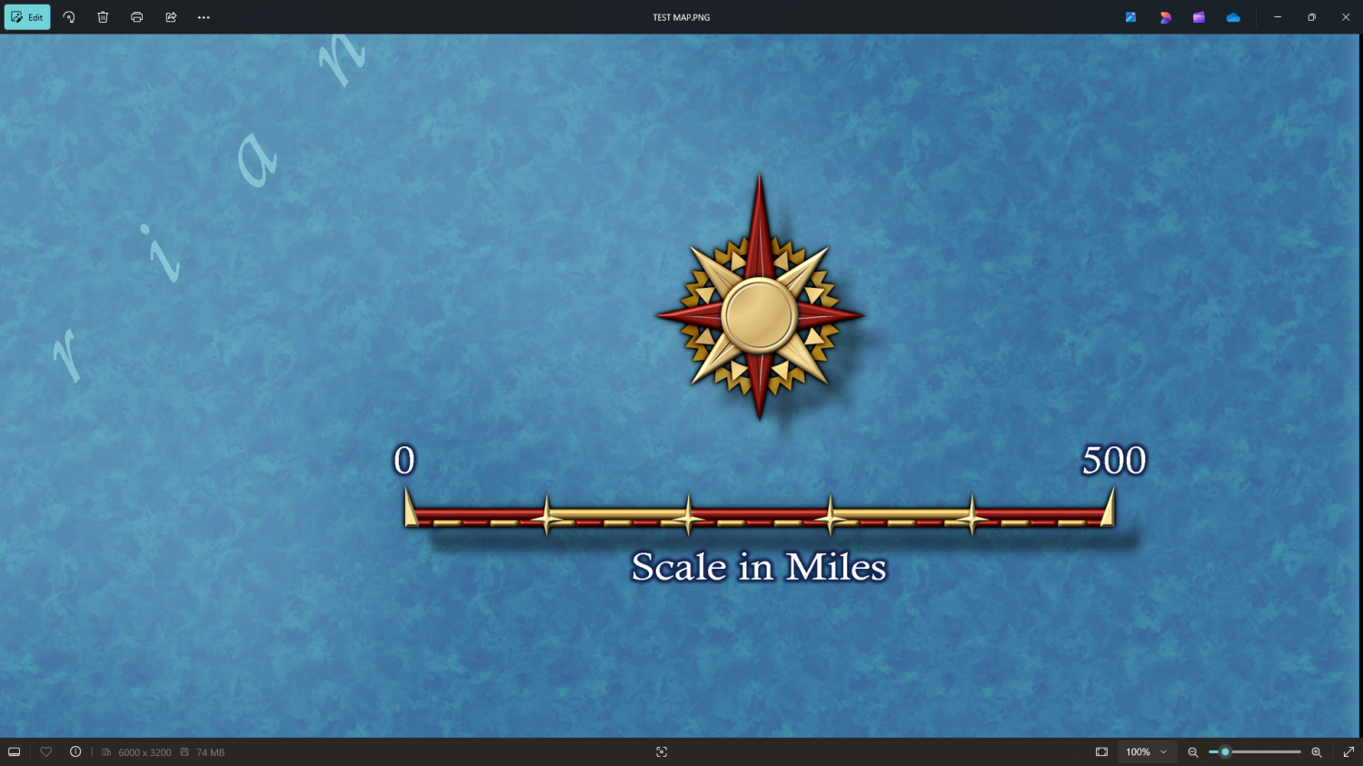
Birdseye Continental - style development thread
Here's a quick scale bar and compass.

-
Birdseye Continental - style development thread
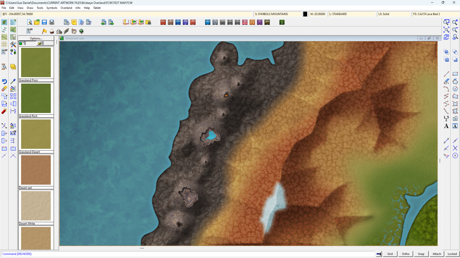
I've done quite a bit more work on the ridges, and also the overall colour scheme.
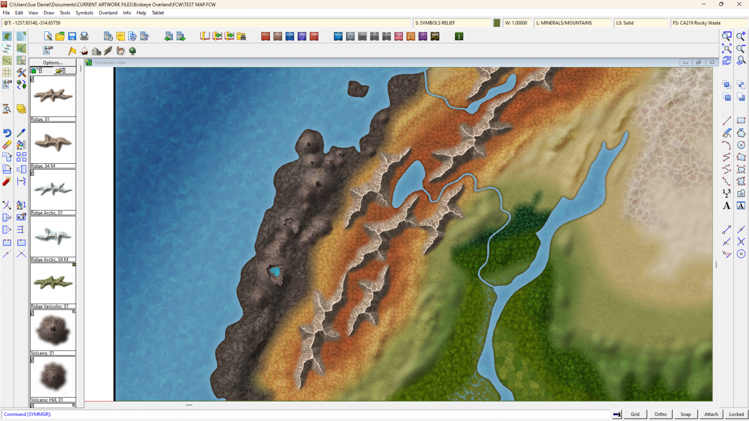
And there are varicolour versions as well, with special colours in the custom palette to match the style fills.
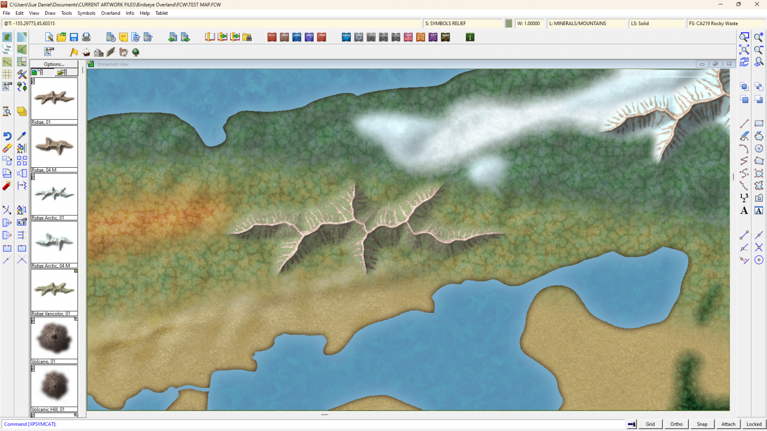
Smaller ridges and mountains to come, along with other things as I think of them.

-
Birdseye Continental - style development thread
I think I might have sorted out the general volcanic theme. If you are happy with this as the toolkit I'll make the mirror copies of the volcano symbols.