


Loopysue
Loopysue
About
- Username
- Loopysue
- Joined
- Visits
- 10,354
- Last Active
- Roles
- Member, ProFantasy
- Points
- 10,103
- Birthday
- June 29, 1966
- Location
- Dorset, England, UK
- Real Name
- Sue Daniel (aka 'Mouse')
- Rank
- Cartographer
- Badges
- 27
Latest Images


-
Using any MDR with FT3+ consistently crashes
I'm not having the same problem as you, so maybe we are doing it slightly differently to each other. Here is how I would import an MDR file. Is this also how you are doing it?
Use New from the File menu.
Pick Binary File and click Next.
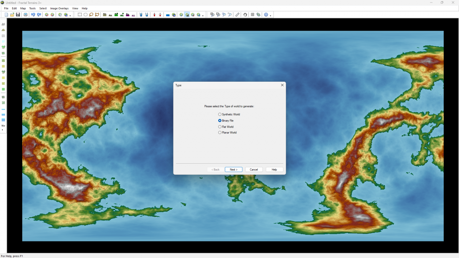
This opens the Binary Data dialog.
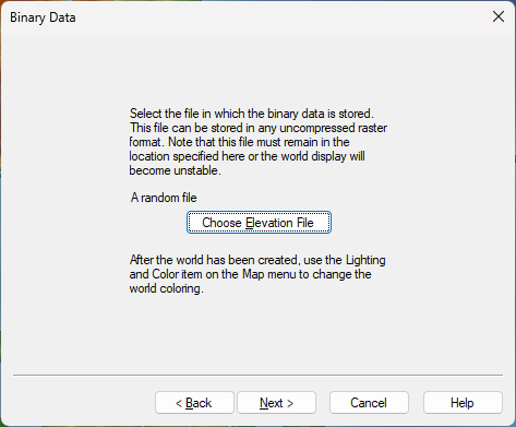
Hit Chose Elevation File and in the following dialog (also called Binary Data), navigate to your MDR file
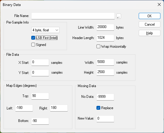
Remember to change the file type at the bottom of the Select Binary Altitude File dialog to MDR Files (*.mdr).
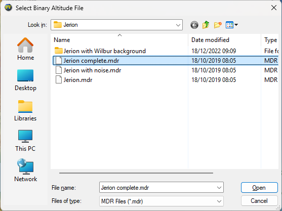
Pick your MDR file and click Open. I have used the example MDR file in CA155, which if you have that annual can be found here: ProgramData\Profantasy\CC3Plus\Annual\Issue 155 - The One Day Worldbuilder\Jerion\Jerion complete.mdr
Whether you have picked the CA155 example or your own MDR file, the file name and it's path should now have been added to the Binary Data dialog. Note that this is an absolute file path. That will be important at the end of this process.
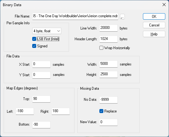
Clicking OK takes you back to the first Binary Data dialog, but with your chosen MDR file named across the middle.
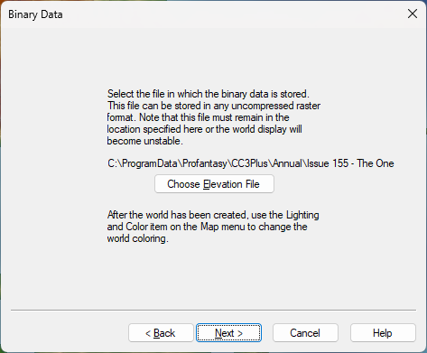
Hit Next, and then in the Summary dialog click Finish.
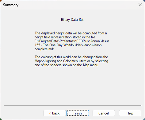
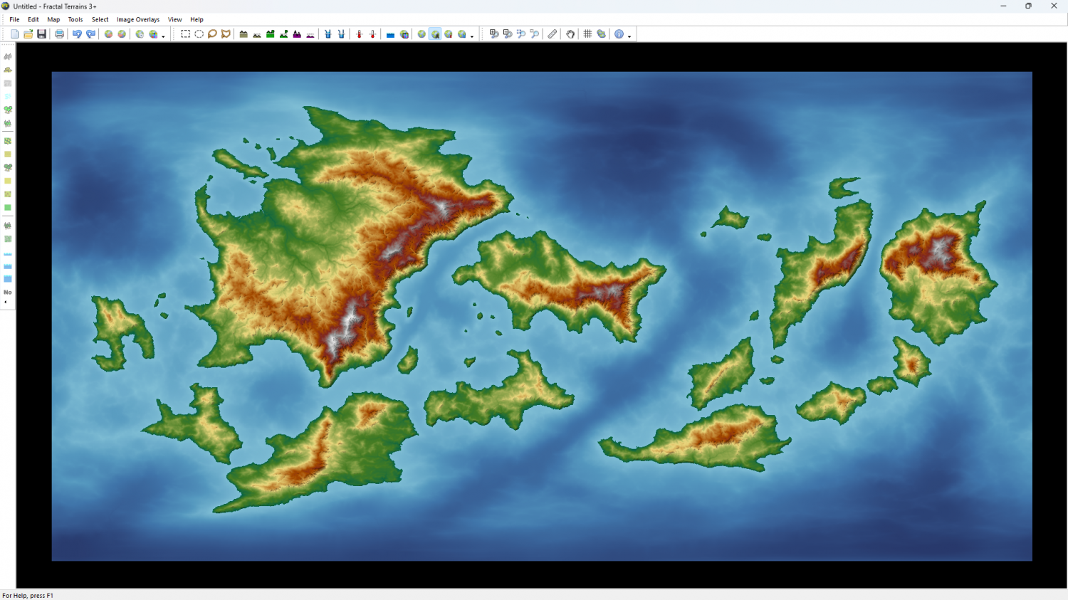
Now your world should appear.
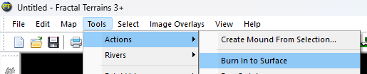
Because the filepath is an absolute reference, moving or deleting the MDR file will cause the FT3+ world to lose it's data source, so it is best to then burn the height data into the file using Burn In to Surface in the Tools>Actions submenu, then save the .ftw file. This will prevent the data going missing if you move or delete the source MDR file.
Please try this process yourself, and then let me know if it worked this time.
Thanks.


-
A Monastery by the Sea
Here is a really time intensive solution. It's only a solution if you want to spend the time doing it.
Add a new sheet called SHADOWS or somesuch logical name, then draw a black polygon that is the full extent of both of those shadows. Move the sheet in the list to a position where it is drawn below the floor level, then add a small blur effect and a transparency effect and turn off all the shadows you've just traced on the other sheets. The idea is to replace all the shadows from all the different sheets with one general shadow.


-
RGB/hex value of Magenta #6?
Open the palette (left below) and pick colour 6, then click Define Color. That opens the Color dialog. You will need to click on the magenta in the Custom colours block in that dialog to see the details on the right.
Red: 255, Green: 0, Blue: 255.
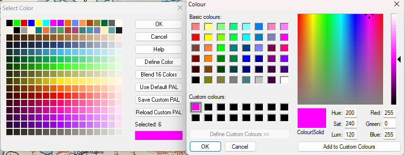
Hex is a little more tricky. I used Blender to create the maximum red-blue colour, and read the Hex from the text box at the bottom, so I don't know for sure if this is correct.
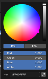
Hex: FF00FFFF (those are zeros, not letter 'o')
EDIT: I have a distant memory of trying to do something like your idea a few years back. I can't really remember if it worked or not. How are you going to use these symbols?

-
SVG exports?
I don't think they can, but I might be wrong as I'm no great tech. I just remember things reasonably well.
These are the export formats available through "Save as..." on FT
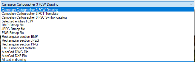
And these are the formats availabe in save as on CC3
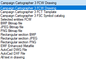
There are a few vector formats at the bottom of both these lists, but none are SVG. Maybe you could find an online converter for one of the AutoCad formats? I've never wanted to do this myself, so I can't tell you how successful that may or may not be.
-
trace map aligning to grid
You can use the Move, Scale, Rotate tool|CC2MOVE| to pick the image and move it. If you pick a key point in the image as your "move from point" (check the command line), and then use SNAP to place the map you should have perfect alignment on that one spot.
As for scaling, it depends which videos you watched as to whether you got the information you wanted. There are about 200 of them.
