


WeathermanSweden
WeathermanSweden
About
- Username
- WeathermanSweden
- Joined
- Visits
- 3,755
- Last Active
- Roles
- Member
- Points
- 459
- Location
- South of Lübeck in northern Germany
- Website
- https://www.astroinfo.se
- Real Name
- André Franke
- Rank
- Surveyor
- Badges
- 6
Latest Images
Reactions
-
SS6 - Isometric Cities
@JulianDracos "I am just hoping that the style set has a B&W option. I do like the MS B&W so if that is an option for the isometric city then I will pick it up."
Have you thought about that every colourful map and every colourful symbol can be easily turned into a B&W, a less colourful or more colourful version inside CC3+ by using sheet effects?
This map ships with the Symbol Set 5 as an example. The "original" colour is presented in the second stripe to the left. The leftmost stripe is less colourful, the widest has more colours and contrast. To the right there are examples of a B&W, light and dark gray and the rightmost one is sepia. All these effects are achieved by using the RGB Matrix Process effect to the whole drawing. The second stripe on the right though has applied this effect to separate sheets so that you get a grayscale map with some colourful elements to e.g. emphasize these.


![[Deleted User]](https://secure.gravatar.com/avatar/c75d9a245b74d9c59be0999ea81ca541/?default=https%3A%2F%2Fvanillicon.com%2F92add7f8c954488718110edc4896ad39_200.png&rating=g&size=200)


-
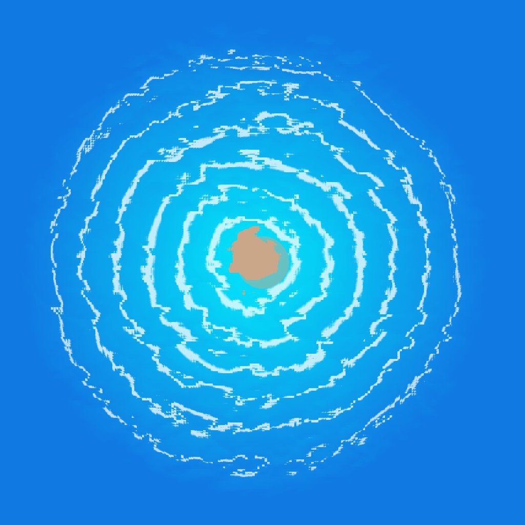
Northern Europe 15.000 before present - how it might have looked like...
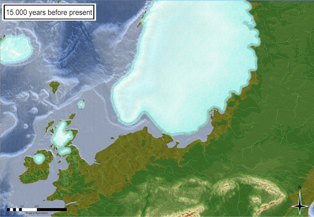
I somehow managed to get the data (from the source sited below) into FT3+ and then into CC3+. The map shown above is plain CC3+ output. The rivers are generated in FT3.
The conversion of the files to files that can be imported into FT3(+) and Wilbur was not as easy as for the paleo-maps (shown earlier) because the data are not provided in equirectangular coordinates...
Gowan, Evan J (2019): Global ice sheet reconstruction for the past 80000 years. PANGAEA,https://doi.org/10.1594/PANGAEA.905800 ,Supplement to: Gowan, Evan J; Zhang, Xu; Khosravi, Sara; Rovere, Alessio; Stocchi, Paolo; Hughes, Anna L C; Gyllencreutz, Richard; Mangerud, Jan; Svendsen, John-Inge; Lohmann, Gerrit (2021): A new global ice sheet reconstruction for the past 80 000 years. Nature Communications, 12, 1199, https://doi.org/10.1038/s41467-021-21469-w


 and 2 others.
 -
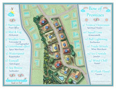
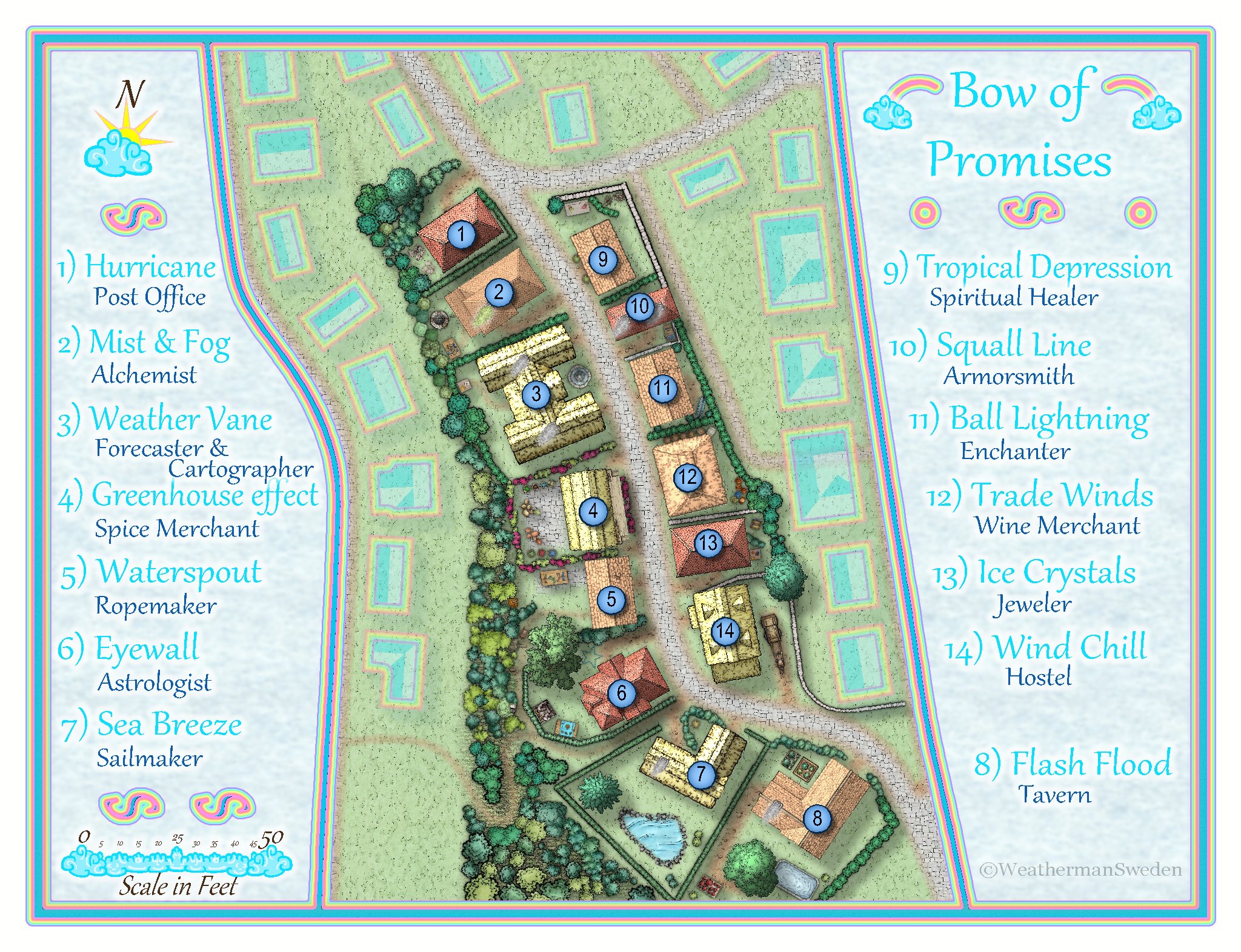
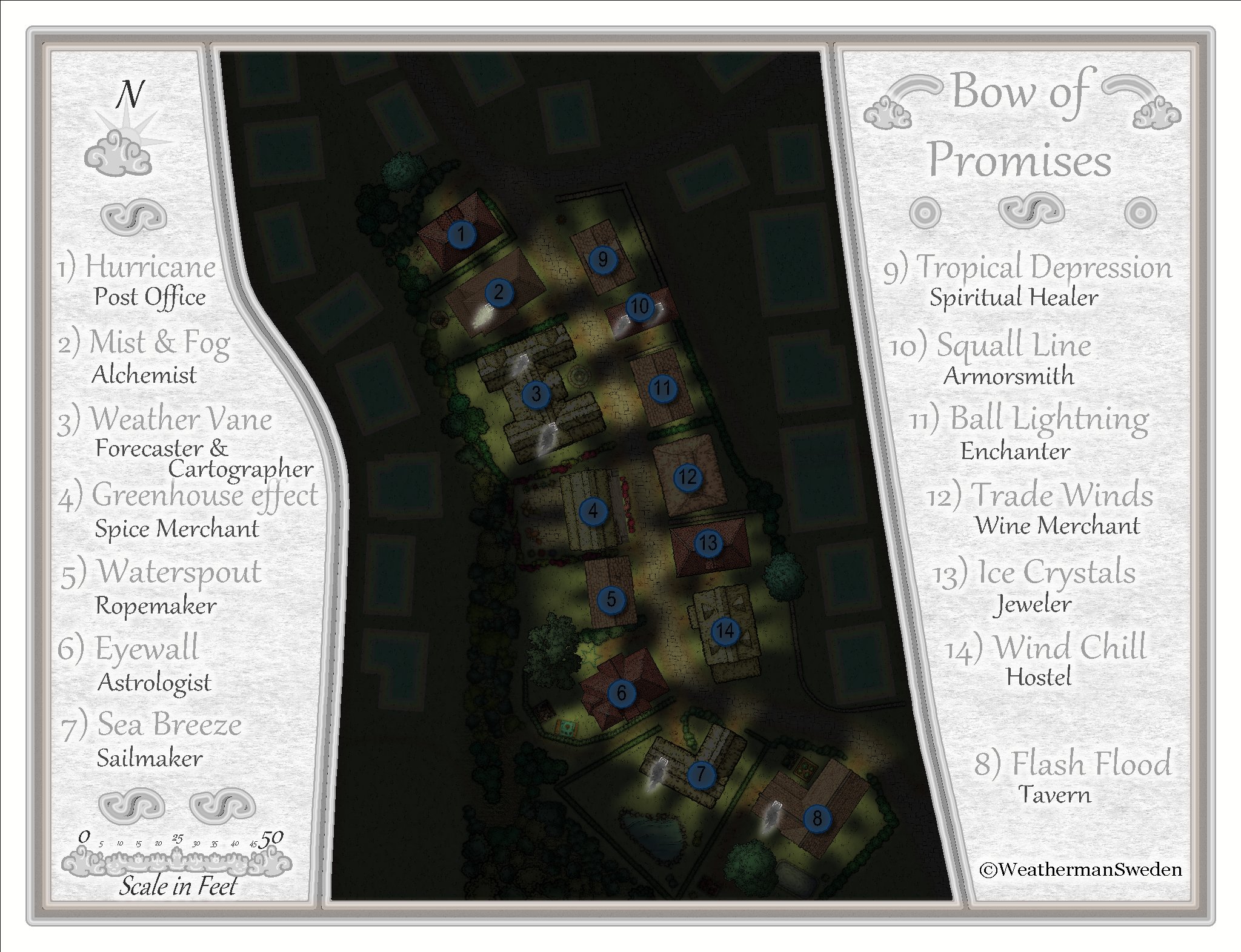
October challenge: Bow of Promises (Street) WIP
Location 6 in Dunor City
Why did I choose location 6?
Back when the challenge started there where 20 locations where streets should be mapped. I wanted to map a location with a little more space around the houses and where my passion for wind and weather could come in.
Where do I find location 6 in Dunor?
Location 6 is situated in the western part of Dunor just at the foot of the castle hill. The next parallel street in the west leads up to Dunor Castle. To the south the street of location 6 leads to a marketplace that is connected to the harbour of Dunor where all the sailing and trading ships arrive and depart.
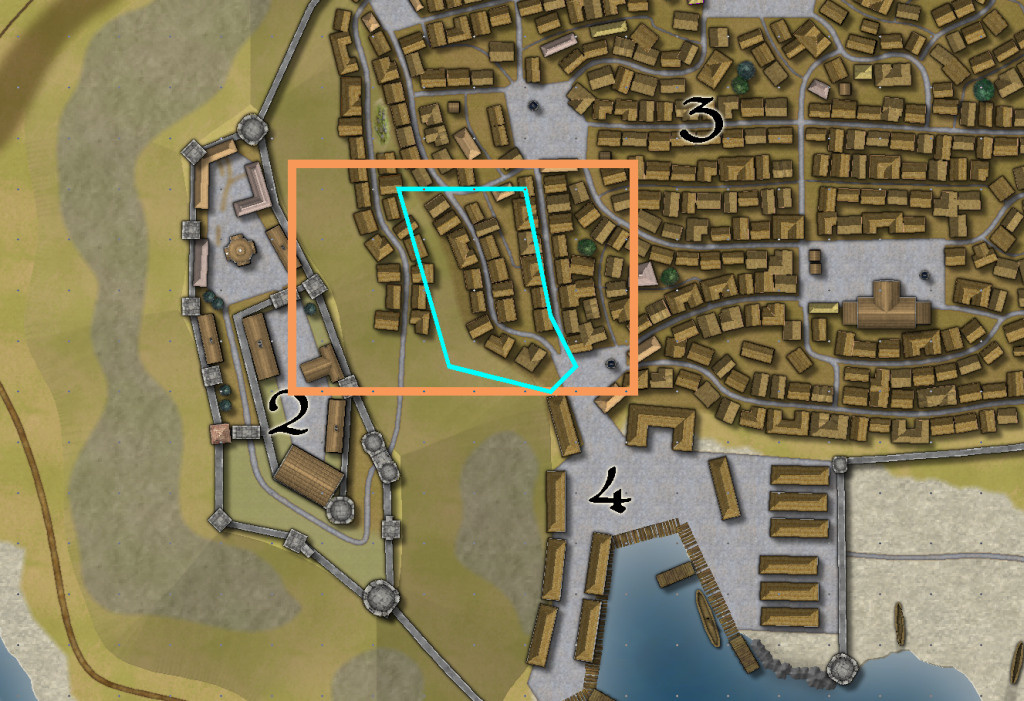
So at least when you arrive by ship - this street is one of the first you will pass on your way further in to town. The street is also one of the streets that you may pass on your way to the harbour - on your way to explore or travel around the world. Maybe you follow rumors that tell of immeasurable treasures or promises to start a new better life somewhere else.
And with this in mind and the aim to establish a connection to wind and weather the name for the street was chosen:
Bow of Promises Street
The picture above shows location 6 with its surrounding and the map below shows the houses that I will focus on: 14 buildings / houses along the street
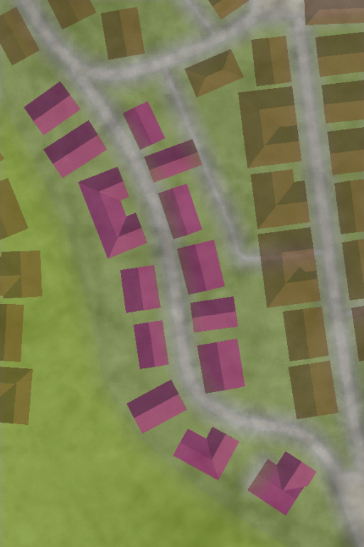
What mapping style?
Mapping at this scale is somewhere in between cities an dungeons/floorplans. So I chose the Schley style that offers plenty of symbols at both scales.
And this is the actual state of the map:
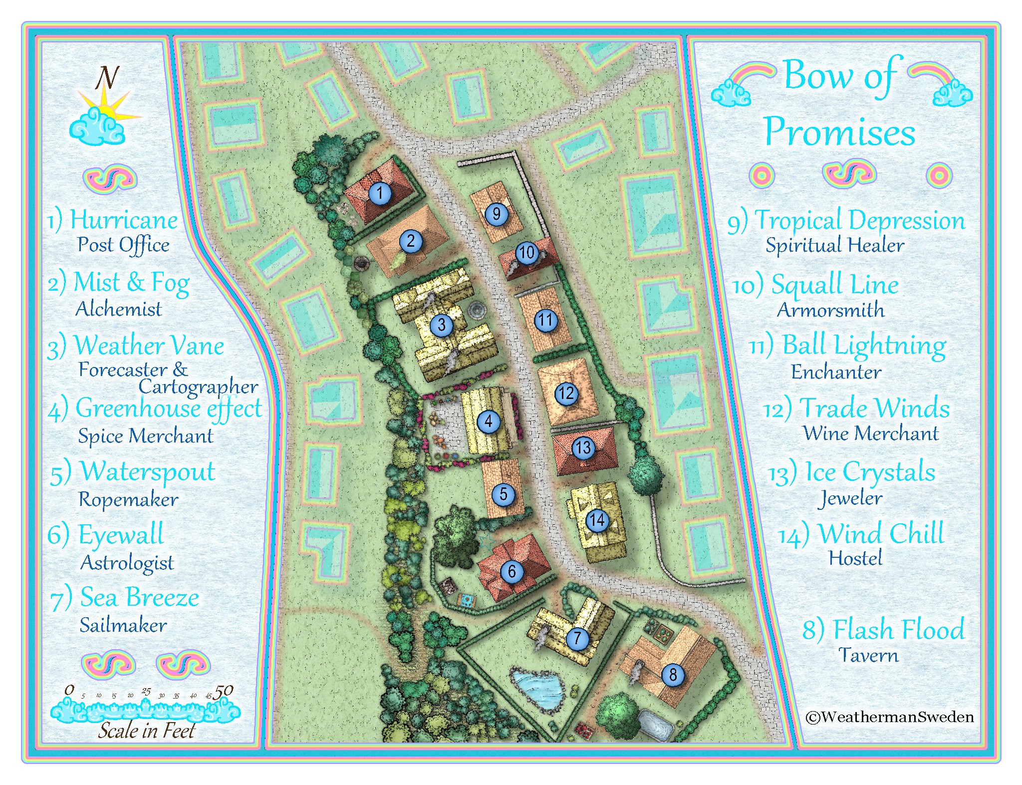
What do you think? Any suggestions? By the way...this is my first fantasy city map...


-
Instruction: How to get PALEO DEMs into FT3(+) – or how do I get Pangaea into CC3+?
What do you need?
1) The datasets with height information for the whole world at different times in the past:
Scotese and Wright 2018 Maps 6minX6min PaleoDEMS
2) A tool that can read can convert the above netCDF data: Panoply (Panoply needs Java 9 or above)
3) My little converter-tool “TXT2MDR” that converts the exported txt-file(s) from Panoply to mdr files that can be imported directly into FT3(+). Download the converter-tool here.
Let’s do it!
1) Download the PaleoDEMS and unzip them to a folder. You will get over 100 .nc files, each of them about 25 Mb in size containing 3601x1801 or almost 6.5 million heights.
2a) Download Panoply, install it (unzip it to a place where you will find it again – I would suggest to create a folder like PaleoDEM and place both the datasets and the program inside it). Try to run the program. If it does not run or it says “at least Java 9 is needed (or so)” follow the download and install instructions given in a txt-file in the Panoply installation folder: “Because of licensing issues, […] use one of the several alternative open source Java distributions […] Panoply users have reported good results using AdoptOpenJDK” The AdoptOpenJDK installer on Windows will display a panel labeled "Custom Setup". In this panel, you must specifically enable the "Set JAVA_HOME variable" and "JavaSoft registry keys" options." I chose the .msi installer for the JRE version 11 from AdoptOpenJDK.
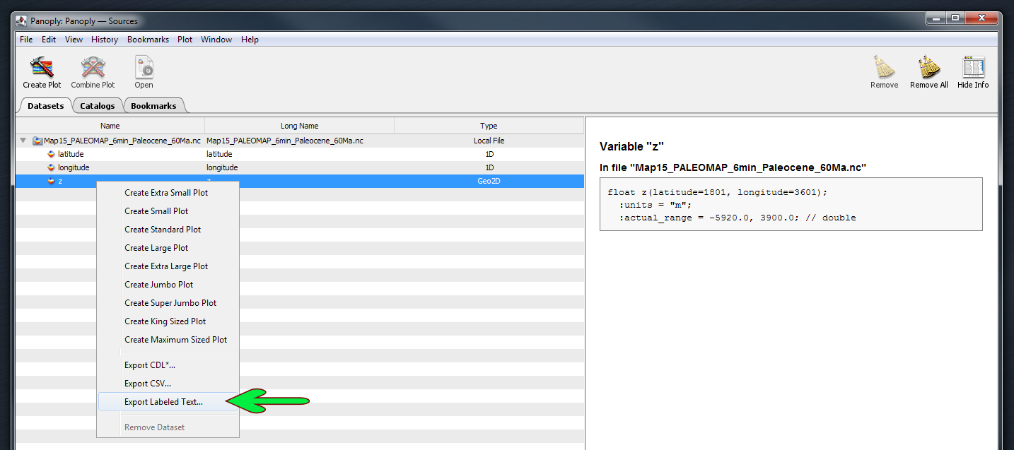
2b) In Panoply open one of the desired .nc files. Mark the row "z", right click and choose export as labeled text. The default name is "z.txt". I recommend to choose a more proper name...
3a) Download my little converter-tool and unzip it to a folder near the above files (recommended) The zip-file contains 4 files and is only about a half Mb, but it unzips to a little bit more than 25 Mb. This is due to one dummy mdr-file “empty_3601_1801.mdr” that almost contains “nothing” – about 6.5 million zeros… It also contains the converter “TXT2MDR_fileconverter.Exe” and the runtime library “GfaWin23.Ocx”, which is needed for running the program. The fourth file is a little textfile “tab.txt”. It is just what it says; it is a text-file containing exactly one tab. Because I could not figure out a way to search for a tab in tab-separated text files, the program reads the tab from this file to search for others in the Panoply labelled text export files (in lack of an other solution…)
3b) Usage: Start the program, press the button and choose the .txt file you whish to convert in the file selection box. Wait till the program tells you that it has finished the conversion. Choose another file to convert by clicking the button or exit the program by clicking the read x in the upper right.
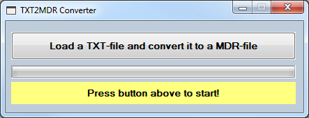
Keep in mind: The program should only be used for importing .txt files that have been exported from Panoply with the “Export labelled text” option – these files are almost 300 Mb big in size! There is no need to keep those .txt files after the conversion. The converted file will have exactly the same name after the conversion but with the file extension .mdr and it will be about 25 Mb in size. The conversion process should last less then one minute, depending on your computer.
And now to the fun part:
Open FT3(+). Choose New, Binary and load your newly created mdr file!
Export to CC3+ and enjoy!


-
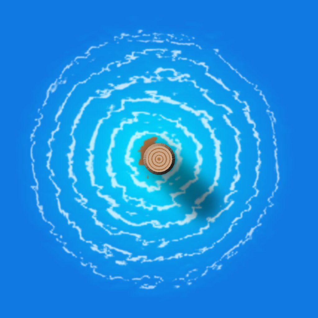
Edge Striping and Displace - combining both and the resulting effects
In the discussion How would you create a fantasy port harbour there were some attempts to create water ripples around piles with the
Edge Stripingeffect.Meanwhile I created some other patterns both for use with the
Edge StripingandDisplaceeffects to figure out what can be achieved by the combination of both effects.Here is one result:

and here an other one:
The halv transparent circle represents the undisturbed object (pile)


-
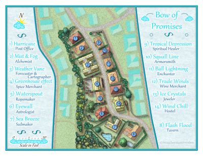
October Community Challenge - City Streets - VOTING POLL in first post
This is area 6 for submission. Bow of Promises Street - your way from or to the harbour of Dunor.
The .FCW includes the night version that can be viewed in my gallery or in this discussion:

-
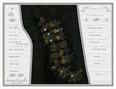
October challenge: Bow of Promises (Street) WIP
I recently watched Remy's video tutorial about making night version maps of existing day versions. So I gave it a try and ended here:
By now the environment is lit up only by light from inside the houses. I thought about placing some light sources outside but could not find matching symbols for that. There are open fire symbols but placing them near all the houses with thatched roofs seem kind of dangerous...?
-
[WIP] Community Atlas - Topographical map of Nibirum with ocean currents

I have to admit that @Loopysue will recognize some of her arrows... ?
They are from Sue's great annual "The One Day Worldbuilder" - Issue 155


-
"The Most Accurate Flat Map of Earth"/"Astrophysicists Design World Map That Looks Like a Vinyl LP"
are some of the headlines in the last few days and a projection of earth looking like this
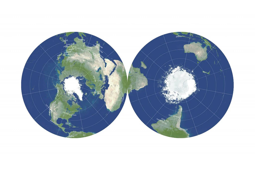
is presented in many articles all over the internet.
My first question was - can we reproduce this or a similar projection in FT3?
And luckily the answer is: Yes, we can!
Here is my result of projecting the ETOPO2 data in a similar projection.
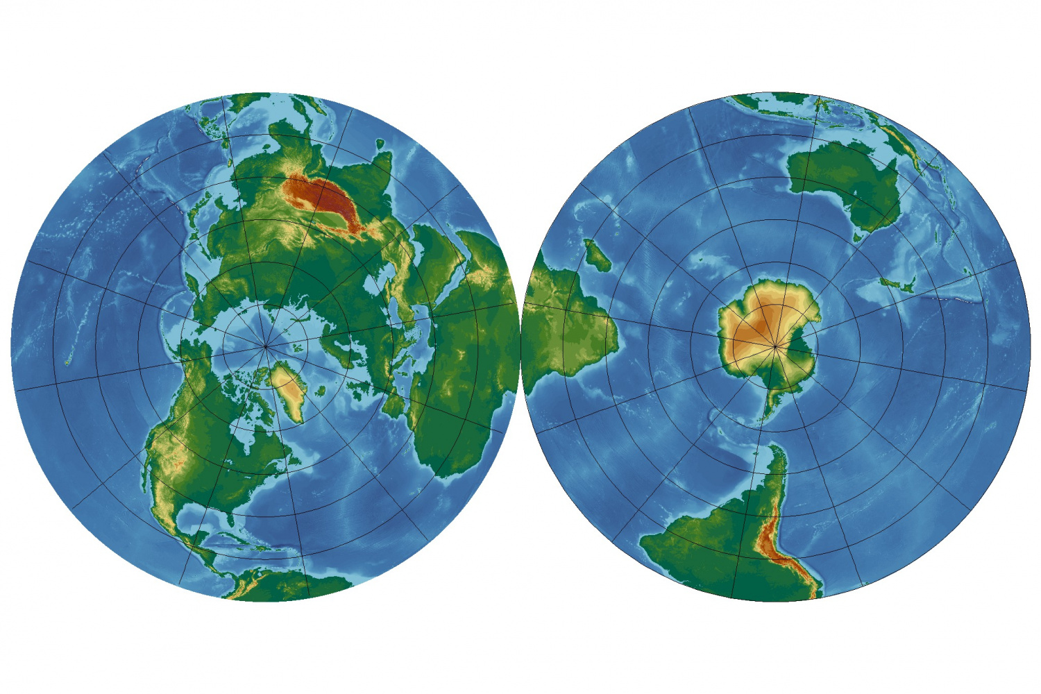
It seems to be partly the old fashion "Azimuthal Equidistant" projection - but limited to the northern (or southern) part only.
You can add the following lines in your
projections.txtfile in your FT3 installation folder to get this projection:Projection 90, "AE Northern and Southern Hemispheres"Scale 1.0Description "Azimuthal Equidistant Northern and Southern Hemispheres"Segment "Azimuthal Equidistant", 90, 0, 0, 0, 1, 0, 0scale 1, 1Offset -0.5, 0.0Effective -180, 90, 180, 0Rotate 70EndSegmentSegment "Azimuthal Equidistant", -90, 0, 0, 0, 1, 0, 0scale 1, 1Offset 0.5, 0.0Effective -180, 0, 180, -90Rotate 110EndSegmentEndProjectionGreetings,
André

-
Edge Striping and Displace - combining both and the resulting effects
Here is the .fcw for the "pile" with the "water ripples" and its belonging .png filters
Both filter images have to be copied into the ProgramData\Profantasy\CC3Plus\Filters\Images folder to make the map work properly.
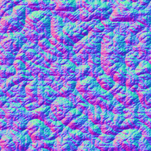
The displace filter was generated in Gimp and converted to a normal map in Wilbur (I think you could have done this also in Gimp...) ...and as I use the german version of Gimp the filtername became also german - for me to remember how I created the image...?

The .png does not show up correctly in the preview - black should be transparent... The filter map is inspired by the one @Raiko posted.
The .png file above seems to loose transparency - here the .png as a ZIP file:

If someone is interested I can also post the .fcw for the island/beach/waves...

