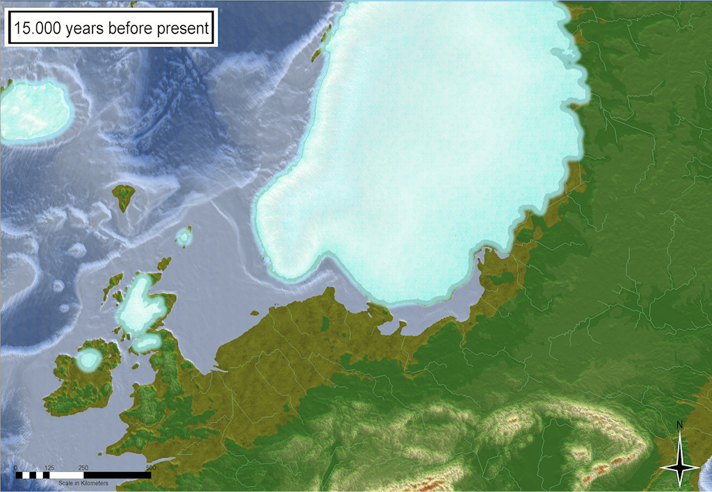
Northern Europe 15.000 before present - how it might have looked like...
 WeathermanSweden
🖼️ 3 images Surveyor
I somehow managed to get the data (from the source sited below) into FT3+ and then into CC3+. The map shown above is plain CC3+ output. The rivers are generated in FT3.
The conversion of the files to files that can be imported into FT3(+) and Wilbur was not as easy as for the paleo-maps (shown earlier) because the data are not provided in equirectangular coordinates...
Gowan, Evan J (2019): Global ice sheet reconstruction for the past 80000 years. PANGAEA, https://doi.org/10.1594/PANGAEA.905800 ,Supplement to: Gowan, Evan J; Zhang, Xu; Khosravi, Sara; Rovere, Alessio; Stocchi, Paolo; Hughes, Anna L C; Gyllencreutz, Richard; Mangerud, Jan; Svendsen, John-Inge; Lohmann, Gerrit (2021): A new global ice sheet reconstruction for the past 80 000 years. Nature Communications, 12, 1199, https://doi.org/10.1038/s41467-021-21469-w


Comments
Nicely done!
Your first link in the attribution has the comma inside the link, making it fail.
It would be nice if you offered some advice to users on how to go about getting the data into an input format suitable for use in FT.
Outstanding
Awesome, Weatherman
Please tell me how to get my CC3+ continent into FT3+ and I will dance at your wedding or anniversary. 😁
Um, well supposing you have one heh
Cal
As soon as my MDR-converter is more user-friendly I will write a short tutorial as I did for the Paleo-maps.
I also plan to describe the data provided by the authors a little more in detail and some of the problems I ran into when using the data.
This is a great source for everyone who ever wanted to get "real" elevation data for the ice age - though we never will know exactly what our earth looked like plenty thousands of years ago...
Meanwhile - here is what the whole world might have looked like about 15.000 years before present: