

"The Most Accurate Flat Map of Earth"/"Astrophysicists Design World Map That Looks Like a Vinyl LP"
 WeathermanSweden
🖼️ 3 images Surveyor
WeathermanSweden
🖼️ 3 images Surveyor
are some of the headlines in the last few days and a projection of earth looking like this
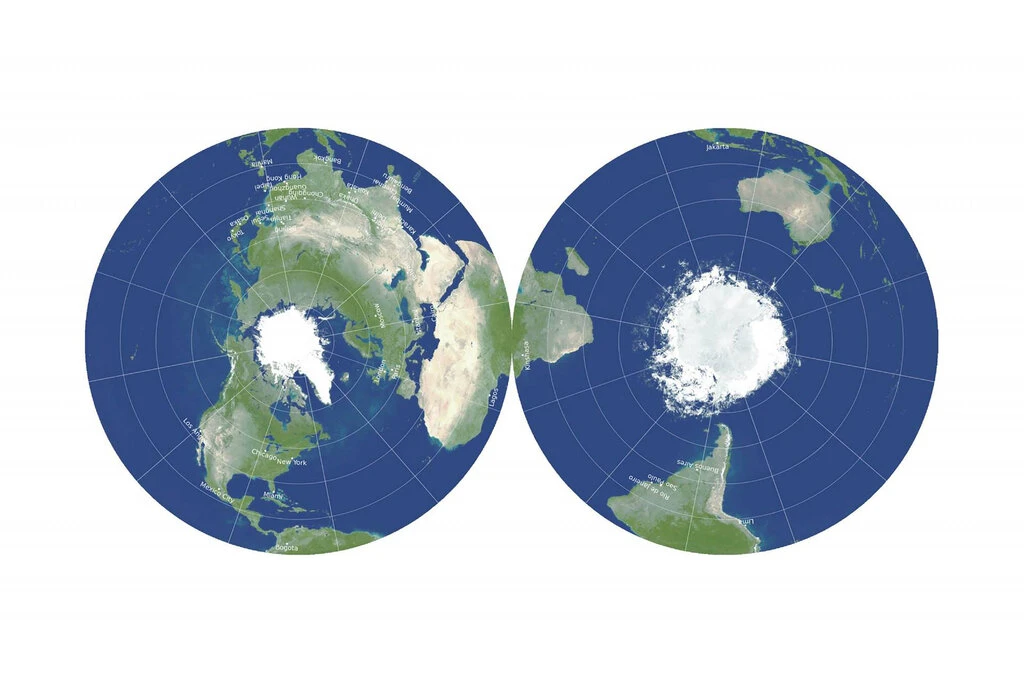
is presented in many articles all over the internet.
My first question was - can we reproduce this or a similar projection in FT3?
And luckily the answer is: Yes, we can!
Here is my result of projecting the ETOPO2 data in a similar projection.
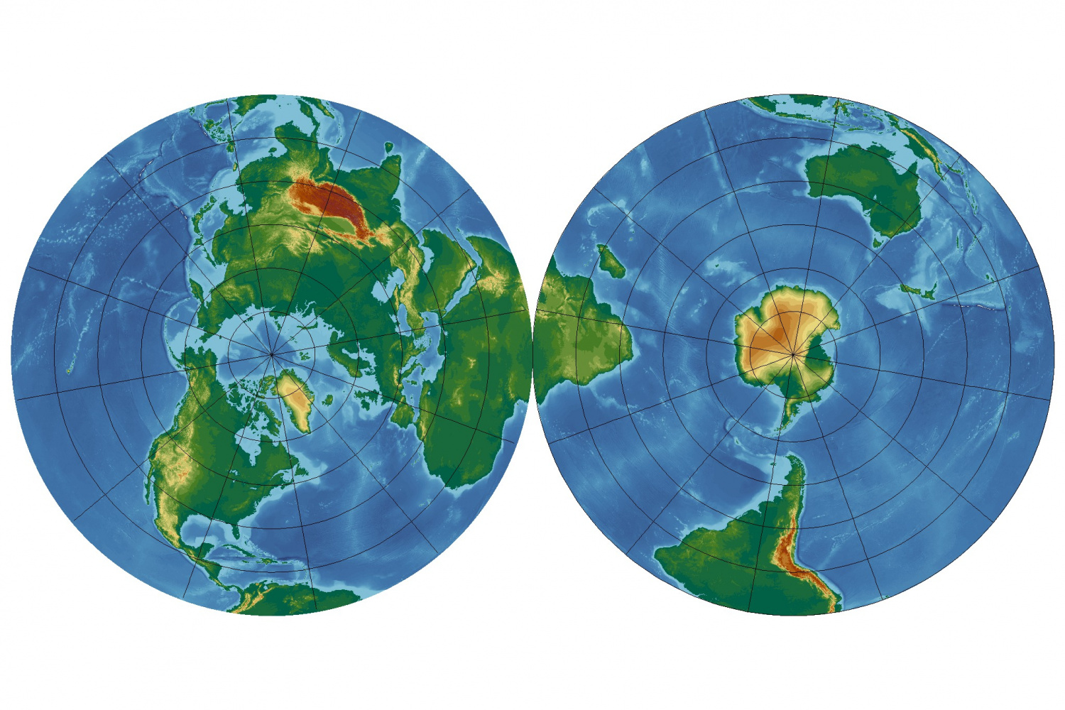
It seems to be partly the old fashion "Azimuthal Equidistant" projection - but limited to the northern (or southern) part only.
You can add the following lines in your projections.txt file in your FT3 installation folder to get this projection:
Projection 90, "AE Northern and Southern Hemispheres"
Scale 1.0
Description "Azimuthal Equidistant Northern and Southern Hemispheres"
Segment "Azimuthal Equidistant", 90, 0, 0, 0, 1, 0, 0
scale 1, 1
Offset -0.5, 0.0
Effective -180, 90, 180, 0
Rotate 70
EndSegment
Segment "Azimuthal Equidistant", -90, 0, 0, 0, 1, 0, 0
scale 1, 1
Offset 0.5, 0.0
Effective -180, 0, 180, -90
Rotate 110
EndSegment
EndProjection
Greetings,
André


![[Deleted User]](https://secure.gravatar.com/avatar/c75d9a245b74d9c59be0999ea81ca541/?default=https%3A%2F%2Fvanillicon.com%2F92add7f8c954488718110edc4896ad39_200.png&rating=g&size=200)


Comments
I tested the projection on Nibirum and I think it looks quite interesting...
Neat stuff.
Just tried it on my Myirandios world, and it worked really well. Thanks, WeathermanSweden.