Loopysue
Loopysue
About
- Username
- Loopysue
- Joined
- Visits
- 10,416
- Last Active
- Roles
- Member, ProFantasy
- Points
- 10,161
- Birthday
- June 29, 1966
- Location
- Dorset, England, UK
- Real Name
- Sue Daniel (aka 'Mouse')
- Rank
- Cartographer
- Badges
- 27
Latest Images


-
How to properly use the ridge line construction tool?
Ralf covered this in a relatively recent live mapping session here.
Welcome to the forum bakrin :)


-
Commission WIP!
You may need a style that is more simple and straightforward with simple blocked in houses and no fancy artistic stuff going on. A highly detailed style like Darklands has a tendency to look quite horrible when printed so tiny. There wouldn't be a problem if this was intended as a poster map to put on the wall, where you might still expect to pick out the details of individual rooftops and chimneys, but it isn't.
If you have a free hand to suggest other styles I recommend something like the Ferraris Style, which is more suitable for larger areas printed small, or the more recent Tactical Maps published in April this year in the Cartographer's Annual. Something more Ordnance Survey in style than artistic. There are other relatively simple styles to chose from, of course. Have a look at what you've got and take the time to consider carefully just how much detail you really want when each house will be little more than a squashed ant in size on the finished letter-sized map.


-
jumpy glow
No. There are only 8 steps in 100, so every 12.5 units is a step.
You can get more subtle effects by setting the Strength to zero and duplicating the effect.

-
Community Atlas - Forlorn Archipelago - Fisher Isle, several villages and surrounding areas
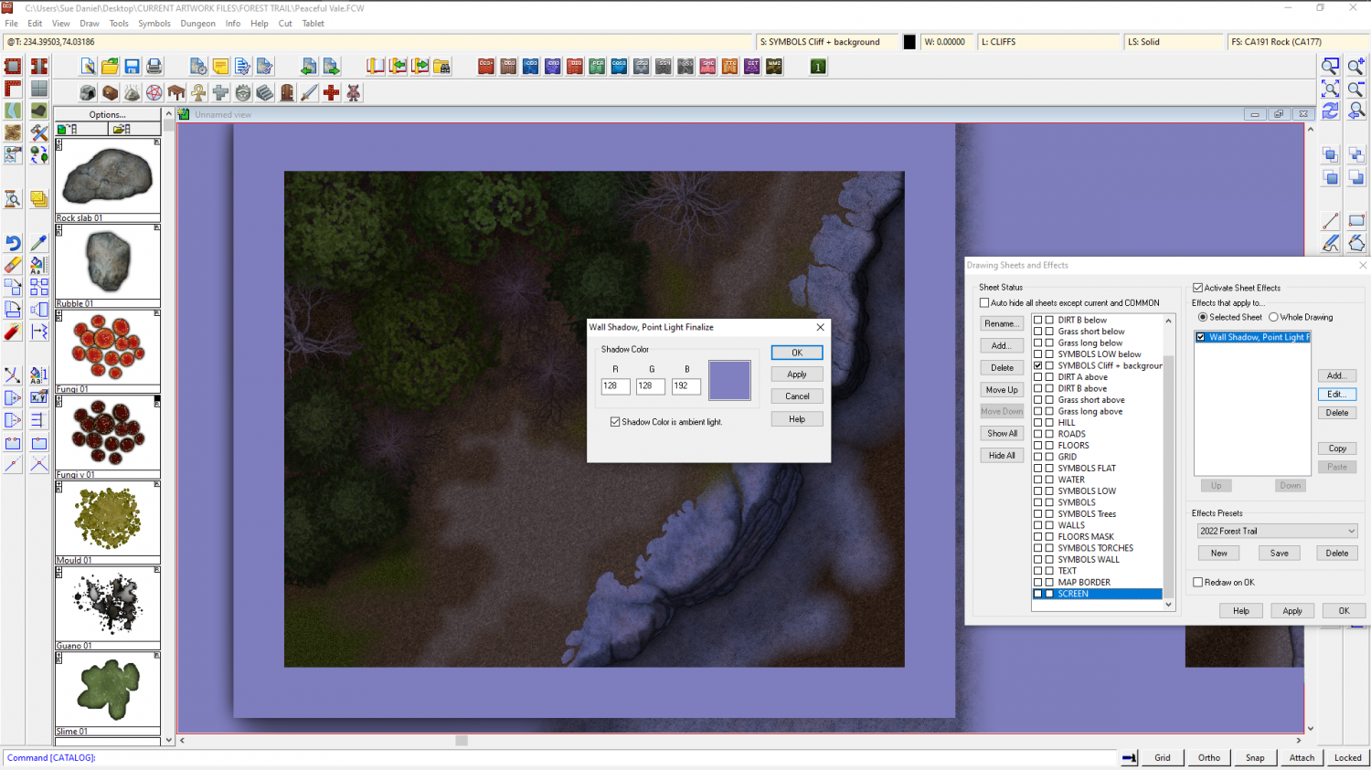
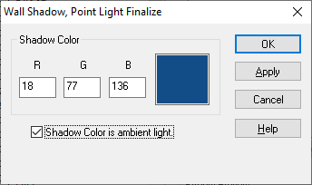
The simplest way is probably to add a Wall Shadow, Point Light Finalize sheet effect to one of the last sheets in the list, check the Shadow Color is ambient light box and pick a nice bluish colour. That way you can turn the effect on and off.

![[Deleted User]](https://secure.gravatar.com/avatar/c75d9a245b74d9c59be0999ea81ca541/?default=https%3A%2F%2Fvanillicon.com%2F92add7f8c954488718110edc4896ad39_200.png&rating=g&size=200)
-
[WIP] August Competition - House within city
Hello galik, and welcome to the competition :)
To align the fill of a polygon with one of the edges first hide all the other sheets so that you only have the one with the floor on it showing. Then right click the Polygon tool |CC2POLY| and pick the "Shaded Polygon (Angle by Edge)" menu option. Use the little box on your cursor to pick the edge of the floor where you want the fill aligned.
This will align the fill, but it will also shade the polygon as if it is a roof part, so we need to correct that by typing EDITSHADING on the keyboard and pressing the Enter key. Pick the floor again. The dialog that appears then will look quite complicated, but the only thing you need to do is check the little box called "Shade only copy", and then OK.
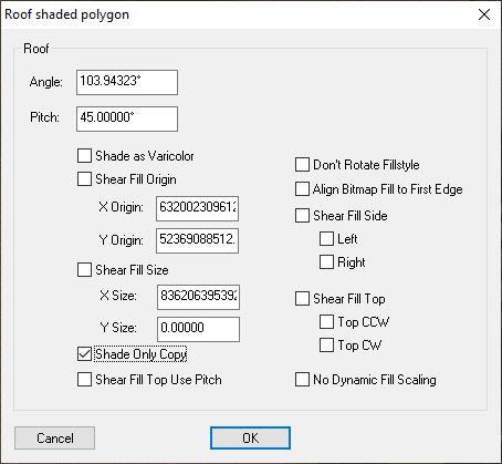
It is worth noting here that once a polygon is aligned this way you can still use the change properties tool to change the fill and its other properties, but the shape of the polygon cannot be edited. To do that you will have to undo the alignment by using the Explode tool |CC2EXPLODE| on it just the once, and then re-align the fill when you have finished. So it is a good idea to make sure you have the shape of the floor just right before you align the fill.
-
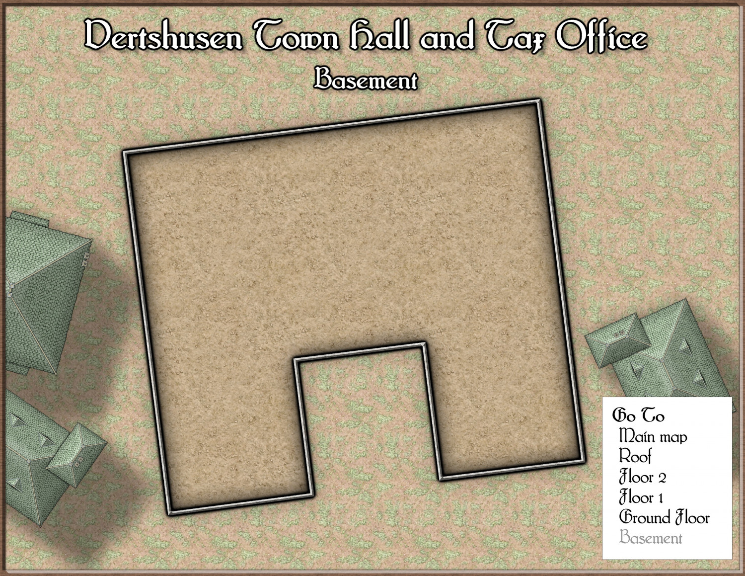
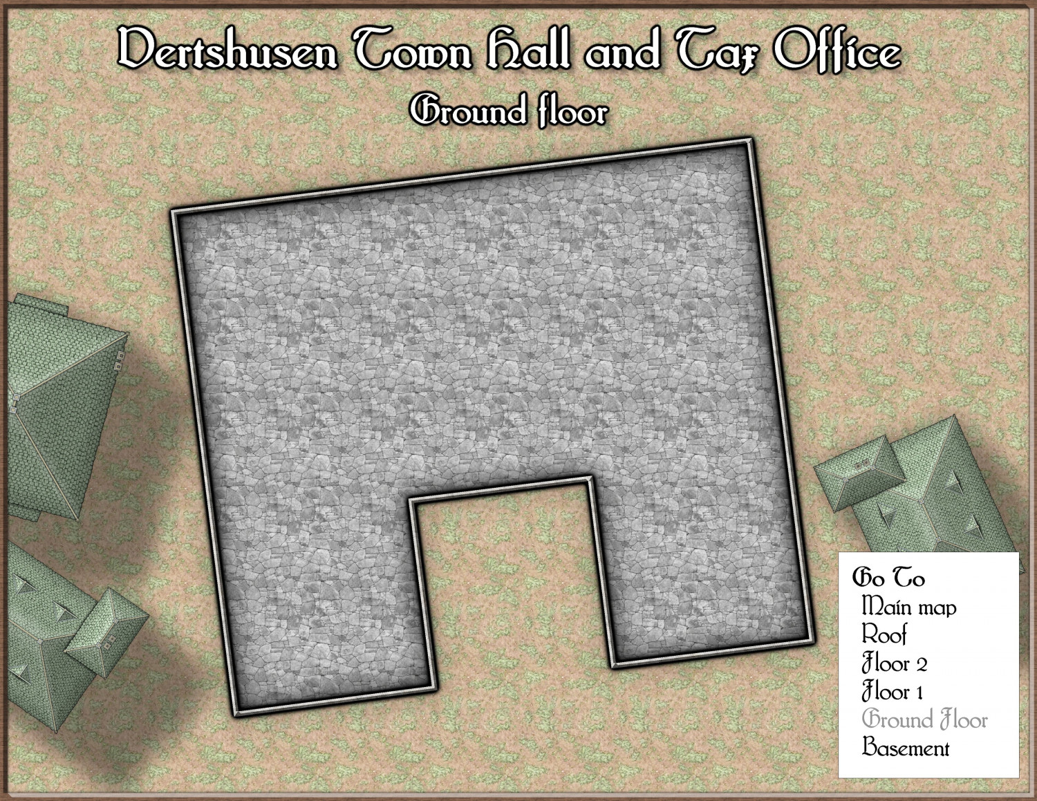
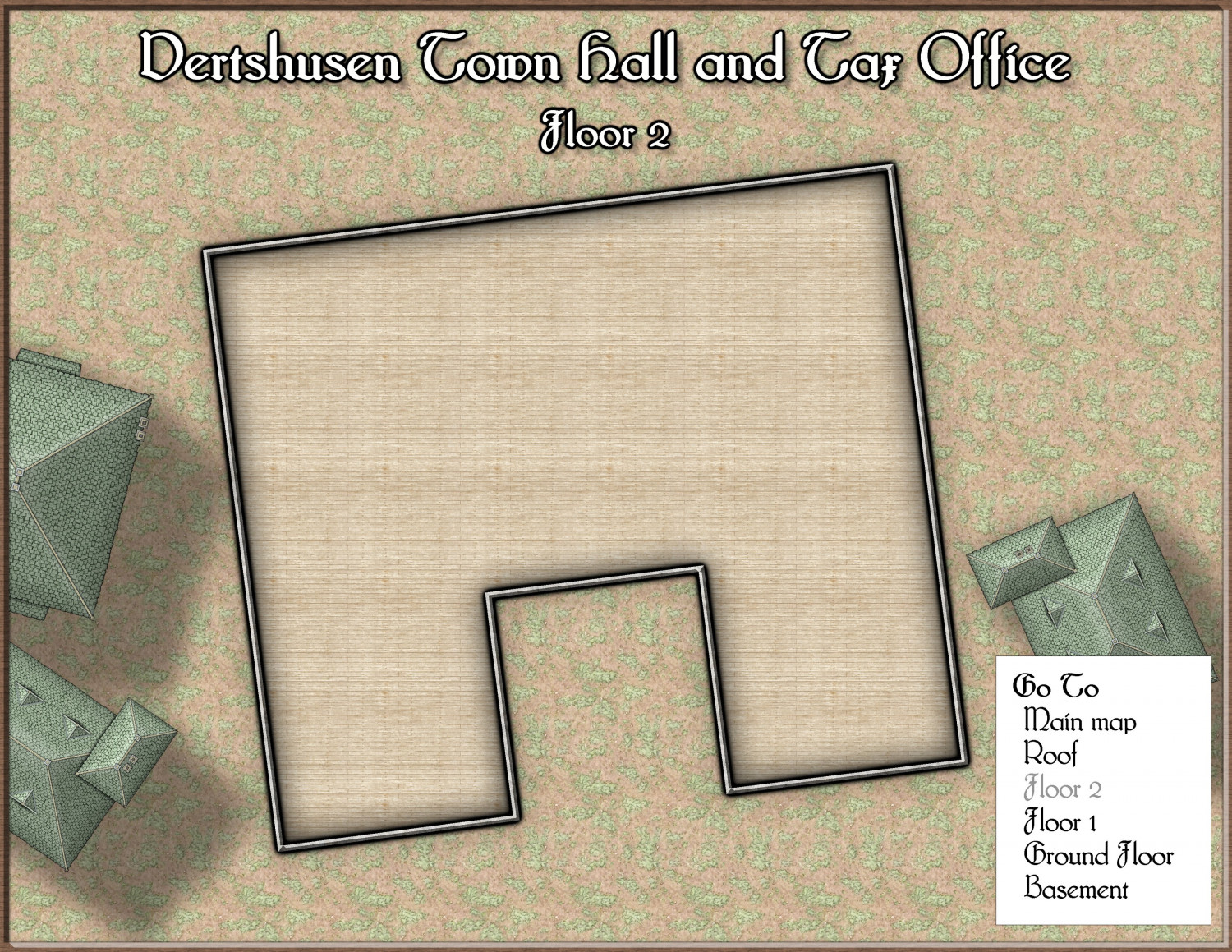
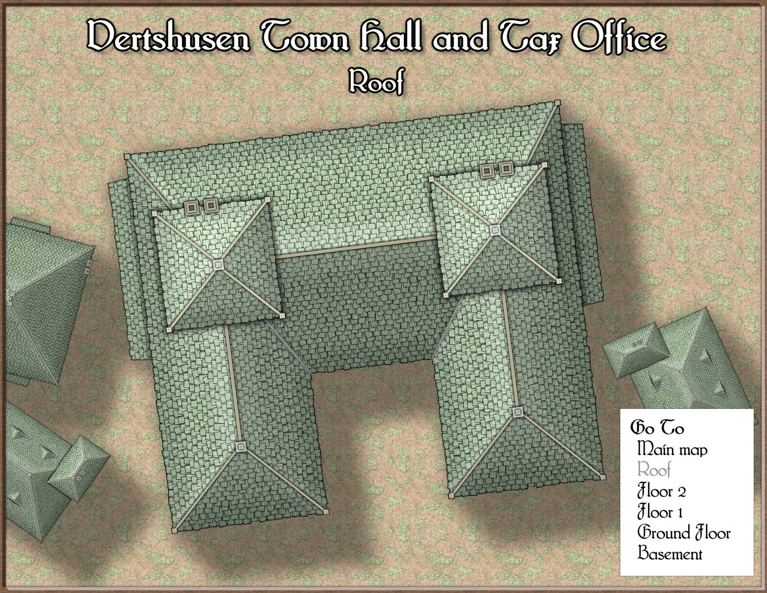
[WIP] August Competition - Vertshusen Town Hall and Tax Office
I used the Floorplan tool, and then spent the first hour cropping and arranging the maps with the building itself as close to centre as possible, while trimming as much as I could from the edge - leaving just about enough room for the key and title. No real mapping as yet. I haven't even put the city wall in (adjacent to the back wall of the town hall), or decided what to put on each floor.


-
August Mapping Competition - Building Floorplans - Win Prizes
@Wyvern LOL! Whoever is doing building number 1 is in for a bad deal.
-
How can you quickly restore missing symbols?
I believe, though I don't know for sure, that you may need to download and install the free third party assets from Vintyri. The reason I'm not sure is because I have red Xs also in those maps, and I have all the Profantasy sets. What I don't have is the CSUAC, the Dundjinni archives, and the Vintyri Cartographic Collection.
You can get hold of these sets through links on this page. Installation can be a bit tricky, so be sure to read the installation guides very carefully and do exactly as described.
If I am wrong I do apologize, but I can't think that there would be another reason for it. At the very least you will gain a whole load of new stuff to use.
I didn't mention Bogies Mapping Collection because I do have that one installed, but still have mostly red Xs in those maps.


-
How do I break an entity (trying to seperate a single landmass into an island and mainland)
There are several ways of varying complexity - each has a 'best use' scenario. In this situation, since the outline is clear of anything else in the vicinity and relatively simple, I would use the Extract Properties tool |CC2KEEP| to set the active properties to match the land, and then break that polygon open by snipping a small piece out of each side of that neck using the break tool |CC2BREAK|. Then I would right click the Fractalise tool |CC2FRX| and use "Path to Polygon" from the menu to convert both the resulting bits of polygon back into separate polygons - one at a time.

-
The Swamp Rat - Playing around with Lighting
Right click the hourglass and pick Global Sun from the menu. The two settings that affect the way lighting works are in the Activate lighting panel. You can adjust the blur on the shadows cast by your lights, and how intense the shadows themselves are.
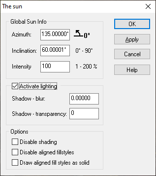
In the 'Wall shadow, Point Light Finalize' sheet effect there is also an option to make the shadows a colour other than black, called 'Shadow Color is ambient light' Have a play with that as well. You will need to change the colour in the Shadow Color panel to see any difference. The default is black.