


Loopysue
Loopysue
About
- Username
- Loopysue
- Joined
- Visits
- 10,356
- Last Active
- Roles
- Member, ProFantasy
- Points
- 10,108
- Birthday
- June 29, 1966
- Location
- Dorset, England, UK
- Real Name
- Sue Daniel (aka 'Mouse')
- Rank
- Cartographer
- Badges
- 27
Latest Images


-
Live Mapping: Character Artist 3
This week, Ralf will be taking a look at the Character Artist add-on for CC3+ to build a character and a monster, and create a paper standee for printout.
Come along to youtube on the day to join in the live chat here:
https://www.youtube.com/watch?v=A35xcjcvKiw
Or watch it any time here on the forum:*
*This thread is not monitored during the live show, but is a place where you can chat about the event and ask questions.
Your local time for the event is displayed in the forum side bar.


-
Live Mapping: Roof Shading
This week in our Live Mapping session we have a special treat for everyone. Ralf will be examining the roof shading options in City Designer 3 and demonstrating how you can create your own roof-shaded symbols.
Come along and join us live to ask questions or make suggestions here:
https://www.youtube.com/watch?v=E2zoaQqTRAo
Or you can watch it later here on the forum:*
*This thread isn't monitored during the show, but is a place where you can discuss the topic or ask further questions before or after the show.
-
Live Mapping: New Isometric Cities
Hi Everyone! :D
In this week's Live Mapping session Ralf will be demonstrating all the beautiful new symbols Mike Schley has made to expand the Isometric Cities style. All such free monthly sets can be downloaded from your account page listed under your "Campaign Cartographer 3 Plus" registration list as a single combined installer.
Come and join in the discussion live here on YouTube:
https://www.youtube.com/watch?v=MvJC8OMXCDo
Or if you prefer you can watch it later right here:
We look forward to hearing from you in the chat :)
If you miss the live session a recording will be available on the Profantasy channel, and if you want to chat about it after the event feel free to use this thread.


-
Aligning two separate maps when you are unable to see the one at the back
If I were doing this I would first make sure the source maps covered an identical area by trimming them together in an image editor (PS, Affinity Photo, GIMP - take your pick). Then I would turn on the snap grid and import them one after the other, using the same snap points to define their extent. Once they are in CC3 you can scale them together, so keeping the alignment you've already set up.
There are probably many other ways you can do it. This is just the way I would do it.


-
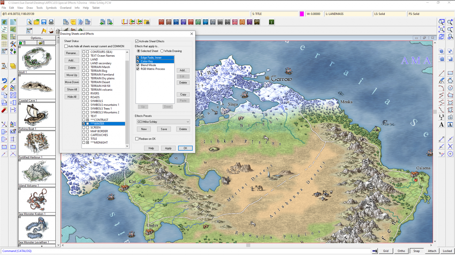
How Do I Trim 2 Polygons?
If the shapes are on the same sheet just add the transparency effect. It is applied to the sheet, rather than to individual polygons, so you won't be able to see the overlap.
If these shapes are on different sheets, and if they are only ever to have a transparency applied and no other sheet effects, the easiest way is probably to add a Colour Key effect to the sheet with the pale green polygon on it, and then copy the dark green polygon onto that sheet and use Change Properties to turn the copy solid colour and magenta (the colour of the colour key). This will cut the precise shape out of the pale green polygon.
If you mean to have these polygons on separate sheets and with sheet effects like Edge Fade, Inner applied, then things could be a little more complicated, but still it shouldn't be necessary to actually trim anything at all.


-
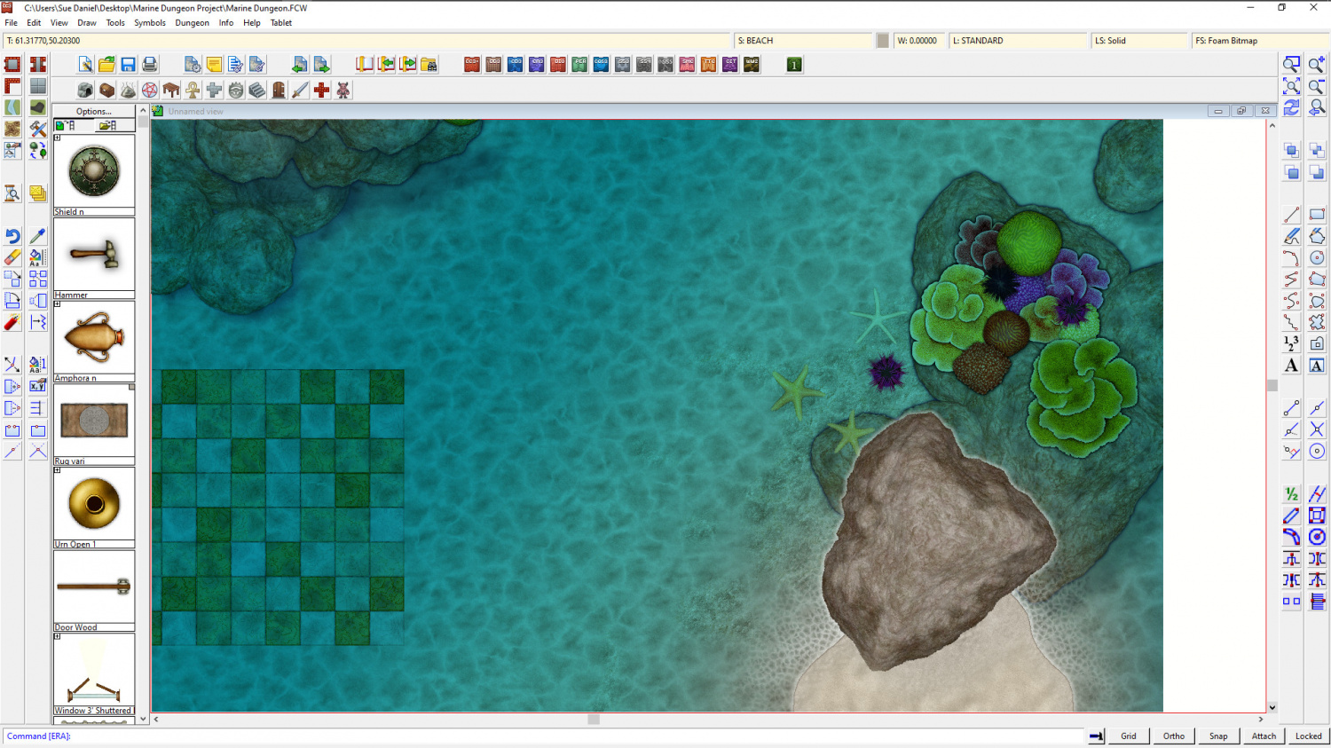
Marine Dungeon - a Cartographer's Annual development thread
It's a pity you can't do it the way I do it in dreams. The water exists as air. The only way I can tell I'm underwater is the light, the ripples in the sky, and the creatures swimming past. Think Mars gravity, thick air you can fly through if you flap your arms, coral and kelp instead of grass and trees, and 'flocks' of fish flying past instead of birds.


-
Marine Dungeon - a Cartographer's Annual development thread
@Wyvern - take away the coral, leave the starfish and urchin, and add barnacles, mussels and limpets instead... do you think these colours would be a nice compromise for both tropical and temperate seas?
I've also split the rocks so that the underwater ones are darker, and the shore ones have wet sides.
-
Live Mapping: Mercator Historical
Hi Everyone :)
In this week's Live Mapping session Ralf will be creating a map in the Mercator Historical style, which was the very first issue of the very first Cartographer's Annual 15 years ago now.
Come along and join in the fun! :)

![[Deleted User]](https://secure.gravatar.com/avatar/c75d9a245b74d9c59be0999ea81ca541/?default=https%3A%2F%2Fvanillicon.com%2F92add7f8c954488718110edc4896ad39_200.png&rating=g&size=200)
-
WIP: Dominion of Ostia
You can use a Color Key on the coast side of the snow to stop it peeling back. This is a different setup where I've used other effects as well as the Edge Fade/Color Key combo, but if I turn those effects off, you can see what I've done here.
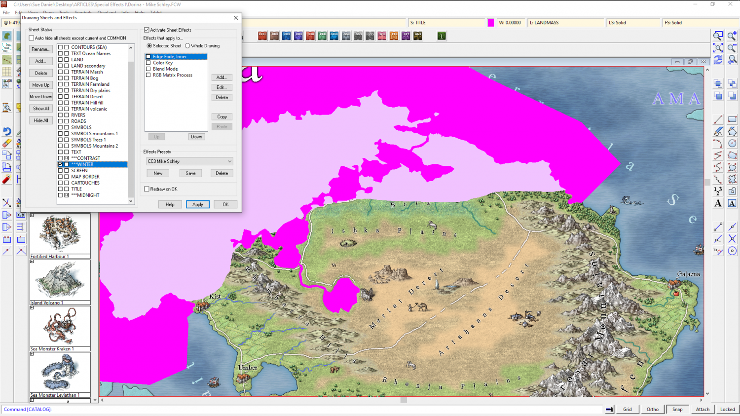
There are 2 polys on the same sheet. Light and dark pink (the light pink represents the snow). The dark pink will be removed by the Color Key, but before that the combined area is eroded by the edge fade. The end result is that where the light pink is the edge of the combined area that edge will be faded, but where it is protected by the dark pink it will remain.
An alternative to this is to use the same snow texture on your tundra sheet, but you can have transparency acne issues if you do it that way.


-
[WIP] Recreating Thedas
Looking good :)
If you are wondering why some of the terrain has sharp edges that's because the Edge Fade Inner sheet effect only acts on the outside edge of the combined polygons on that sheet. To give them all the same faded edge all the way around it may be necessary to create LAND FEATURES 1, LAND FEATURES 2, etc, and copy the EFI effects across to the new sheets, then move some of the land feature polygons to the new sheets. To avoid confusion I sometimes call them TERRAIN DESERT, TERRAIN MARSH, etc, so I know exactly what sheet something should be on when I move it.
Where you do forests you can make them look more natural by dotting a thinning band of single trees around the edge to break up the hard line.


