


Loopysue
Loopysue
About
- Username
- Loopysue
- Joined
- Visits
- 10,414
- Last Active
- Roles
- Member, ProFantasy
- Points
- 10,161
- Birthday
- June 29, 1966
- Location
- Dorset, England, UK
- Real Name
- Sue Daniel (aka 'Mouse')
- Rank
- Cartographer
- Badges
- 27
Latest Images


-
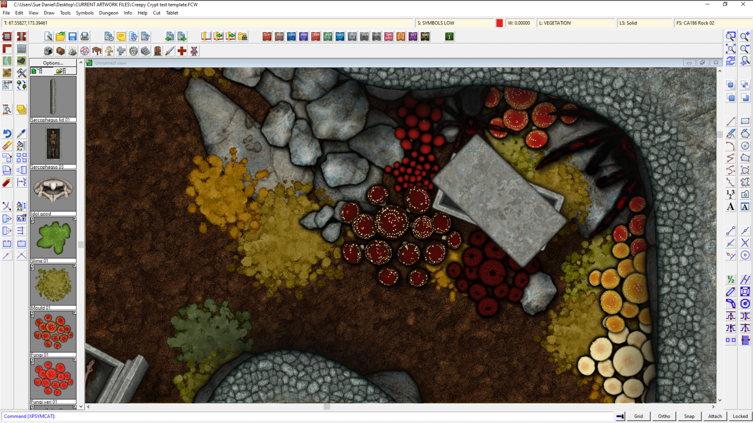
The Creepy Crypt project
I forgot to add the mould!

![[Deleted User]](https://secure.gravatar.com/avatar/c75d9a245b74d9c59be0999ea81ca541/?default=https%3A%2F%2Fvanillicon.com%2F92add7f8c954488718110edc4896ad39_200.png&rating=g&size=200)


-
Sheet Effects Question
It's possible you have an effect in the Whole Drawing category. In this map I have an RGB Matrix Process turning the entire map grey
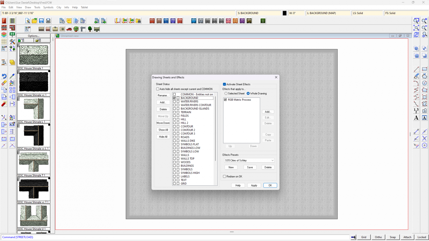
To check your own map click the Whole Drawing radio button at the top of the effects panel. Anything there will affect the entire map.


-
Banners
Thank you, Calibre :)
Quenten - yes, that's what it is. Two ends and a middle, but with the middle being a connecting symbol which means you can make it go all the way across the map if you wish.


-
Convert Map Style to Look Drawn
Here is how I would do it if I just wanted a background with nothing fancy, like scrolls or ragged edges.
- Add a new sheet on top of your map (bottom of the list)
- Add a Blend Mode sheet effect to the new sheet
- Set the Blend Mode to Multiply
- Draw a rectangle of the desired parchment fill over the entire map on that new sheet.
- Refresh the drawing
You may find that this trick works better with black and white styles, but it does depend on the style. Here is an example:
You will find parchment fills in the Bitmaps\Tiles folder and subfolders depending on what add ons you have. If you can't find any you like in there, there are some free here:
https://www.profantasy.com/products/subsamples.asp#&panel1-1


-
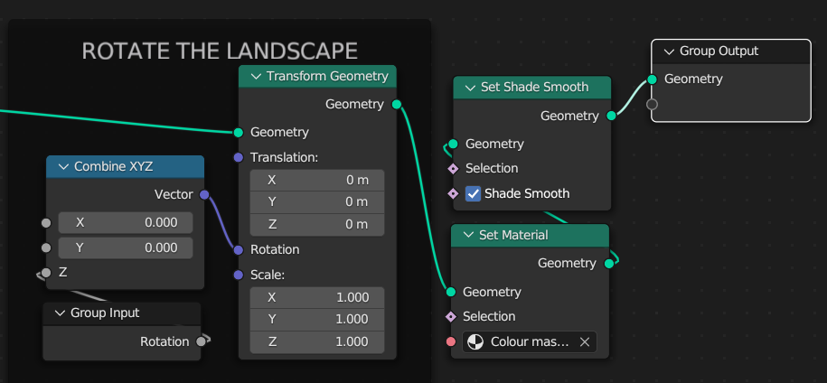
CC4 Overland Development Thread
The image for the node setup turned out a bit blurry, so this is it again in a more readable fashion. I continue to work in Blender version 3.6.8 even though there are more up to date versions. They update/upgrade in a fashion that damages version compatibility. Some of these nodes no longer exist in the current version, or exist in such a changed state that they don't work the same way.
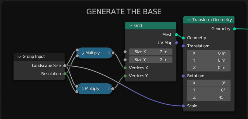
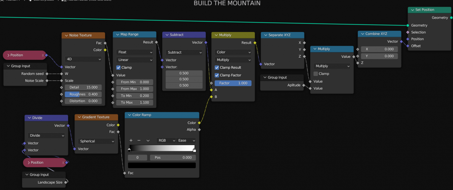
In the first image I use 2 Math nodes to do the same thing. This can be done with just one linked to the same inputs and outputs.
Have fun! :)


-
There any master printable lists of symbols?
Hi :)
If you open the catalogue file (that's the [Foldername].FSC file usually visible in the parent folder of the [Foldername] containing the symbols), you can export an FCW file with all the symbols arranged neatly and ready for printing using the "Create catalog thumbnail file..." option.
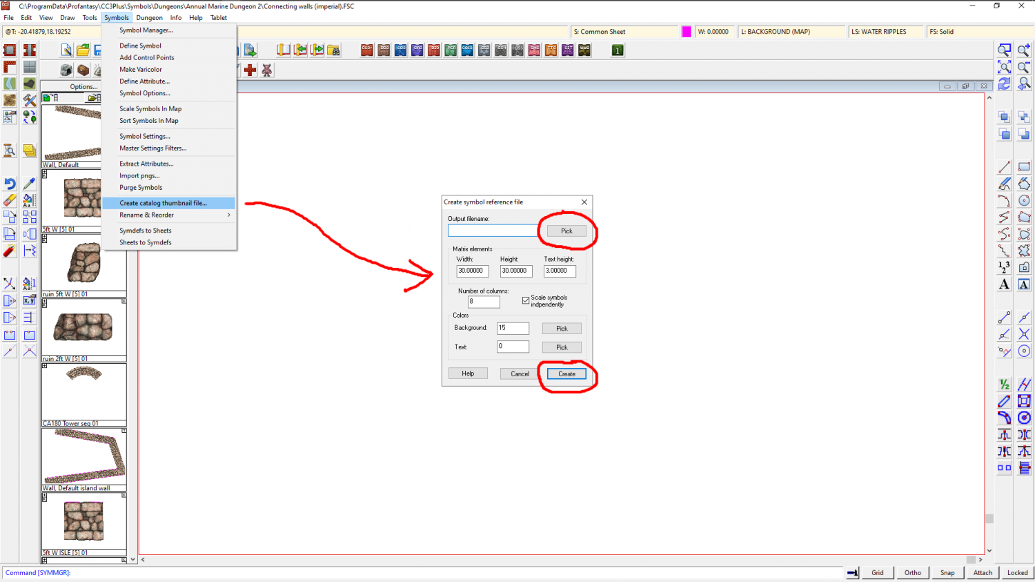
In this example I created a Test.FCW file on my desktop which looked like this when opened.
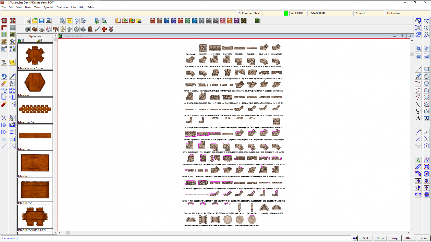
The blank space at the top left is a drawtool and not a symbol, so it's name is there but the sample line is not.
I then exported a jpg bitmap from this and got this result (this is only a 500 px export to preserve the copyright on these symbols on the forum, but you can set it any size you prefer using the Options button in the Save as dialog.
This works for each catalogue at a time, but it doesn't take too long to do, and if you print each one you can make a reference book of them for yourself.


-
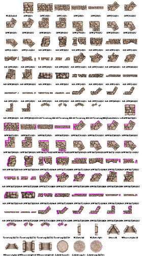
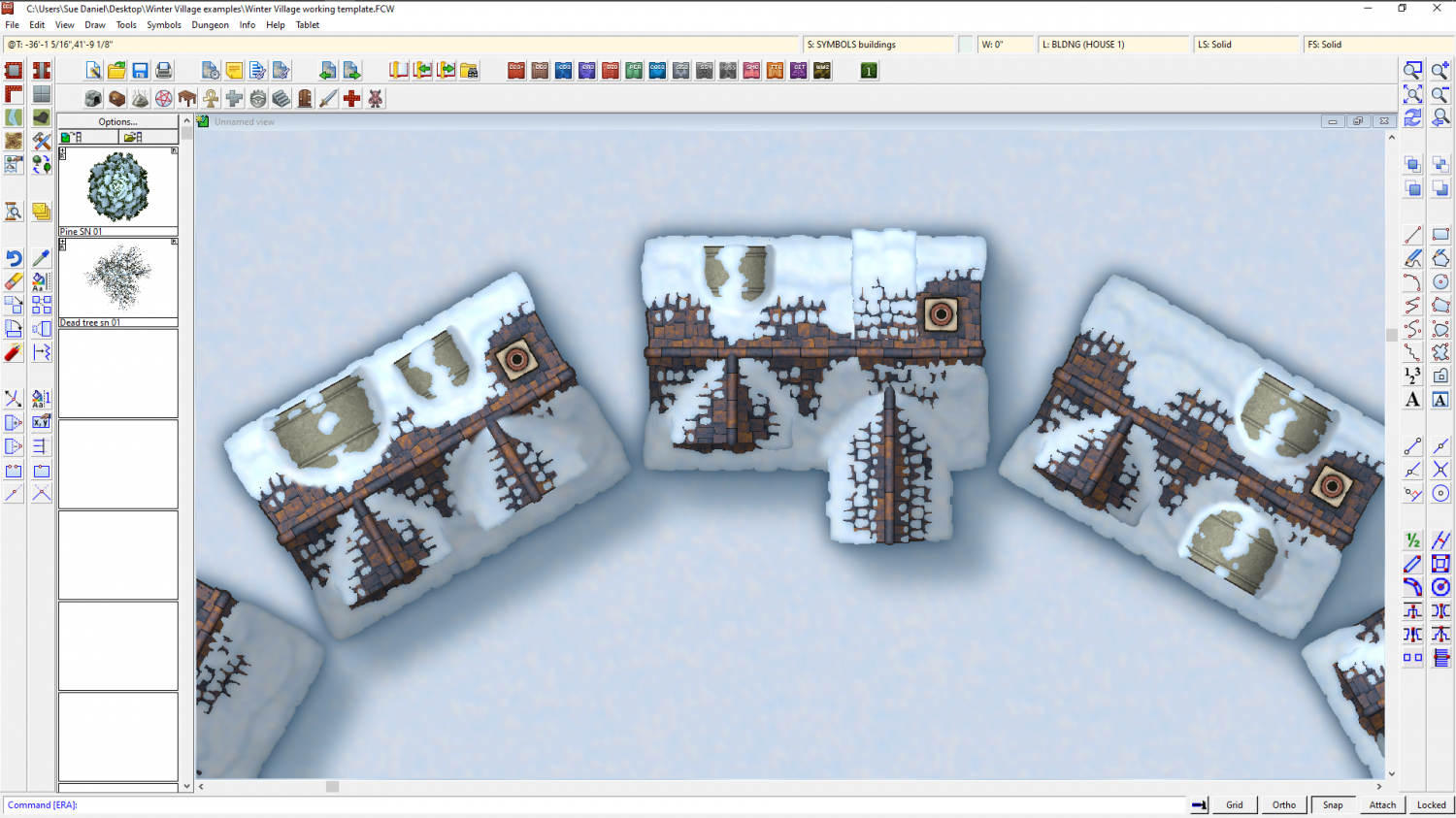
Winter Village style development (March 2022 CA issue)
Having fun with different kinds of dormer. This is the same basic building...
-
Annual Darklands fill question
Thanks :)
I did a quick sampler of all the forest and woodland drawing tools with the tool names shown for identification.
The trees from Darklands are quite dark compared to other styles, so you won't get any lighter trees than the jungle ones.
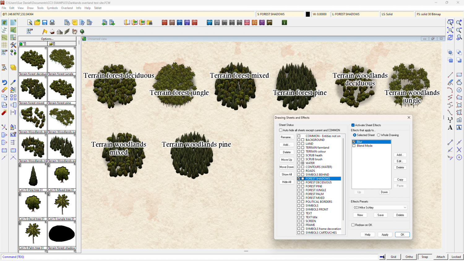
I think you might have the blurred FOREST SHADOWS sheet above the FOREST* sheets (above in the map - below in the list). That would cause the blurring seen in your shot. Check to make sure the sheets are in the right order.
As for the drawing tools themselves, the forest ones all seem to be in order, but the last two woodlands drawing tools seem to have a higher than expected density. I don't know if this is intended or not.


-
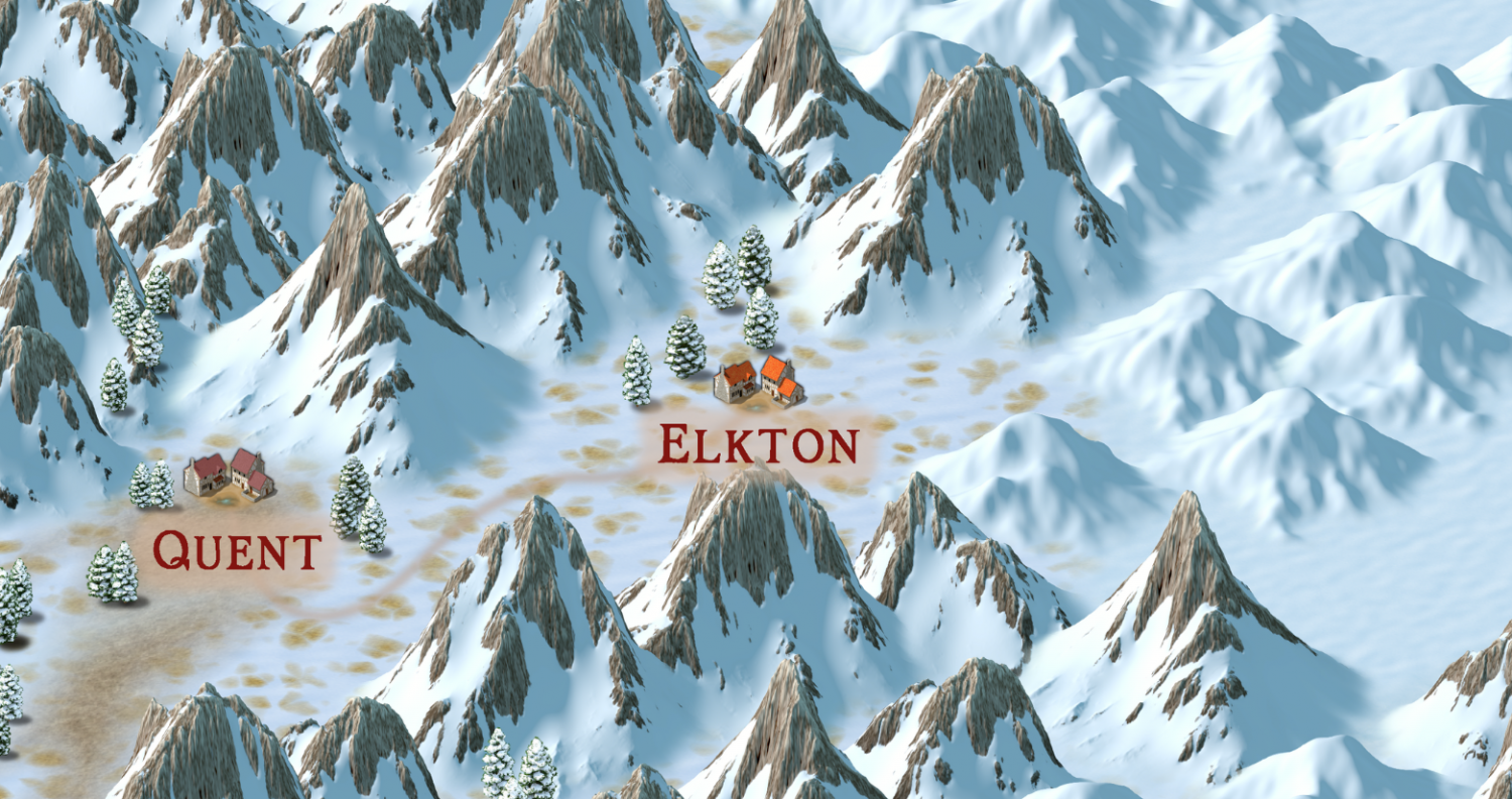
Community Atlas 1000th map Competition - with Prizes [August/September]
Please can I do the village of Elkton, from the Alarius North Central map?


-
Is there a way to add windows and other stuff to the walls from SS6 Isometric Cities?
Hi Aggelos :)
There is a blog article all about adding buttons, and a link to a video from within it here:


