


Mythal82
Mythal82
About
- Username
- Mythal82
- Joined
- Visits
- 781
- Last Active
- Roles
- Member
- Points
- 366
- Rank
- Traveler
- Badges
- 3
Latest Images
Reactions
-
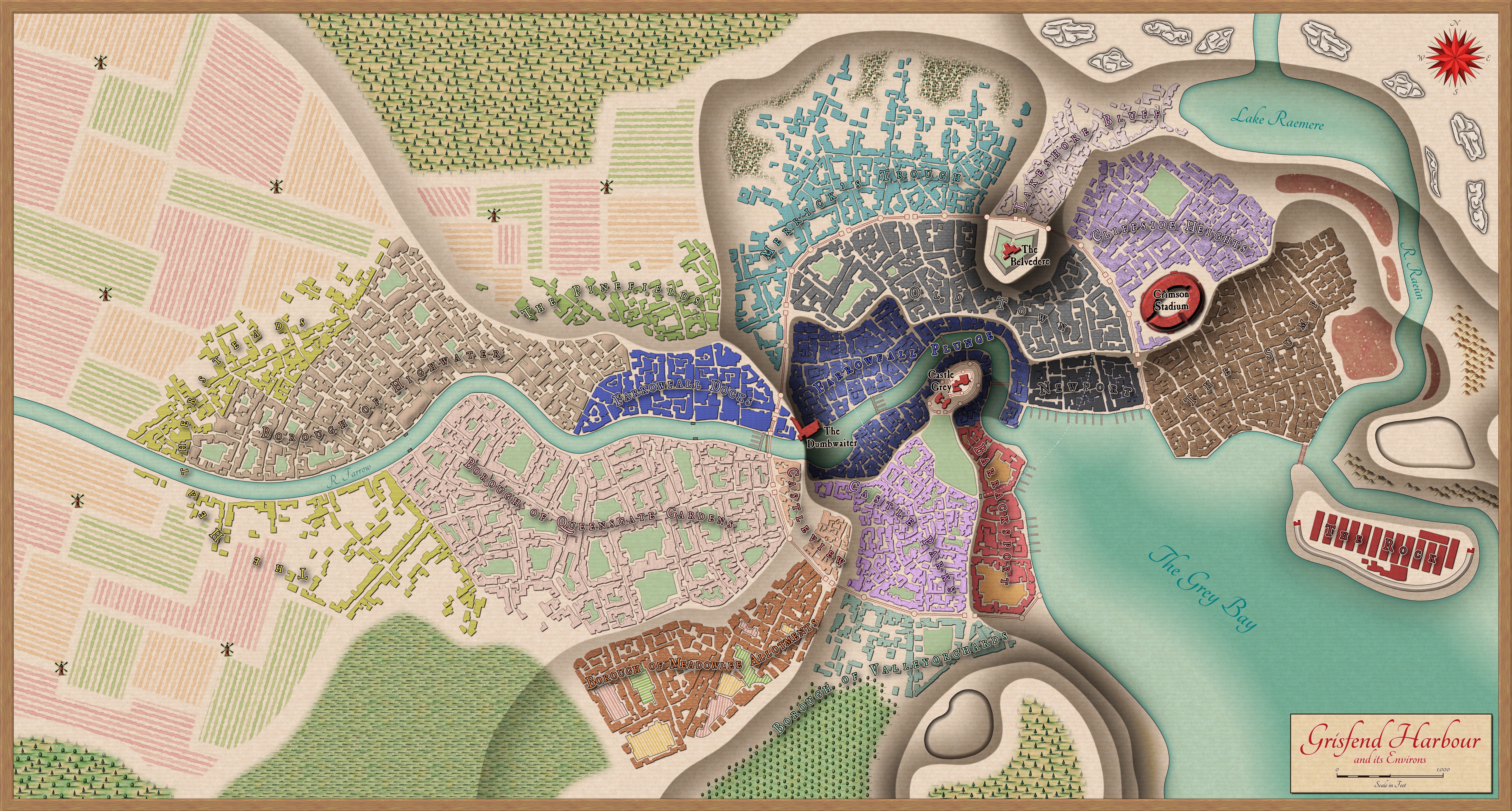
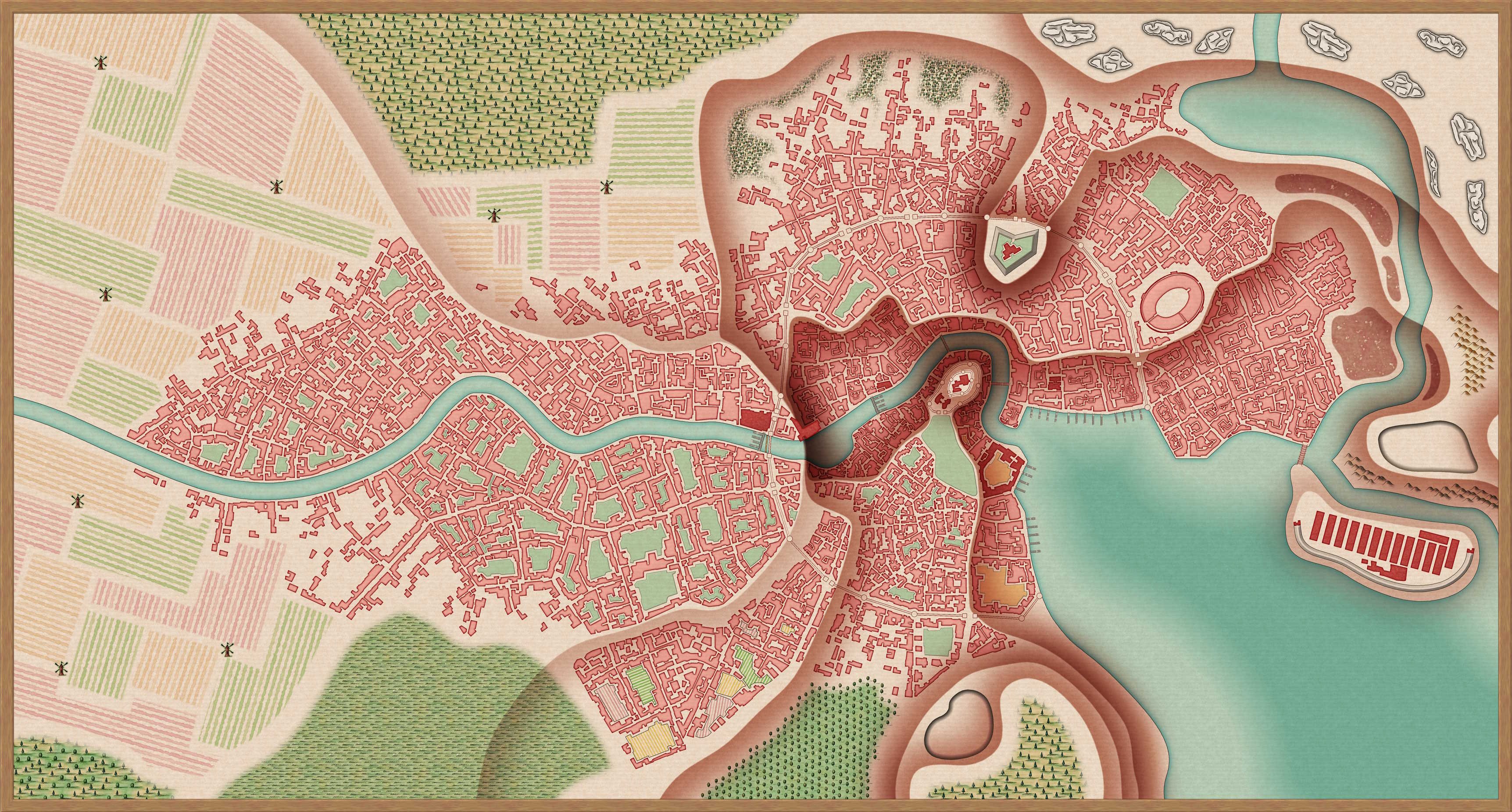
[WIP] Port City Map - Watabou to Ferraris Style
Tried a more subdued colour scheme, and also put together a regional map for the city's immediate surroundings:


and 4 others.
-
[WIP] Port City Map - Watabou to Ferraris Style
So my current project is taking a Watabou City Generator map of a port city metropolis, and adapting it to the Ferraris annual style. The challenge here's two-fold. First, I want to make a tiered city, with the sea-facing docks in the basin, the urban settlement mid-tier, and the farmsteads and suburbs at the highest level. Second, it needs to be a large, abstract city which can believably hold 35-40,000 people - so detailed-building city styles like the MS (which is my general go-to) are just too detailed.
This is the Watabou-generated 35,000-population port city I opted to use as a basis (14,000ft by 7,400ft):
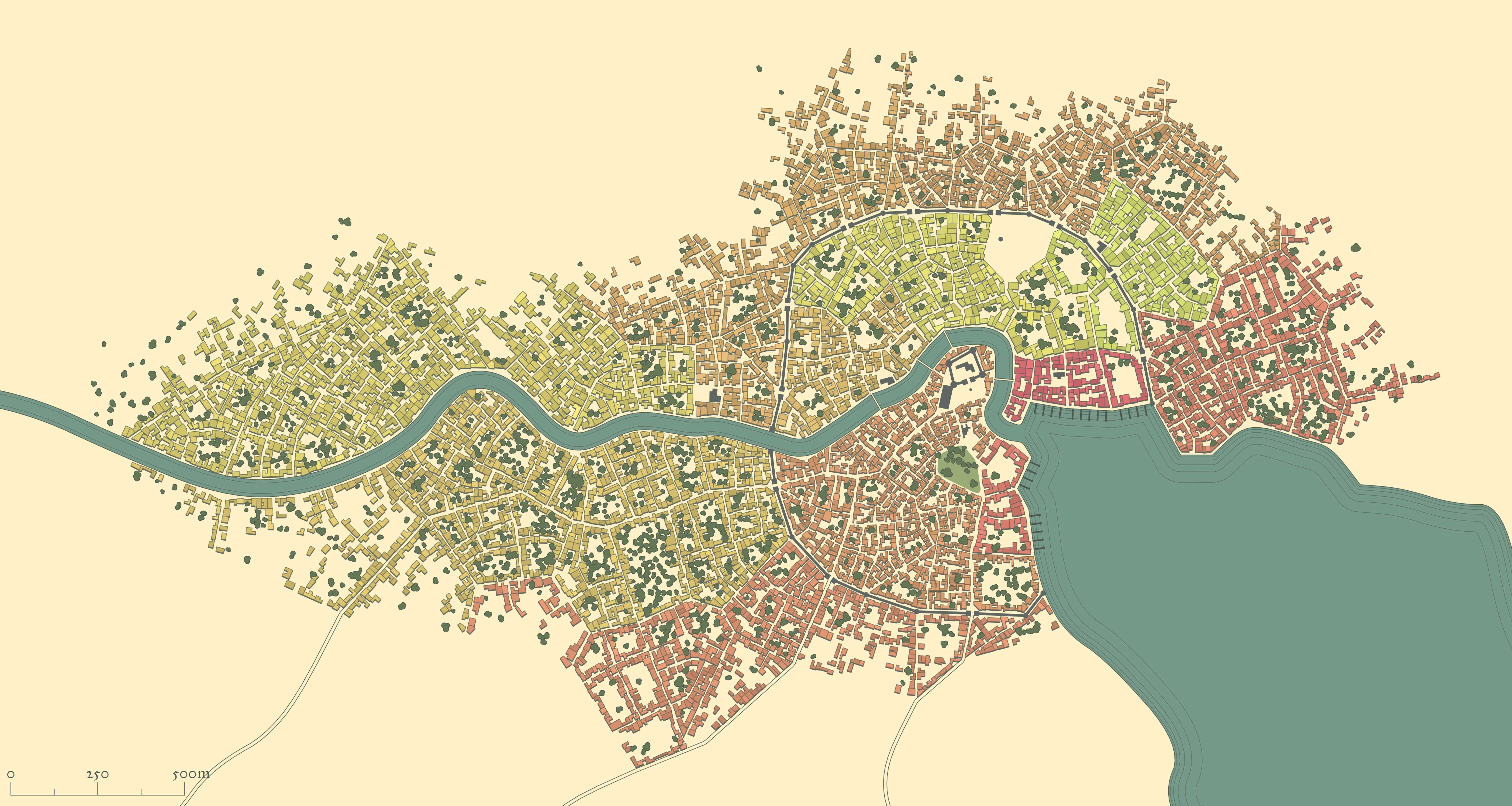
And here's what I've got so far as a WIP:
You'll notice a little splash of green in the middle - that was just proof-of-concept for using Colorize effects and layers for buildings to differentiate between the city's various districts - deep green for the riverside docks, light green for the farmsteads, red for the military district, etc.
All input gratefully received!


 and 4 others.
 -
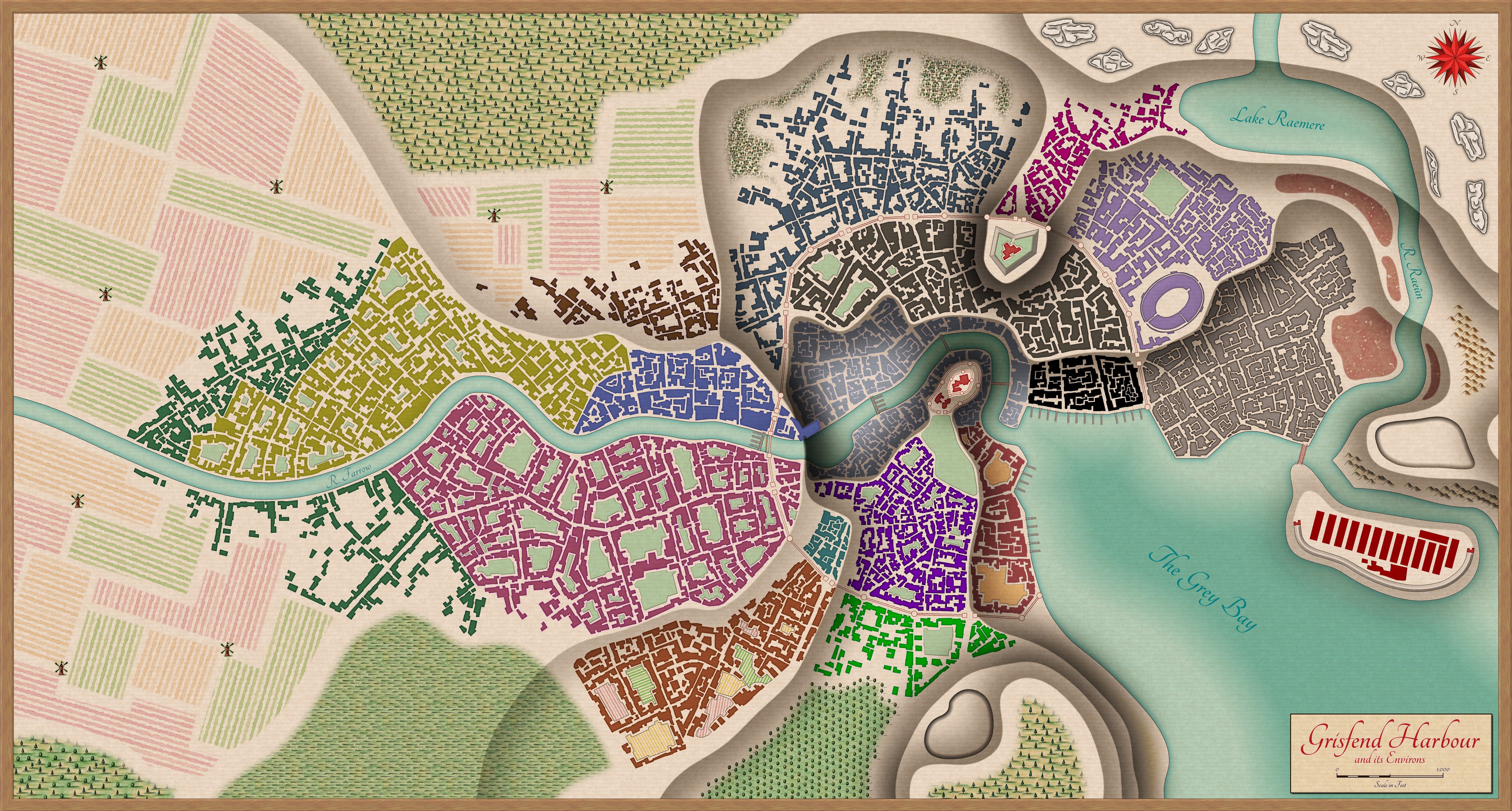
[WIP] Port City Map - Watabou to Ferraris Style
And here's the final product - thanks for the input!


 and 4 others.
 -
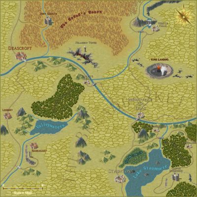
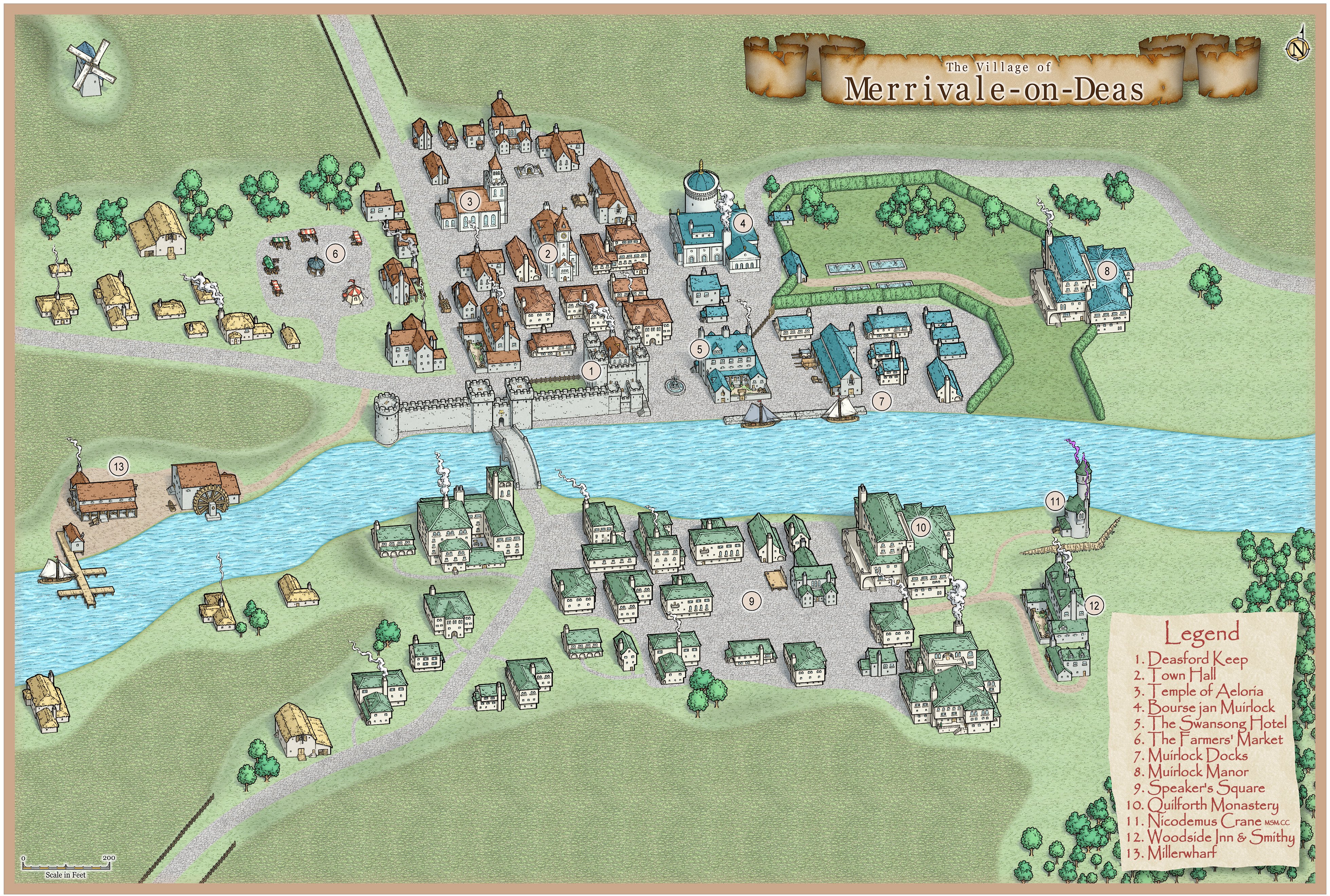
SS6: First Attempt
I've loved the new Isometric Cities style since it first launched, but this is the first chance I've had to build something in it for a campaign. Here is Merrivale-on-Deas, a small farming village which recently started aspiring to bigger things. Once merely a revenue stream for the better-known township of Deascroft, Merrivale in the last few years has boomed, since the opening of its own grain exchange.
The owner of the exchange, Vannin Muirlock, has done very well out of this, buying up the old Village Park and turning it into a private estate, and establishing a new upstream docks. This has taken a lot of business from the old Millerwharf and, new-found prosperity or no, some of the villagers aren't too fond of their new benefactor...
 and 4 others.
 -
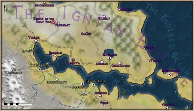
Town Map for a Cthulhu Game
Heya,
Put this map together for a Call of Cthulhu game, based on an actual small town. Used the 1930s street map from the Annual as a base, Photoshop for the street names, effects and highway label.
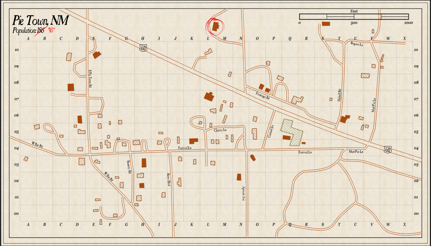
All feedback gratefully received!
![[Deleted User]](https://secure.gravatar.com/avatar/c75d9a245b74d9c59be0999ea81ca541/?default=https%3A%2F%2Fvanillicon.com%2F92add7f8c954488718110edc4896ad39_200.png&rating=g&size=200)


 and 7 others.
 -
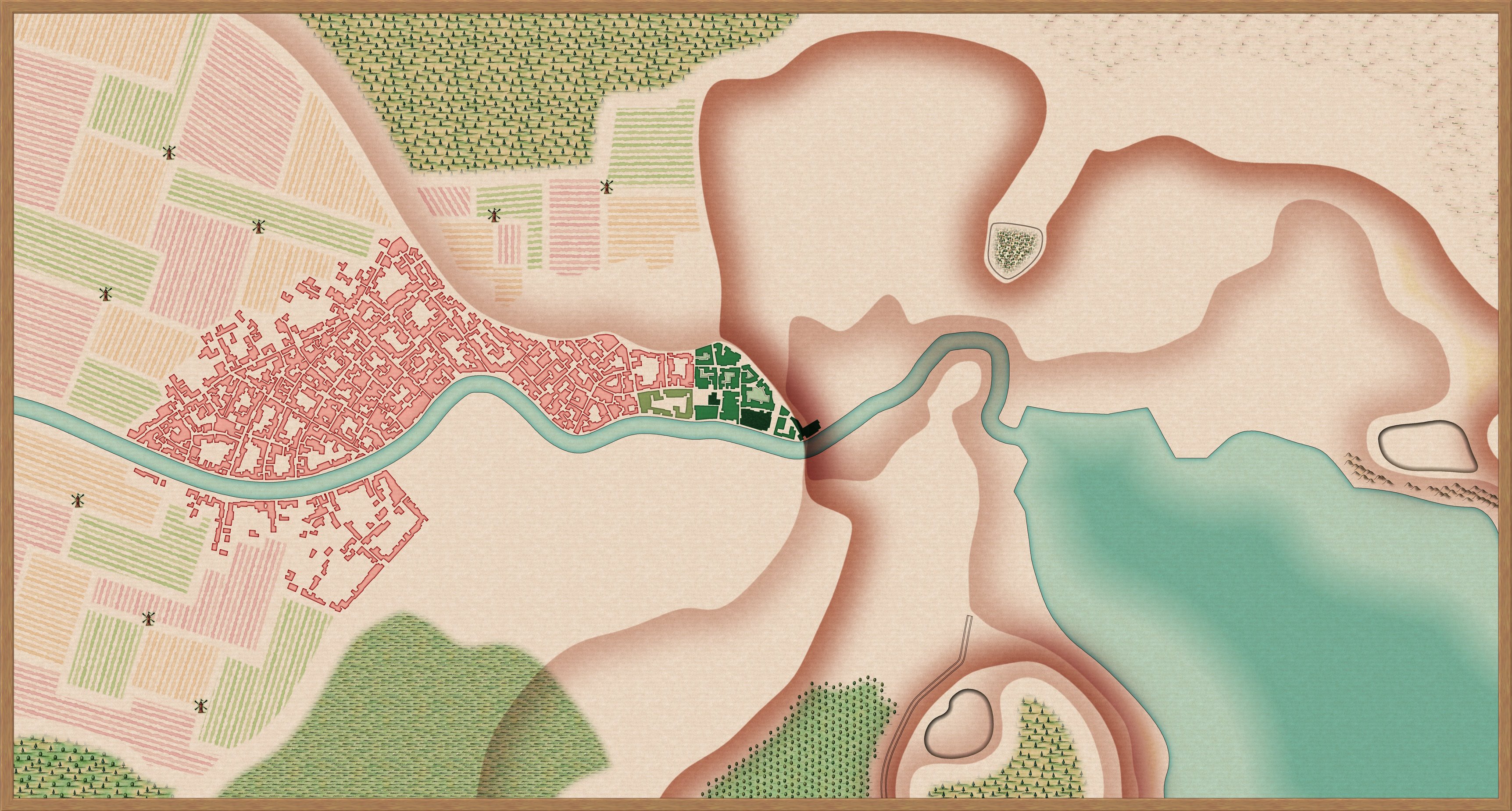
[WIP] Port City Map - Watabou to Ferraris Style
Almost finished with the urban blocks - only the basin to do - then it's on to additional features (city walls, interior fortifications).
Definitely feel like it's starting to take shape...
-
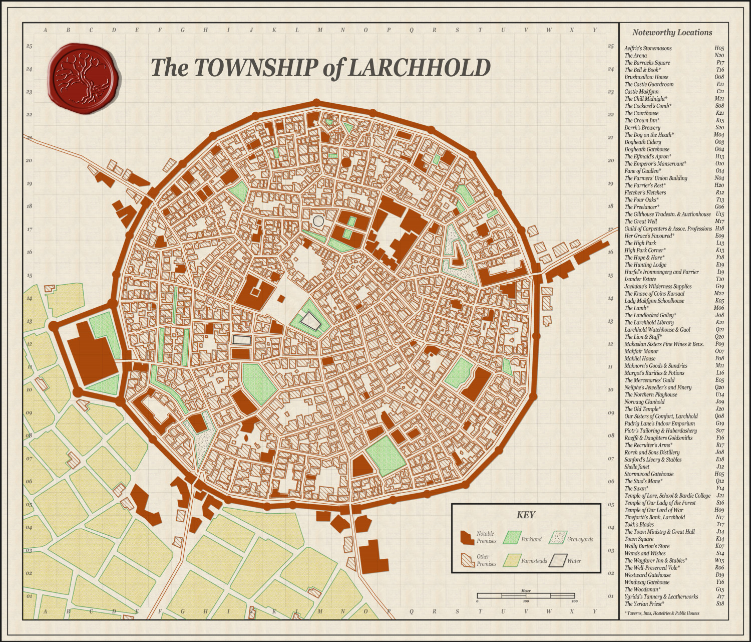
[WIP] Using Watabou as a basis for a mediaeval fortress town, using the 1930s Street Map Annual
Thanks! Here's what I think is the final draft - all feedback gratefully received, as always (edit: realised tired me had mucked up the alphabetisation for the last quarter of buildings)
-
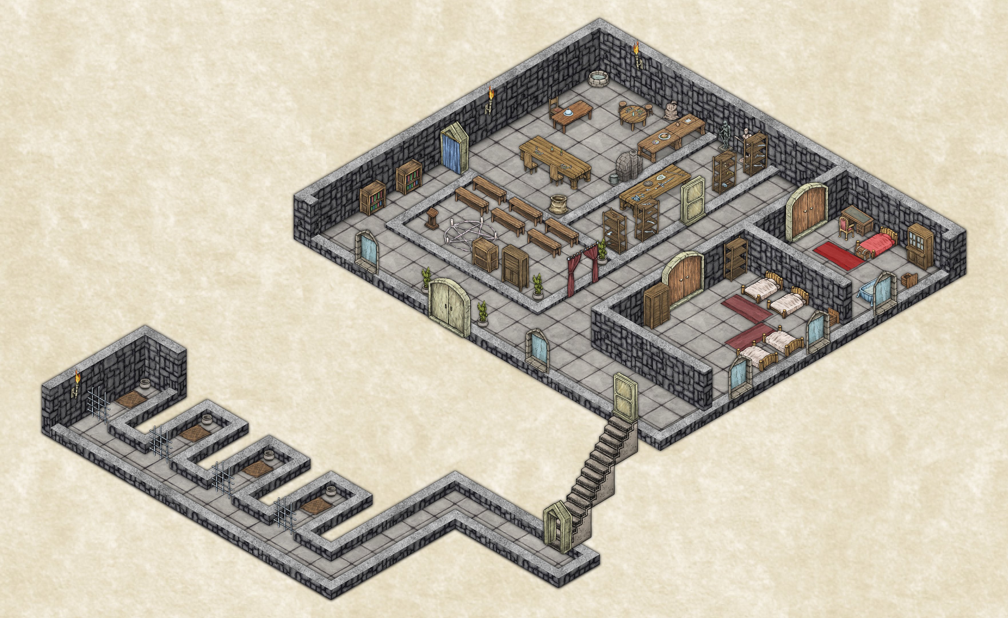
Using 'Perspectives' - First Attempt
Decided that for a particular scene in a game I'm running, a small isometric, multi-level scene was better suited than a traditional top-down, so made my first attempt at using the Herwin Wielink style (bolstered by the Temple of Bones annual for the steps).
Was run over a VTT, with use of dynamic lighting to control room visibility. I was rather happy with the result - it was slightly scrappy, I didn't try to split the walls to make space for doors etc., but the players really loved it and a couple actually asked for a copy of the image file after the session.


-
[WIP] Port City Map - Watabou to Ferraris Style
Here's the last WIP image - I've added every feature I planned to add, and all that's left (I think) is to colour code the buildings by district. Of course, if there's something I've missed, all suggestions gratefully received:


-
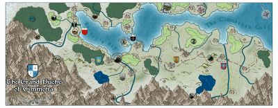
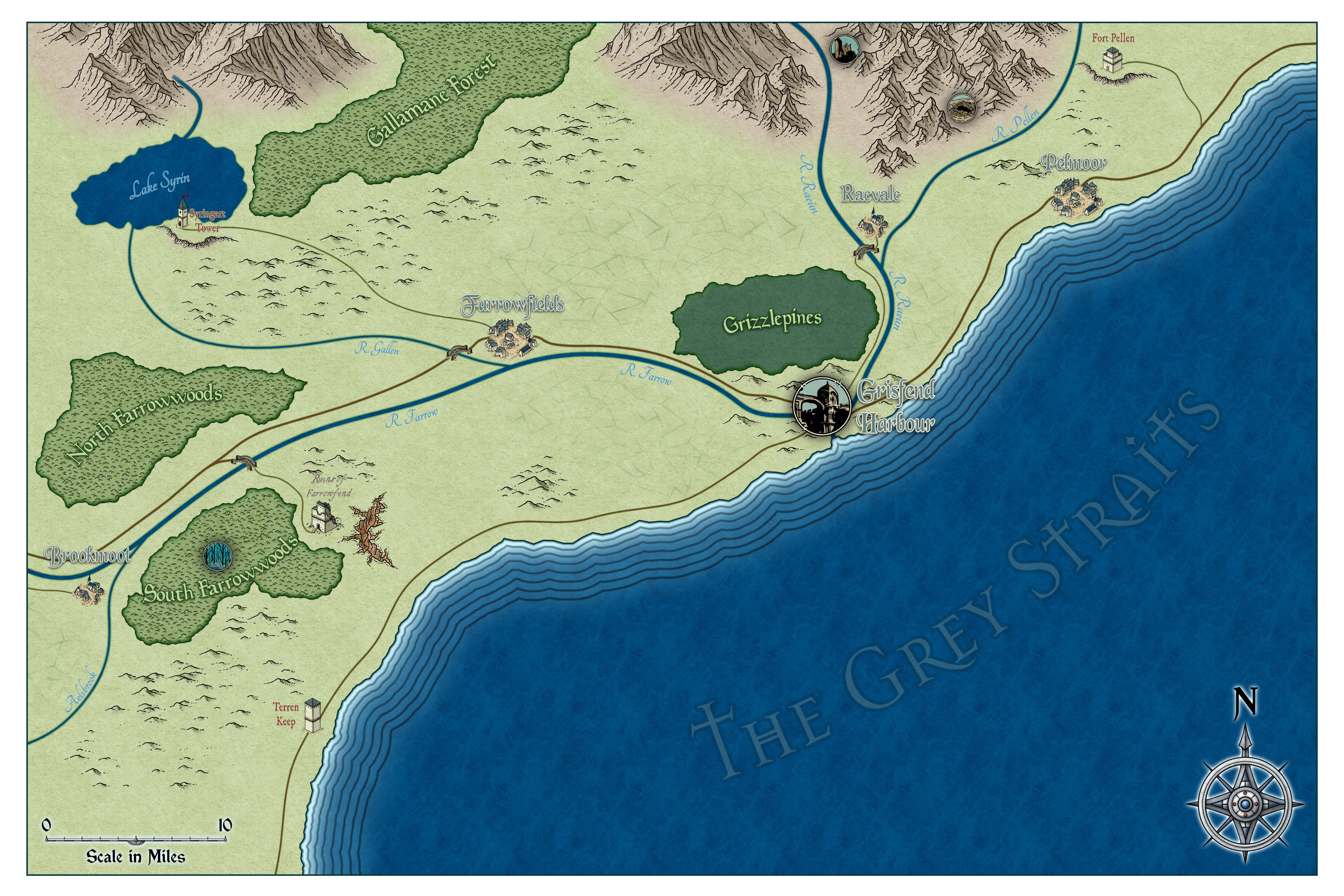
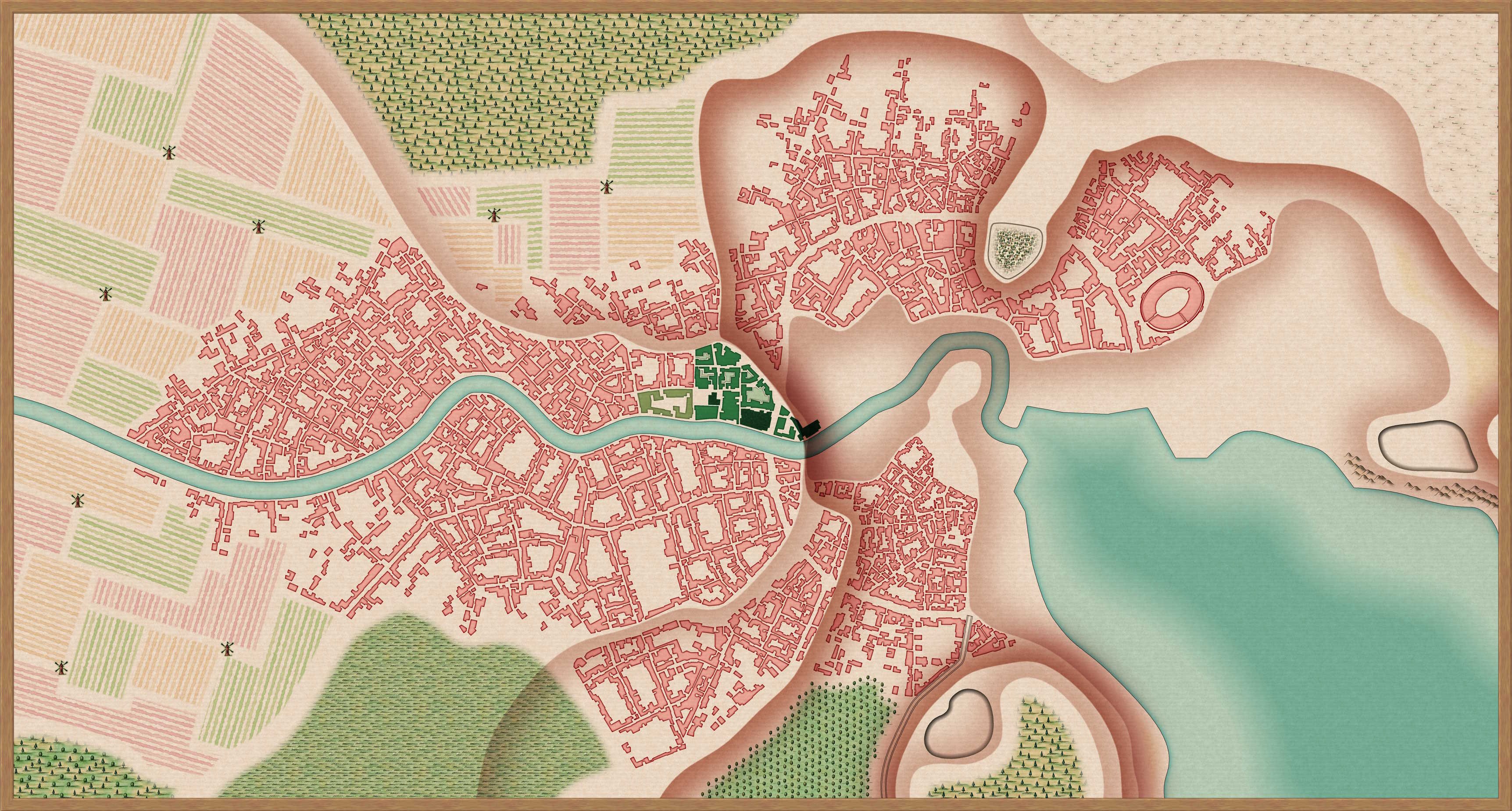
[WIP] Continent Map using CC3+ MS Overland and other resources
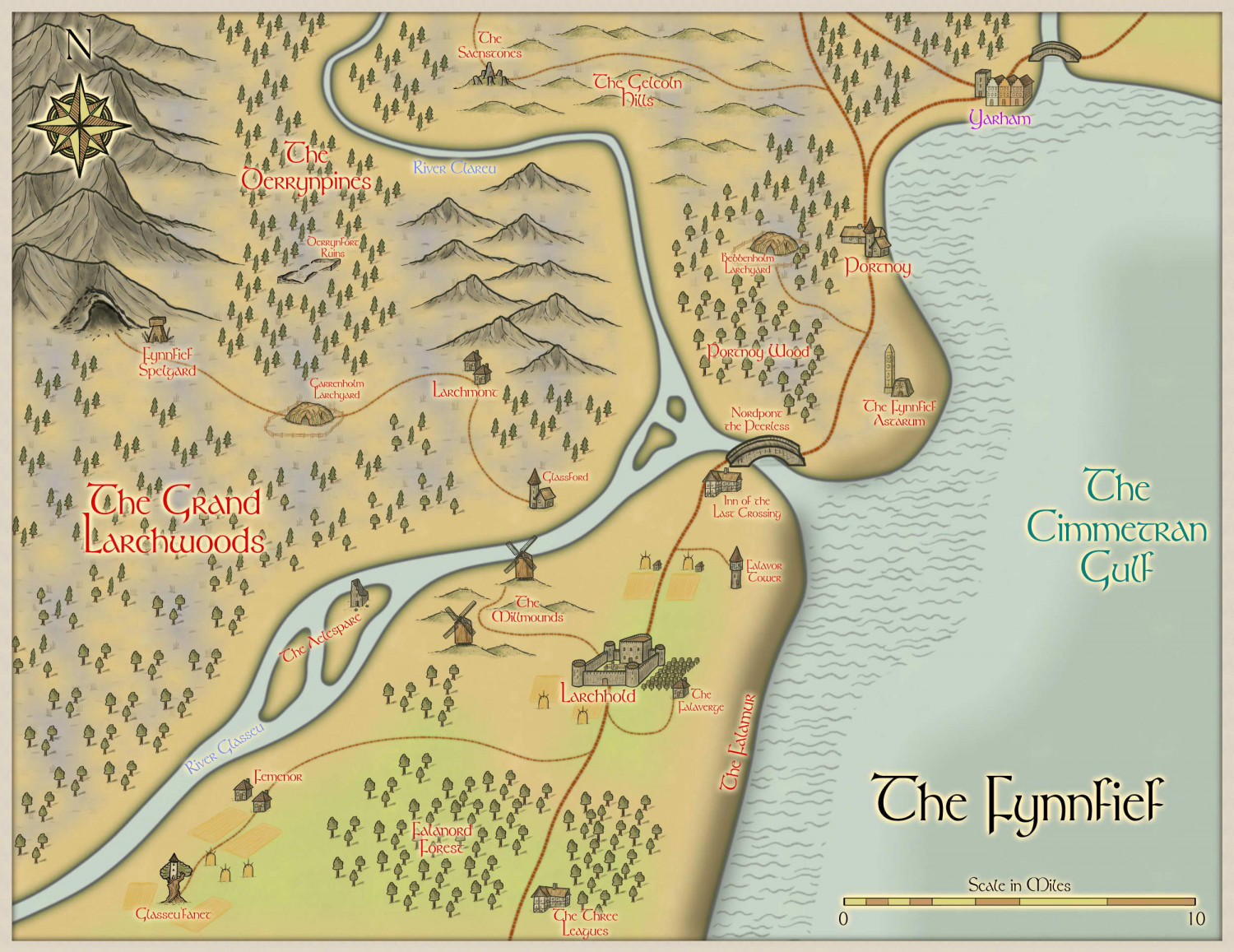
Here's my first attempt at a regional map based on the above Continent. It depicts a tiny (35mi x 27.5mi) region in northernmost Cimmetra (where the yellow country meets the purple country at its northern tip).
A couple of issues I found. First off, the road tools bugged quite a bit, so I wound up just replacing them with splines assigned to the relevant sheets - I think the result works, though. Second, and more of an issue, I couldn't think of any way to indicate on the map that The Falamur is a shield-wall of cliffs - there's no cliff symbol, etc. - so I wound up just using the same technique I've used to indicate elevation in maps before. Does it convey the intent well enough, do you think? Or is there a better way to get this across?
(It's important to the plot - it makes Nordpont the Peerless the only way to move cannon and heavy troops north to south)

