

[WIP] Port City Map - Watabou to Ferraris Style
 Mythal82
🖼️ 19 images Traveler
Mythal82
🖼️ 19 images Traveler
So my current project is taking a Watabou City Generator map of a port city metropolis, and adapting it to the Ferraris annual style. The challenge here's two-fold. First, I want to make a tiered city, with the sea-facing docks in the basin, the urban settlement mid-tier, and the farmsteads and suburbs at the highest level. Second, it needs to be a large, abstract city which can believably hold 35-40,000 people - so detailed-building city styles like the MS (which is my general go-to) are just too detailed.
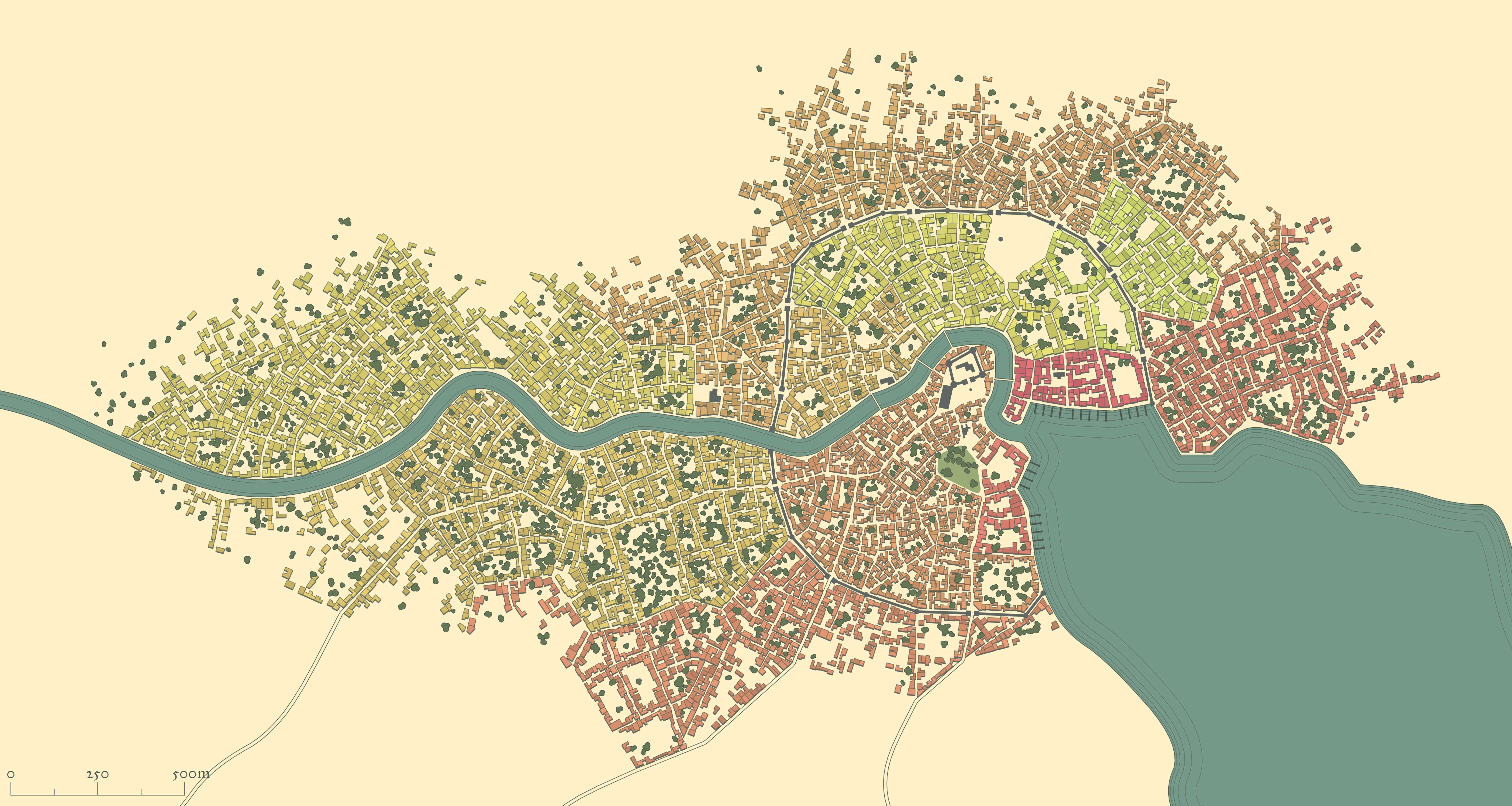
This is the Watabou-generated 35,000-population port city I opted to use as a basis (14,000ft by 7,400ft):
And here's what I've got so far as a WIP:
You'll notice a little splash of green in the middle - that was just proof-of-concept for using Colorize effects and layers for buildings to differentiate between the city's various districts - deep green for the riverside docks, light green for the farmsteads, red for the military district, etc.
All input gratefully received!


 and 4 others.
Comments
Wow! That's quite a feat.
How are you doing the buildings in ferraris - are you converting the Watabou stuff directly, or just drawing over the png?
I really like this style for Watabou cities of large volume, so i would love a detailed methodology.
Inspiring stuff.
I’m tracing over the png - it takes a little time (the above was an evening’s work, off and on) but I didn’t really have another option since I wanted the layers of relief in the map (which means editing the block layouts to avoid houses going over cliffs, etc).
In terms of the methodology I’m following:
I’ll post updated WIPs in the thread, let you know how it goes ^_^
Thanks for all of that. I am going to give this a go once I finish my current projects
Almost finished with the urban blocks - only the basin to do - then it's on to additional features (city walls, interior fortifications).
Definitely feel like it's starting to take shape...
Here's the last WIP image - I've added every feature I planned to add, and all that's left (I think) is to colour code the buildings by district. Of course, if there's something I've missed, all suggestions gratefully received:
And here's the final product - thanks for the input!
That is one gorgeous map!
So, I thought I was done with this map, but I decided to experiment with something inspired by the amazing maps of Alyssa Faden. I created some new building tools and layers, and applied some slight texturing, to try and mimic the way she does roofs. This allowed me to recolourise the Districts a bit brighter, and to give them (I hope!) a bit more character. Lastly, I labelled it all up with the district and borough names, and highlighted some key buildings.
I must say I prefer the more subdued colours. But that is just a personal opinion. Your city is awe-inspiring
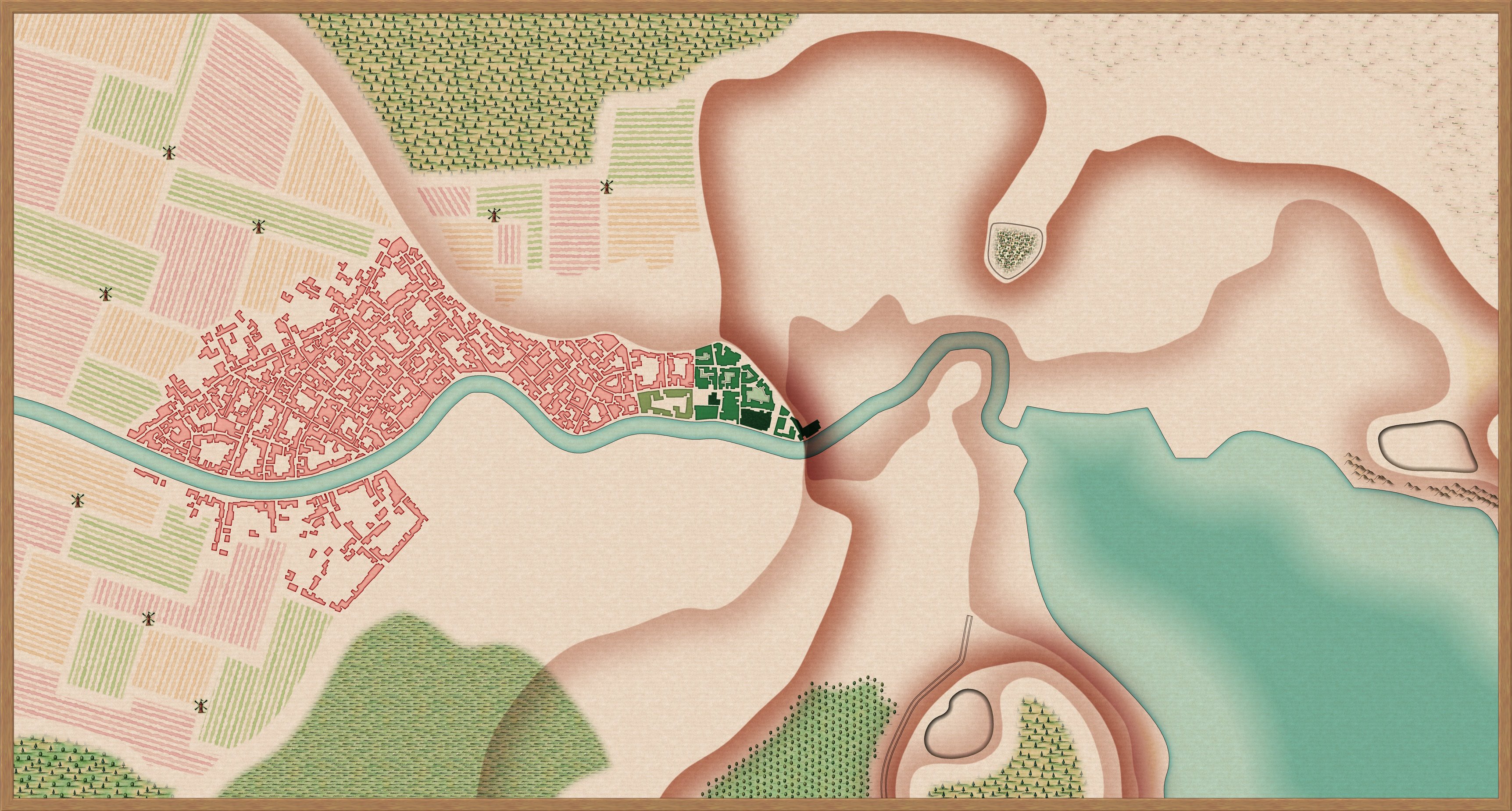
Tried a more subdued colour scheme, and also put together a regional map for the city's immediate surroundings:
Hi Mythal82,
What art style have you used for the regional map, I really like the hills in the map.
Dak
Hi Dak,
I used the Ancient Realms style from the 2015 annual - it’s one of my favourites, mostly due to the hills and the way it handles forests
Cheers,
Mythal82
Very Impressive, Lots can learn here for any project.