


Loopysue
Loopysue
About
- Username
- Loopysue
- Joined
- Visits
- 10,411
- Last Active
- Roles
- Member, ProFantasy
- Points
- 10,161
- Birthday
- June 29, 1966
- Location
- Dorset, England, UK
- Real Name
- Sue Daniel (aka 'Mouse')
- Rank
- Cartographer
- Badges
- 27
Latest Images


-
Live Mapping: Winter Lights
It's the festive season again!
Matching the holiday spirit, this week Ralf will be using the Winter Village style along with lighting options to create a festive village square map.
Come join us live on Youtube for the live mapping show at the time indicated in the left margin of the forum, and join in the chat.
https://www.youtube.com/watch?v=Cl6XfJeI9Cw
Or you can watch it here at any time after the show if you prefer.
I don't monitor this thread during the show, but if you have any comments or questions you can put them below if you missed seeing it live.


-
Community Atlas: Temple of Nidag, Stormwatch, Emerald Crown Forest, Alarius
Pretty colours :)

-
Community Atlas: Temple of Nidag, Stormwatch, Emerald Crown Forest, Alarius
While they might cause occasional screams of frustration, these are beautiful maps, Wyvern :)
-
Live Mapping: Hand-drawn Outdoors
This week in Live Mapping Ralf will be looking at the December Annual issue and its expanded outdoor battlemap options.
Come join us on Youtube here:
https://www.youtube.com/watch?v=g7azavUE1_A
Or watch it here if you prefer.
This thread is not monitored during the live show, but you can put your comments or and ask your questions here any time.
-
How Can I Draw Real-World Places in Campaign Cartographer?
You can use letters as well as numbers when you create the grid
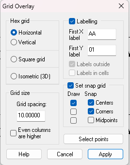
I'm a newbie myself as far as understanding how to modify the labels, but I did find a rather laborious way of doing it.
Pick the properties of the grid (this is something I forgot to do, but quite important if you want to regroup everything at the end).
Hide everything else and explode the grid.
Use Change Properties and right click to select all the labels by entity type
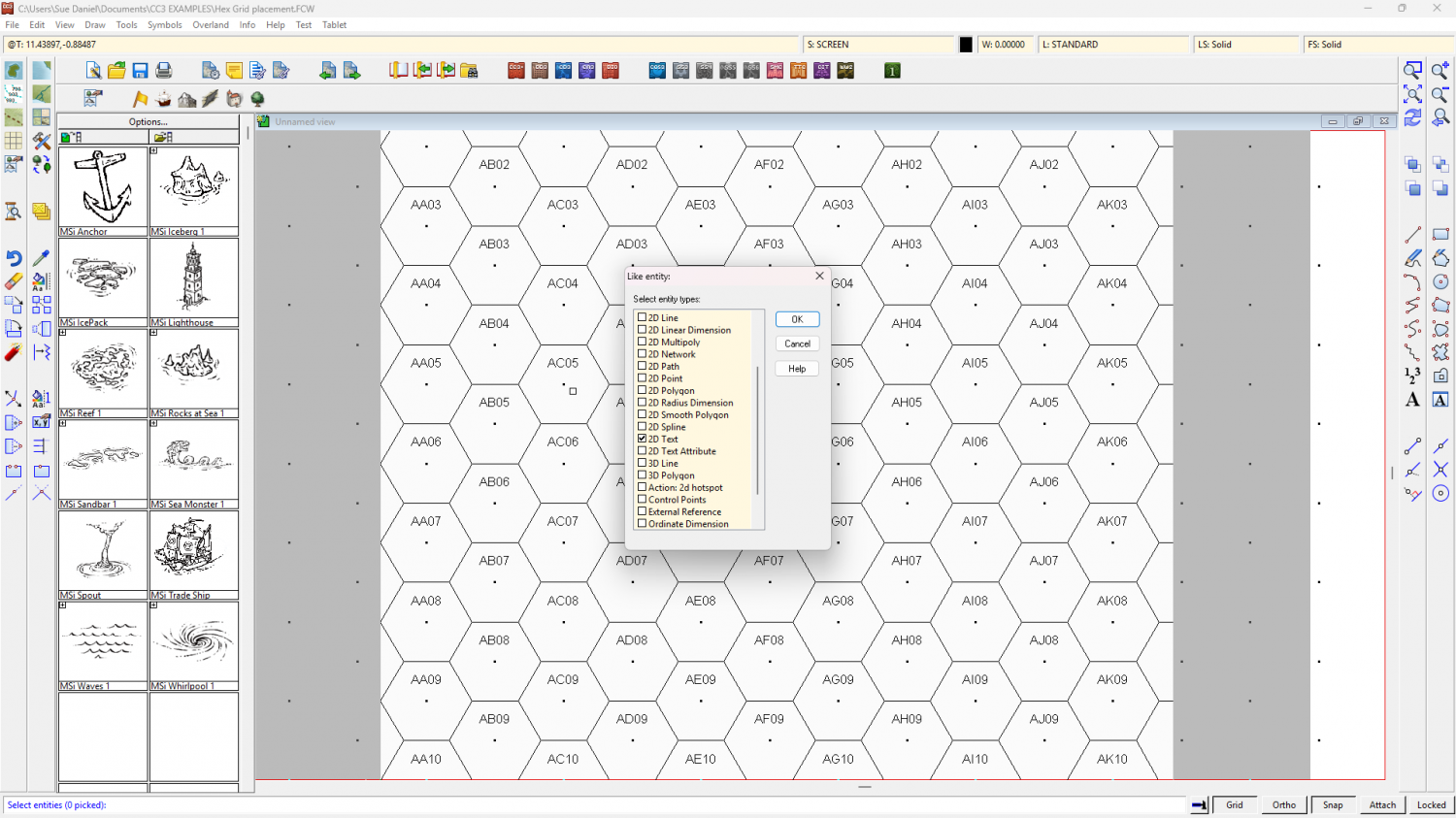
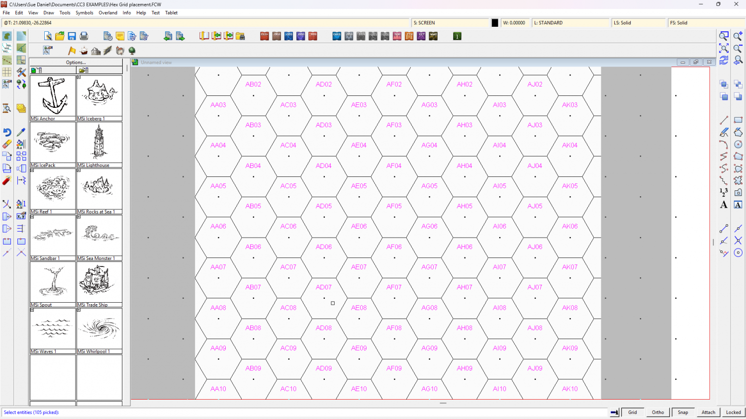
Do It, and use the Pick text properties button to set the size.
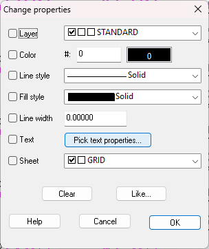
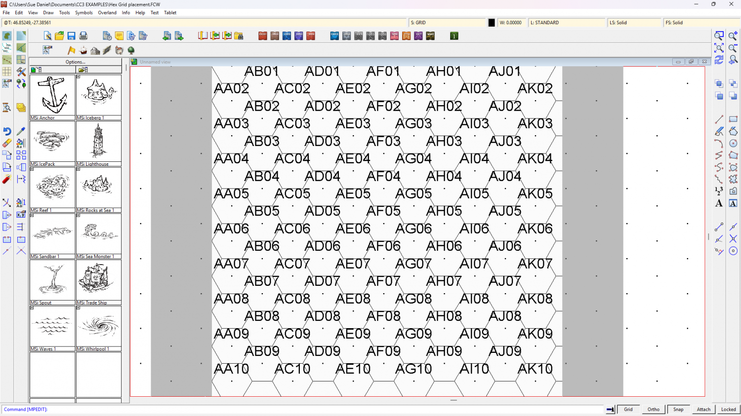
It's an undoable operation, so if you get the wrong size the first time just undo and try again.
I think it might be quite inconvenient to continue work with the grid exploded like that, so maybe best to regroup the labels and the grid when you are done. If (unlike me) you remembered to pick the grid's properties before you started that's just a simple operation because the grid will end up grouped on the right sheet and layer the moment you regroup it.


