


mike robel
mike robel
About
- Username
- mike robel
- Joined
- Visits
- 4,196
- Last Active
- Roles
- Member
- Points
- 435
- Rank
- Surveyor
- Badges
- 6
Latest Images


Reactions
-
Jim Pierce 1947 - 2024
Jim was very, very talented in crafting maps. I was always impressed, regardless of whether or not it was a world or a starship or something else.


-
a large city, I have been putting off, now started
That's all really nice work Jim. As a lover of large maps, I really like it. I want to make topographic isomorphic maps, but my imagination just doesn't work in creating them. I also have thought about trying to make the large maps out of the individual map sheets, but I find the trapezoidal nature of grid "squares" and alignment of features to be a real bear, particularly when I have to 'cut' the map portion out of the full map sheet.
I keep lusting after a large format scanner, but I can't justify it and a laser cutter might be more effective for my work, but they cost too much for a hobby, too. Sigh.

-
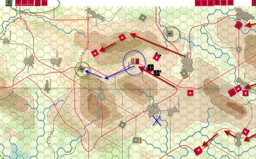
Cowpens Battlefield
This is my map of Cowpens battlefield. The battle was a near decisive action in the American Revolution, partially portrayed in the movie "Patriot". The victory here caused Cornwallis to retreat to Yorktown. It is interesting terrain, but not a lot of relief. Part of the brilliance of the American Commander was he defended from ground that resulted in the British shooting high because of they way they 'aimed' when they were shooting down hill.
I am interested in only a few battles during the 1700-1800s. Cowpens, Saratoga, Yorktown, Gettysburg (1st Day), and the Little Bighorn. I jump from ancients to Modern with those few stops.
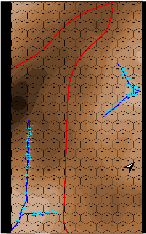
Each Hex is 200 feet. (odd for me, usually I think in meters for this sort of thing.) The map will be about 12 inches by 18 inches when completed.
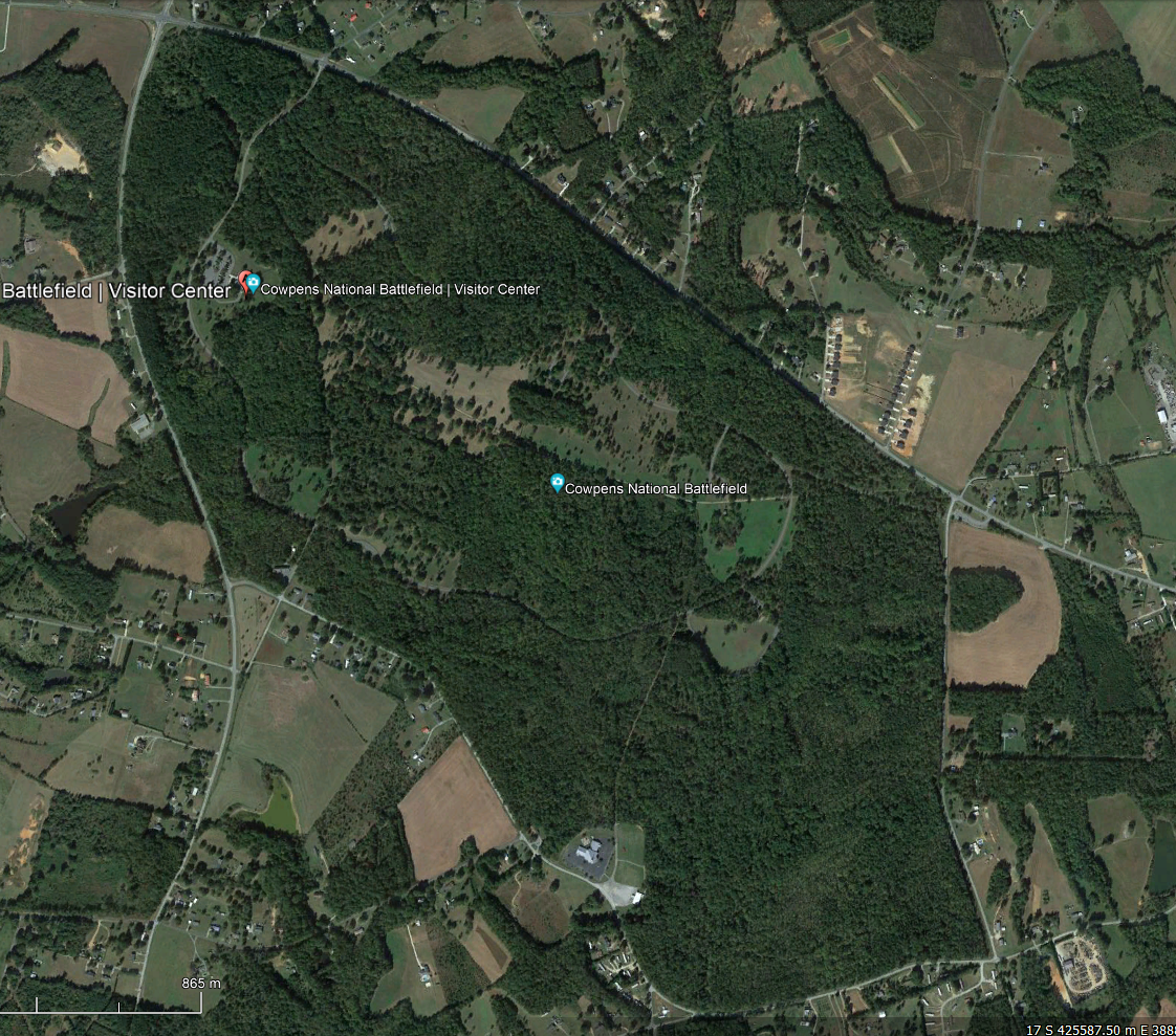
This is the battlefield today. There was not nearly as much forest.
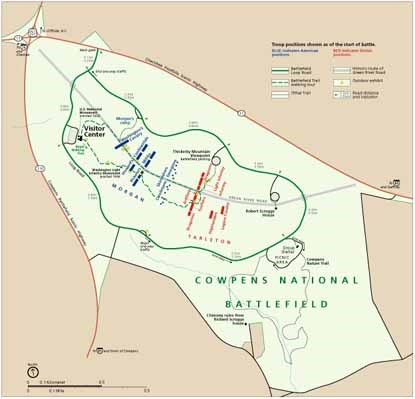
This is the battlefield layout. The US is on the left in Blue, the British are on the right in red, attacking generally from the South to the North. (Today in NATO and the "West" Blue is "Friendly" and Red is "Enemy". In a British World War II history I read, I was confused because the British were in Red and the Germans were Blue.).
The battle was fought in December. There apparently was some snow on the ground, but only a scattering of trees, which I have not put in yet. The question is, how to portray a 'dusting' of snow?
EDIT: I forget to mention, the terrain colors come from the 48 Shades of Brown Palette Andre made for me, as well as 48 Shades of Green, 32 shades of Green and Blue, and one that has 32 shades with 16 green and 16 brown that sort of blend into each other.


-
Little Bighorn Battlefield Map
When (IF) it ever gets published as part of a game, there will be a terrain effects chart depicting elevation, water courses, road, vegetation types, terrain types (ford, bog, etc) and their effects on movement, combat, and spotting (if any).

-
New Map
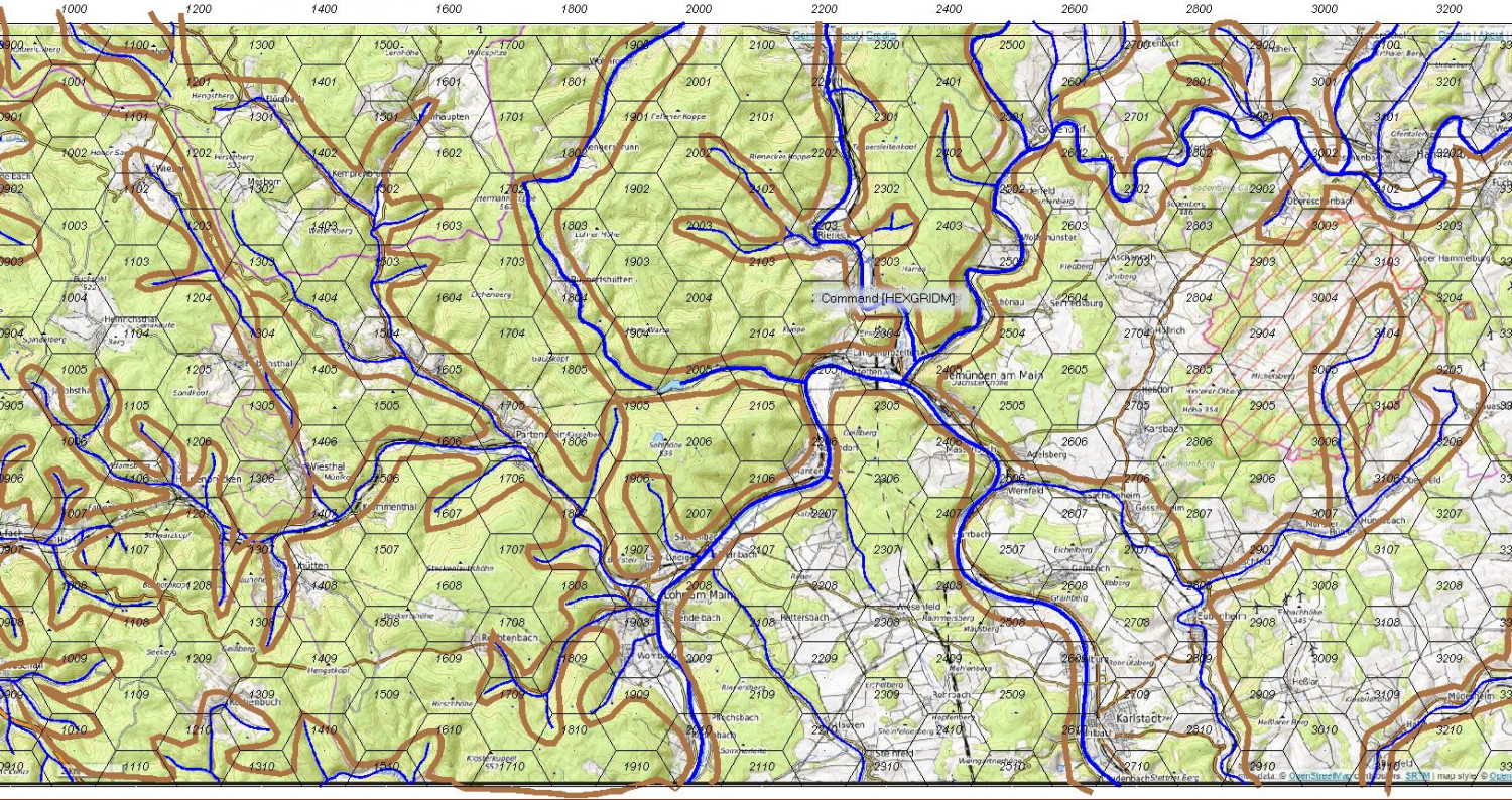
After a long while, I am working on a new map. This is for a sci-fi game and is based on the WWII Raid to Hammelburg to rescue US prisoners by the 4th Armor Division's Task Force Baum, one of whose elements was C/37th Armor which I commanded many years later. C/37 was also the unit which led the breakthrough into Bastogne (and I have a photo of me and the company commander shaking hands at the break-in point on the 35th anniversery of the battle) as well as in the battle around Arracourt, France. C/37 was destroyed during the raid and pretty well beat up at Arracourt.
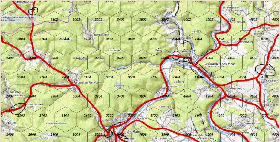
The map stretches from Mannheim to Hammelburg and is about 68 km wide and 20 km tall. Each hex is 2km.
I am trying to be less anal (or maybe more relaxed) and not trying to make this a copy of a topographic map, particularly with my slavish devotion to contour lines or following river/road routes.
The first photo is of the map as a whole. I have laid in the roads and the watercourses to get a view of the terrain compartmentalization.

A frequent method of adjusting the terrain is to move roads so they generally flow from hex center to hex center and watercourses so they move along the hex edge. However, I really cannot bear to do that, so I pretty much follow those and then adjust them so there is some precision as to which hex a road/watercourse lays in. You can see some areas where this needs to be addressed in the 2nd picture.
The third picture is the rub. Here I have turned off the roads, but left watercourses and then tried to define the terrain compartments. Where I have trouble is how to decide how to place and space contour lines so they generally follow the real terrain, if that makes sense.
What I am trying to avoid is the typical geomorphic terrain as defined in the last picture. This seems to lack the 'flavor and feel' of the real terrain to me. The hexes in this map are 250 meters, not that it really matters.
My terrain sketching skills suck to say the least. My platoon and company fire plans always looked like they were drawn by a kid who failed lines, coloring, and penmanship in kindergarten which they did. Thankfully, my children inherited their artistic skills from their mother and perhaps mine, which is fortunate for them. :)
Anyway, any suggestions for how to approach the map? Maybe I am reduced to something like the last picture where I just add contours to the compartments without using the real map as such a base?


