Loopysue
Loopysue
About
- Username
- Loopysue
- Joined
- Visits
- 10,414
- Last Active
- Roles
- Member, ProFantasy
- Points
- 10,161
- Birthday
- June 29, 1966
- Location
- Dorset, England, UK
- Real Name
- Sue Daniel (aka 'Mouse')
- Rank
- Cartographer
- Badges
- 27
Latest Images


-
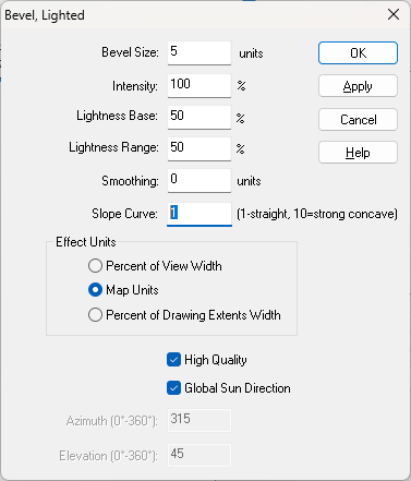
an inverted bevel ???
On the Bevel, Lighted it is possible to make the bevel concave by increasing the value of the Slope Curve.
With a bit of fiddling you can reverse the shading to show the effect of a hollow by unchecking the Global Sun Direction and setting the Azimuth to 180 degrees from the global sun settings.
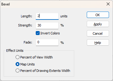
With the ordinary Bevel, you can't make the curve concave, but you can reverse the shading by checking the Invert Colors box. That would make the polygon appear to be sunken instead of raised.


-
Community Atlas 1000th map Competition - with Prizes [August/September]
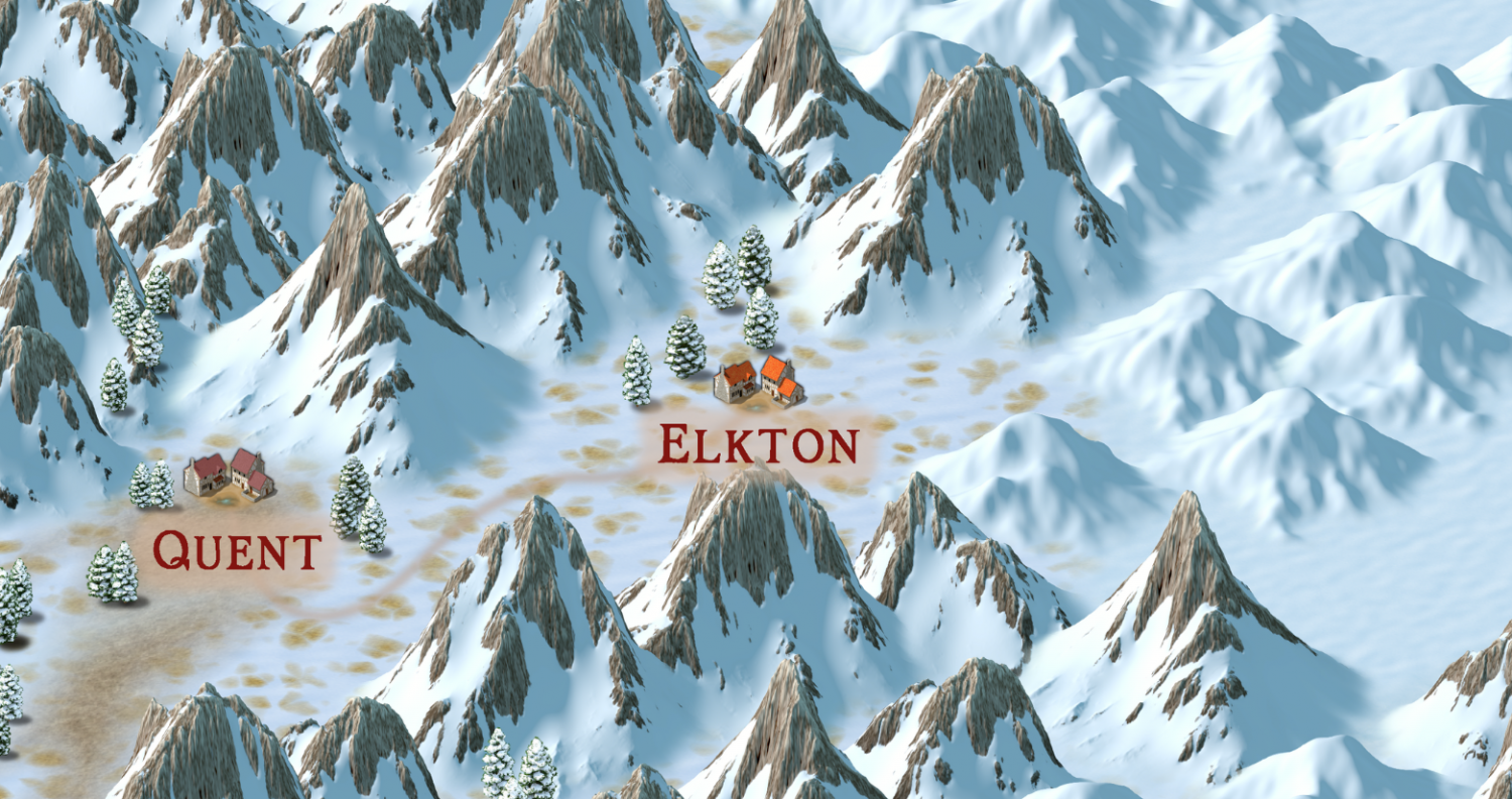
Please can I do the village of Elkton, from the Alarius North Central map?


-
Live Mapping: Regional Zoom
Hi everyone! :D
This week, Ralf will be creating a zoomed-in regional map from an existing larger one.
Come watch the process live on Youtube here, where you can join in the chat and ask your own questions: https://www.youtube.com/watch?v=EXQYu2ayFTc
Or watch it here on the forum if you wish, though there's no live chat on the forum.


-
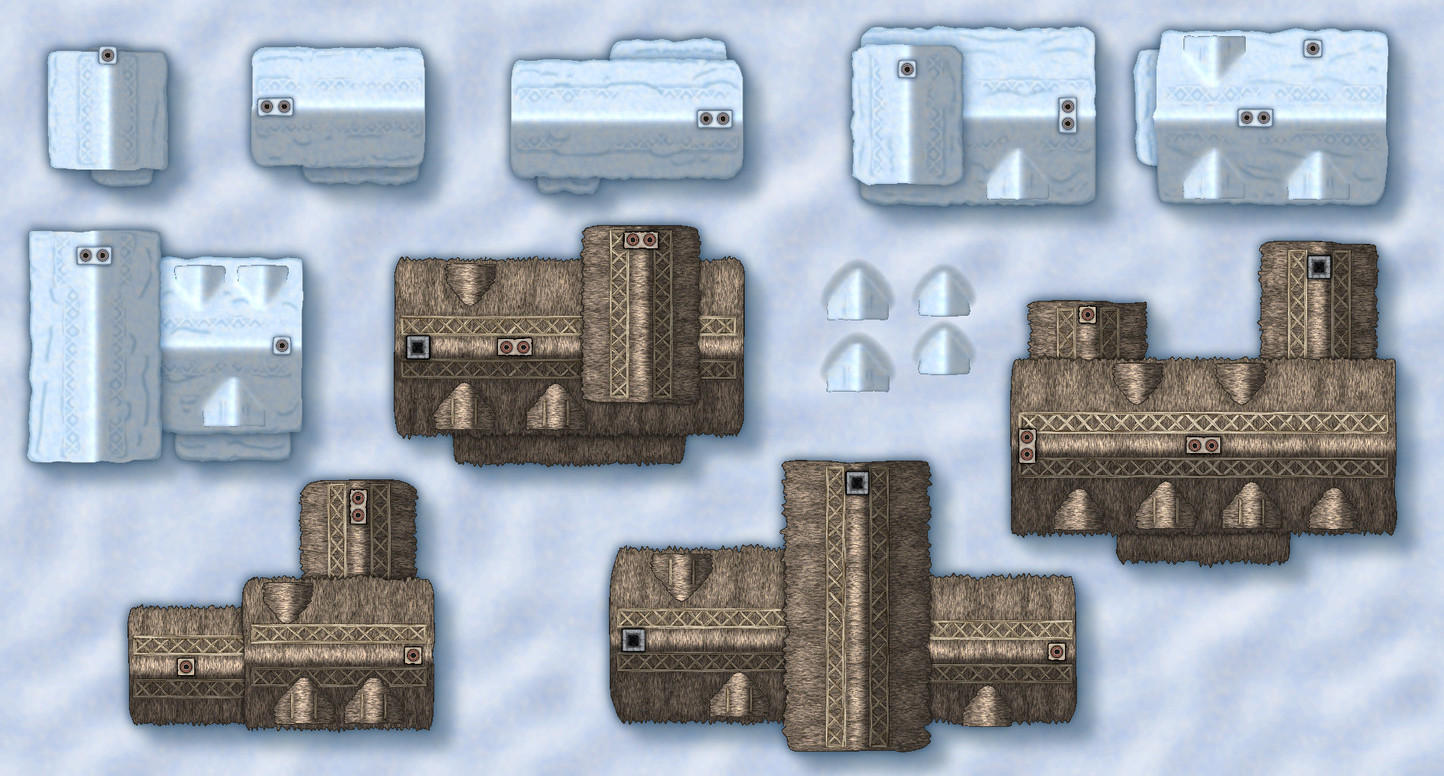
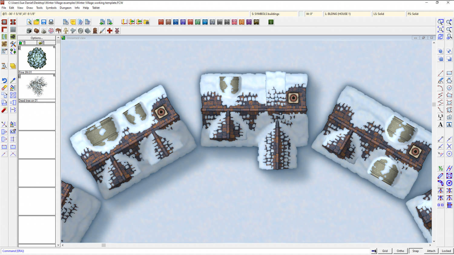
Winter Village style development (March 2022 CA issue)
Having fun with different kinds of dormer. This is the same basic building...

-
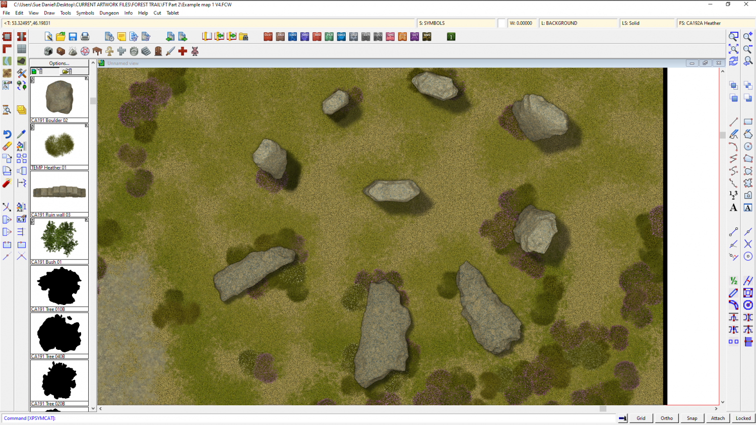
Forest Trail project - part 1
Ok, so they're all just stones, and we are looking down on them, but how do they look?
I also adjusted the heather, since it was looking like colour patches rather than actual plants. The upshot of that is that they don't look like quite such a homogenous mass as is natural on a moorland, but I guess I prefer them this way to the way they were.

![[Deleted User]](https://secure.gravatar.com/avatar/c75d9a245b74d9c59be0999ea81ca541/?default=https%3A%2F%2Fvanillicon.com%2F92add7f8c954488718110edc4896ad39_200.png&rating=g&size=200)


-
Watabou City REVISED (annual 157)
Ok. I think it's coming along pretty well. The main thing I would adjust if I was using it myself for a map is the hills. I would use effects and settings similar to those found in SS5, though I adjust those to make the bevel lighter again than it is in the template.
The HILL sheet uses polygons of "Solid 20", and my personal settings for the Bevel, Lighted sheet effect give the hill a highlight as well as a shadow. It's personal taste, of course, but I find the template setup makes the hills a little too dark for my liking.

These settings also use a lot more smoothing than you have in your template. It gets rid of the knife edge ridge which feels a bit unnatural for a relatively small hill - unless they are meant to be mountains.
Having sufficient edge fade on the hill after the bevel also helps to make the hill look like it's a rise in the ground, rather than something stuck down on top of it - a curve into the slope rather than a sharp line, or a line that hasn't been faded enough with a wide enough EFI. I increase mine from 10ft to 15ft, though it could be wider.


-
Forest Trail project - part 1
A bit like this (though these are very raw at the moment and need some roughing up)

-
The Lakes of Michigami (Jerry's Map) - WIP thread
Is this better?
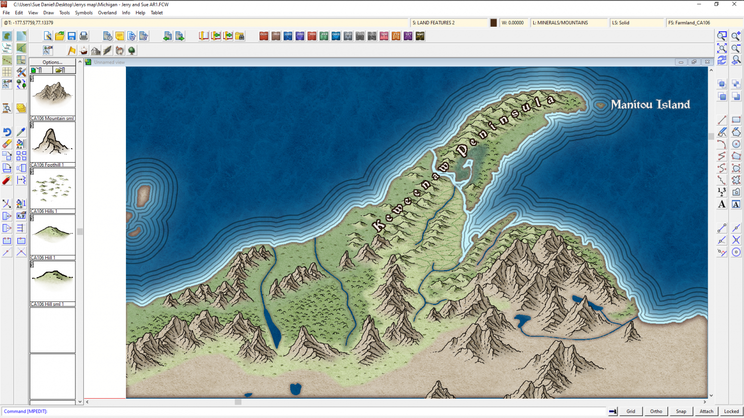
The reason I'm adding the real world names is to give us a reference for further instructions. It's easier if you say change "Fred" to "Burt", than if you give me a lengthy description of where you want a label that doesn't exist yet.

-
Annual Darklands fill question
Thanks :)
I did a quick sampler of all the forest and woodland drawing tools with the tool names shown for identification.
The trees from Darklands are quite dark compared to other styles, so you won't get any lighter trees than the jungle ones.
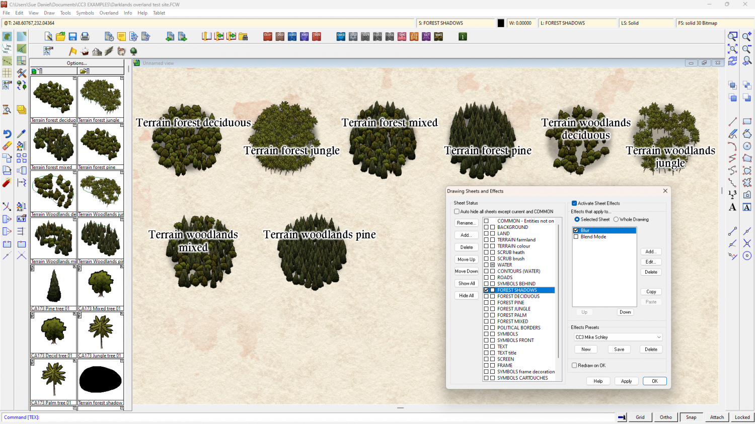
I think you might have the blurred FOREST SHADOWS sheet above the FOREST* sheets (above in the map - below in the list). That would cause the blurring seen in your shot. Check to make sure the sheets are in the right order.
As for the drawing tools themselves, the forest ones all seem to be in order, but the last two woodlands drawing tools seem to have a higher than expected density. I don't know if this is intended or not.


-
Winter Village style development (March 2022 CA issue)
A little more progress - a few more houses converted from DC to WV