


Loopysue
Loopysue
About
- Username
- Loopysue
- Joined
- Visits
- 10,412
- Last Active
- Roles
- Member, ProFantasy
- Points
- 10,161
- Birthday
- June 29, 1966
- Location
- Dorset, England, UK
- Real Name
- Sue Daniel (aka 'Mouse')
- Rank
- Cartographer
- Badges
- 27
Latest Images


-
[WIP] Adnati - Birdseye Continental
I'm wondering if it would be better to have wider edge fade inner effects on a map of this scale - to blend the biomes into each other.

-
How to install CC3+ on a different Drive
Hi Calibre :)
Please report this issue to Tech Support. It's not a good idea to start moving folders around without technical advice.
-
Missing Fill and Castles Failure
@Royal Scribe Yes. But use it when you are certain the map is finished.

-
shadows in a top-down cave
Well, thanks Don, but I think we should wait to see if I got the right end of the stick here ;)
-
Combine Path causing crash
This may or may not have anything to do with the problem, but as I worked along that red line I discovered a piece that was duplicated. The only difference was the entity tag number, so I used that to delete the first and shorter one.
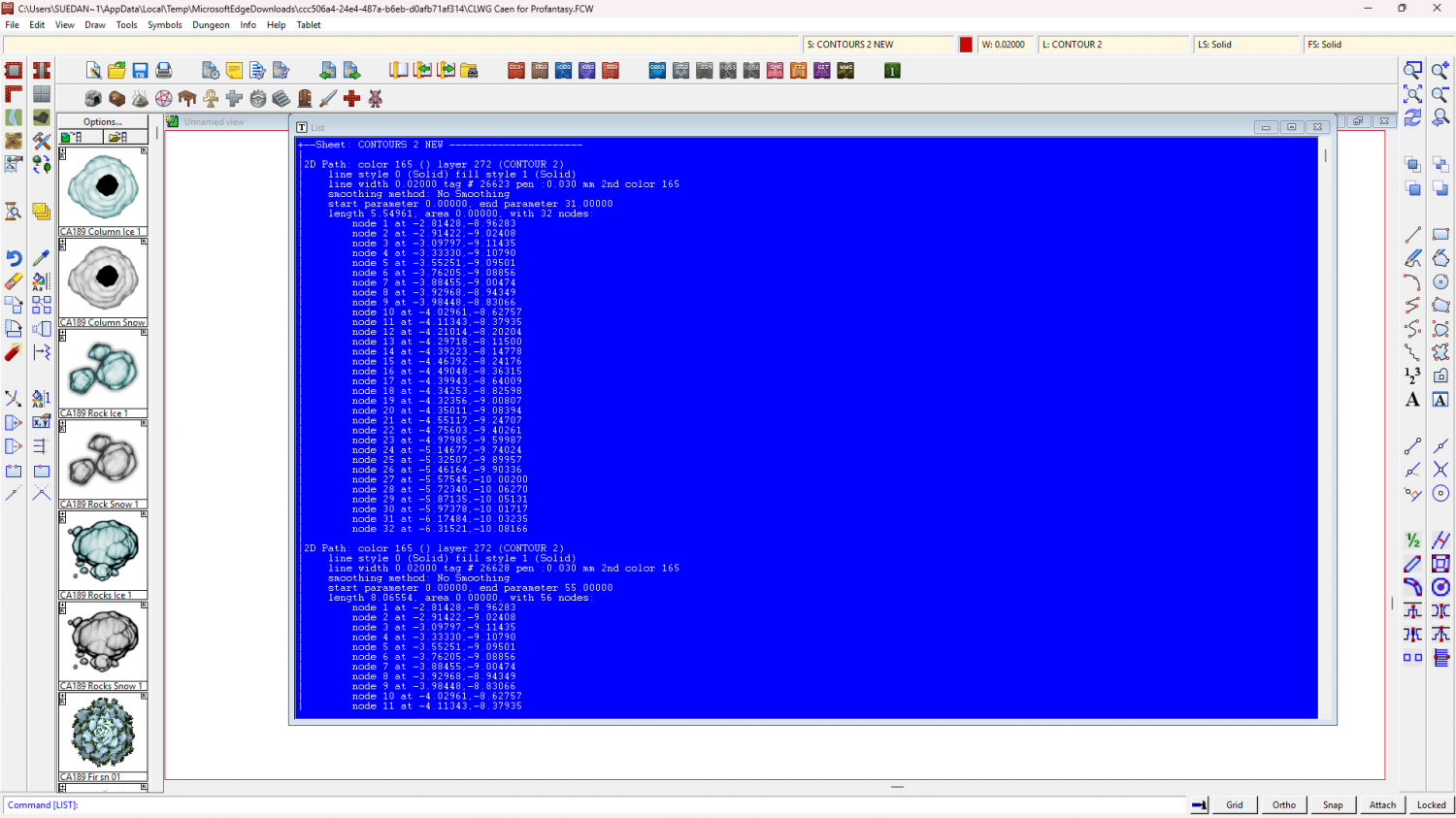
I will stop here because I can see that Don has commented before I really got going.
EDIT: I wasn't having any trouble all the way along that red line myself, until I got to that duplicated section.
EDIT2: One thing that strikes me is that you mention using D or return to finish the command. You don't need to do that with Combine Paths. Just right click once when you finish adding all the pieces together. The only extra thing you need to do is if you hit a line that's the wrong way around and have to switch it's direction using F or S.
EDIT3: I am now very curious to see if you can join thse lines together, knowing what you do now about the way to complete the command, and with the awkward duplicate part removed. If you still can't join things let me know.
-
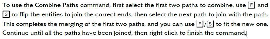
Combine Path causing crash
You don't need to press enter. Just right click. That ends the command.
This is what the Tome says about using Combine Paths:
-
Playing Card County Maps
I wonder if they would sell, if any of us made a new set of the counties of England and Wales using one of these custom playing card printing sites mentioned by Taustinoc.
-
shadows in a top-down cave
I really need to see the FCW once you've had a go at setting up the lights. I can't see what the problem is without it. I really don't understand what you mean about the yellow wall thing. I can see there is a yellow wall, but I don't understand what you are asking for.
-
Live Mapping: Black and White Fantasy
Thanks very much Ralf :)
-
Help with snapping symbols to hex grid
Looking at the way the symbol is misaligned it appears to be too big - overlapping equally on 3 sides.
Get another symbol on your crosshairs and then right click. You will see a dialog there. Click the Set Normal button and ok. I'm hoping that should give you proper alignment.

