Loopysue
Loopysue
About
- Username
- Loopysue
- Joined
- Visits
- 10,354
- Last Active
- Roles
- Member, ProFantasy
- Points
- 10,108
- Birthday
- June 29, 1966
- Location
- Dorset, England, UK
- Real Name
- Sue Daniel (aka 'Mouse')
- Rank
- Cartographer
- Badges
- 27
Latest Images


-
Vignette in CC3
Another way of doing something similar (if you want a rectangular vignette, for example), is to cover the entire map in a polygon and use an EFI turned inside out (100% opacity on the outside, and zero opacity on the inside), then a Blend Mode to control opacity and how the vignette works with the map.

-
Birdseye Continental - style development thread
Thanks for the compliments and insight, Don :)
The textures are solid, so the background is matched, not transparent. I only did it roughly this morning, so matching them better will be relatively easy.
-
Dragon sheet
I forgot to thank you, Jack. Thank you :)

-
What art programs do you use?
Affinity used to be a British app, but Remy tells me it's been bought out by an Australian company. I won't post a link here because it's paid-for software, but you will find it easily enough by search engine. When you do find it, compare the cost of that one time purchase with a lifetime of paying for PS.
A lot of people regard it as an affordable alternative to PS. I wouldn't know for sure. By the time I could afford to buy PS it was just going rental, so I never bothered with it.
I never got on with Inkscape because it's outlandishly complicated and clunky compared to Affinity.
-
What art programs do you use?
Affinity Designer does most things that Photo can do. It has a bitmap mode. I have Photo as well, but only use it once in a blue moon for warping bitmap images.
To get comparable functionality from PS I would have to pay that much every month for as long as I continue being an artist.
-
Birdseye Continental - style development thread
Thanks guys :)
I was more concerned about the number of sheets involved.
One of the traps that can be fallen into when developing a style is to make it too complicated.
I have many, many terrain sheets to ensure that all the terrain textures can have their own sheet and never end up sharing a sheet, However, these all start with "TERRAIN...", so once you grasp the meaning of the first terrain sheet you encounter, it's easy enough to understand what all the rest are for.
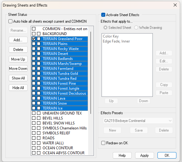
However, if I start adding too many specialised sheets from that point on, it may cause more confusion than anything else.
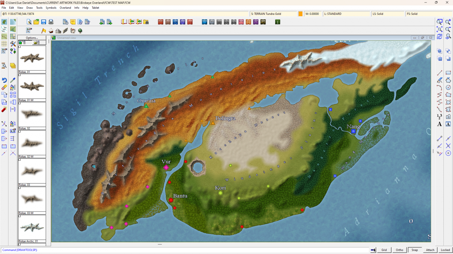
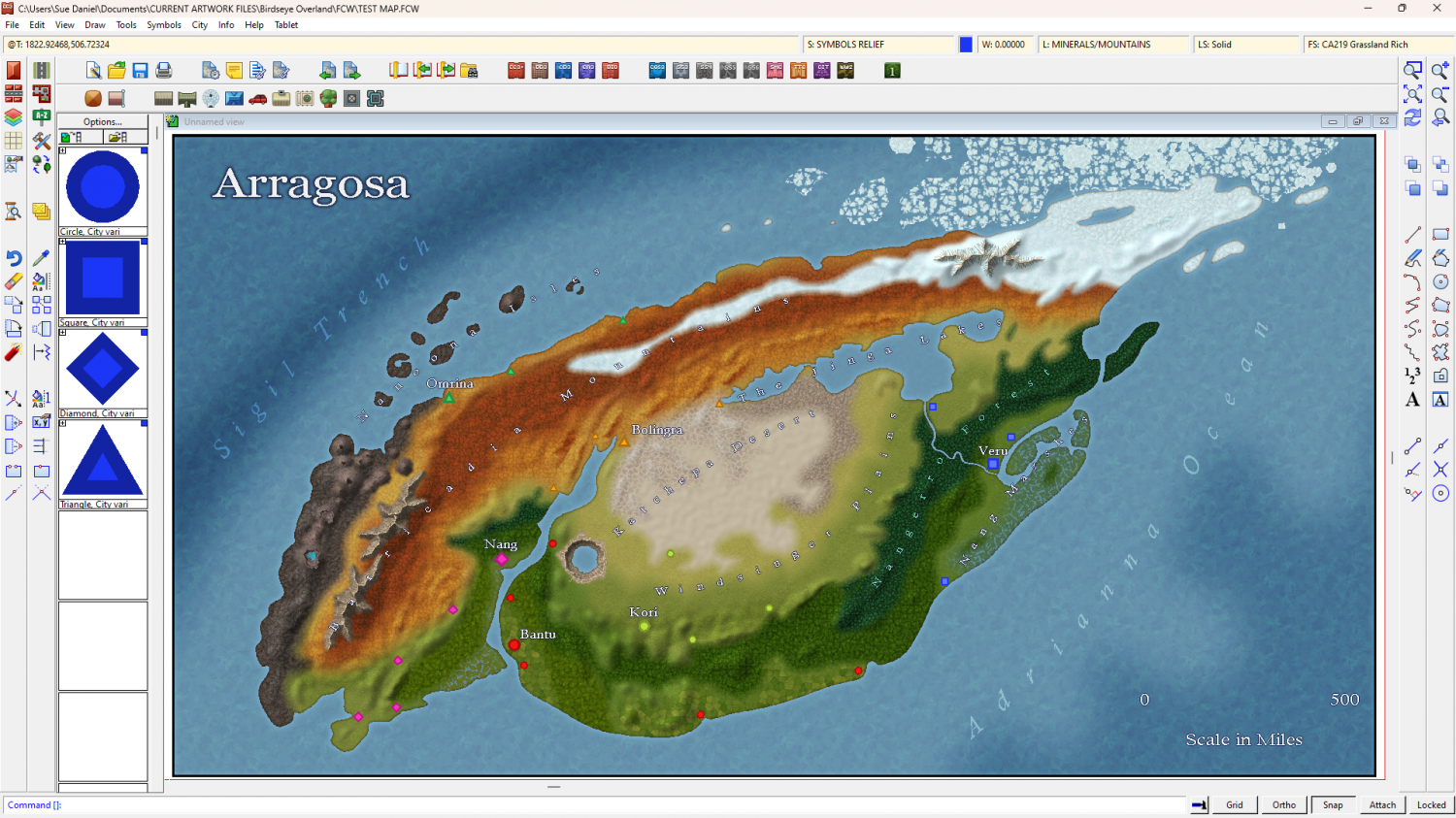
Unfortunately, Quenten, I have already added the mountain and hill symbols sheets together as one "SYMBOLS RELIEF". It shouldn't be too confusing because there are only 2 actual hills in all of this, and both of those are volcanic hills. These are the symbols in the map so far.
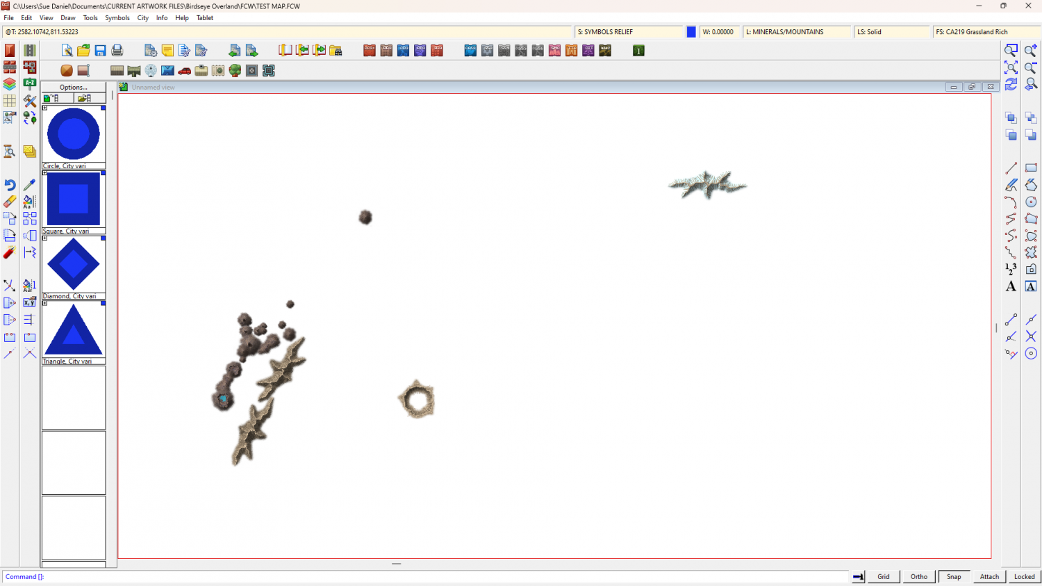
So you see that most of the bumpy bits are actually polygons maskquerading as hills.
There will of course be many more ridge components and other features, like outcrops and fissures, but they will mostly all go on a very short list of "SYMBOLS..." sheets.
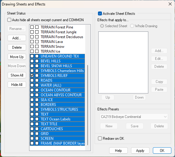
As you can see, if you take all the TERRAIN sheets out of the mix, the rest of the sheet list is surprisingly short, and the whole list would easily fit in a single dialog window - if not for the TERRAIN sheets. I'm a bit concerned by the psychological effect of such a lengthy list when they are all put together. If you can think back to when you began mapping with CC, would this have seemed quite a daunting wall of sheets?

-
Birdseye Continental - style development thread
Naming them all independently also allows me to create drawing tools that put terrain fills on the right sheet first time. No messing around trying to move things between numbered terrain sheets.
-
Live Mapping: Fractal Parchment Worlds
This week in Live Mapping, Ralf will be using Fractal Terrains and the February Annual issue to create a parchment-style world map.
Come and join us live on YouTube and join in the chat here:
https://www.youtube.com/watch?v=aoRRwRMMZnE
Of if you prefer you can watch it here on the forum*
*There's no live chat on the forum.
-
How to Recombine Text
Thanks for letting us know. I'll know not to recommend that again.
-
Birdseye Continental - style development thread
Work on the ridges continues, but I took a break from that to consider how not everyone will like the bright red and gold tundra, so I added two HSL sheet effects to those sheets so you could take your pick between bright and natural.