


Loopysue
Loopysue
About
- Username
- Loopysue
- Joined
- Visits
- 10,354
- Last Active
- Roles
- Member, ProFantasy
- Points
- 10,108
- Birthday
- June 29, 1966
- Location
- Dorset, England, UK
- Real Name
- Sue Daniel (aka 'Mouse')
- Rank
- Cartographer
- Badges
- 27
Latest Images


-
Birdseye Continental - style development thread
Sorry, @Royal Scribe For some reason I missed your earlier comment in the turn of the page.
Thank you :)

-
WIP: Temple of Ssiss'Ythar
Looks like it's going to be an interesting map :)

-
[WIP] Community Atlas: Snakeden Swamp, Lizard Isle, Alarius - Dedicated to JimP
Congratulations :D

-
Birdseye Continental - style development thread
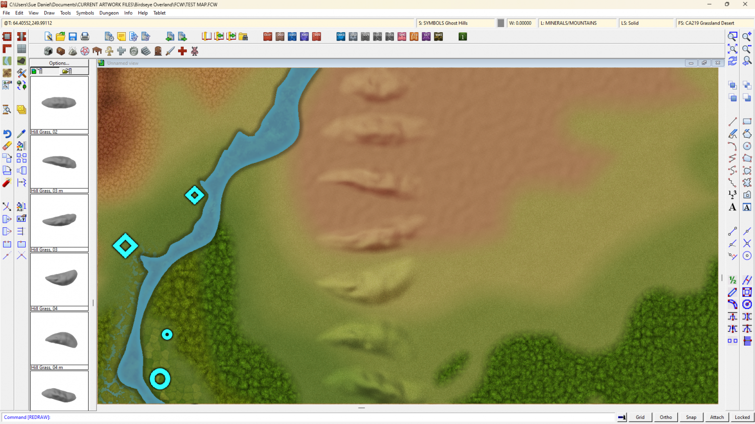
I haven't done any more mountain ridges, but I have worked out a way to make hill symbols that let the underlying terrain texture show through them.
What are the most useful shapes for hills, seen top view?

-
Birdseye Continental - style development thread
They don't really change the shape of the underlying hill because all of them are transparent - sort of. I added the second sheet so they could be put closer together than they can on just one sheet.
That's why I need to try and get all the most useful shapes ready made.
-
Birdseye Continental - style development thread
The result is a combination of both - like you get with a bevel hill.
-
Best approaches for tree shadows?
You can get an idea of how roughly I traced them if you hide the trees and turn off the sheet effects. Then you will see the black polys I drew.
-
Best approaches for tree shadows?
I can't tell you how CC4 will do things, as I'm only involved with the DD4 art assets, but in my opinion it would be reasonable to suspect that what works in CC3 will also work in CC4 - whatever else it may do.
-
Birdseye Continental - style development thread
@ScottA - Oh that was a ring of mapped symbols. I was checking the map file worked from all angles and made a circular array of the same mountain ridge symbol. The symbols do some pretty experimental things as far as having fades all around, which is never done in a house symbol, and sometimes do unexpected things. I will have to check each and every mapped symbol the same way so you don't get any weird effects just by rotating one a little bit.
I will make a crater symbol.
@Don Anderson Jr. - Unless you count tundra as a kind of desert itself? How is a desert defined? Extreme dry? Extreme heat/cold? Anywhere the plants and animals have a hard time?

-
Question about CA143 Asian Town "well" symbol
Thanks :)
