


Loopysue
Loopysue
About
- Username
- Loopysue
- Joined
- Visits
- 10,413
- Last Active
- Roles
- Member, ProFantasy
- Points
- 10,161
- Birthday
- June 29, 1966
- Location
- Dorset, England, UK
- Real Name
- Sue Daniel (aka 'Mouse')
- Rank
- Cartographer
- Badges
- 27
Latest Images


-
Colors I drew keep changing
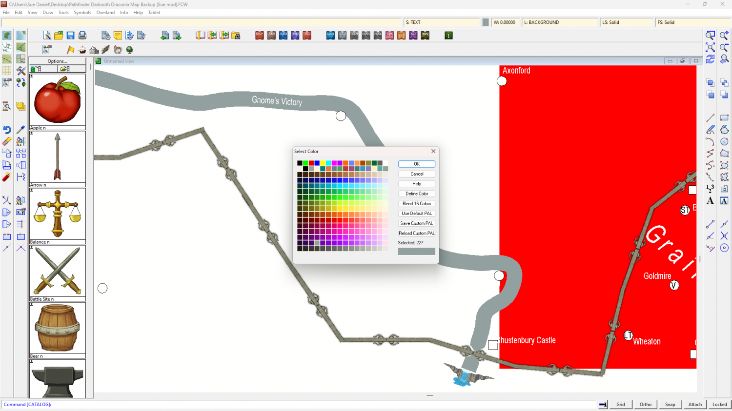
Your rivers are set to be colour number 14, which is towards the end of the top row of palette colours. Those top 2 rows aren't meant to be modified at all, so before we put the changing colour problem right it's best if we use Change Properties to make all the rivers some other colour that doesn't appear in those top 2 rows.
I picked a dark purple swatch near the bottom of the palette (number 227) and changed 227 to be your specified RGB shade, then attached the palette to the map and saved it. Then I changed the properties of the rivers to be colour 277. Let me know if this has cured the problem.
There are lots of bits of river in this map. If I've missed any all you have to do is use Change Properties to make them colour 227.
When you open the palette you should see the altered colour.

-
Live Mapping: Naomis Floorplans. 28 Nov
60 minutes :)
-
Installation Failure
Hi DoctorSweets :)
I can't see that you've done anything wrong there at all.
I recommend contacting Tech Support via the Support tab when you log into your account on the main webpage.

-
CD3_Thatch_Roof_VH.png
You could try altering the speed settings.
Right click the hourglass and pick Display Speed...
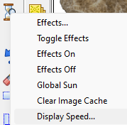
The default settings are:
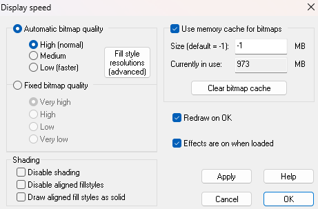
But you can temporarily pick Fixed bitmap quality and Very high, if you need to see the fill styles in pin sharp resolution.
However, it's not recommended that you keep this setting on while you are working since the larger images being used for it will slow your map down.

-
resizing symbols
You could use SCALE. I've just tried it and it works ok. You have to pick the scaling origin after Do It.
There's also SCALEXY if you want to scale the dimensions differentially. You must pick both scale origins with that one.
-
[WIP] Spectrum Overland Waterfalls x 2
Nice work so far.
It's very much up to you how you develop your maps. I find it quite useful to leave it a couple of days if I'm not sure how to go forward. The moment you open it after a break like that you will know what you want to do.
-
[WIP] Spectrum Desert
I can't remember exactly why I did several shades of dune, but they look ok together. Real deserts are all kinds of colours.
-
Lumadair and the Caves of Dread (Pencil Sketch annual)
It's completely up to you how you group things.
I don't have that many maps to show, but I tend to group similar types of map - like cities, overland, and dungeon, though I do have folders for single projects as well.
-
Live Mapping: Latest Monthly Symbols
Hi everyone! :)
It's time again for Ralf to check out all of those free monthly symbols that have been added to the Mike Schley Overland style. Join us in the Live Mapping session tomorrow to see Ralf build a map from them - and to take part in the live discussion.
https://www.youtube.com/watch?v=IQU26pyyWRc
Or if you prefer you can watch it right here, though there's no live chat on the forum.
We look forward to seeing you there.
-
Jim Pierce 1947 - 2024
A lovely and beautiful tribute, Remy. Thank you so much for putting it all in words.
Jim - I will miss your mischevious 'I'm really a very evil DM' teasing regarding your maps and all the traps you put in them. Rest in peace sweet friend.

