


Loopysue
Loopysue
About
- Username
- Loopysue
- Joined
- Visits
- 10,415
- Last Active
- Roles
- Member, ProFantasy
- Points
- 10,161
- Birthday
- June 29, 1966
- Location
- Dorset, England, UK
- Real Name
- Sue Daniel (aka 'Mouse')
- Rank
- Cartographer
- Badges
- 27
Latest Images


-
weird line
This kind of flaw usually occurs when there are two nodes too close to each other and is more common in these heavily fractalised polygons.
When you say you tried changing the amount of nodes, do you mean you tried SIMPLIFY on the keyboard?

-
Cowpens Battlefield
Great work, Mike :)
Though I am surprised about the aiming!
A dusting of snow is a really tricky thing - especially with this kind of map where its more about accuracy and altitude than artistic impression. Do you really need to partially obliterate the important information?
But if it's important maybe find a patchy snow fill and use it on a sheet with quite a strong transparency effect on it? Difficult to know what to suggest.

-
WIP, suggestions please
Yes that's right. It may just be a simple case of the TEXT sheet being too high up the list, or hidden.
Have a good sleep :)

-
WIP, suggestions please
It certainly looks like it should be visible.
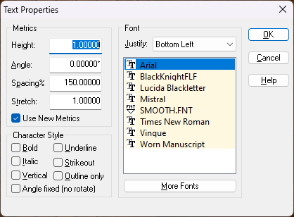
Can you see the text on your cursor just before you place it? The only other thing I can think is that the text is there but incredibly small. If you think that might be the problem check the size of the font in Text Properties. Sometimes, and for reasons I'm not sure I understand, the text can start off really tiny.
-
Free symbol pack - Tentacles
Yes - but not on any set timetable.
-
WIP - Tomb of Shadows
That looks better, but before you take the same texture any further down the same road, have you thought of switching the background to one of the other fills?

-
Moving objects in front of or behind in same sheet.
I was able to replicate this issue, but only when I added the trees after I had already added the smoke.
The easiest solution is to delete the smoke and re-add it, or to move the smoke to a new sheet above the rest of the symbols. Perhaps calls it SYMBOLS Smoke.
I'm not sure if this is what would technically be called a bug, or intentional behaviour, so I will report it for you.
-
Made a city to a friend
Another beautiful map!
Welcome back :)

-
Made a city to a friend
Spectacular :D
-
downloading the annual month by month
Hold on a moment. I contacted Ralf to check my information just to be sure, and he says you should have received an email with a link. Clicking that link automatically adds the licence to your account. If you recieved the email and clicked the link then the registration is already done and the annual should be available in your downloads. If this hasn't happened, or you never got an email, you need to contact Tech Support.
If you can see the annual listed in your downloads click the link '3 files'. A popup should appear with a link for each of the 3 issues so far.

