


Loopysue
Loopysue
About
- Username
- Loopysue
- Joined
- Visits
- 10,416
- Last Active
- Roles
- Member, ProFantasy
- Points
- 10,161
- Birthday
- June 29, 1966
- Location
- Dorset, England, UK
- Real Name
- Sue Daniel (aka 'Mouse')
- Rank
- Cartographer
- Badges
- 27
Latest Images


-
Why Do Sheet Effects Not 'Stack'?
Please can you show us a screen shot? It's a bit difficult imagining the effect :)

-
WIP - Bone Pit Practice
Remy did a live mapping session that showed how to make a hole in the floor here:

-
What is Steampunk...
That's really interesting Calibre! It's nothing like the image I've been building in my own imagination.
I can see this is going to be quite a prolonged project.

-
CA style development - "Darklands City" (issues for September and December 2021)
And there will be burnt out buildings as well, if there is time.
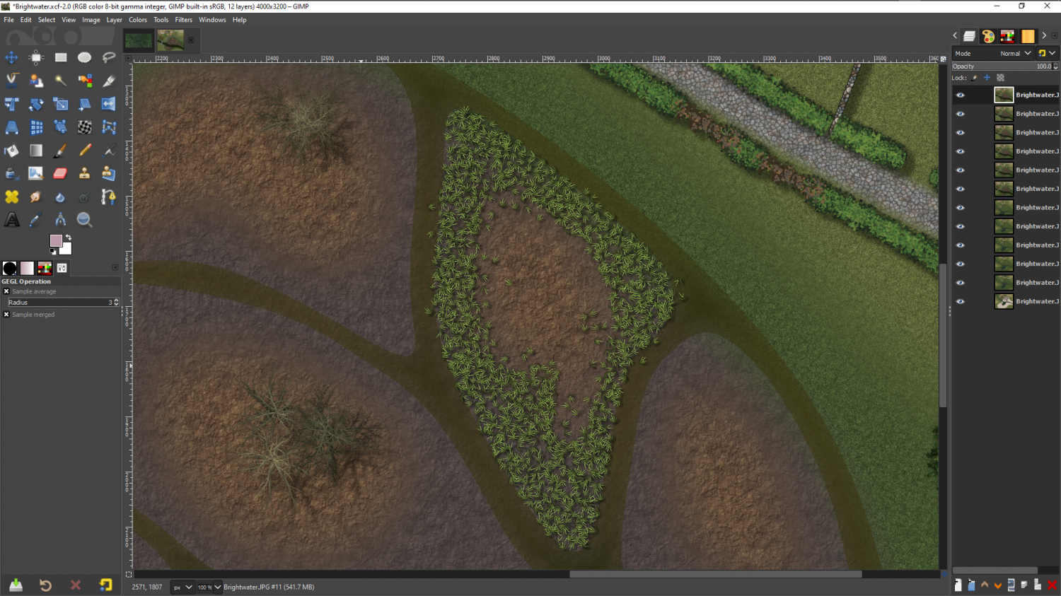
This evening, though, I got distracted by the idea of reed beds for the marshy/boggy/swampy areas that were requested. Not quite there, but close, I think

-
[wip] a star ship, my GURPS Space
I've been here a couple of years now, Jim, but I've never got around to doing anything with Cosmographer. I really like this map, though. Maybe I should give it a try sometime.
-
Filling unneded space
You can switch on the sheet effects by opening the Sheets and Effects dialog |CC2SHEETS| and checking the Activate Sheet Effects box on the top right of that dialog. Click Apply, or Ok and you should see quite a difference in your map.
-
First Completed Map, looking for feedback
That's a pretty good first map, NicodemusRa :)
Only a couple of things I would recommend trying - to see if you think it improves the look or not.
Try adjusting the white glow around the map labels to make it smaller and more opaque, but keep the fade. It's not quite working to cut out the map detail right up against the letters. It's close, but it's not quite there.
Try reducing the size of the title just enough that the tops of the letters don't overlap the edge of the map.
-
Cant find Dungeons of Schley from menu window when making house interiors
There is a Live Mapping session Ralf did in 2020 showing how to create a floorplan map from a city building here. If this is the one you have already watched, I will look for another one, but this one is probably the best and most appropriate for the style you are using.

-
[WIP] Hyboria Map
Have you thought of making the continent lines thin enough to match the average thickness of the ink in the mountain lines? That will make the coastline look less distinct, but you can counteract that by adding a Glow effect to the LAND sheet, set to Outer and a dark grey, so that the water is shaded away from the land a set distance all around.
I know the old 'I'll know it when I see it' issue. I have that myself quite a lot. So lets try to get the coastline looking good first, and then maybe you will have a better idea of what you want for the land.
Are you going to use this with a pure white background, or are you looking to add a subtle paper texture? A plain white background is what you want if you intend to use the map printed on paper, which will be its own paper background, but if you only ever intend to use it as an image file you might want to add the paper texture in.

-
Community Atlas: Errynor - Aunty MacKassa's Home & Vehicles
Wonderful work, Wyvern :)
