


Loopysue
Loopysue
About
- Username
- Loopysue
- Joined
- Visits
- 10,418
- Last Active
- Roles
- Member, ProFantasy
- Points
- 10,163
- Birthday
- June 29, 1966
- Location
- Dorset, England, UK
- Real Name
- Sue Daniel (aka 'Mouse')
- Rank
- Cartographer
- Badges
- 27
Latest Images


-
Stain Symbols for Maps
I think I have a potentially easier way to produce them as bitmaps. I've just spent a happy hour messing around with watercolour and a few mugs on my best smooth watercolour paper. (I never have time to do paintings, so why not).
Unfortunately, it will take several hours to dry, and then I will have to try and figure out how to use my scanner all over again.

-
My hex symbols disappeared. How to solve it?
It looks like you have the wrong symbol catalogue open.
Click the Open Symbol Catalogue button at the top of the Symbol Catalogue Window |ICON_CATALOG| and navigate to:
Symbols\Maps\Mike Schley Hex
Then double click the file called All.FSC
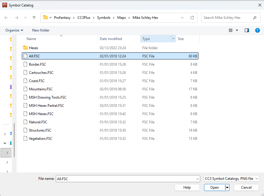
That will open the full catalogue for the style.
...
I'm not sure why you have a catalogue from a completely different style active.

-
Looking for Symbols
All the ones I've ever used in non-CC3 maps are GIMP, Affinity V1 and V2 'grunge brushes'. The version of Affinity is significant here, since the app was sold to Canva after V2, and I want it to be very clear that I don't use Canva or any other AI tools that depend on other artists' artwork in my own work for Profantasy.
Unfortunately, while I can show maps created using them (These are really old now and not as good as more recent work), I can't share the brushes. To have something similar for Profantasy, someone would have to spend a few days having a lot of fun splashing, smearing, and flicking real brushes, sponges and scrumpled up bits of paper on actual paper and scanning in the results - just like I did with the cup stains.
Also unfortunately, and I'm really sorry about this because I had an enormous amount of fun with a lot of black watercolour paint all over the place doing the cup stains, I genuinely don't have time to do anything else that isn't CC4 Overland right now. But maybe someone is just waiting to volunteer for fun? All you need is a decent scanner (A4 will do), some really white paper, ink or watercolour paint, some ideas about what you want to make, and a devlish desire to get paint and/or ink absolutely everywhere!
...
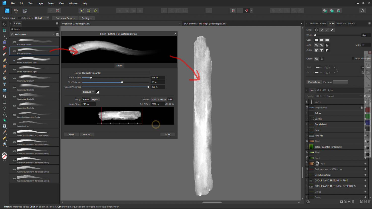
Regarding fountains in particular...
If you are lucky enough to own Affinity V1 or V2 (or if you rent PS or any other advanced image editor), the app has a selection of oil paint brushes that can be used as vector lines like this
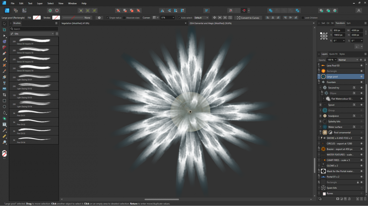
A single stroke from the fountain.
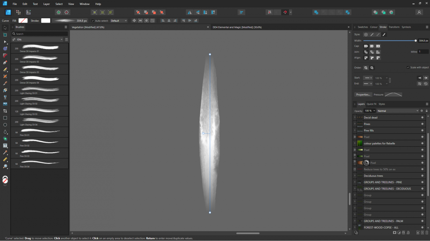
Or maybe it might have been one of the gouaches? It's really hard to remember after a year or so. This is the very same stroke with the end-pinching profile removed.
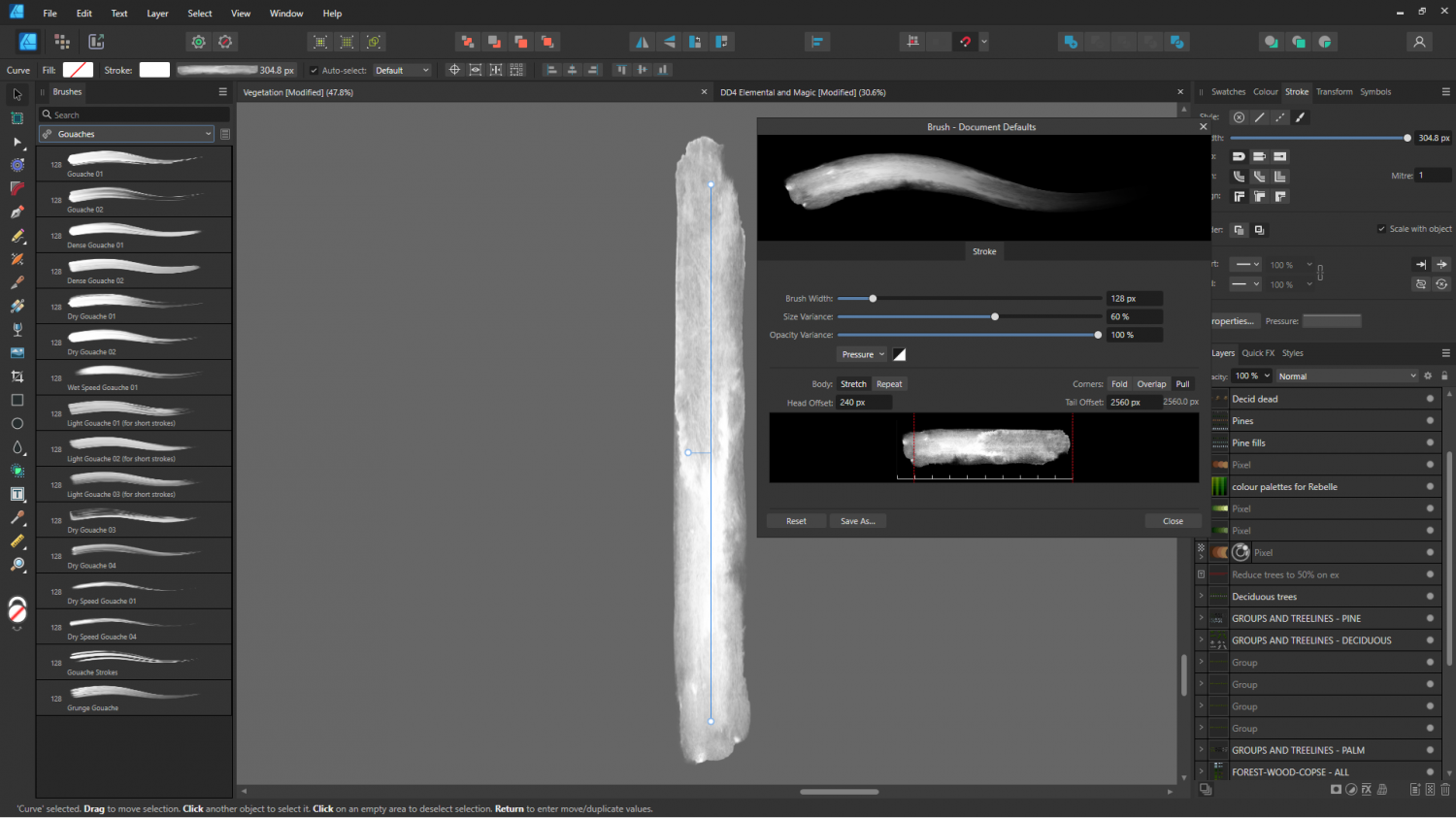
EDIT: I found the exact brush. It's called "Flat Watercolour 2". I think it's actually one of the Affinity V2 preset brushes, rather than something I bought.
-
Stain Symbols for Maps
Looking at the way the ends are apparently still tied up as a rolled up scroll might be, and considering that no one has claimed it as their own work, it's likelly to be an AI image. AI doesn't understand that ties don't go through the actual scroll like shoelaces in a boot.
But yes - it does illustrate a point.
I've just realised I got a little confused between this thread and the latest comments on "Looking for Symbols". There's a bit I wrote just there that is probably more relevant to this thread!

-
CC3+ export from FT3 is wrong
FT exports maps to CC at different levels of detail, though this may not be obvious unless you edit the Export Settings you pick. The third dialog in that process presents the controls.
The higher the level of detail, the more accurate the result. The lower the level of detail, the more likely you are to get these anomalies that don't accurately reflect what you can see in the FT window. Even then, there will always be far more detail visible in FT than can be exported to CC, where the total number of nodes in the exported polygon is limited by what CC can handle. In most cases this is more than sufficient.
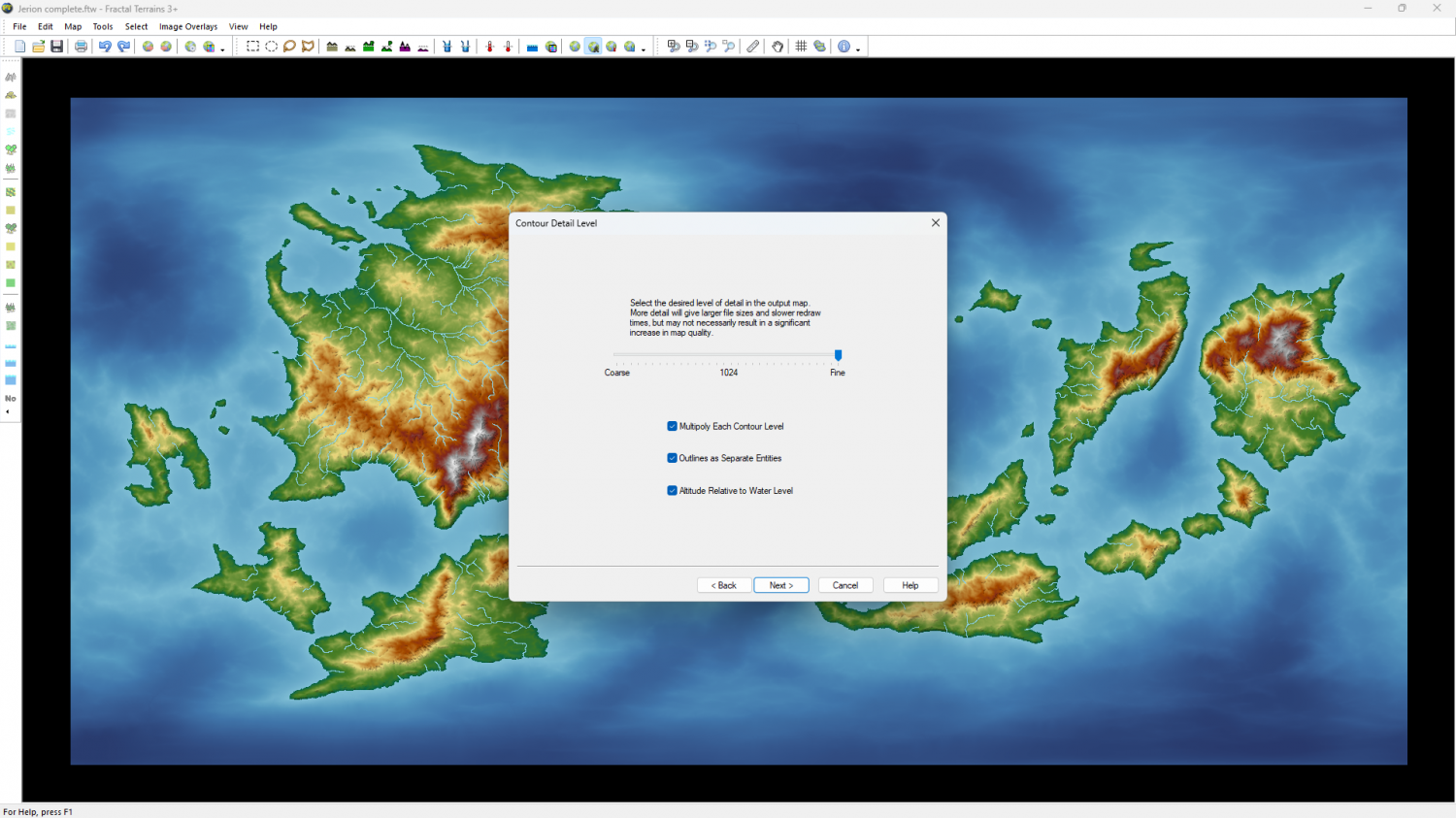
If the Export Settings are already on Fine level of detail, I recommend zooming into the area that lacks details to create smaller regional maps. The closer you get to a detail, the more accrately it will be exported.
I hope that helps.

-
Issues with Circular Array Copy
The circular array copy puts the copies on the currently active sheet. If you go to the sheets and effects dialogue and hide all sheets except the currently active one you should find them. Then it's just a case of using move to sheet (right click the hour glass), or change properties to put them all back on the correct sheet.
-
Project Spectrum - Part 2
Thank you, Quenten :)
I will think about it, but as I said above I have to finish the core set of symbols first, and part 2 is due out in the November issue.
![[Deleted User]](https://secure.gravatar.com/avatar/c75d9a245b74d9c59be0999ea81ca541/?default=https%3A%2F%2Fvanillicon.com%2F92add7f8c954488718110edc4896ad39_200.png&rating=g&size=200)
-
Welcome to the Updated Forum
He absolutely did, Mike ;)

-
Project Spectrum - Part 2
LOL!
Cheers!
-
Project Spectrum - Part 2
Thanks again, Lorelei!
That photo has enabled me to make a final choice about the colour adjustment of my symbols - 7 tiny notches less yellow than they were, and looking good.
But I won't bore everyone with another image of just the cacti. I hope to have some more new stuff to show off later today.
