


Loopysue
Loopysue
About
- Username
- Loopysue
- Joined
- Visits
- 10,413
- Last Active
- Roles
- Member, ProFantasy
- Points
- 10,161
- Birthday
- June 29, 1966
- Location
- Dorset, England, UK
- Real Name
- Sue Daniel (aka 'Mouse')
- Rank
- Cartographer
- Badges
- 27
Latest Images


-
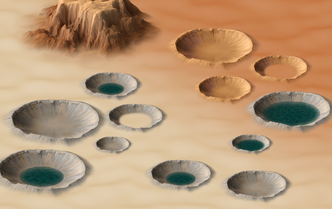
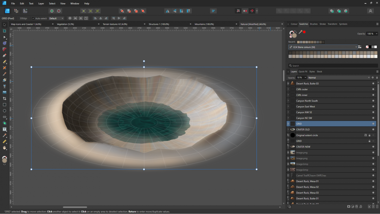
CC4 Overland Development Thread
Is this one better?


-
CC4 Overland Development Thread
I gave in to temptation and warped a copy of the inner crater to the new grid. Looks like I also still have craters on the brain.
Oh well, I might as well carry on...


-
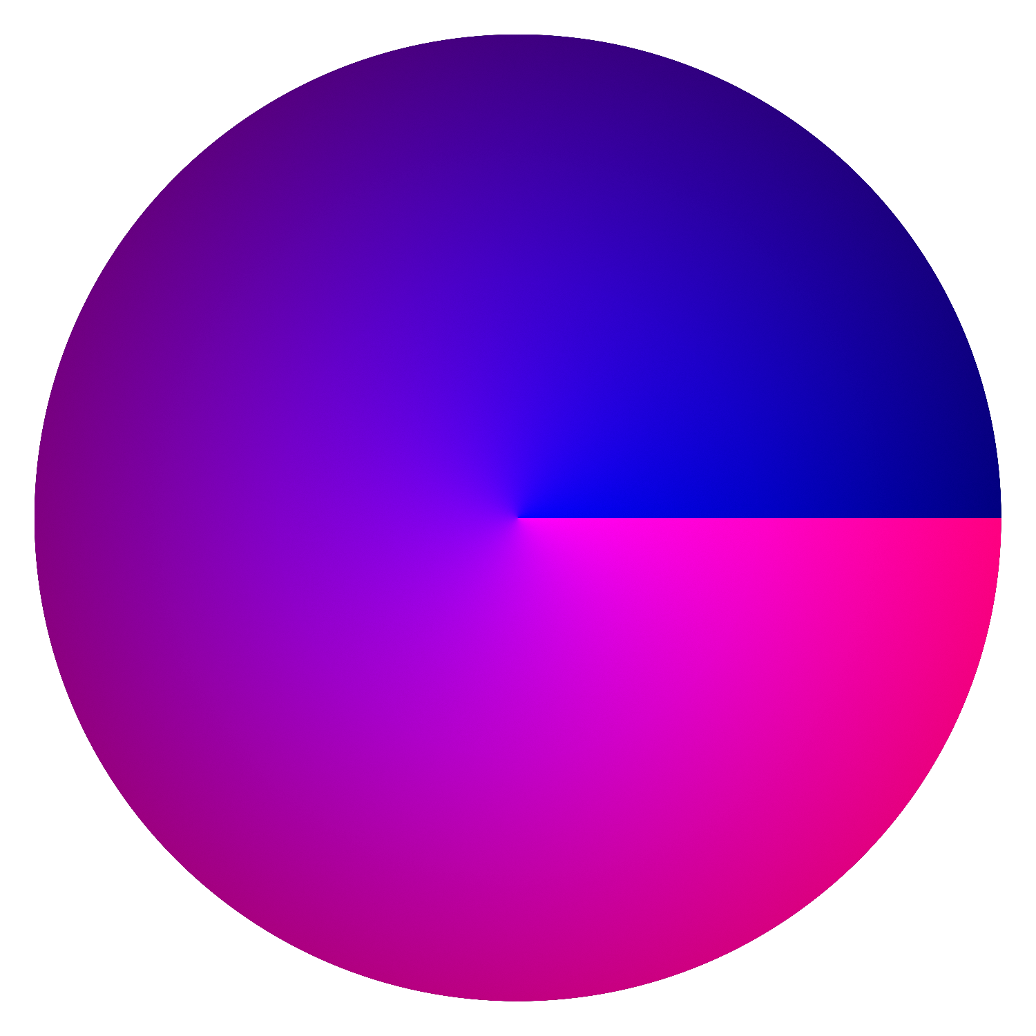
Live Mapping: Roof Shading
I used Blender back in the day, but you can do the same in a bitmap editor with radial and spherical gradients.
These are the 2 layers used for a dome shader in Affinity Designer - 2 gradient shaded circles.
The blue element is the pitch of the roof, created with a spherical gradient. The brighter the blue is the more flat it is, so the top of the dome is very bright blue (255), while the base of the dome is very dark (128).
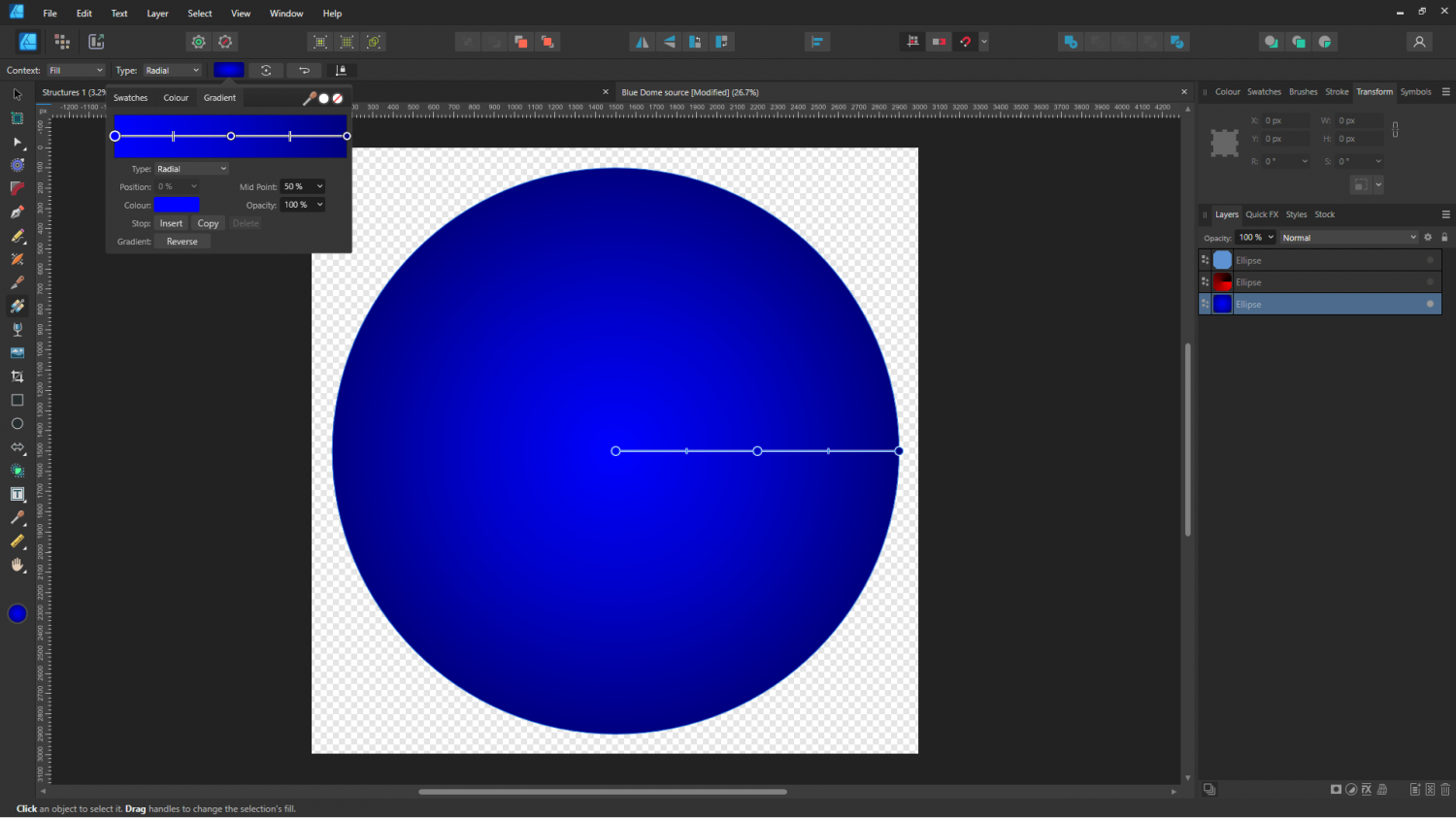
The red element is a radial gradient from black to red, like this:
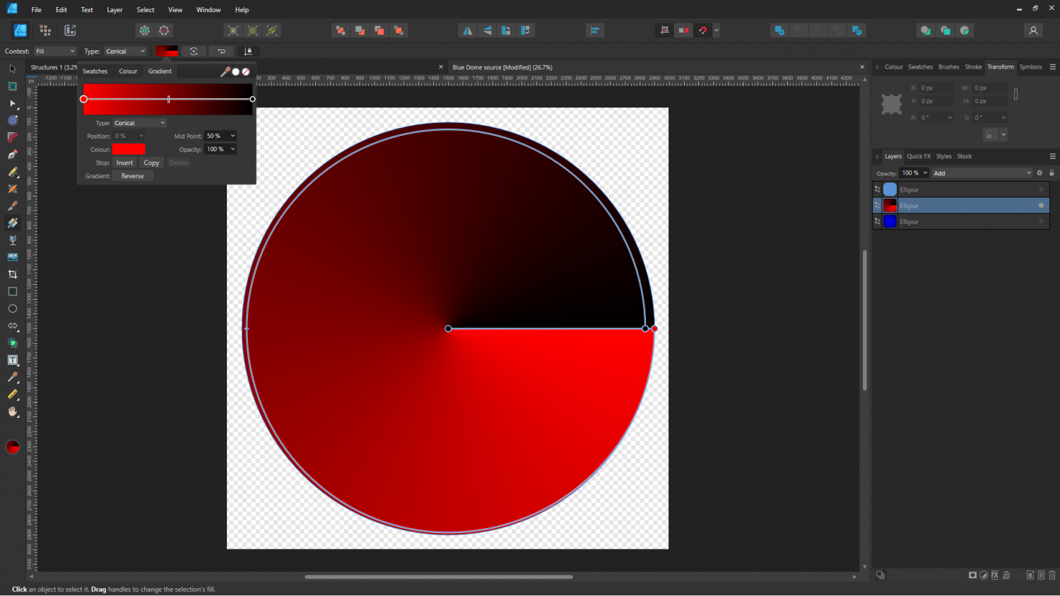
The red layer is 'added' to the blue layer using the Add blend mode setting on that layer, so that where the red is black nothing is added.
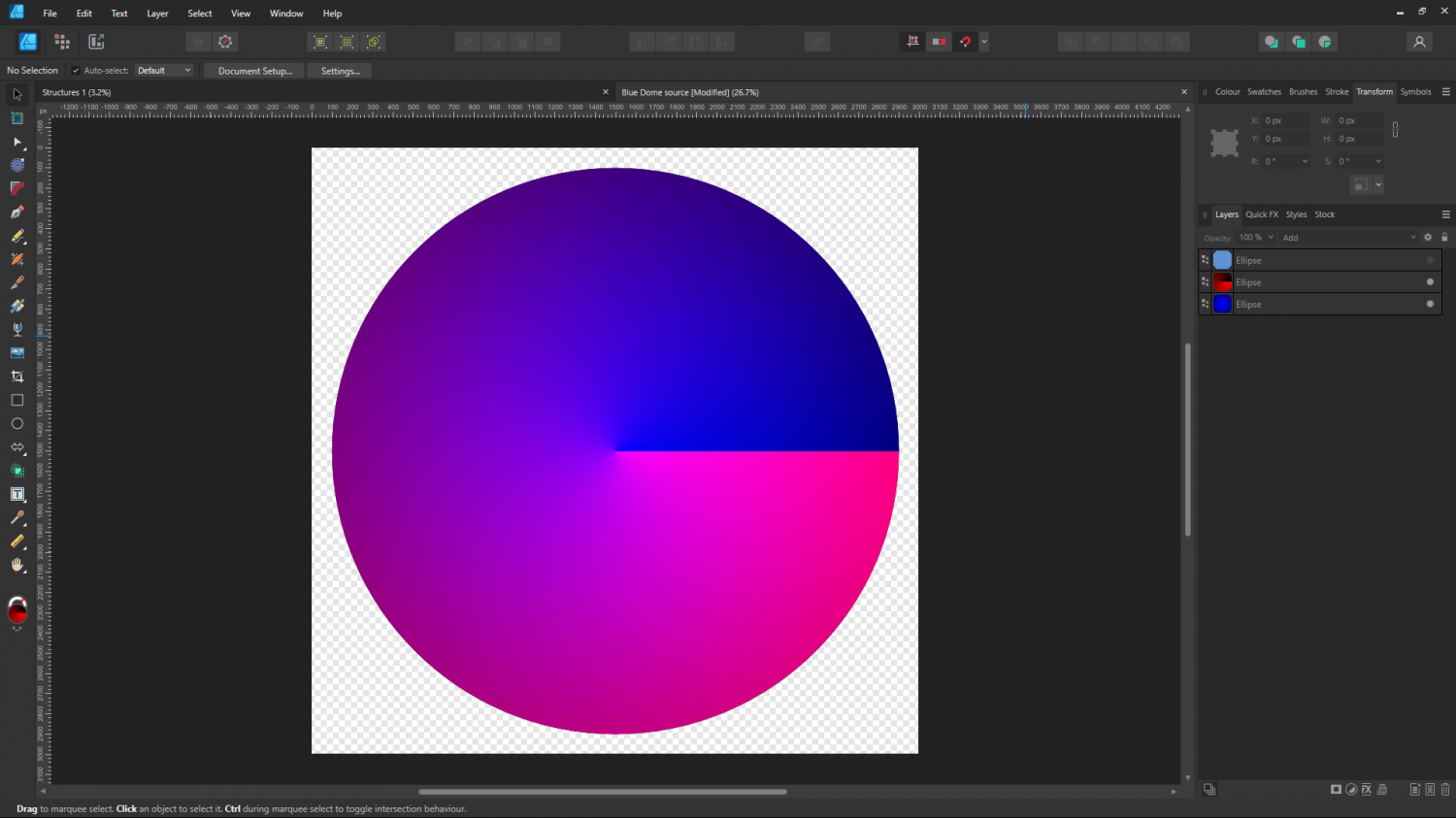
I think I may have uploaded this before, but here it is again if you want it.
I have added the necessary 1 green to the blue layer, so if you use this png as part of a map file it should also work as varicolour.

-
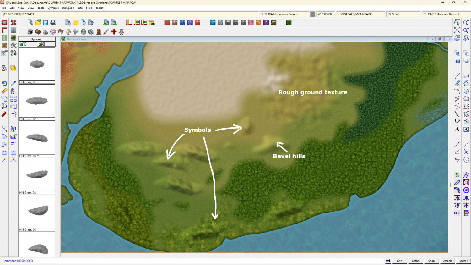
Birdseye Continental - style development thread
There are 3 ways to make hills in this style.


-
Difference between layers and sheets
I think (though I might be wrong) that when these two were named it might have been before 'layers' were commonly accepted as the industry standard as the things you draw on in bitmap apps. But I also get confused at times by the now non-standard names for things that we all used in the early days of computer graphics. I use bitmap apps more frequently than CC these days because I generate CC assets using Affinity, GIMP, Krita... etc, so it was several years before I stopped accidentally calling sheets layers, and layers sheets, back in the days when I was helping new mappers on a range of different mapping apps over at Cartographer's Guild.
However, that's a great explanation from Joseph Slayton about how it all works in CC.
These are the layers most commonly kept frozen so the entities on them don't get moved or deleted by mistake:
- MAP BORDER - should only have a rectangle or 4 defining lines (usually in bright green) that tell CC where the edge of the map is.
- SCREEN - Holds the white collar around the outside of the map to cover up bits of symbols and fills that don't lie within the map border.
- BACKGROUND - not always frozen, but I prefer it that way so I don't keep picking the edges or corners when mapping.
Layers that you shouldn't manually mess with:
- MERGE - is used by CC, and causes some really weird stuff to happen if it's hidden, or things end up on it by mistake.
- SYMBOL DEFINITION - I wouldn't know how to technically describe it, but this layer has something to do with logging or controlling what symbols are in the map.
Example maps usually have all the layers frozen so they can't be accidentally altered, but if you want to make a copy and unfreeze the layers to create your own version for a game, that's easy enough to do.

-
Live Mapping: Random Dungeons
Hi Everyone! :D
In Ralf's words: We've got a new cool tool in CC3+? Of course I need to take a look, check it out and let you watch in tomorrow's live mapping session.
Watch it live on YouTube and join in the chat here:
https://www.youtube.com/watch?v=IREi3GbsRAY
Or you can view it here if you prefer:


-
Project Spectrum - Part 2
Thanks Mike
I've been working on the remaining jungle and swamp trees this afternoon. The jungle trees are just fillers to go between the palms and nothing all that special, but the swamp trees are a bit more important than that. This is the wrong colour, because texturing in ngPlant is a pain and extremely basic, but it gives some idea.


![[Deleted User]](https://secure.gravatar.com/avatar/c75d9a245b74d9c59be0999ea81ca541/?default=https%3A%2F%2Fvanillicon.com%2F92add7f8c954488718110edc4896ad39_200.png&rating=g&size=200)
-
Winter Trail Project
Like this, @Wyvern ?
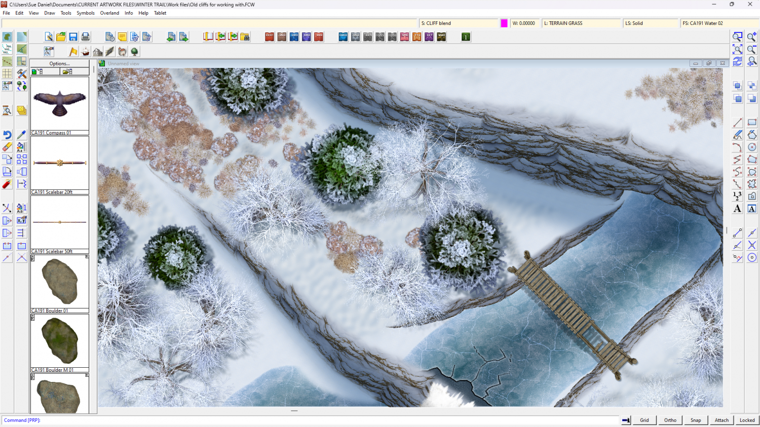
I've had to change the order of the sheets a bit so the shadow is on top of the cliff and enabled me to put the CLIFF blend sheet between it and the cliff symbols.
-
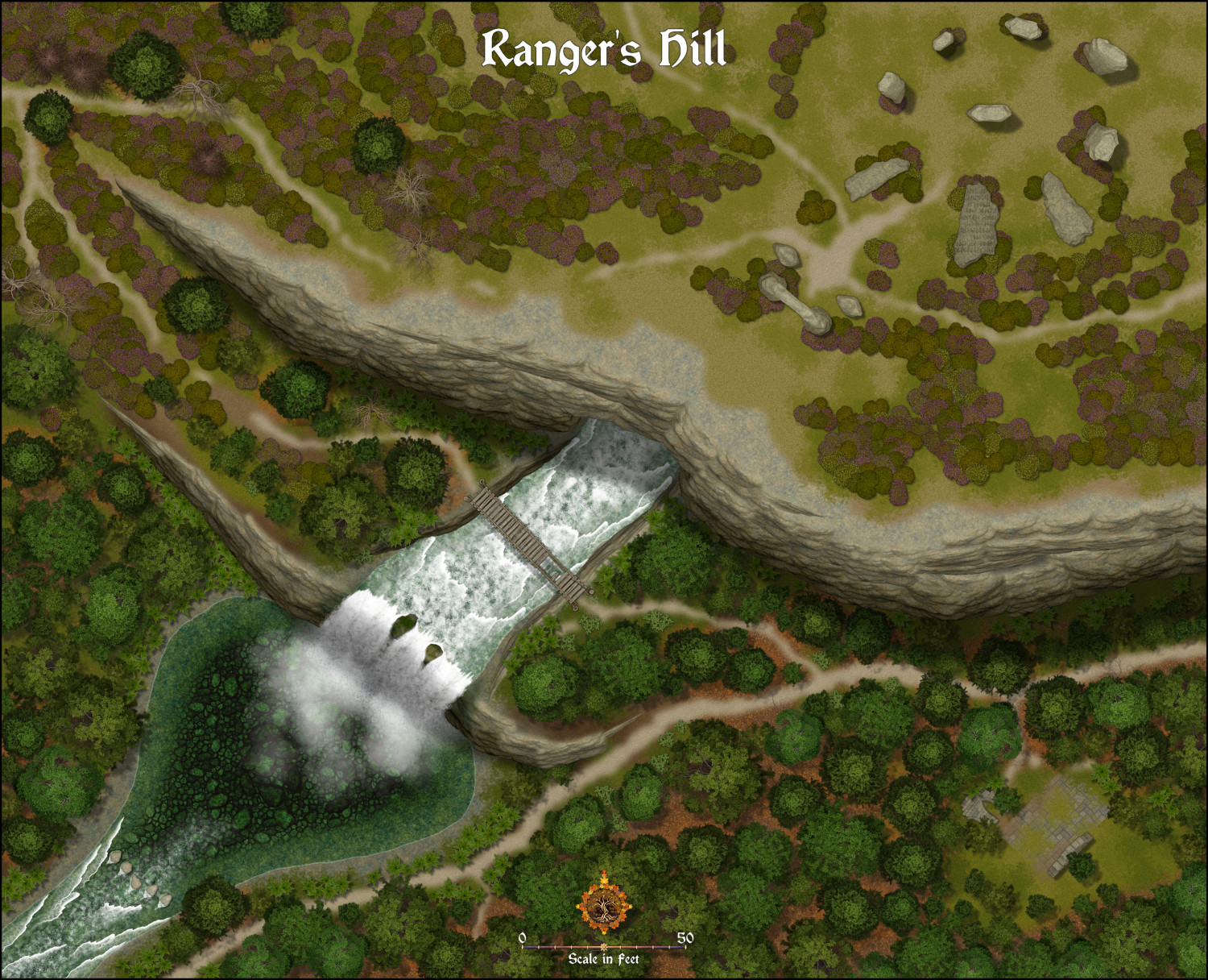
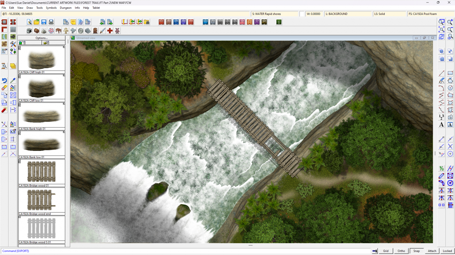
Forest Trail project - part 2
Well, I've more or less wrapped this up, so this is a slightly reduced version (though not much reduced) of the map I've been working on all this time so you can see what's in part 2.


-
Forest Trail project - part 2
Well, I decided to leave the rapid symbols as they are - webbing and all. In addition, though, I've made two white water fills that seem to work ok with them to give quite a different impression.
I've also done some work on a bridge.
I'm tinkering with proper stepping stones to go with all types of river, but there are only 2 days left now and these are proving quite difficult to draw.


