


Loopysue
Loopysue
About
- Username
- Loopysue
- Joined
- Visits
- 10,419
- Last Active
- Roles
- Member, ProFantasy
- Points
- 10,163
- Birthday
- June 29, 1966
- Location
- Dorset, England, UK
- Real Name
- Sue Daniel (aka 'Mouse')
- Rank
- Cartographer
- Badges
- 27
Latest Images


-
Live Mapping: Naomis Floorplans. 28 Nov
Hi Everyone! :D
Next week, Ralf will be creating a tavern layout with the Naomis Floorplans style, which is included in the Humble Bundle offering: Maps Extravaganza 2024.
Come watch it live and join in the chat here on Youtube: https://www.youtube.com/watch?v=Ondg6forUKM
Or if you prefer you can watch it here on the forum (no live chat on the forum)


-
How do I fix the lines on my map?
Hi Otaku :)
The blue lines are eminating from the objects on the CONTOURS (LAND) sheet because the line width there is greater than zero.
There are duplicate entities on the LAND sheet, and the COASTLINE entities aren't behaving properly at all, I recommend working with just the CONTOURS (LAND) sheet entities and deleting the entities on the LAND and COASTLINE sheets. I've written a more detailed suggestion below.
Please work on a copy of your original map in case anything goes wrong, or in case I've completely forgotten to tell you about something.
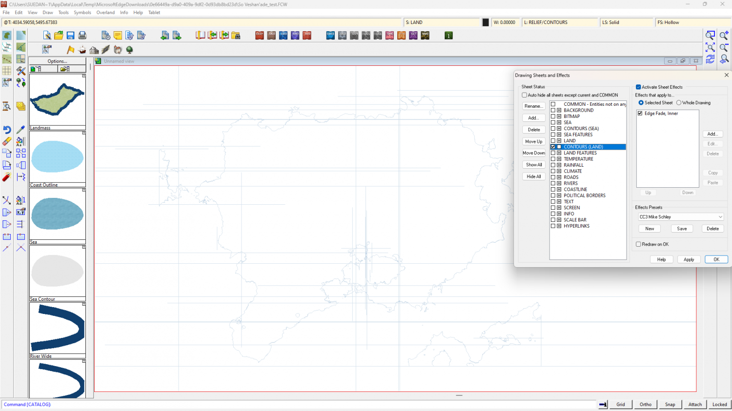
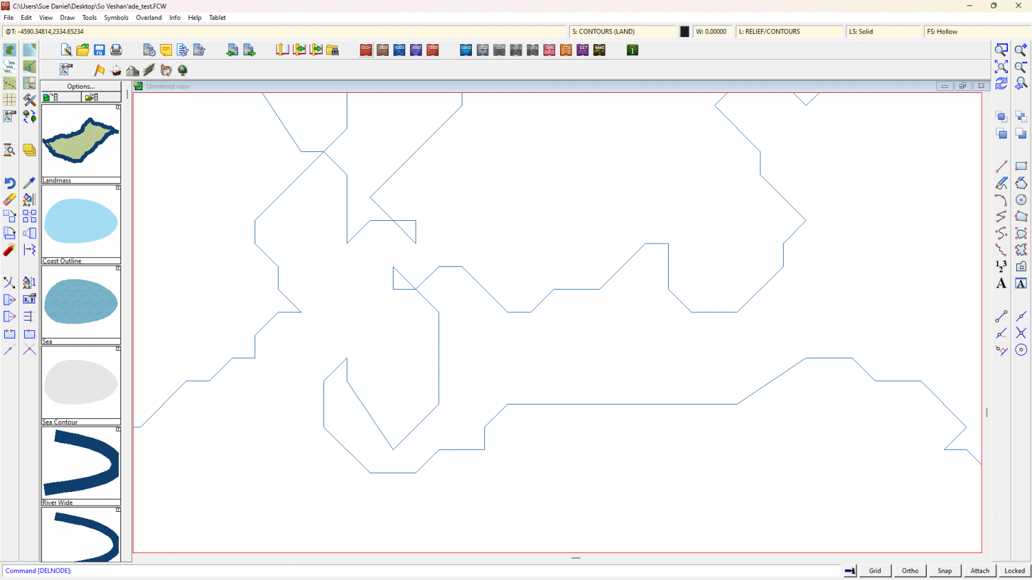
Step 1 - The first thing to do is isolate and delete all the duplicated entities on the LAND and COASTLINE sheets by hiding all the other sheets. Then reshow just the CONTOURS (LAND) sheet.
Step 2 - Switch off the sheet effects (uncheck the Activate Sheet Effects checkbox at the top right of the dialog). Make sure that only the CONTOURS (LAND) sheet is visible. Ok the Sheets and Effects dialog and use the Change Properties tool |CC2MCHANGE|to set the line width to zero for all the visible entities. This should get rid of those grid lines. At this stage you can then use SIMPLIFY on the visible entities if you wish. I found that the shapes were already quite simple and didn't look any more simple until I used a distance factor over 1 (I used 2).
Step 3 - Whether or not you use SIMPLIFY, the polygons on this sheet have artefacts you probably don't want to keep, such as these single lines - 2 node polygon islands and peninsulars. You can use the delete node tool |CC2DELNODE|to get rid of them.

Step 4 - Once you have tidied up all the undesirable bits use the Change Properties tool again |CC2MCHANGE| to set the Fill style (choose the land fill), and the Sheet (LAND), and hit OK.
Step 5 - show all the sheets again and turn the sheet effects back on.
Notes...
There are other ways of doing the same thing, but this one worked best for me in this situation.
The reason I haven't recommended recreating the COASTLINE polygons (the blue line around the edge) is because the staggered nature of the coast does not lend itself well to that method of delineating the land. Any increase in line width, which is what the coastline is - a line with a width, will most likely cause the grid to reappear. If you want to have a blue line around the land as if there is still a coastline present, you can use sheet effects on the LAND sheet to simulate one without that grid problem. If you are unsure of how to do that shout again. Either I or another member will help you.
-
Almost all Entities have disappeared
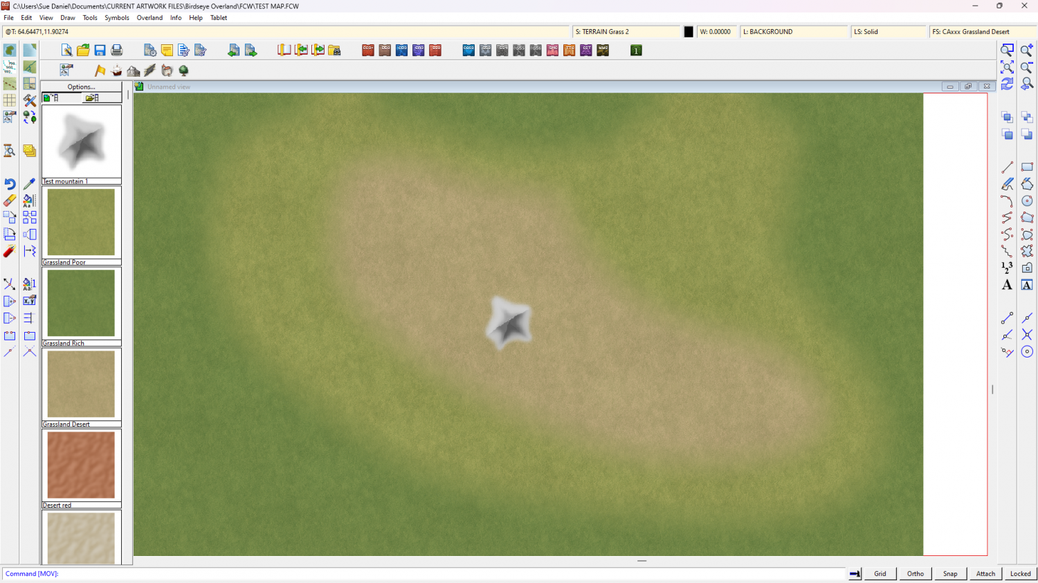
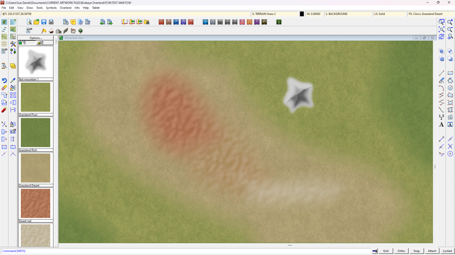
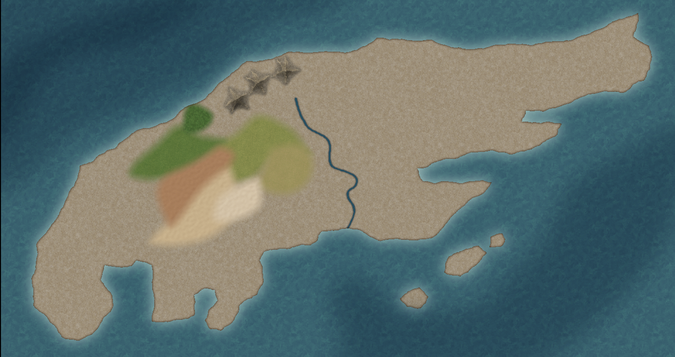
There are a few things that aren't on the right sheet, but I'm not sure which sheet these things should really be on.
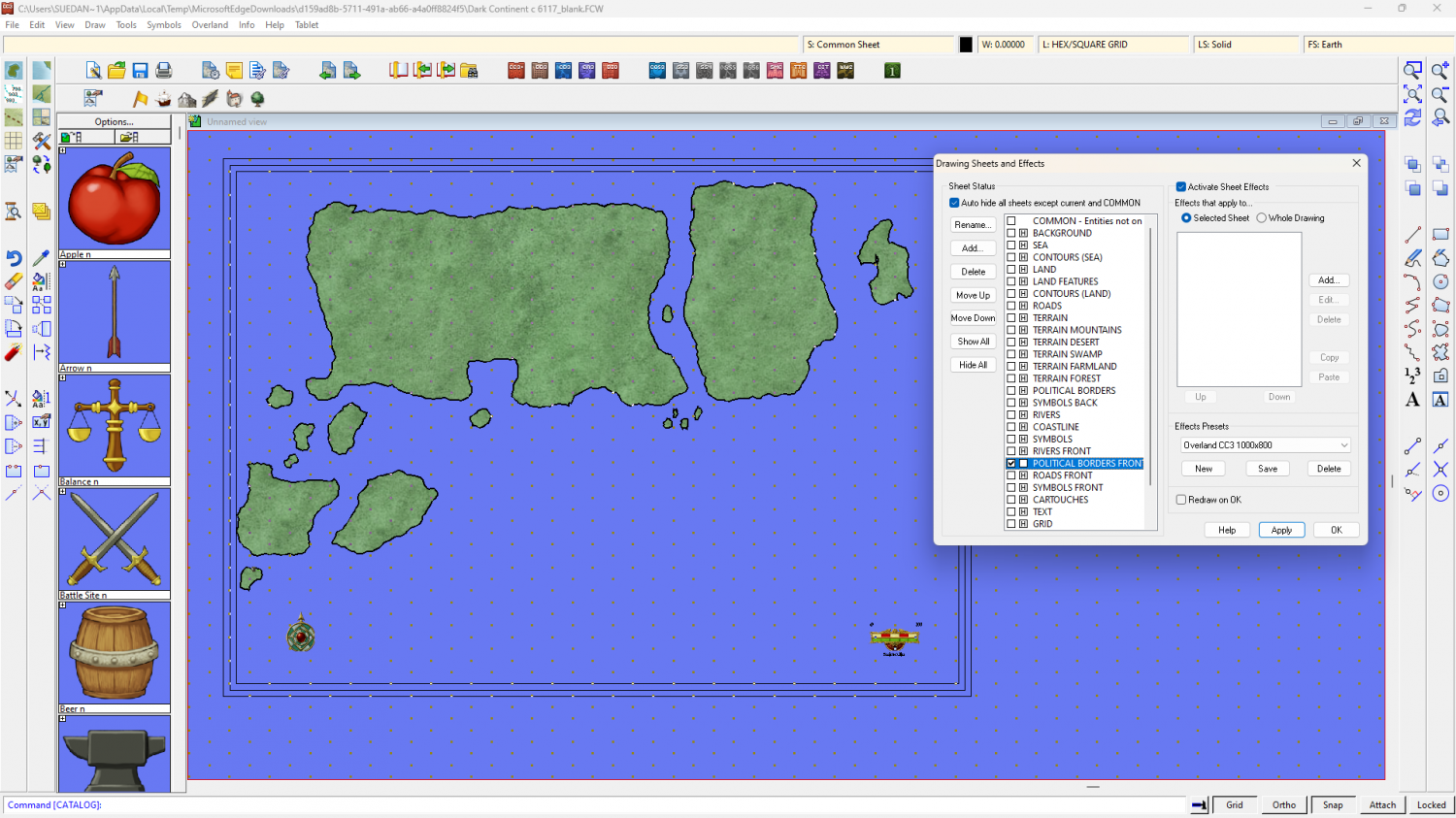
For instance, you have what appears to be the landmass on the POLITICAL BORDERS FRONT sheet, which is on top of most of the other stuff - hence everything vanishing.
This is what's on the LAND sheet.
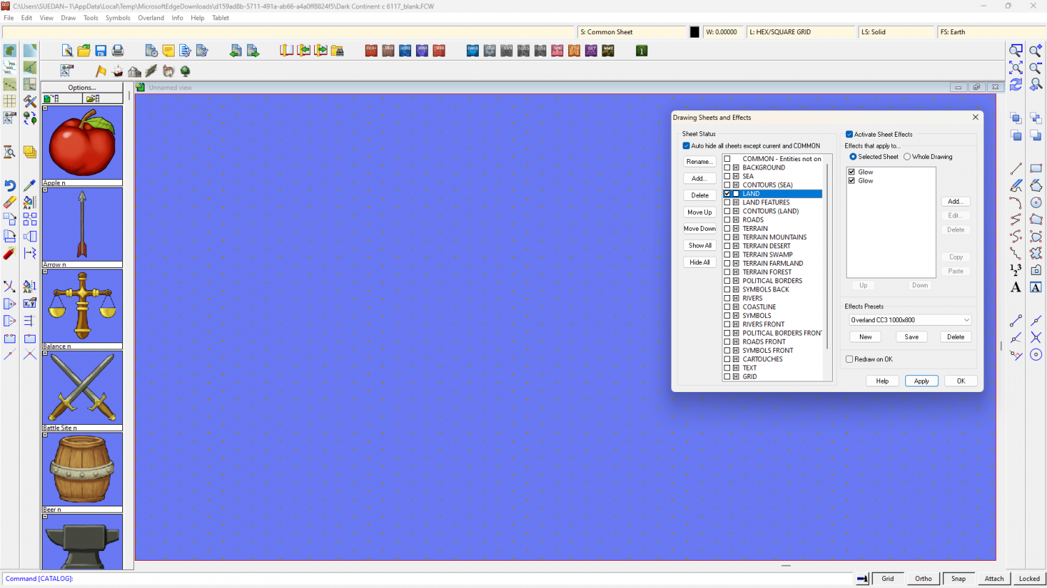
And this is what's on the POLITICAL BORDERS FRONT sheet
If I start moving stuff around between sheets for you that will leave you in an even bigger mess, so I have turned the background to the sea texture and left everything else as it was.
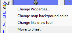
If you want to move things between sheets, like moving the land to the LAND sheet from the POLITICAL BORDERS FRONT sheet, first isolate the POLITICAL BORDERS FRONT sheet by hiding all the rest (that's what is shown in my second screen shot). Then right click the Change Properties button on the left and pick Move to sheet...
Select all the land polygons and hit D for do it, then pick the LAND sheet as the destination.
I've noticed that you appear to have the land polys and a set of identical black outlined polys on the same sheet and layer, so you may have to select by colour or fill to separate them. Select options can be accessed by right clicking when you are asked to make your selection.

-
Birdseye Continental - style development thread
It's only the structures I was thinking of doing fish-eye, and not very much at that. Just enough to show what kind of buildings are under those rooftops.
I promise I will do more structures this time around ;)
Would you like it to be similar in colour scheme to Darklands City?

-
Birdseye Continental - style development thread
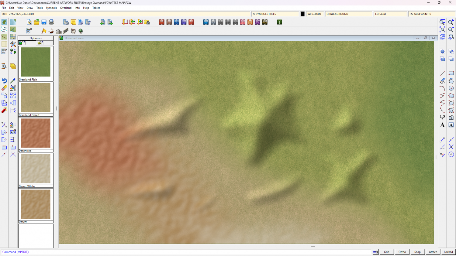
Calibre - you might be able to use the 3 shades of grassland as contours.
In the meantime I've realised there's no escaping the necessity of doing all the textures first. Only that way can I draw the mountains and hills to fit the colour scheme. So here are 3 desert textures.
I'll put a SYMBOLS HILLS sheet in the style for the foothills that uses a bevel to generate them from hand drawn patches of Solid 20 bitmap. But I may also do regular hill symbols.

-
Birdseye Continental - style development thread
Less contrast in the deep water now. I was using 'Glow' as the blend mode, but now I've switched to Multiply.
Is it possibly a little flat now I've done that?
I can always adjust it at any time up to publication, but at least we are rid of the cracked mud look now.

-
Creating large cities without crashing
Using Count All in the Info menu, you can see there are over 100,000 entities in this drawing. That is because most of the buildings are House entities laid down in Streets. That's fine, but you can expect things to be a little slow.
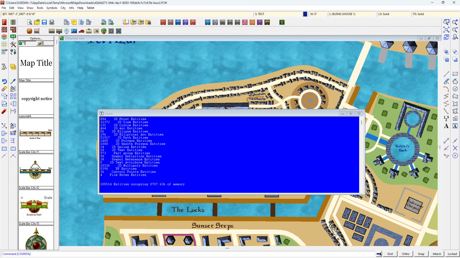
If you hide the buildings there are only just over 8,000 entities - less than 1/10 of the total. The map also zooms and pans much faster.
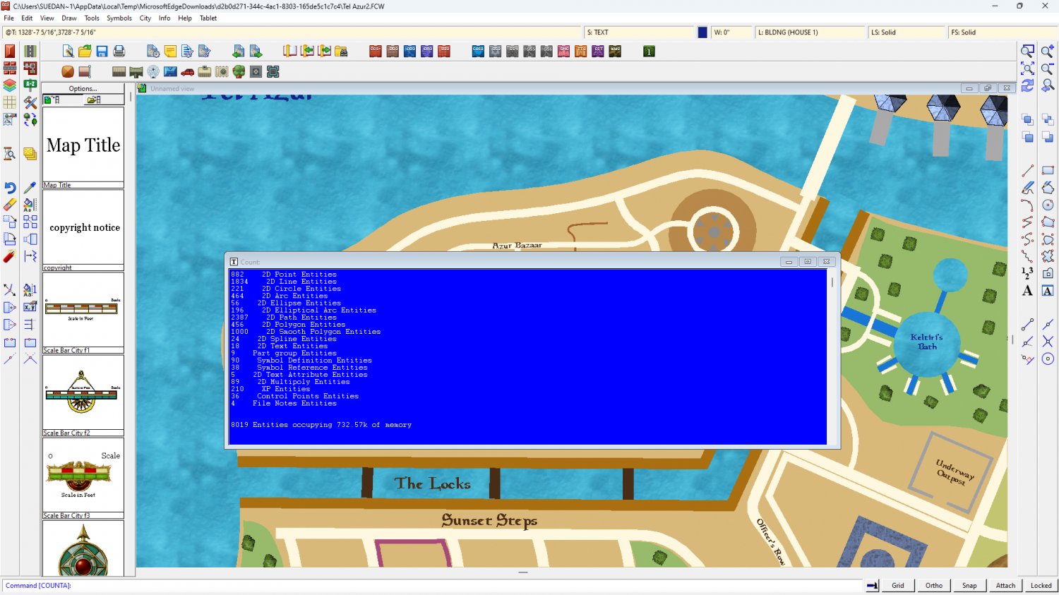
So putting different districts on different layers as described in detail by Quenten above, you should find it a lot more maneagable.
I didn't have any trouble with CC crashing. Did you mean crashing to desktop, or just giving you a green screen within the map window? The green screen shows when CC uses all the available memory to calculate the new display, rather than trying to show you all the stages between then and now, and is quite normal on maps with this may entities.

-
Almost all Entities have disappeared
Just in time then!
You're welcome :)
-
Birdseye Continental - style development thread
LOL! No, but I do like watching volcano live streams. Kilauea is erupting again right now.

-
Birdseye Continental - style development thread
I mean to have quite a bit of fun doing the Structures for Birdseye Regional.

