


Loopysue
Loopysue
About
- Username
- Loopysue
- Joined
- Visits
- 10,419
- Last Active
- Roles
- Member, ProFantasy
- Points
- 10,163
- Birthday
- June 29, 1966
- Location
- Dorset, England, UK
- Real Name
- Sue Daniel (aka 'Mouse')
- Rank
- Cartographer
- Badges
- 27
Latest Images


-
[WIP] Haunted Mansion
The strange band across the map you describe may be down to the number of passes the render has to do to export the bitmap.
Use the command EXPORTSETMPPP to find out how big each pass is. The default value is 4000000 (4 million). If yours is still at the default, change that to 40000000 (40 million) and try the export again.

-
grid dots
That looks like transparency acne, which happens when the pixels in overlying polygons are identical in colour to those of the underlying polygons. It confuses the rendering engine into thinking there is nothing there in that particular pixel space.
When you have sheet effects that modify the appearance of the edge, they will also affect the edge of all these 'pinholes' as well - hence the spotty appearance. Each pinhole gets a bevel.
The easiest way to deal with this is to change the texture in the WALLS sheet polygons to make it different enough from the background fill that this doesn't happen.
Or...
You can make a backing sheet to separate the two grey tones that are causing the problem using a third colour that isn't related to either of them. You do that by creating an exact copy of the WALLS sheet but with the texture turned to a solid unrelated colour (I used purple in the example below). I copied the Color Key across to the new sheet to cut identical holes in it.
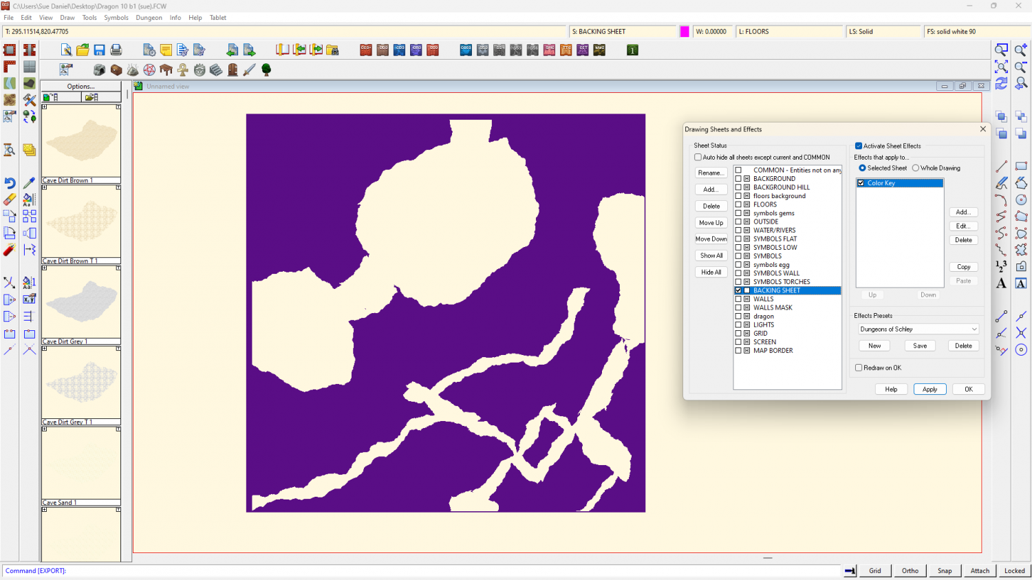
When you make all the sheets visible again it looks no different to before because the purple is entirely hidden by the original WALLS sheet, but when you export it those pimples will be gone.
It will be easier for you in the long run to change the texture of the walls polygons to a different one so you don't have to mess with the BACKING SHEET every time you want to adjust the WALLS sheet, but in case you are fixed on those two greys you can have the one I made.
-
Live Mapping: Modern Streets with Cities of Schley
Hi everyone! :D
This week in live mapping, Ralf will be combining two different styles (Modern Floorplans and Cities of Schley) into one new kind of map.
Come along and join in with the chat with us live on Youtube here:
https://www.youtube.com/watch?v=HowAqyzt00w
Or watch it on the forum here:
(There's no live chat on the forum)

-
Strange Behavior with Marine Dungeons
Hi Cal :)
The colour palette has changed for some reason.
This is the palette attached to a new MD map:
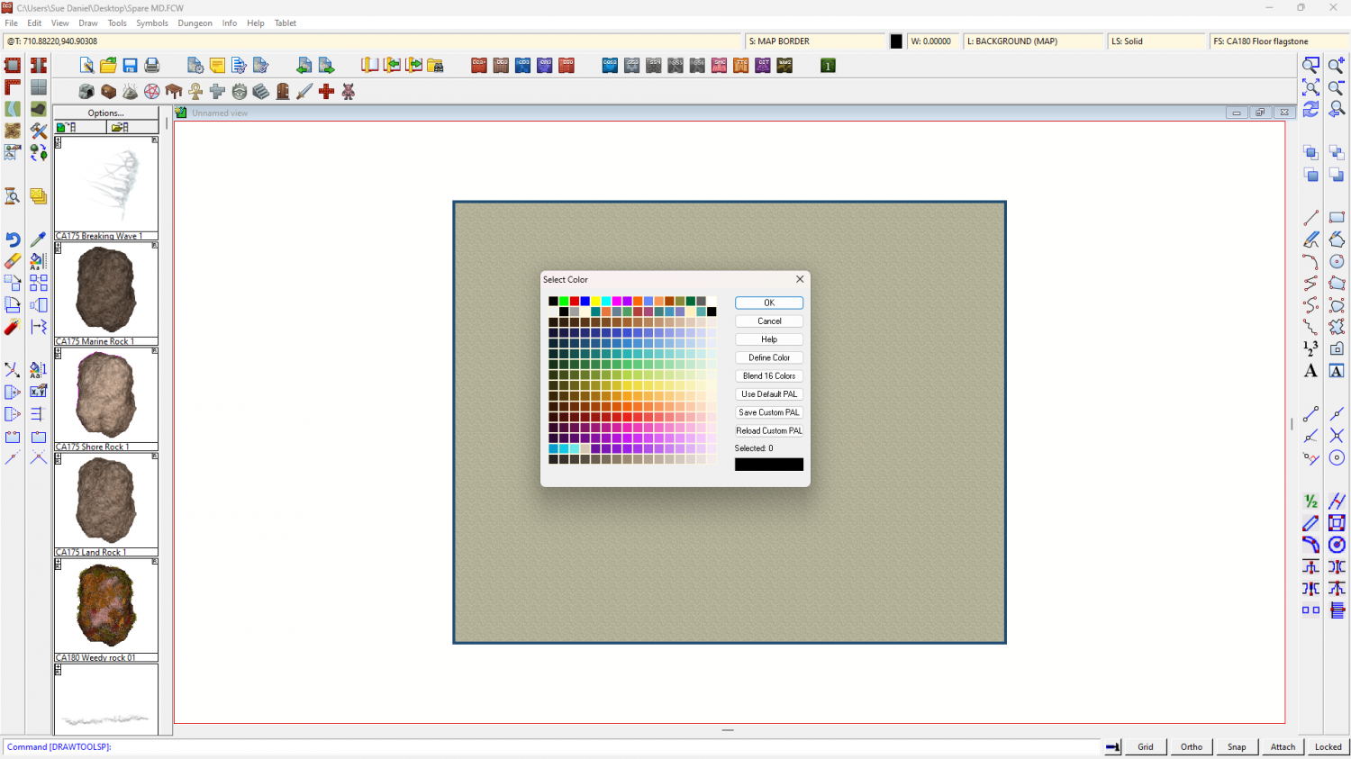
And this is the palette attached to your map:
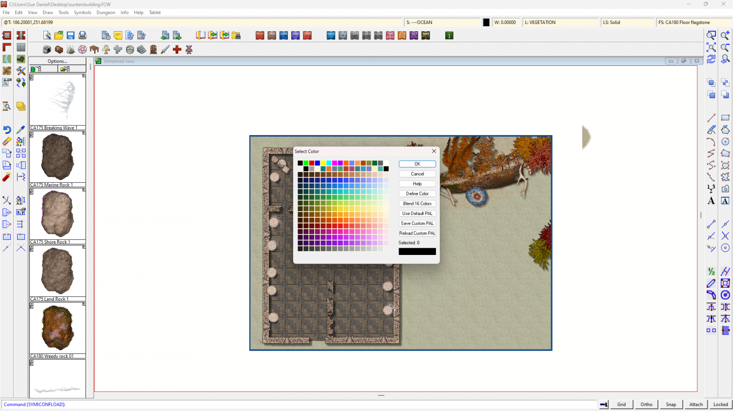
I saved the custom palette from the new MD map and reloaded it in your map. Then attached that palette to your map and here it is:
-
Pencil Sketch Overland
If you don't mind having to learn a new app, there's a free bitmap editor called Krita that can help with the seamless tiles. I once used it to draw all the seamless tiles in the Ferraris Style, but I've forgotten a lot of how to use it these days.
Basically, you open or create your square tile and press SHIFT+W for the tiled view, and then you can draw on it right across the tiled view disregarding the edges.
I wish more bitmap editors provided seamless tools.
-
fill style locations
You should be able to import the one you want by creating a new and temporary Mike Schley overland map, and then importing that dummy map into your own map - pressing the ESC key just before you actually paste it.
That will cause any missing Mike Schley fills to be imported, even though you never actually pasted the dummy map.
Doing it that way will also automatically scale the fill correctly for you.
Once you have imported the fills you can switch to the "Overland Mike Schley" drawing tools in the dropbox at the top of the drawing tool dialog and grab the correct drawing tool for the farmland.
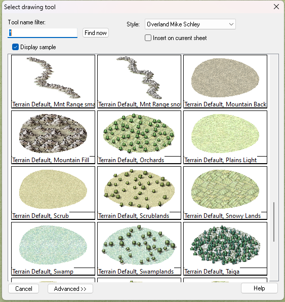
EDIT: although looking at the names in my drawing tool list there seems to be a bit of a mix up on my system at the moment. I'm sure yours will be fine.
-
Pencil Sketch Overland
Krita is better quality, but if you are happy with the GIMP version that's fine.
-
Cavern Symbols - Stalactites/Waterfalls
If you search for stalagmite in the C:\ProgramData\Profantasy\CC3Plus\Symbols folder, you might come up with a few. That will give you the location, and therefore the style. There aren't that many, but there are a few.
Same for waterfalls.
It really depends on which parts of the full set you haven't got.
-
Pencil Sketch Overland
That was the drawback. Krita works well and gives good results, but it takes a couple of days to get used to it.
This video covers the basics in Krita, though you have to use your imagination to see how it can be applied to the kind of tiles we make.
I recommend using tiles that are 1-2000 pixels square, rather than the smaller size demonstrated in the video. Use larger tiles when the pattern is something large, like rocks (when the repeat becomes rather more obvious on smaller tiles), and smaller tiles where the pattern is something fine grained, like sand or grass.
-
WIP Thyra
Yes, the original Color Key matches the canals you drew - in that blue colour.
If you switch off the sheet effects you see them light blue, instead of the ocean. They are cutting (at least on my machine they are), but adding a magenta patch as you did in your screen shot above won't work until you add the second Color Key as Joe indicated.
No sheet effects.
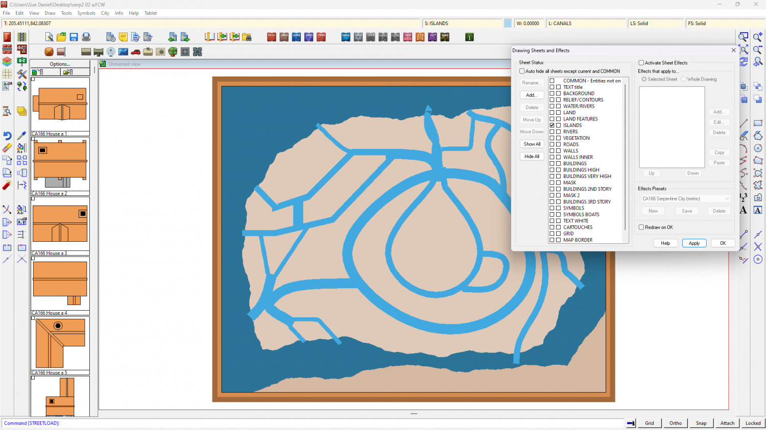
Sheet effects.
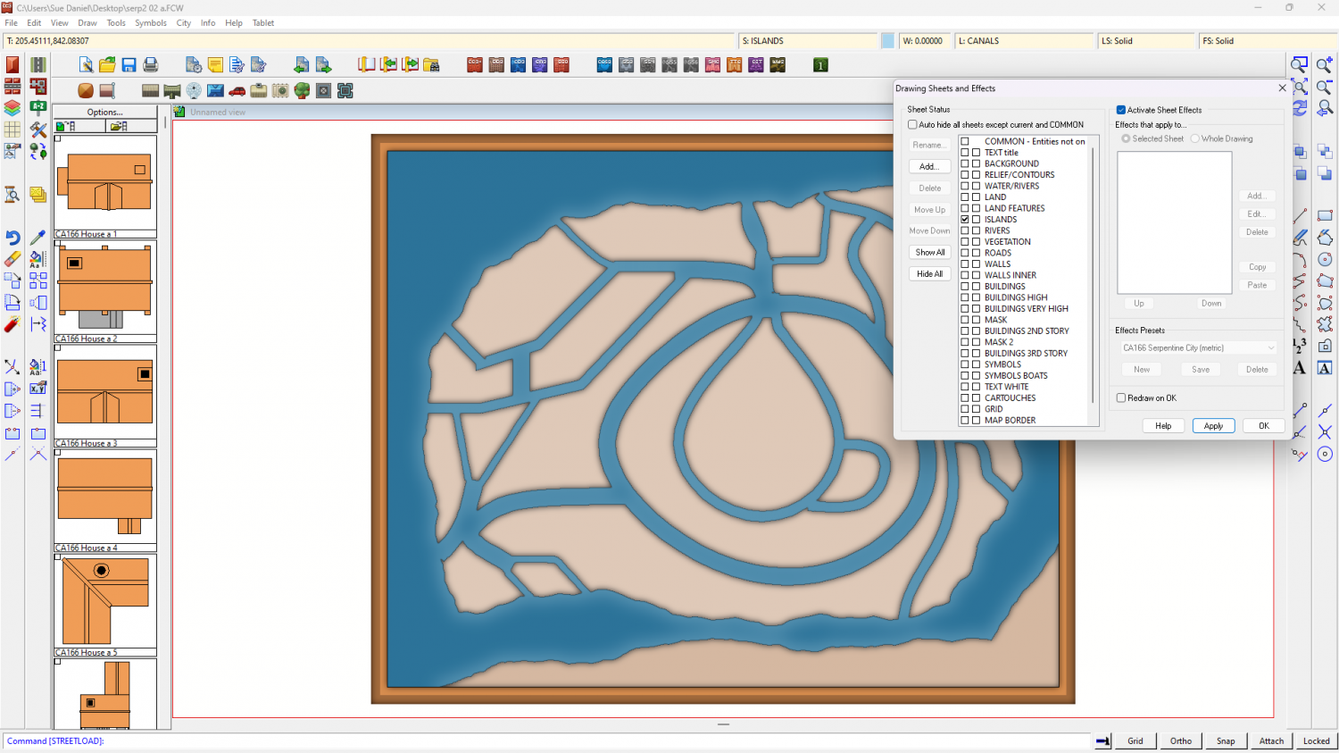
Don't delete or alter that first Color Key, or these blue shapes will no longer work. Just add the new default one.


