


Loopysue
Loopysue
About
- Username
- Loopysue
- Joined
- Visits
- 10,419
- Last Active
- Roles
- Member, ProFantasy
- Points
- 10,163
- Birthday
- June 29, 1966
- Location
- Dorset, England, UK
- Real Name
- Sue Daniel (aka 'Mouse')
- Rank
- Cartographer
- Badges
- 27
Latest Images


-
Donut-shaped buildings?
I've got one of those. You might have to work a bit with fills and so on.
https://forum.profantasy.com/discussion/comment/72048/#Comment_72048

-
[WIP] 1000th Map Competition: Elkton, Alarius North Central
LOL! Where would I be without you, Wyvern?
I know! I know! Some-were-elks, I guess.
...
I don't usually do a preparatory sketch, but I was waiting to drive my mum somewhere, so here's a quick sketch of the basic idea.
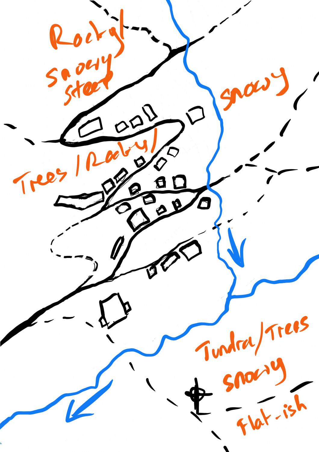
I'm going to use Winter Village for the base, and add from other styles to create the brighter colours of the tundra in the low area to the south of the map. The whole village is on a slope with higher ground to the north.

-
[WIP] 1000th Map Competition: Elkton, Alarius North Central
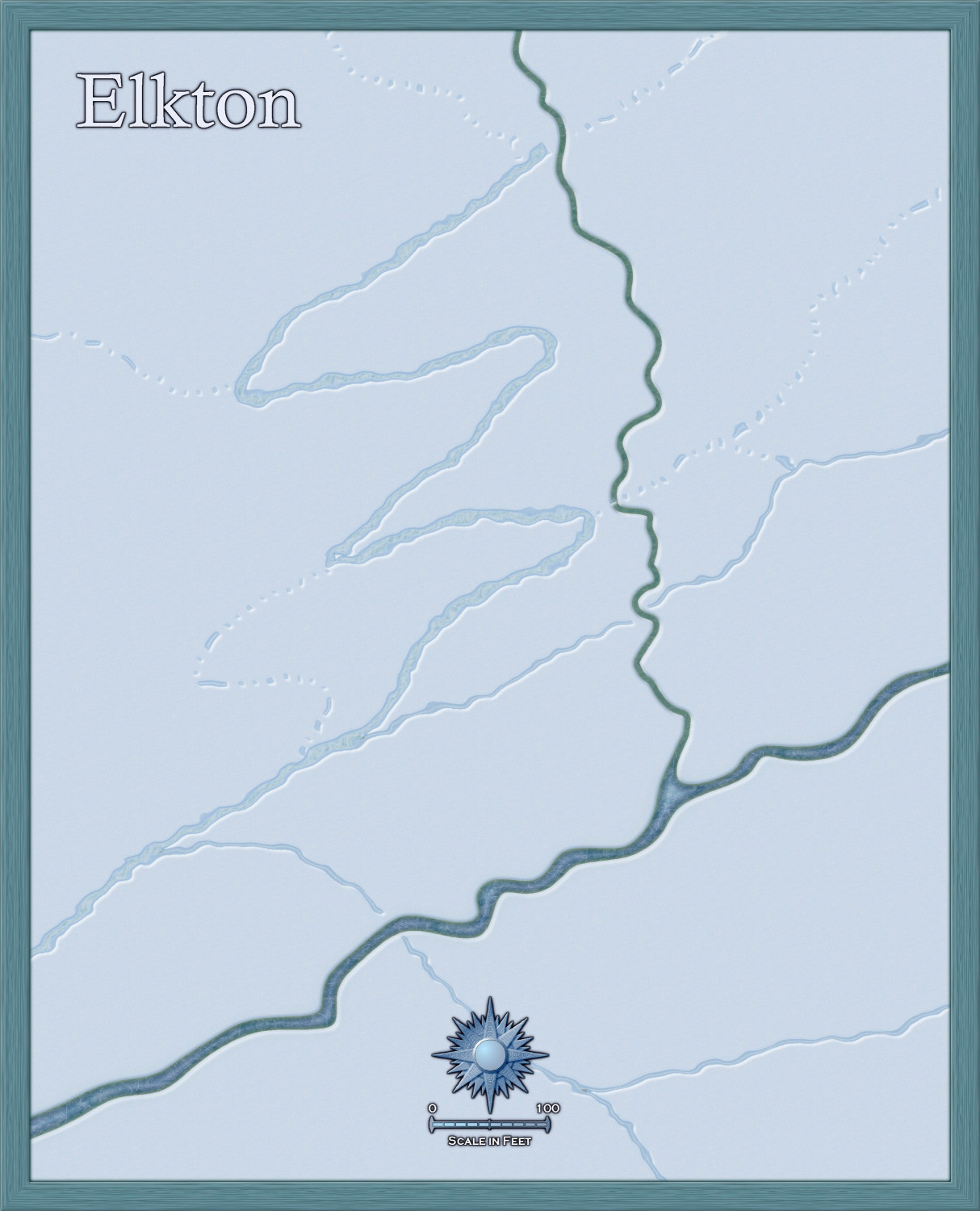
I'll do the map at first all in Winter Village and modify it where necessary once the basics are in.
There aren't any rivers marked on the area map. Should I take these out?

-
[WIP] 1000th Map Competition: Elkton, Alarius North Central
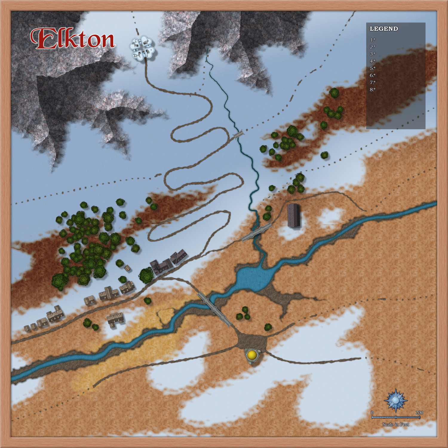
You can tell I haven't done an actual map for years. I'm still trying to get the right size and shape, and make enough space for a legend.
I replaced those Darklands City trees with Forest Trail pines, and laying out the roads for a split community - some of them live on the tundra in the valley, while others live on the steep slope above it. This being a village at the end of the civilised road, the only things that leave Elkton apart from the road into the village from the west are trails. Animal trails...

-
[WIP] 1000th Map Competition: Elkton, Alarius North Central
Ok. The streams stay :)
Can't have the were-elks wandering away in search of water.
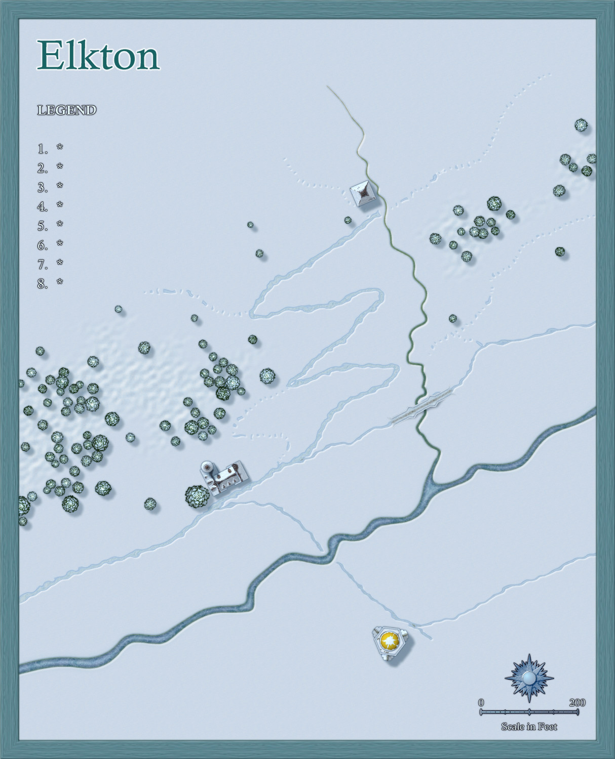
Still playing with map size and composition, but soon it will be time to start looking at the rocky north and the tundra plain in the south.

-
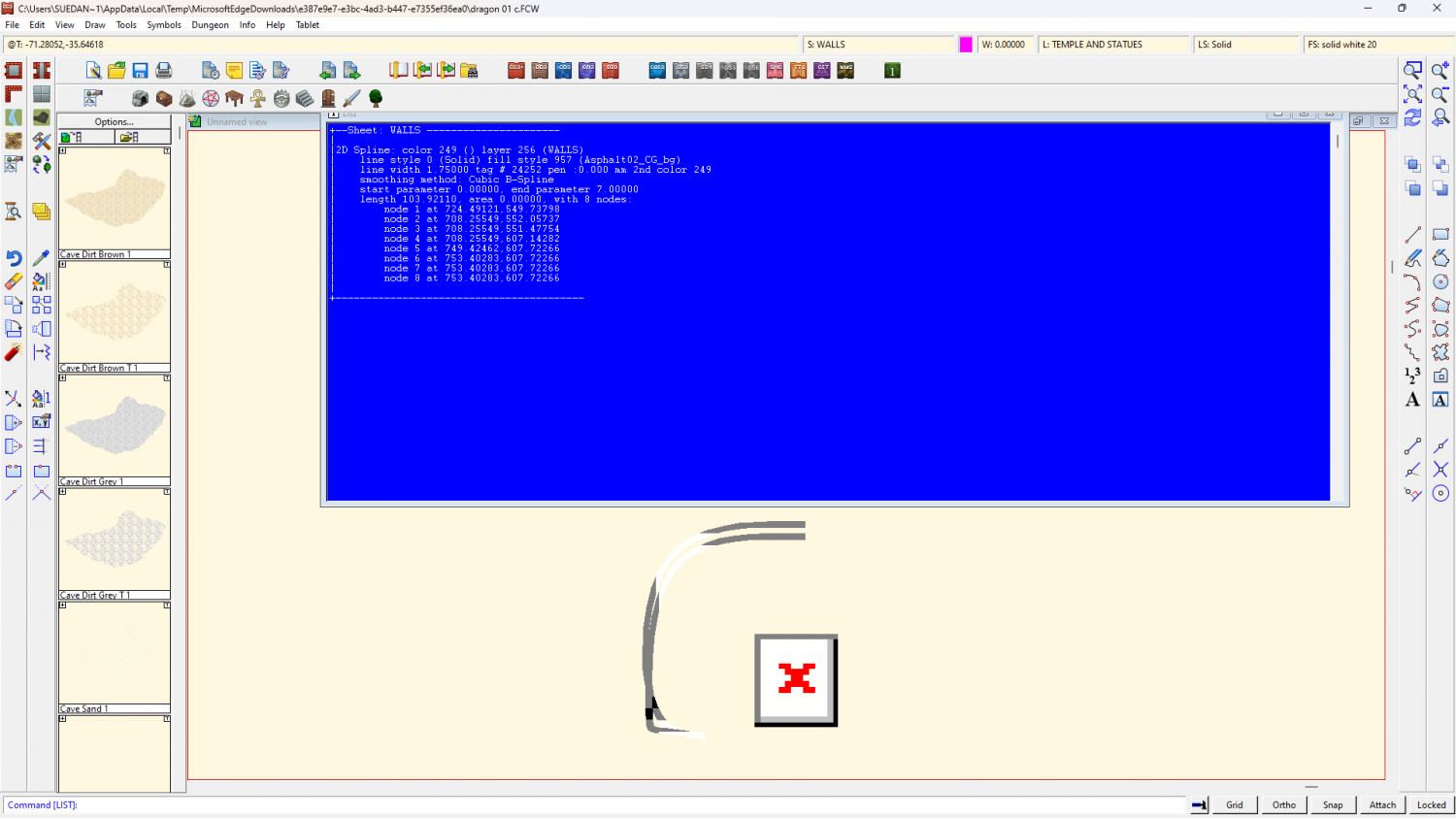
a prototype under ground home for a dragon and some questions
Thanks Helen :)
This is just an analysis of what's there and what isn't on the WALLS sheet alone.
There are 3 entities on the walls sheet. One is a spiral staircase symbol, and the other 2 are lines drawn with one of the Bogie's Mapping Collection tarmac fills. I don't have the BMC installed, so these are all red X entities on my PC.
There is a Color Key on that sheet, but there are no pink polygons or lines, so nothing is being cut.
-
Invisible entities outside of map on TEMPLATE layer
Point entities on the TEMPLATE layer were once used to fix sheets that were otherwise empty. If they weren't there the sheet would vanish next time you opened the map.
That's how it used to be, and quite a few of the older templates still have them in place.
Things have significantly improved over the years, so you can safely delete those points now. Just hide everything but the TEMPLATE layer and box select them to delete.

-
Live Mapping: Sticky Note Dungeon
Hi everyone! :D
In this week's Live Mapping session Ralf will be using the new October Annual issue to create a quick and fun dungeon with sticky notes.
Come along and join in the chat - ask questions, etc, on Youtube here:
https://www.youtube.com/watch?v=lE_QWCbyZ4o
Or if you prefer you can watch it right here on the forum (though there's no live chat here)
-
a prototype under ground home for a dragon and some questions
You would need to put the blur after the cutout.

-
[WIP] Haunted Mansion
Well... you could move the "lights end" sheet up the list till the buildings are above the light effects altogether.
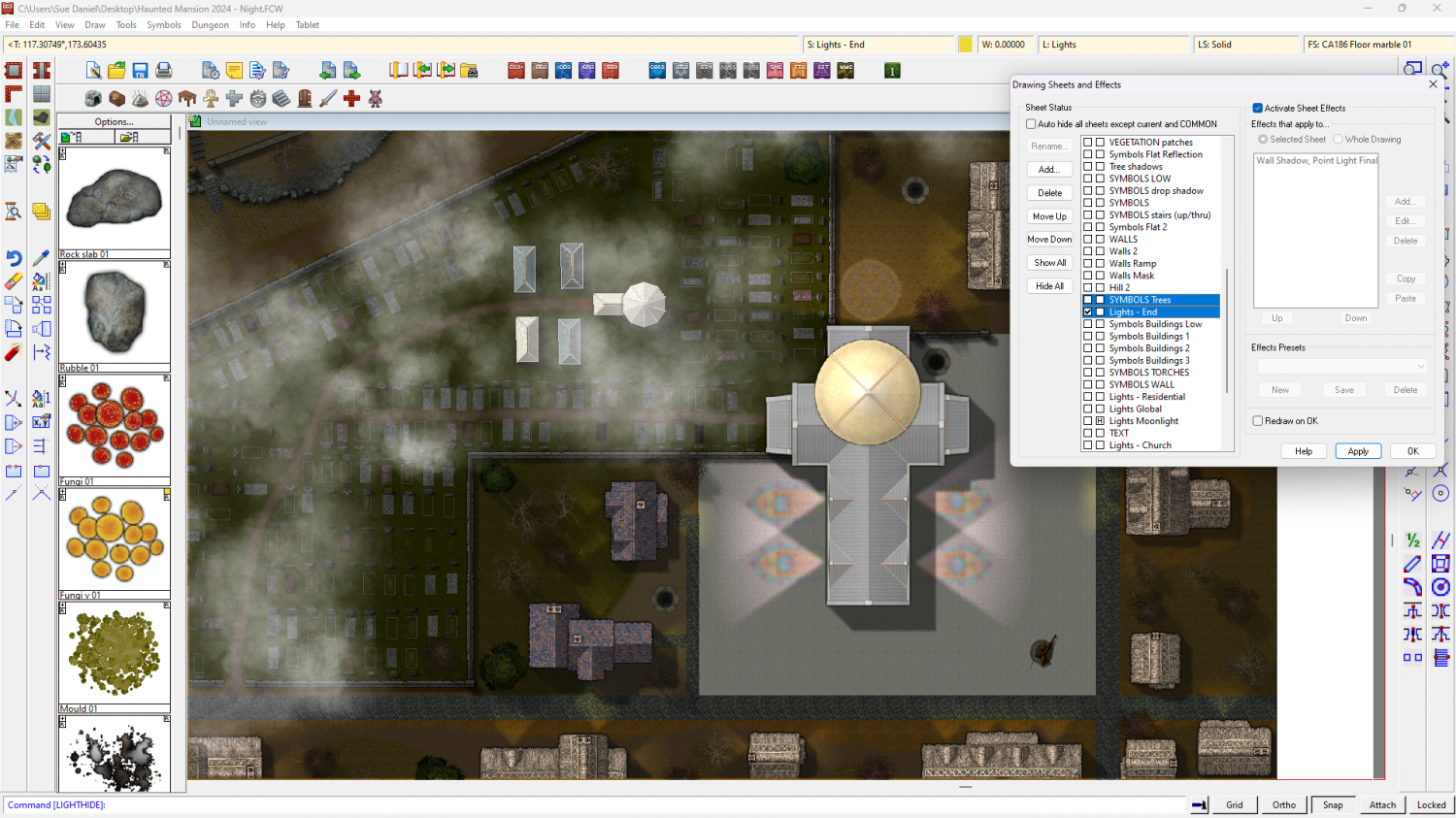
Then, given that they are now far too light and need to have that light dropped to 50% like the lit part of the map, you could add an RGB Matrix Process to each of the "Symbols Buildings" sheets, and set it up to give only half the unity colour. (Unity is a diagonal of ones)
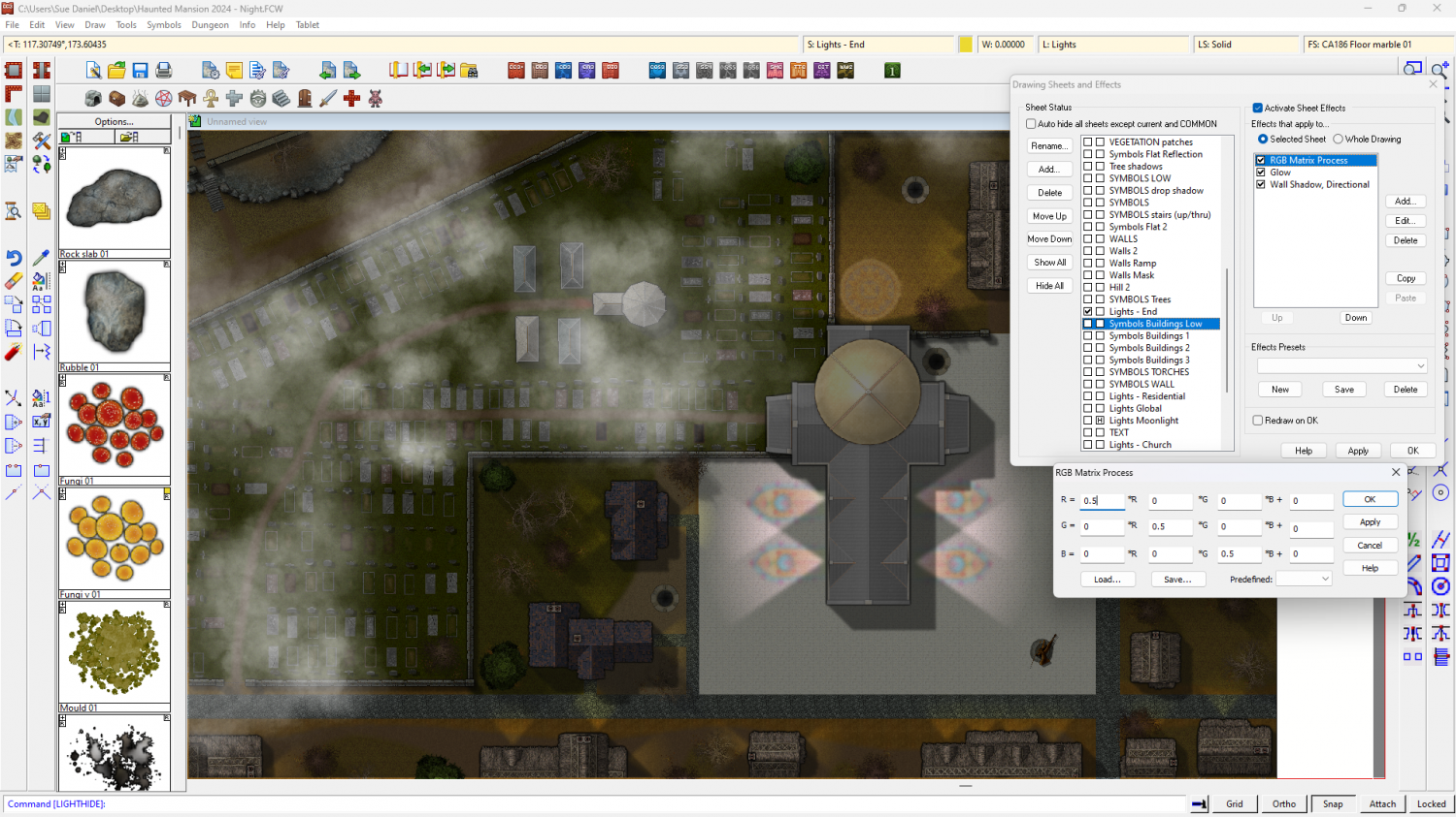
Notice how I also moved the SYMBOLS Trees sheet up the list to keep it above the Lights - End sheet. That's because I'm not sure if an RGB Matrix Process will work on regular symbols (ie, not shaded symbols like houses and buildings)

