


Loopysue
Loopysue
About
- Username
- Loopysue
- Joined
- Visits
- 10,412
- Last Active
- Roles
- Member, ProFantasy
- Points
- 10,161
- Birthday
- June 29, 1966
- Location
- Dorset, England, UK
- Real Name
- Sue Daniel (aka 'Mouse')
- Rank
- Cartographer
- Badges
- 27
Latest Images


-
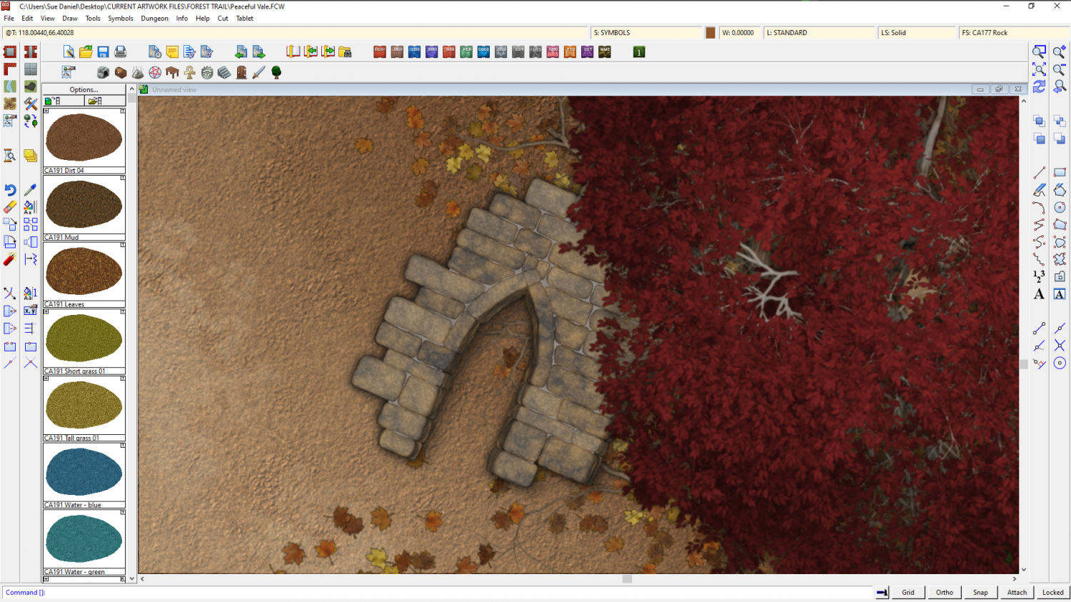
Forest Trail project - part 1
No, it's ok. I haven't got lost in the trees. I was doing a lot of background work - like matching the exact level of blur between different symbols so they all look right with each other, colour adjustments, scale adjustments, and so on. Redoing a lot of the varicolour versions again and again until they also looked right with each other and the non-varicolour symbols.
I've also added ferns (which was a whole lot more tricky than you might think) and I've been working on an idea of adding a selection of ruin pieces.
Varicolour tree with a ruin piece:
Ferns:
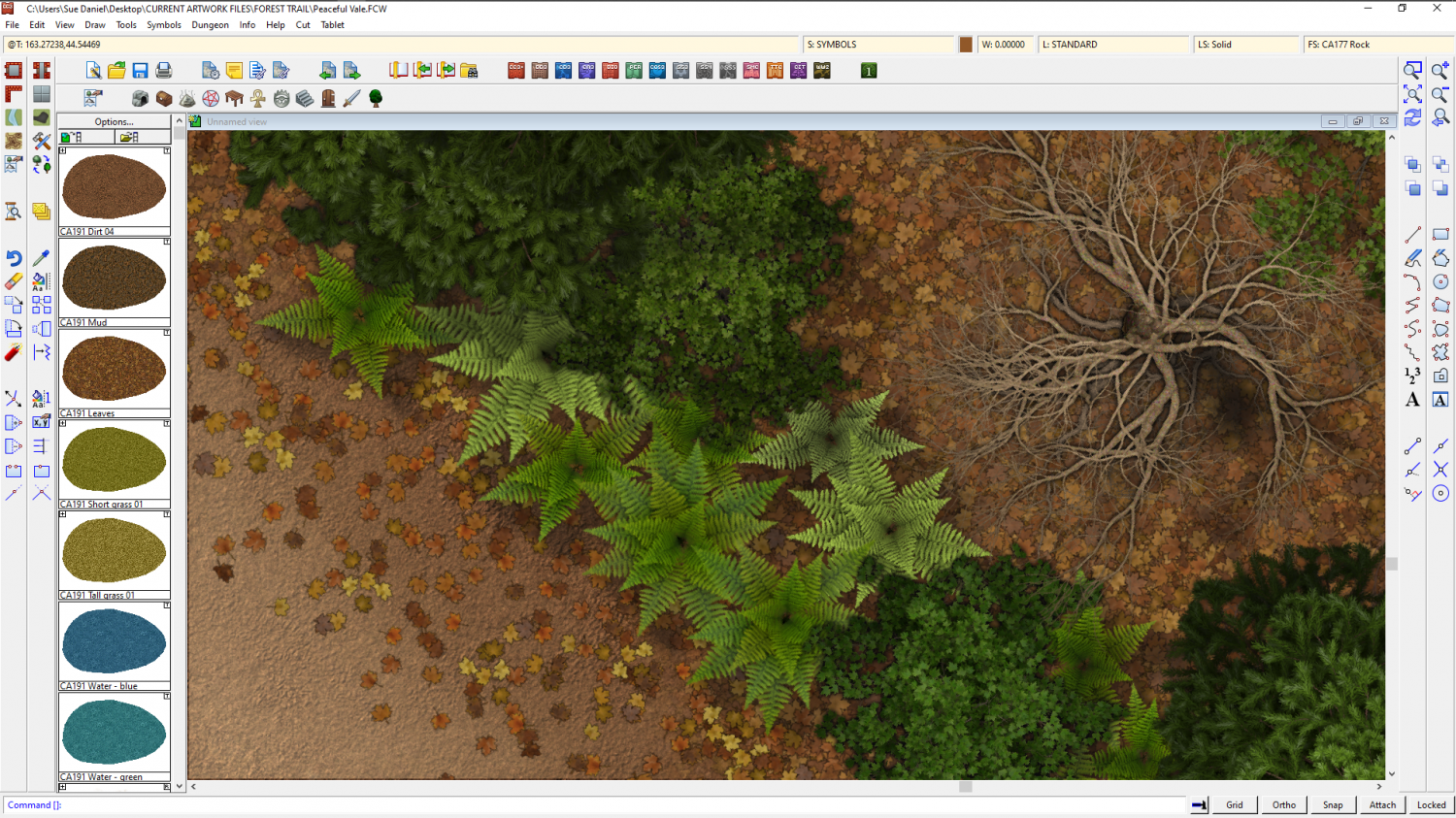
And as you can see there is also a new dead leaf fill, after Ralf suggested it as being the most common ground cover in woodlands.


-
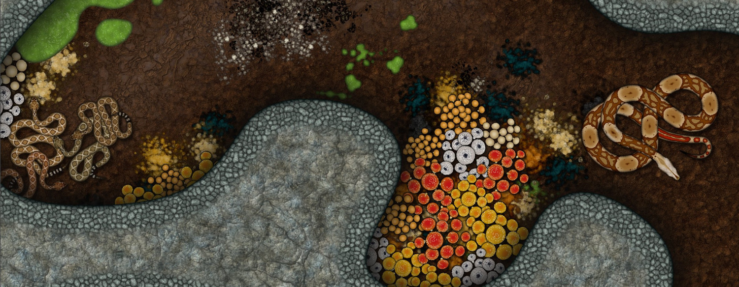
The Creepy Crypt project
Snakes, fungi, mould and guano...


![[Deleted User]](https://secure.gravatar.com/avatar/c75d9a245b74d9c59be0999ea81ca541/?default=https%3A%2F%2Fvanillicon.com%2F92add7f8c954488718110edc4896ad39_200.png&rating=g&size=200)

-
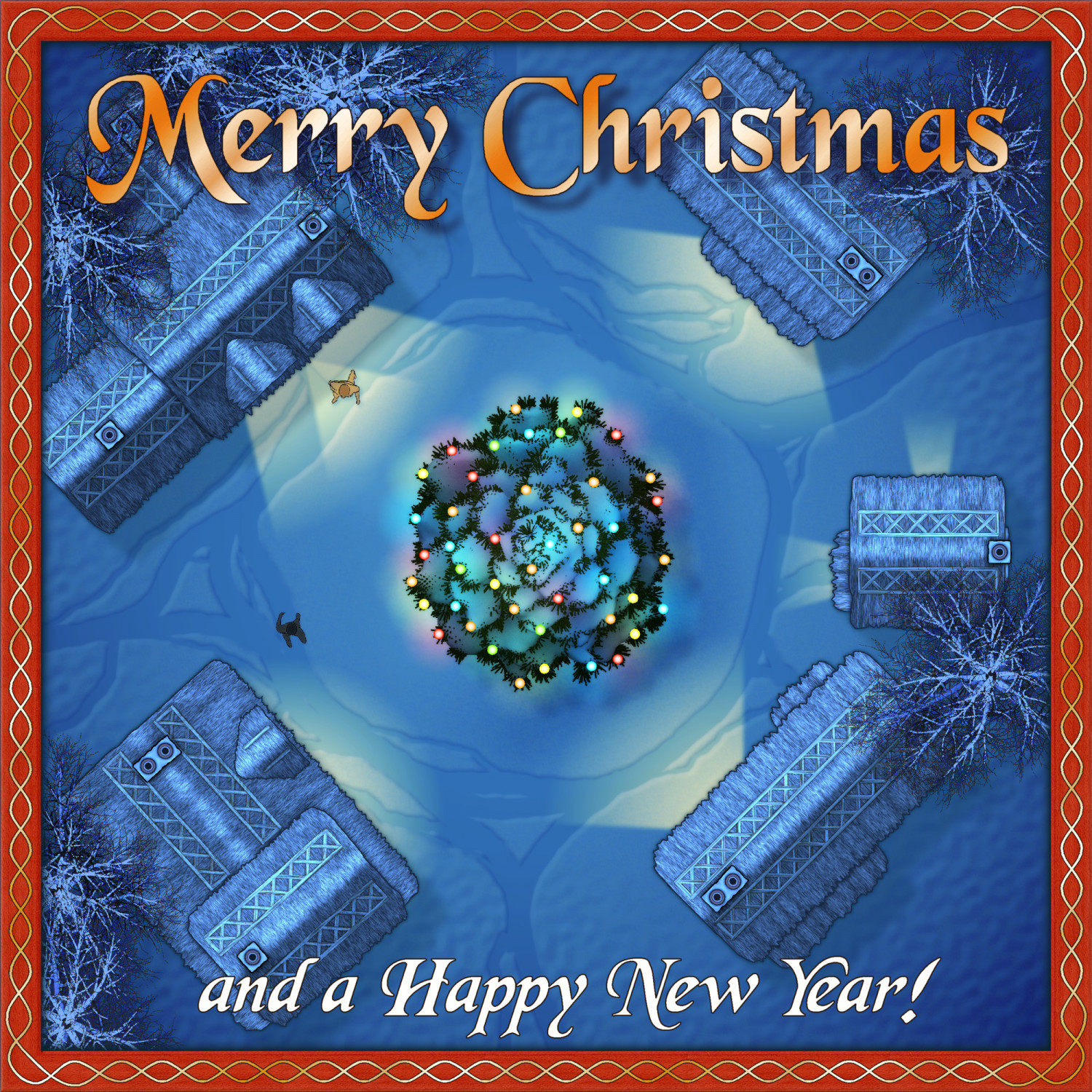
Festive Winter Card Challenge WIP: Frosty Village
Ok, I made some more snowy trees and messed around with the lights and the sheet effects. Now I think I need to make some people, or something. The centre feels a bit empty. Those are just scribbles I've placed at the moment.


-
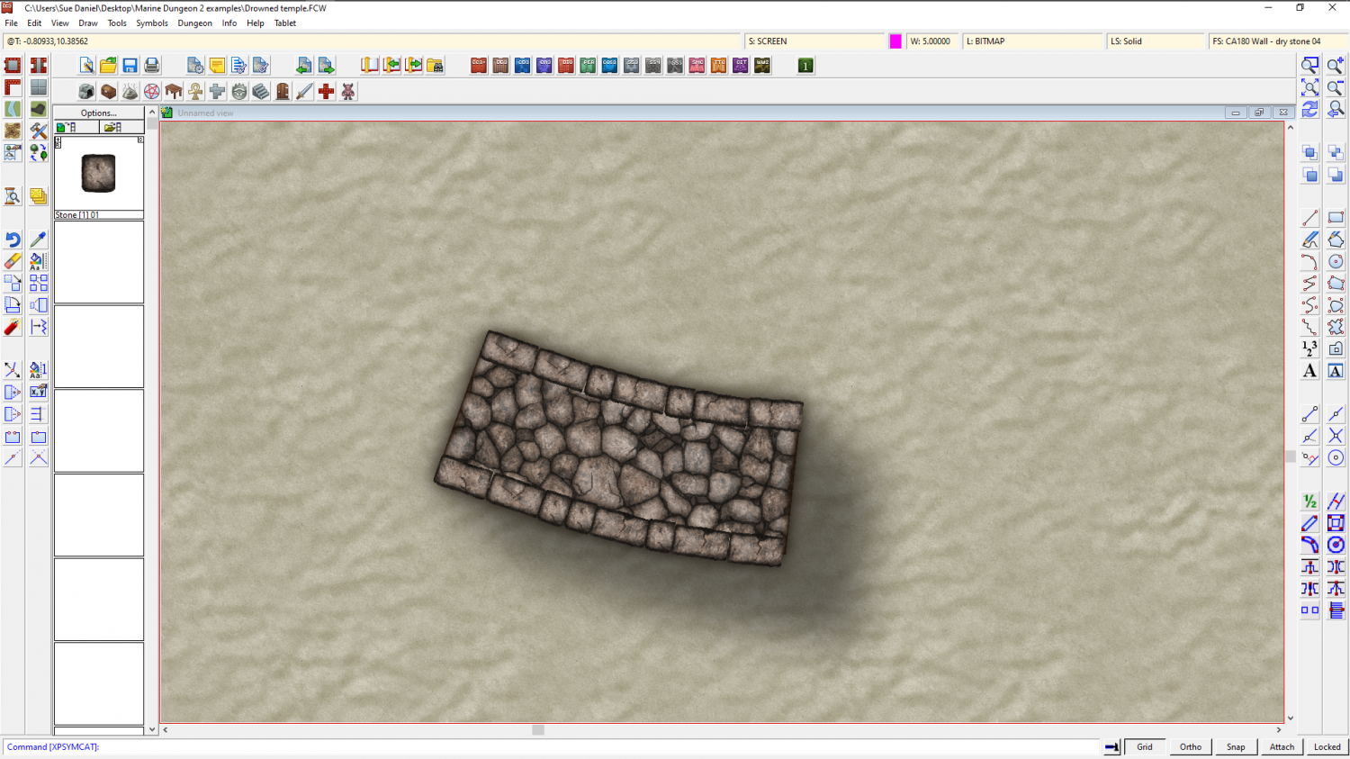
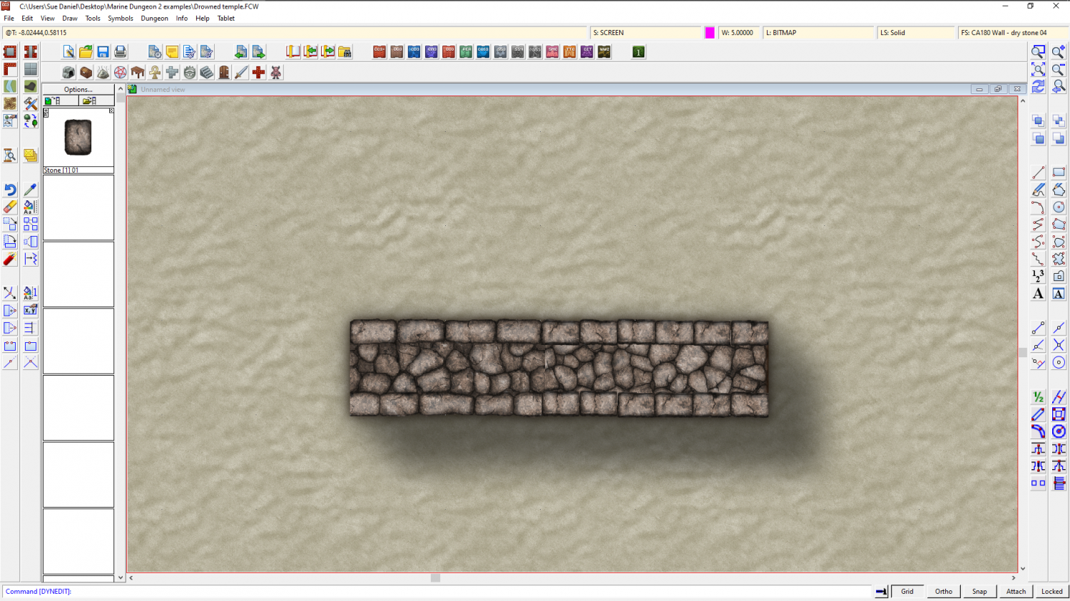
Marine Dungeon - further developments
I've hit a problem with a new and very last minute idea of connecting stones to make odd-shaped wall bits that can't be done with the main connecting wall set. Unfortunately, it keeps missing stones, but I don't know everything about connecting symbols, so I'm hoping someone else has tried this before and knows what I'm doing wrong here.
There are no corner parts and nothing has a defined length. the exact length of the stones varies because they were extracted from the main wall symbols.
I did say it was a last minute idea.
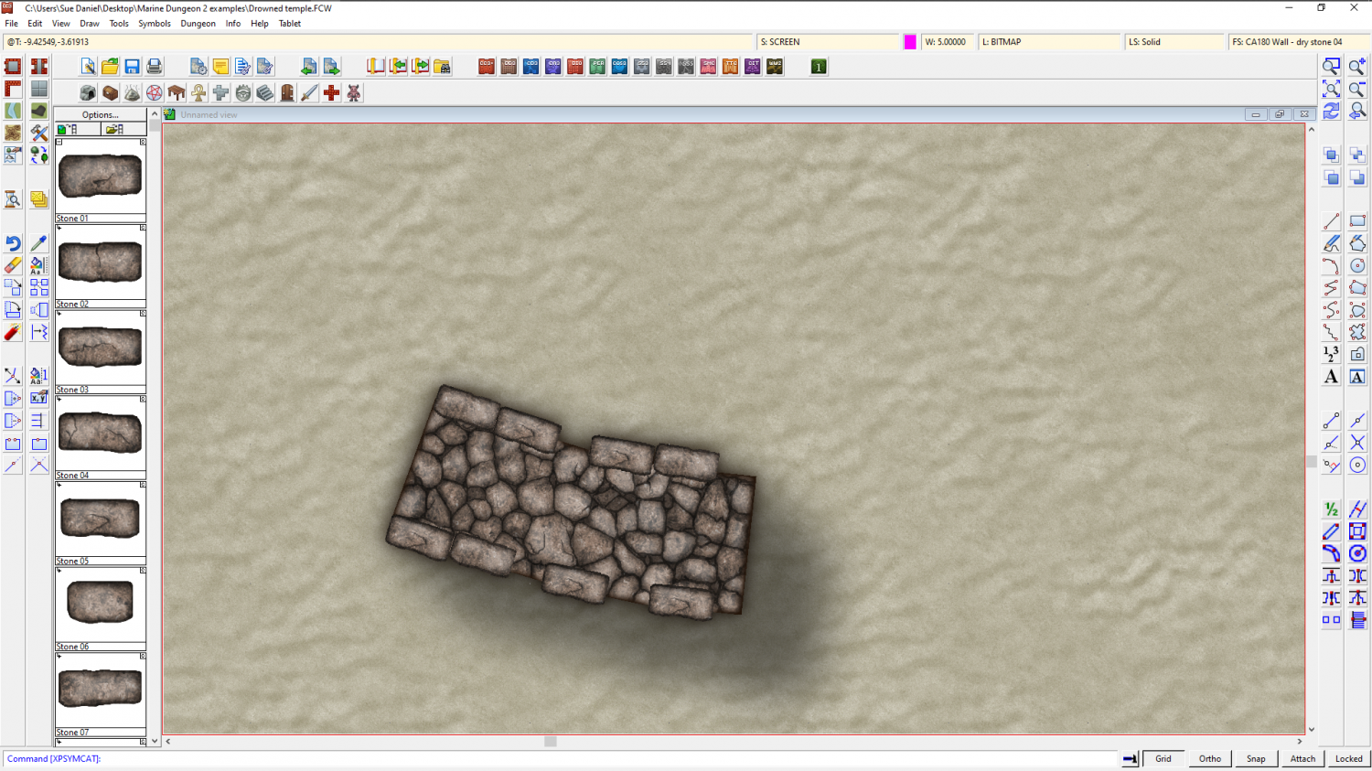
EDIT: I forgot to name them properly! 🙄

-
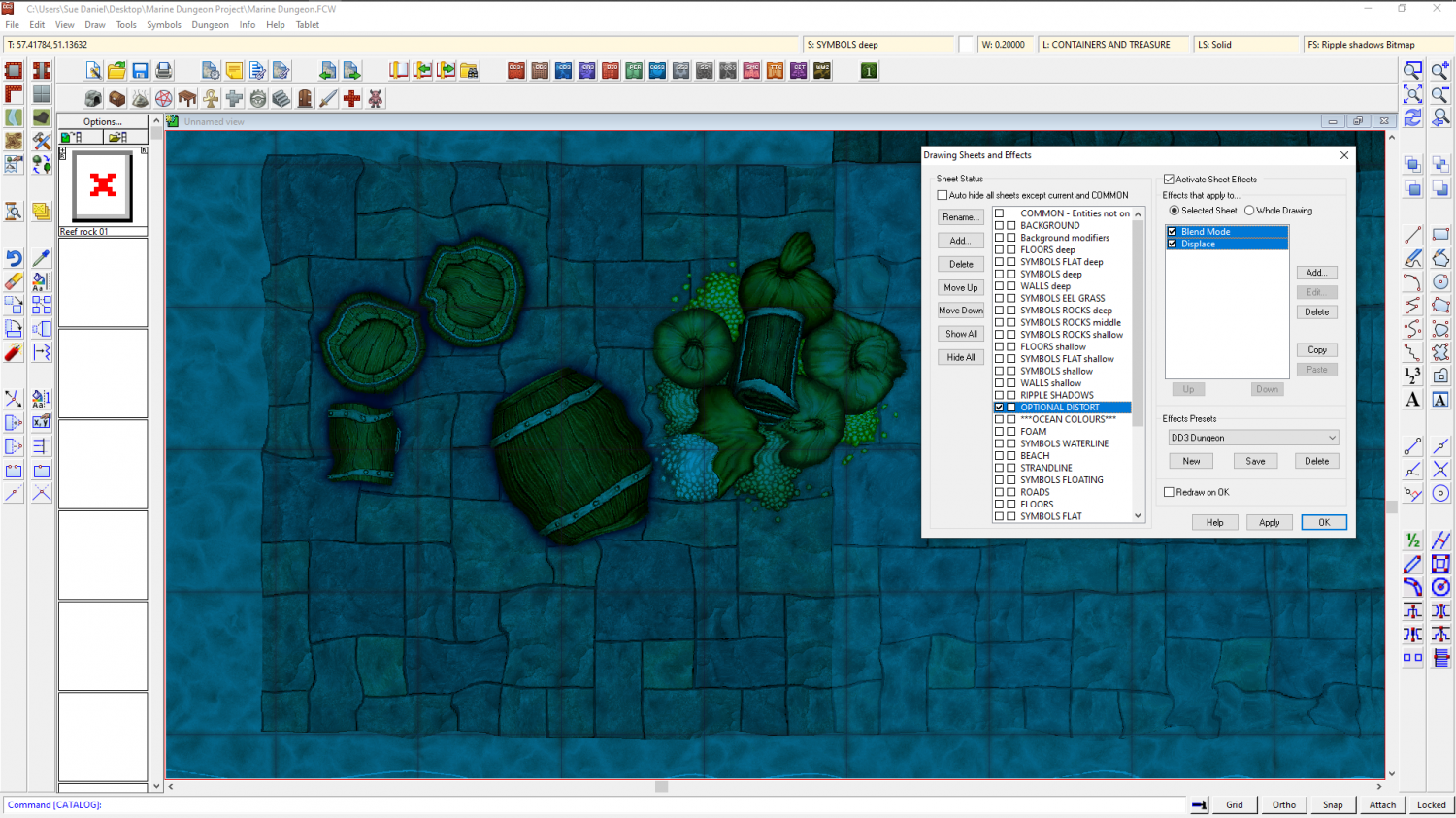
Marine Dungeon - a Cartographer's Annual development thread
Distort has been possible for at least 5 years. All I did was work out how to affect the whole map by adding the effect to just the one sheet, called OPTIONAL DISTORT. The distort is optional because it doesn't make reading the map all that easy. It's more of an artistic effect.
A rectangle of transparent white that covers the map on the OPTIONAL DISTORT sheet is multiplied (Blend mode sheet effect) to the result of the render so far. The Distort effect is then applied. The white of the rectangle itself is no longer visible thanks to the multiply effect (which removes all the white on it's own sheet) but those other colours it has been blended to are treated as part of the white rectangle and distorted by the following Distort effect.
Blend and Distort. Just two effects in that order.
The only thing you need to be careful about is making sure that all your backgrounds and anything that vanishes off the edge of the map extend as far beyond the edge of the map as the distort is set to act, or you get the edges of things pulled back into the map by the distort.


-
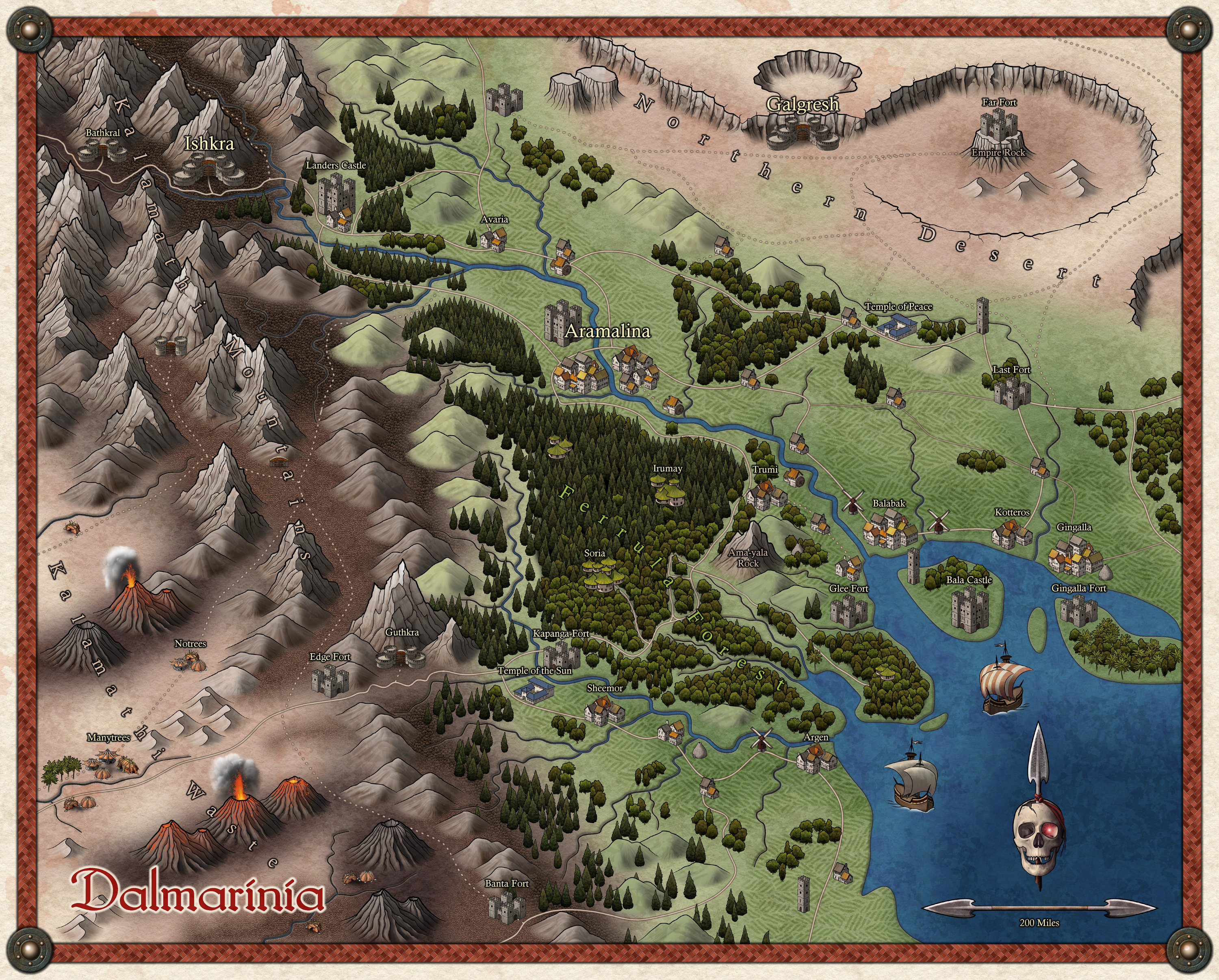
Grimdark Fantasy (renamed "Darklands") - development thread
The finished example map...
Darklands is due to be published as the May issue of the 2021 Cartographer's Annual.

-
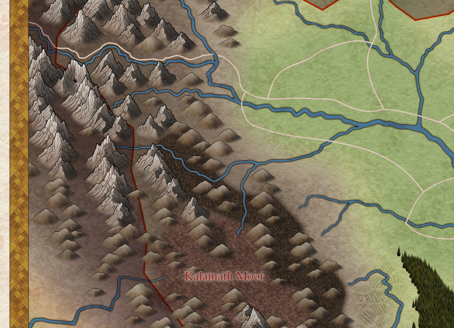
Grimdark Fantasy (renamed "Darklands") - development thread
It's been a while since I updated this thread. There's not been all that much progress, but I've done some new hills and I was wondering what you all thought about them.

-
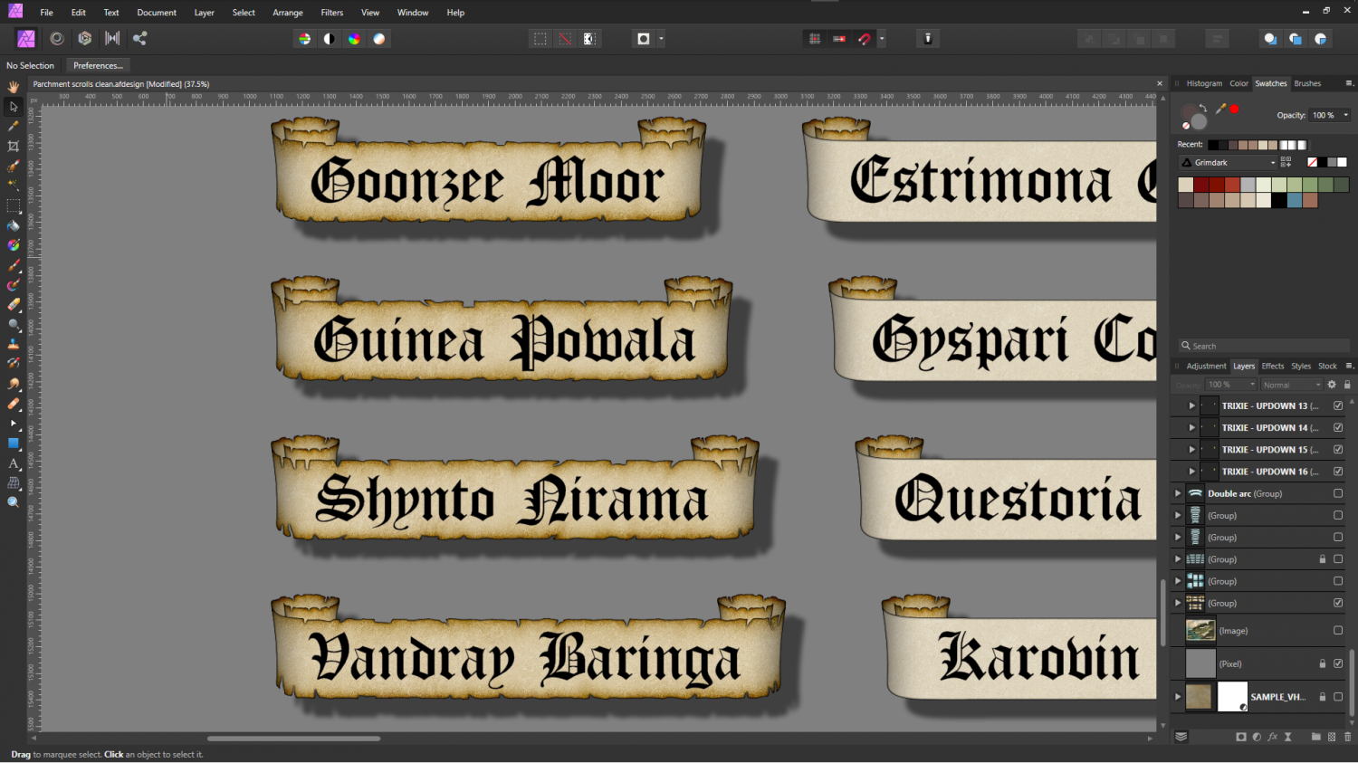
Banners
And already onto the scrolls. I did some titles, but I'm not happy with them yet. I think the labels came out better.
-
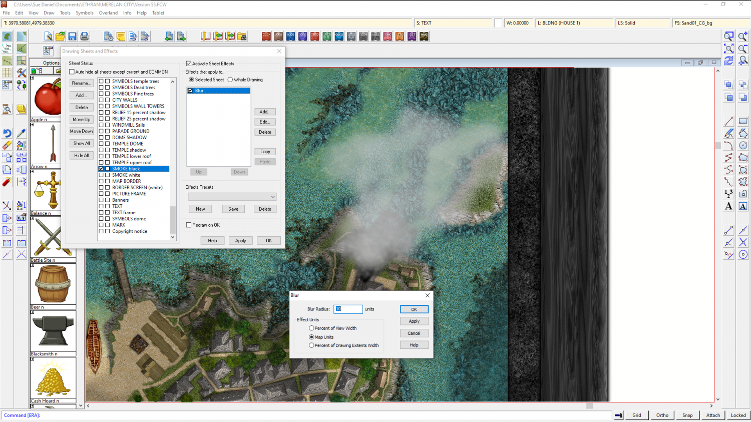
Cloud Cover
It's not generally done, but easy enough.
Add a CLOUD sheet above all but the TEXT sheets, and add a largish blur effect to it. Then either add circles of pale colours (not all white), and/or use the freehand drawing tool with a line width set above zero to scrawl on that sheet in similar off-white colours.
Here is the smoke from a chimney stack done using scribbles and a blur.

-
WIP Commission, Ancient Tombs
Fields can be a bit difficult to get right. This surprises a lot of people, but it's true.
Here are a few thoughts on the shape they take:
- In a medieval field system there were quite often major and minor divisions in the UK. One large field area marked by a hedge or stone wall, with strip fields that were the responsibility of different tenants, and from which the stones were cleared to either side, causing ridges to build up between the strips - strip lynchets.
- Fields tended to follow the contours around hills, and align themselves with a narrow end to the river, so that even if their boundaries were straight the grid they formed warped around these features.
- Even in extremely flat areas the presence of a river or a road will disrupt the gird.
- Not many places on Earth show boundaries that are exactly East-West or North-South. The grid, if there is one, can be aligned in any direction depending on which direction allows for the most convenient layout, or the greatest area put to the plough.
These are only general rules of thumb. I'm quite sure these things are totally contradicted in many places that aren't England, but they hold true right here where I live.


