


mike robel
mike robel
About
- Username
- mike robel
- Joined
- Visits
- 4,196
- Last Active
- Roles
- Member
- Points
- 435
- Rank
- Surveyor
- Badges
- 6
Latest Images


Reactions
-
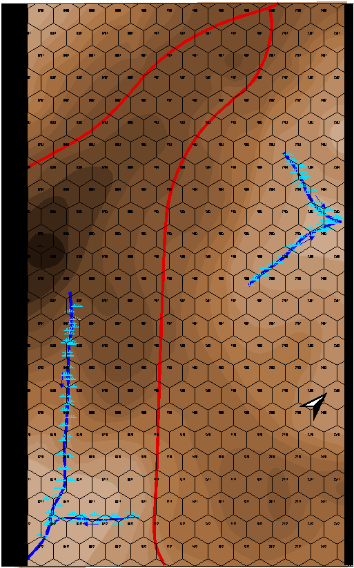
Cowpens Battlefield
This is my map of Cowpens battlefield. The battle was a near decisive action in the American Revolution, partially portrayed in the movie "Patriot". The victory here caused Cornwallis to retreat to Yorktown. It is interesting terrain, but not a lot of relief. Part of the brilliance of the American Commander was he defended from ground that resulted in the British shooting high because of they way they 'aimed' when they were shooting down hill.
I am interested in only a few battles during the 1700-1800s. Cowpens, Saratoga, Yorktown, Gettysburg (1st Day), and the Little Bighorn. I jump from ancients to Modern with those few stops.
Each Hex is 200 feet. (odd for me, usually I think in meters for this sort of thing.) The map will be about 12 inches by 18 inches when completed.
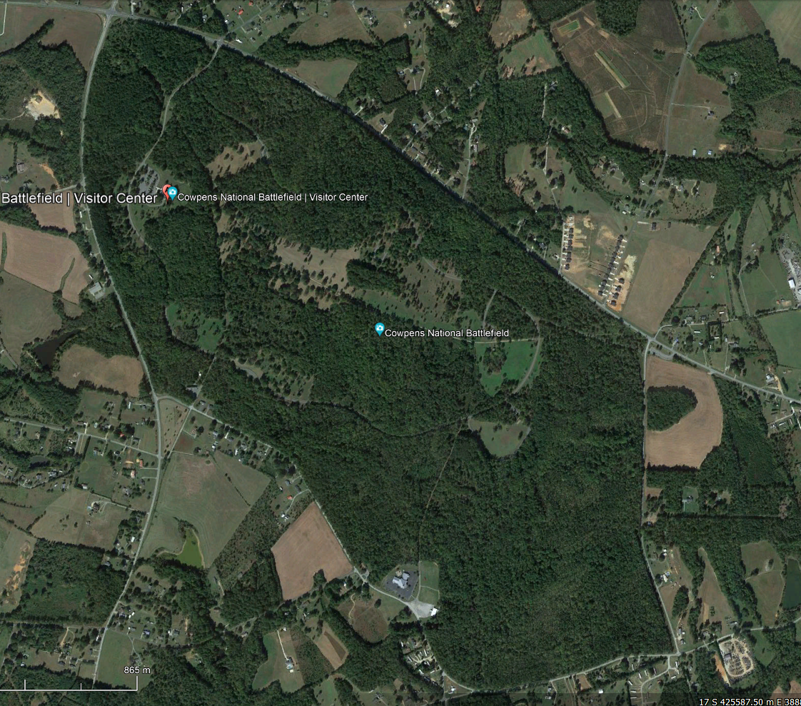
This is the battlefield today. There was not nearly as much forest.
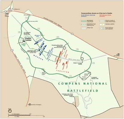
This is the battlefield layout. The US is on the left in Blue, the British are on the right in red, attacking generally from the South to the North. (Today in NATO and the "West" Blue is "Friendly" and Red is "Enemy". In a British World War II history I read, I was confused because the British were in Red and the Germans were Blue.).
The battle was fought in December. There apparently was some snow on the ground, but only a scattering of trees, which I have not put in yet. The question is, how to portray a 'dusting' of snow?
EDIT: I forget to mention, the terrain colors come from the 48 Shades of Brown Palette Andre made for me, as well as 48 Shades of Green, 32 shades of Green and Blue, and one that has 32 shades with 16 green and 16 brown that sort of blend into each other.


-
New Map
After a long while, I am working on a new map. This is for a sci-fi game and is based on the WWII Raid to Hammelburg to rescue US prisoners by the 4th Armor Division's Task Force Baum, one of whose elements was C/37th Armor which I commanded many years later. C/37 was also the unit which led the breakthrough into Bastogne (and I have a photo of me and the company commander shaking hands at the break-in point on the 35th anniversery of the battle) as well as in the battle around Arracourt, France. C/37 was destroyed during the raid and pretty well beat up at Arracourt.
The map stretches from Mannheim to Hammelburg and is about 68 km wide and 20 km tall. Each hex is 2km.
I am trying to be less anal (or maybe more relaxed) and not trying to make this a copy of a topographic map, particularly with my slavish devotion to contour lines or following river/road routes.
The first photo is of the map as a whole. I have laid in the roads and the watercourses to get a view of the terrain compartmentalization.

A frequent method of adjusting the terrain is to move roads so they generally flow from hex center to hex center and watercourses so they move along the hex edge. However, I really cannot bear to do that, so I pretty much follow those and then adjust them so there is some precision as to which hex a road/watercourse lays in. You can see some areas where this needs to be addressed in the 2nd picture.
The third picture is the rub. Here I have turned off the roads, but left watercourses and then tried to define the terrain compartments. Where I have trouble is how to decide how to place and space contour lines so they generally follow the real terrain, if that makes sense.
What I am trying to avoid is the typical geomorphic terrain as defined in the last picture. This seems to lack the 'flavor and feel' of the real terrain to me. The hexes in this map are 250 meters, not that it really matters.
My terrain sketching skills suck to say the least. My platoon and company fire plans always looked like they were drawn by a kid who failed lines, coloring, and penmanship in kindergarten which they did. Thankfully, my children inherited their artistic skills from their mother and perhaps mine, which is fortunate for them. :)
Anyway, any suggestions for how to approach the map? Maybe I am reduced to something like the last picture where I just add contours to the compartments without using the real map as such a base?


-
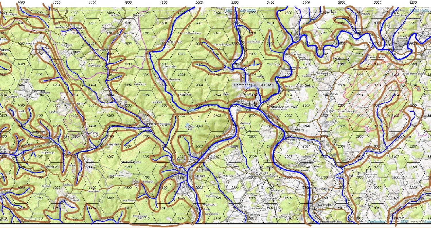
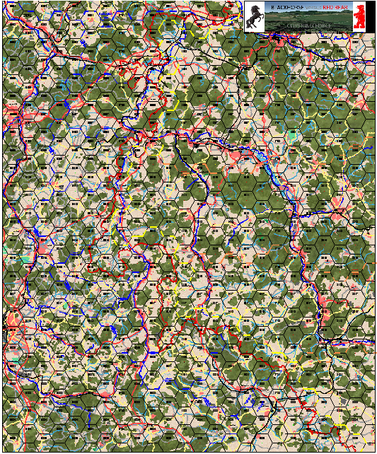
Yet Another Wargame Map set in ...
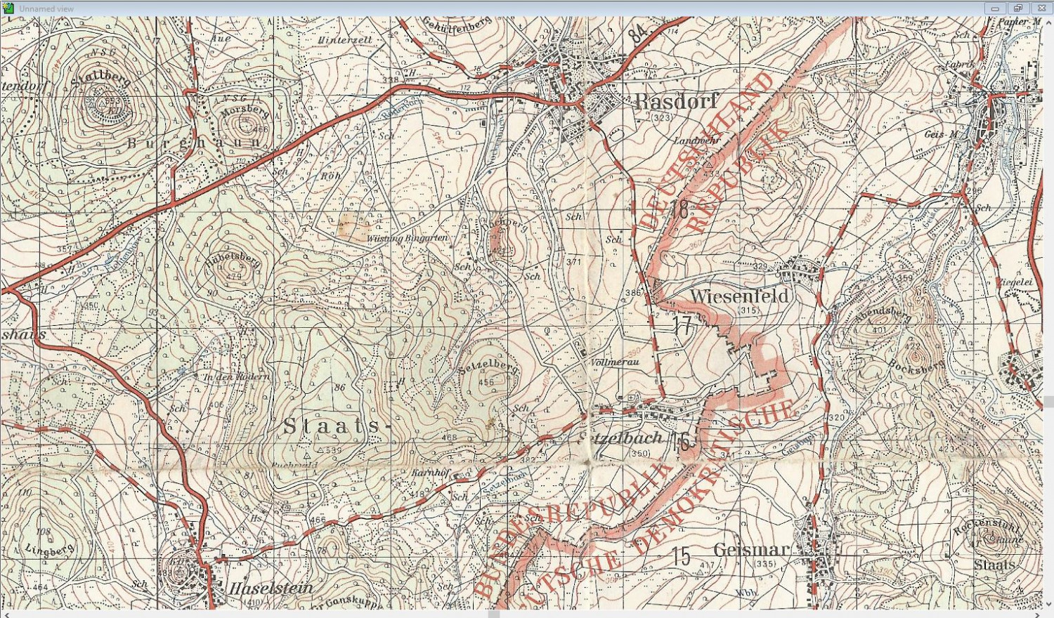
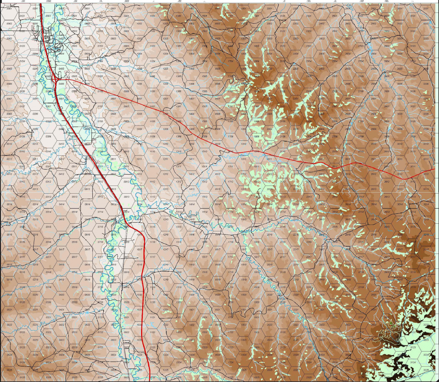
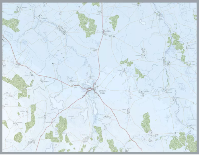
You guessed it in the V Corps area of Germany in the Fulda Gap. This one, while in the same area, is a little different and is centered on Rasdorf which is very near the old Internal German Border. Here is a map of the region, covering an area about 5 x 8 km. the scale is 1:50000 and each square is 1km
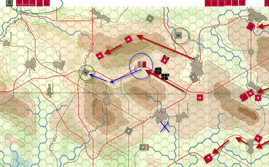
I'm making the game for a game called Assault which was set in the late 80's and I used to play it for both enjoyment and for training my officers. You can read about at https://www.boardgamegeek.com/boardgame/8284/assault-tactical-combat-europe-1985 if you are tired of making maps for the moment.
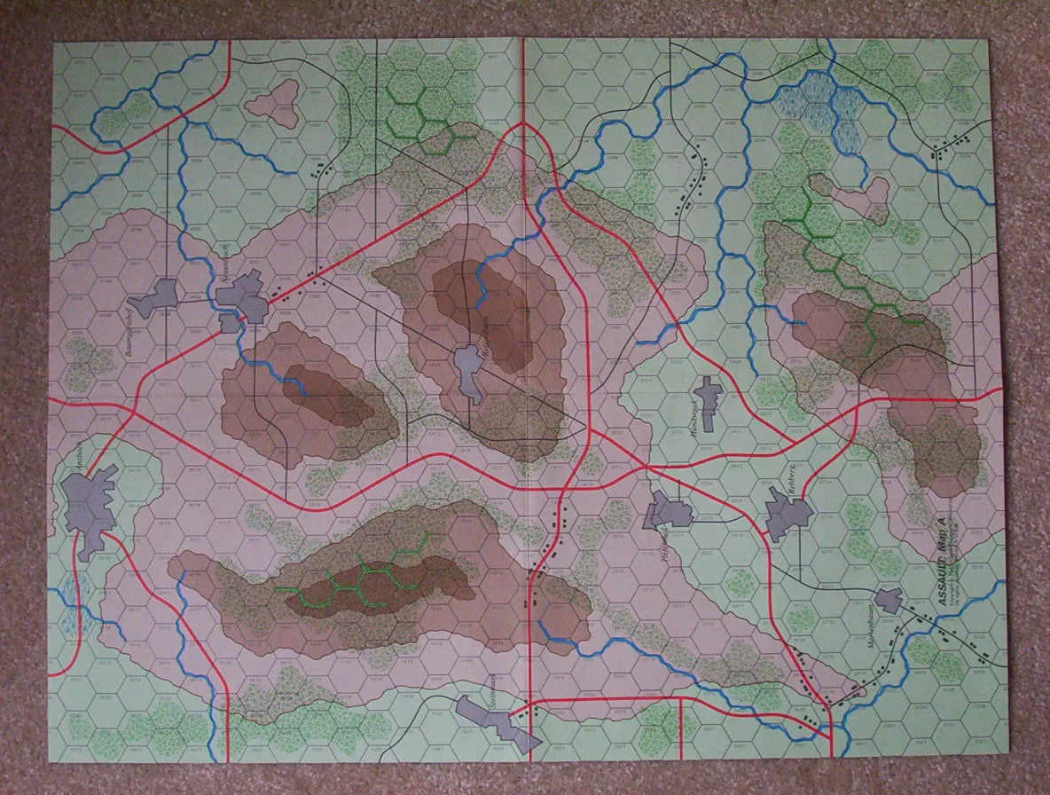
Here is one of the maps from the game. They are based on German terrain, but are isomorphic and very generic and I don't like the roads running in the center of the hex, streams on the hex edge, and other features contained within a hex or a group of hexes. counter interval here is 20 meters, but you can say it is anything you want. The map scale is 1 Hex = 250meters and the unit scale is platoon (3-10 vehicles).
This is a copy of my game map in progress. I had to blow it up to the Assault Scale, so it is much larger than the top map. The map measures 30 x 37 inches or so. (sorry about mixing measurement systems.) Rasdorf is the city in the middle and Setzelbach is directly below it and very near the Red/Black line which marks the Interzonal or Inner German Border.
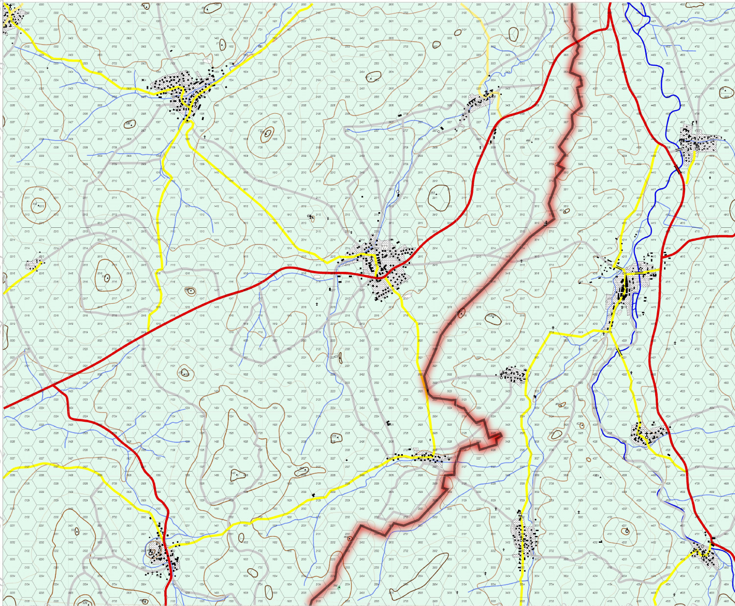
This map is sized to about the same hex size as the Assault map above. The town at top is Rasdorf and the smaller one at the bottom is Setzelbach. My tank and cavalry platoon would occupy an Observation post for three weeks about once every quarter to provide surveillance of the border, the OP is now a museum and sits just about where the light gray road exits the map to the north near the Border.
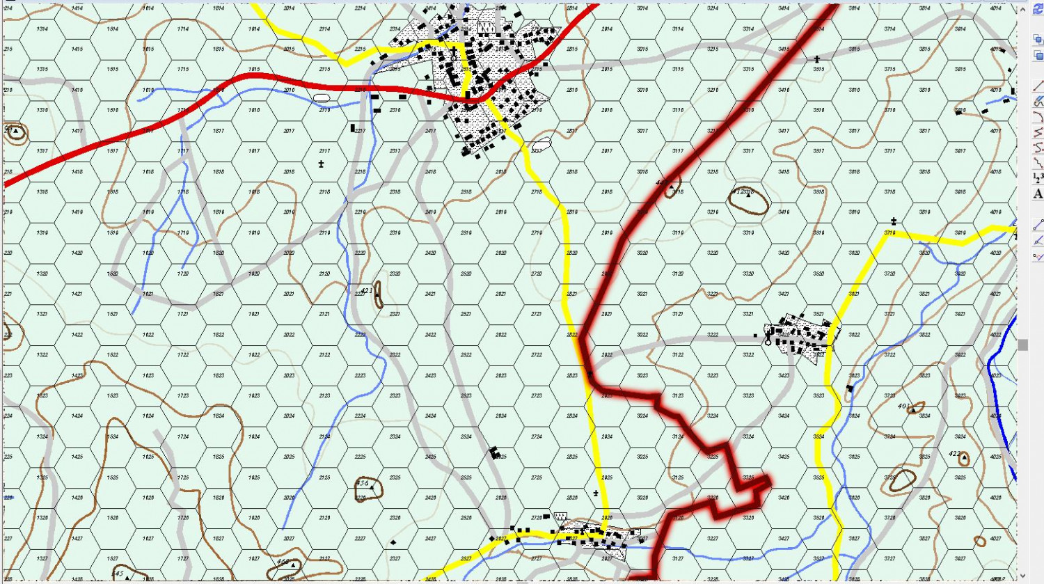
It's getting close to finish. I have to decide if I want to put in more contour lines, fill in the contoursso they are easy to interpret, and detail the areas of forest.
Enjoy


-
Jim Pierce 1947 - 2024
Jim was very, very talented in crafting maps. I was always impressed, regardless of whether or not it was a world or a starship or something else.


-
How Can I Draw Real-World Places in Campaign Cartographer?
Wyvern is very generous in remarking upon my work. All my maps are made by using contour maps, usually at 1:100000 to 1:24000 scale and I mostly trace the contours and other features. My attempts at more generic maps look more like a 6 year old's scribbling. I was chastised mightily in third grade for my inability in penmanship, coloring, and staying inside the lines...
Having said that, I love drawing contour maps.


-
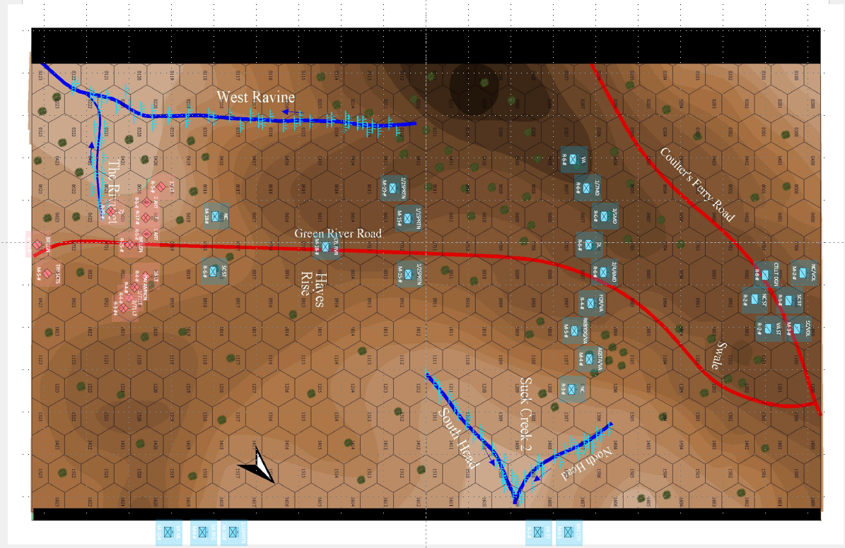
Cowpens Battlefield
This shows the units at the start of the battle (more or less). I am still researching where the units on the side belong.
The R or M stands for Regular or Militia.
The number is the combat strength of the unit.
The # sign represents the movement factor for the unit, probably the game turns are 2 minutes long and that will allow units to march at the Quick Step at 3 Hexes/Turn or speed up to 4 hexes per turn for charging/running. I will also add a range factor since the US had a mess of rifleman that could shoot 400 - 800 feet with a fair chance of hitting.

-
Project Spectrum - Part 2
Actually, things have changed since I learned that. From the Joshua Tree National Park Website:
https://www.nps.gov/jotr/learn/nature/jtrees.htm
Known as the park namesake, the Joshua tree, Yucca brevifolia, is a member of the Agave family. (Until recently, it was considered a giant member of the Lily family, but DNA studies led to the division of that formerly huge family into 40 distinct plant families.) Like the California fan palm, Washingtonia filifera, the Joshua tree is a monocot, in the subgroup of flowering plants that also includes grasses and orchids. Don’t confuse the Joshua tree with the Mojave yucca, Yucca schidigera. This close relative can be distinguished by its longer, wider leaves and fibrous threads curling along leaf margins. Both types of yuccas can be seen growing together in the park. The Joshua tree provides a good indicator that you are in the Mojave Desert, but you may also find it growing next to a saguaro cactus in the Sonoran Desert in western Arizona or mixed with pines in the San Bernardino Mountains.
So, neither a Lily nor a Cactus.
![[Deleted User]](https://secure.gravatar.com/avatar/c75d9a245b74d9c59be0999ea81ca541/?default=https%3A%2F%2Fvanillicon.com%2F92add7f8c954488718110edc4896ad39_200.png&rating=g&size=200)
-
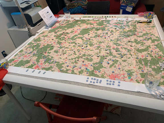
Game World Wall Map
I have maps I have developed for gaming which are almost 5 feet square.
The Little Bighorn battle area. Each hex represents 1 kilometer
The 11th Armored Cavalry Regiment's Covering Force Zone in 1980. Each Hex represents 3 kilometers.


-
Battle of Eylau Map (NOT MY WORK!!!!)
This map was for the Battle of Eylau by Rachel Simmons. She was working on a map for the Eastern Front that was just magnificent as was her Gettysburg Map (and all her other ones as well), She retired from wargame design recently and she is answering various questions about her design philosophy, etc. Her games and maps were ground breaking. The attached map does not do it justice. For a better view go to https://www.boardgamegeek.com/image/6188136/simmons-games where you can enlarge it.
I put a larger image (not my work) in my gallery if you don't want to hop to BoardGameGeek.com to see more on her games and her other work.
You can see artwork from her other games at:
Guns of Gettysburg: https://www.boardgamegeek.com/boardgame/36400/guns-gettysburg (I ended up buying this because the map is so wonderful and got it for a reasonable price as well.)
Napoleons Triumph: https://www.boardgamegeek.com/boardgame/18098/napoleons-triumph
Bonapart at Marengo: https://www.boardgamegeek.com/boardgame/15839/bonaparte-marengo

-
Project Spectrum - Part 2
So, when I look at your mesa just above, I can turn it into a mesa or canyon by switching my focus slightly.
MAKE IT STOP!!!!


