JackTheMapper
JackTheMapper
About
- Username
- JackTheMapper
- Joined
- Visits
- 137
- Last Active
- Roles
- Member
- Points
- 164
- Birthday
- July 18, 1975
- Location
- Tusket, Nova Scotia, Canada
- Website
- https://www.worldanvil.com/w/aralath-jsberry
- Real Name
- James Berry
- Rank
- Traveler
- Badges
- 2
Latest Images
Reactions
-
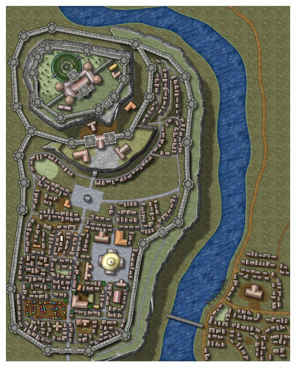
WIP - first crack at a larger scale city
Hello! I've generally just mapped smaller towns and villages and this is my first crack at a larger CD map. Clearly it isn't close to done yet, but it's giving me a chance at experimentation, and I'm eager for constructive criticism and feedback. I'm particularly happy with the circular garden behind the castle in the upper left, and the use of @Loopysue's cliff faces east of that, in the winding road between the castle and outer walls; I think it lens itself well to adding a sense of topographical depth. Definitely aware of some places that need tweaking or cleaning up.
But feedback, please! Quite looking forward to improving this experiment!


-
Map critique
Being new back to using CC3 and related software, this is a project from this morning. It's busy, but it's meant to be as a resource for an RPG campaign I'm running. I'm quite out of practice, so tips, critiques, suggestions, and anything else would be greatly appreciated!


-
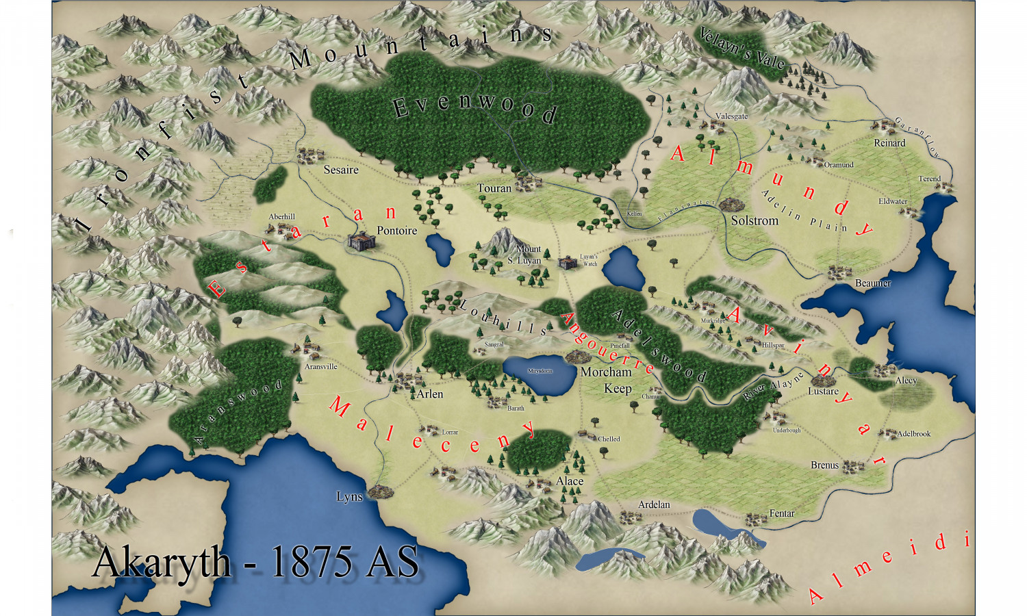
WIP - The Reach of Kingsland
NB - this map is in Selmári, the language of the people of Keledon.
Operating under a feudal system, the monarch retains direct control of the wide lands surrounding the capital; the major and minor noble Houses present there swear their fealty to the Crown directly, rather than through the intermediary of the Great Houses that rule the other Reaches in the name of the Crown.
Called in Selmári Dúírunmór (lit. "land [belonging to] the King), this Reach has been held by the Crown since the kingdom's founding. While the monarch, currently Queen Heulyn, second of her name, rules from the throne under the golden hawk on a field of red that represents the entire realm, she also retains non-royal noble titles in her capacity as head of her family, House Halad. Therefore the sigil of that house, the white unicorn on a field of green, is retained on the map to represent those lands ruled by her family before they came to the throne.
Questions, comments, and map advice are all welcome!


-
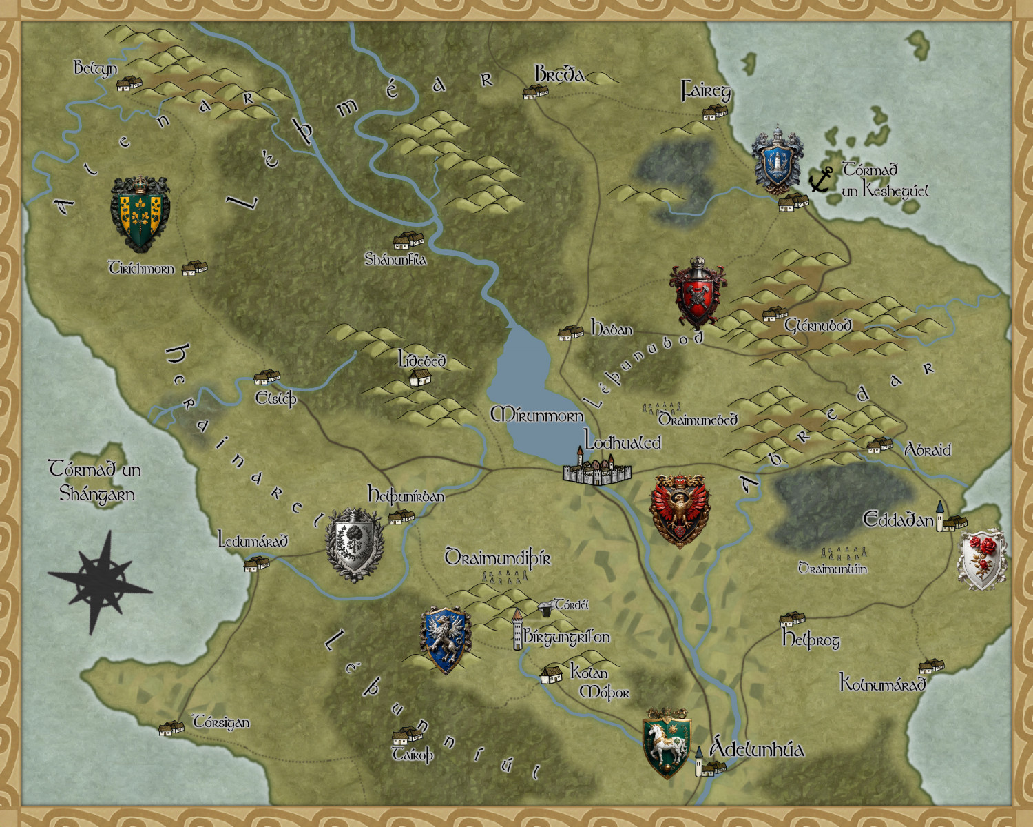
Oh no! Yet another parchment map!!
This is my first go with this style and I'm in love. Shout out to @JulianDracos who taught us how to make the blue sea. I decided to make a map of Haiti, a country I quite love. Please critique!

-
More a request...
In a minute flat I traced out this very easy test using @Loopysue 's Marine Dungeons. Obviously I've done nothing with it yet!
But it got me to thinking...as a lifelong devotee of the sea, and living right on the coast, how about an annual overland style for undersea kingdoms? It could include colour depth similar to the Marine Dungeons, coral structure symbols, seafloor roads, kelp fields, submarine geysers and hot vents, ocean current markers as a kind of road (!), continental shelf, abyssal plains and hills, seamounts, a reverse "hill tool" which would show where an island emerges, being to marine peoples like a mountain whose top disappears into the air....
The applications range from Atlantis to Tristan and Isolde's Lost Land of Lyonesse, Heracleion, Kaskarra, and so much more. Easily expanded to include Marine Cities! Oh, in the holy names of Poseidon, Neptune, Agwe Towoyo, La Sirene Diamon, Manannan Mac Lir, Amphitrite, Njord and the magnificent Blibdoolpoolp, please, lets make this happen...
-
Shout Out to Ralf
Hi everyone!
I'm an old school mapper, going back to CC2. Back in the 2000s I did a lot of mapping with CC3 as I introduced my kids to the joys of both table top RPGs and the joys of worldbuilding. Life and its responsibilities dragged me away for the last decade, and the kids were grown and gone.
Now that I've got free time again I came back to my old hobby. I still had CC3, DD3, etc on my laptop, having saved the installation files and transferred them over when changing machines. However I couldn't remember which email I used to make my account and buy everything, thus being cut off from updates and deals. I emailed in, and Ralf sorted me out like lightning. He located the correct email, and offered to transfer everything over to a new email address if required (happily, it wasn't). And he did this on a Sunday.
I'm really thrilled to be back at this, and looking forward to moving to CC3+ and diving into the annuals I missed, as well as diving into this vibrant community.
So by way of fun, here's a mini-poll weaving my interest in creating languages in with mapping.


-
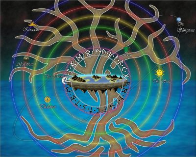
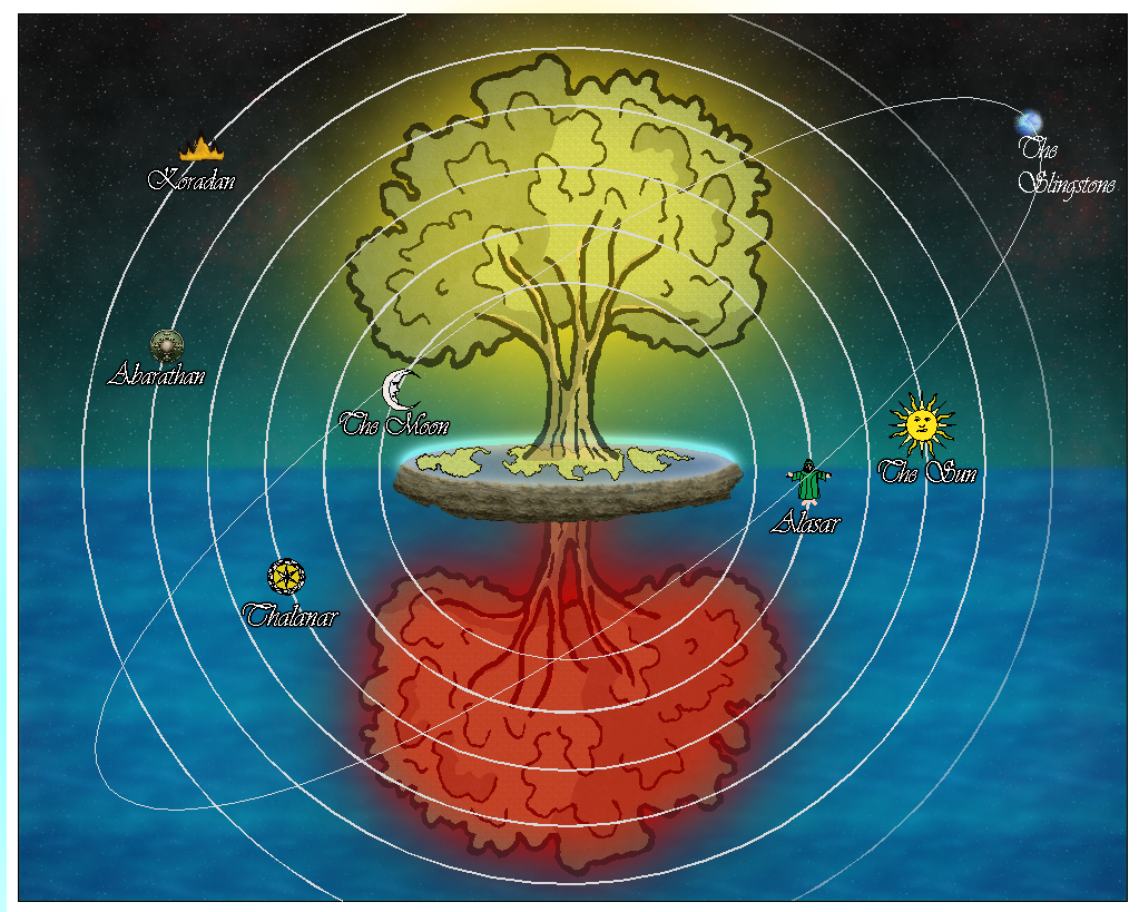
Dragon sheet
Hey all. I'm playing about using CC3+ to make an image of the cosmological arrangement of a fantasy setting. A big WIP, and I'm still deciding on symbols for the Wanders (sun, etc).
What I'd like to add here is the Dragon cutout from Sue's Marine Dungeons 2, with the bronze underlay. The dragon would rest over the trees, head at the top, tail at the bottom, and then have a transparency effect added so it's a thin, ghostly image superimposed over the rest of the cosmological diagram (the Dragon symbolizes spiritual force in this setting, blah blah blah).
I've had fun figuring out how to make things for this image so far, but I am not sure how to do this dragon thing. Any idea?

-
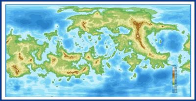
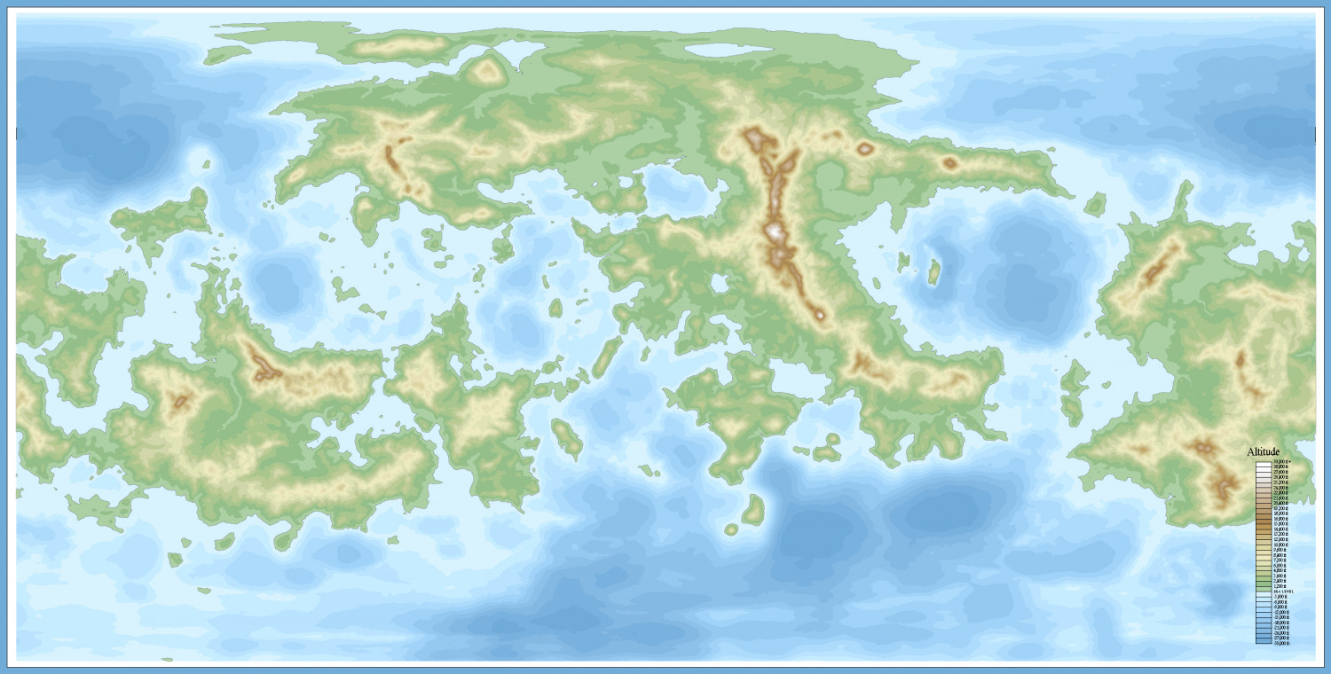
World In A Day question
Figured it out--needed to make a second sheet on which to place the filled contours, placed below the Land sheet in the drawing order. Then select colour, change properties on the contour, select the colour, "fill style solid", "line style solid", and "move sheet" to the filled contour sheet, which was set to hidden so it would disappear on each redraw, leaving just the unfilled contours. Change colour, repeat, and got there!
I cheesed on the frame--just made a huge rectangle over the whole map with the rectangle tool, changed properties (line width to 250), and outlined in black
😁
Here's the result

-
I'm hungry for your lore!
Show me a map you made. A town, a castle, a dungeon, a kingdom, a continent. Whatever you like. And then tell me about it! If its a kingdom, who rules it? Who lives there?
Maps are a glorious way we make something tangible out of the mighty creative impulses that drive our imaginations. I want to know more than just how your map looks--tell me about it, and introduce me to your fantastic world!

-
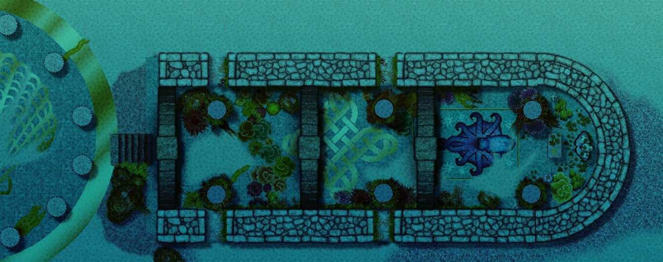
[WIP] Playing around with Sinister Sewers
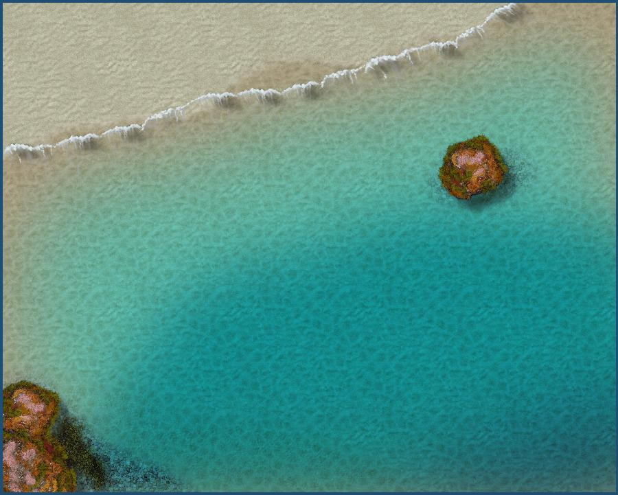
Absolutely love what you've been doing! I haven't build a sewer yet but found I quite enjoy using the arches in other sets--I added them in to an underwater temple I'm working on. Here's a detail of it.
Are you matching your sewer system to a street plan of one of your cities?