


Loopysue
Loopysue
About
- Username
- Loopysue
- Joined
- Visits
- 10,419
- Last Active
- Roles
- Member, ProFantasy
- Points
- 10,163
- Birthday
- June 29, 1966
- Location
- Dorset, England, UK
- Real Name
- Sue Daniel (aka 'Mouse')
- Rank
- Cartographer
- Badges
- 27
Latest Images


-
Live Mapping: Battle Maps
Hi Everyone! :D
In this week's Live Mapping session, if you are planning a game of D&D over the Thanksgiving weekend, Ralf will be creating a battle map in CC3+ with an eye towards printing and/or exporting it for a virtual tabletop.
Come along and join in, or watch later :)

![[Deleted User]](https://secure.gravatar.com/avatar/c75d9a245b74d9c59be0999ea81ca541/?default=https%3A%2F%2Fvanillicon.com%2F92add7f8c954488718110edc4896ad39_200.png&rating=g&size=200)


-
CA style development - "Darklands City" (issues for September and December 2021)
Well, I did some more versatile ruins that don't have the dark blur around them, so that you can put them either flat on the ground or on a sheet with a shadow. After that there is a drawing tool to add a floor if desired, or you can fill in with debris.
After a lot of messing around learning how to draw them, we now have horses and cows. Sheep and pigs to come (I hope). That should give everyone enough things to fill the land around their towns with now that there are 11 different kinds of field :)
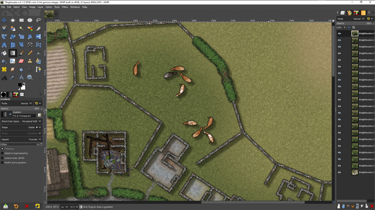
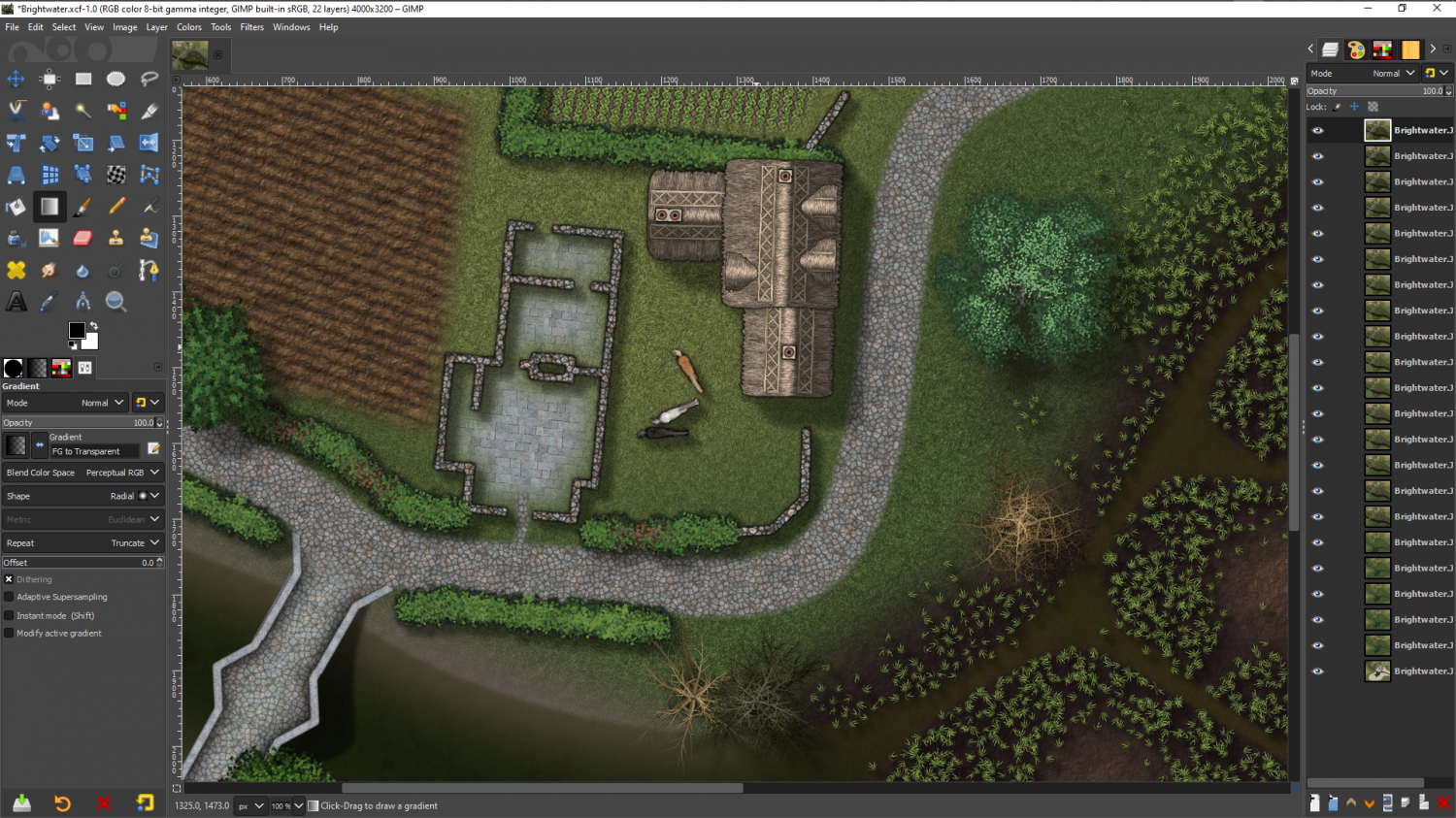
I have a feeling that the animals would have been more use in a dungeon scale setting, but they're there now.


-
Missing CD3 Styles?
Hi Jerolimoloch :)
It sounds like you have something happening there that might be better sorted out by Tech Support. You can contact them through your account page on the Support tab.
-
New Humble Bundle
@Tom B You will have selected issues from those listed annuals, but not the entire annual. The easiest way to find out exactly which issues you have is to go to your Annual folder and check the Issue numbers there.
C:\ProgramData\Profantasy\CC3Plus\Annual
The drive this folder is on will depend on where you installed the software.
The annuals are numbered from the very beginning, back in 2007. 1-179. The next issue due out at the beginning of December is 180, and the bonus issue this year is 180A

-
Practical use of the new Fractal Terrains Profantasy Normal Map in Campaign Cartographer?
@WeathermanSweden - Do you believe in coincidences?
Well, I said just a few days ago that I had lost those shaded mountains I did, and this morning I had one of those FB memory things from this day in November, 2018. It was this pair of images. I might have lost the mountains and all the work I did towards them, but I still have these it seems. If the colours seem strange that is because the image part of both these mountains had to be toned down to a darkish brown to come back to being the same colour as the paper once they where shaded by the map file. So the colours I applied were similarly distorted. They look kind of oddly metallic, don't they.

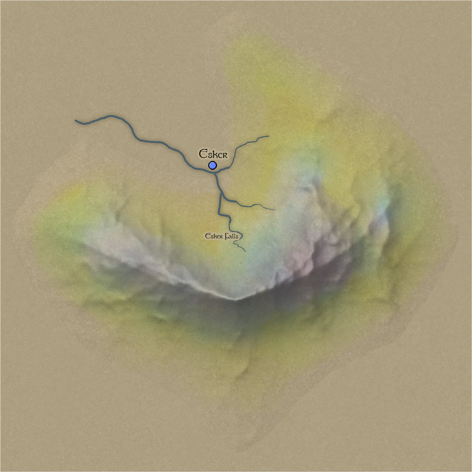
I actually made the mountains and their shaded map files in Blender, where I once had a CC3+ map file shader set up. All that is gone too, thanks to Blender updates.
You can clearly see the edge around the symbol because it has to be cut off rather sharply. And since the only way to make it blend is to have the background uniformly the same all the way around the base of the mountain (no real amount of texturing), I decided it would be an extremly limited style - no more than a 5 minute curiosity and not really much use in the long run.
Some part of me wishes I had taken more care to preserve that work, since I will probably have to redo it at some point in the future!
But anyway - that was my experiment into the idea 3 years ago.


