


Loopysue
Loopysue
About
- Username
- Loopysue
- Joined
- Visits
- 10,421
- Last Active
- Roles
- Member, ProFantasy
- Points
- 10,163
- Birthday
- June 29, 1966
- Location
- Dorset, England, UK
- Real Name
- Sue Daniel (aka 'Mouse')
- Rank
- Cartographer
- Badges
- 27
Latest Images


-
Global Lighting Not Working
Thanks
I had to watch the first part a couple of times to revise what was said in that session, and I just caught it at 2x speed (trying to work this out fast for you). Ralf mentions that he already has some lighting effects set up in the sheets just before he switches on the Activate Lighting. That is why he gets a reaction from the map, and you don't.
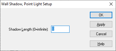
There are two lighting sheet effects used to make a lighting setup. The first is Wall Shadow, Point Light Setup, and is used on any sheet where there are objects or shapes that you want to cast a shadow. You can adjust the Shadow length on this effect so that tables and chairs cast shorter shadows and walls cast infinite shadows.
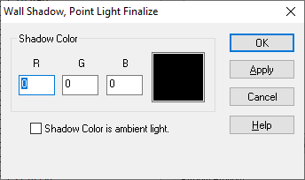
The Wall Shadow, Point Light Finalize finishes the setup. Any sheet above the sheet with this final effect on it won't be affected by the lighting setup, and will appear as if light by ordinary daylight. That can be useful for the frame of the map and titles and labels, etc.
You will need to add these sheet effects (as many of the setup effects as you need on different sheets, but just one of the finalize effects) before you see a response to the activation of the lighting.

-
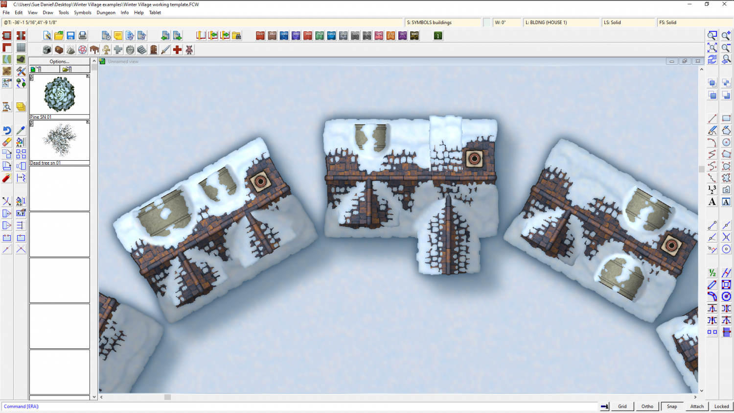
Winter Village style development (March 2022 CA issue)
LOL! They're meant to be lead arch dormers, but maybe the colour has gone off somehow - too yellow against all the blue snow? I will check the original buildings.
Bits of house would be the only way I could think of allowing people to make their own snowy building, since it's going to be impossible to make a roof fill that is snowy in all the right places to be used in the House tool, but we will have to see if there is time.
-
Winter Village style development (March 2022 CA issue)
Having fun with different kinds of dormer. This is the same basic building...


-
Festive Winter Card Challenge - Ended - Please vote for your favorite
Thank you very much to all who voted for me :D
I was kind of hoping for a draw with Shessar towards the end, but well...
That was fun. Maybe we could do it again next year if you aren't too busy?
Congratulations to all! :D
-
WIP Everyone's making Inn's & Taverns - making floor look used / abused
You've worked hard on it, and it's a pretty good start :)

