


Loopysue
Loopysue
About
- Username
- Loopysue
- Joined
- Visits
- 10,413
- Last Active
- Roles
- Member, ProFantasy
- Points
- 10,161
- Birthday
- June 29, 1966
- Location
- Dorset, England, UK
- Real Name
- Sue Daniel (aka 'Mouse')
- Rank
- Cartographer
- Badges
- 27
Latest Images


-
How many times a day does CC3+ crash for you?
If you have an FCW file and a set of instructions that invariably cause a crash that would be worth sending to TS.
-
Live Mapping: OSR Dungeons
We've done so many live mapping sessions now that we're almost running out of material, so requests (as long as they are possible in the space of an hour) are always welcome, and quite likely to be answered.
At the last count I think there were already more than 200 of them.

-
Grid Lines
Pick Grid Settings... from the Map menu.
In the dialog, set the Latitude Polar Endcaps to zero.
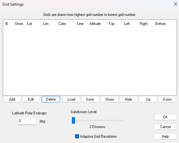
Click Add, and make sure you check Enable Grid in the dialog that appears (see below).
For the sub-tropic lines set the Latitude Spacing at 35 degrees and the Top and Bottom settings to 35 and -35 respectively. This tells FT to draw a grid line every 35 degrees, starting and stopping at 35 degrees north and south, so you only get one line at 35 degrees north, and one line at 35 degrees south. You will also get one one the equator but you wanted that anyway.
To make sure you don't get any longitudinal (north south) grid lines, set the Longitude Spacing to zero.
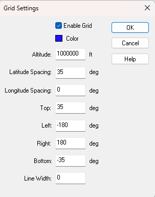
You can also chose the colour of the grid lines and the width of them.
Ok both dialogs and you get this
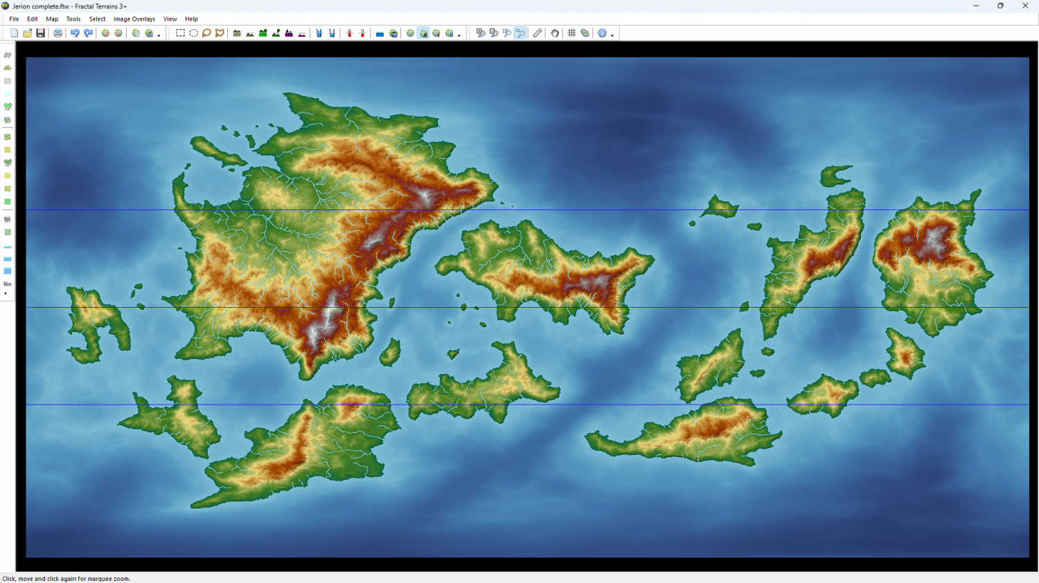
Do the same for the tropics gridlines by adding a second grid and substituting 23.5 wherever you put 35 in the first grid. That should give you something like this. Here I have given the tropics lines a thicker red line. You will see that this second grid appears underneath the first one, but you can move it up to first position using the buttons under the table in that first dialog.
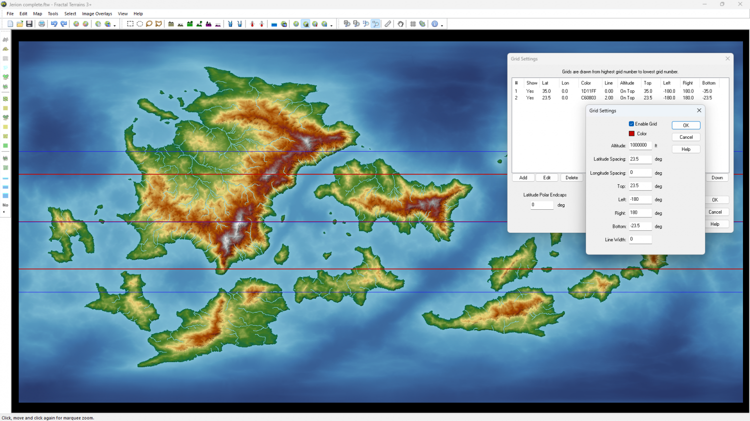
You can hide, show, edit or delete either grid.

-
[WIP] - Doriant - Gold Coast - Eknapata Desert - Sakherma Ruins
With the bevel you can present the illusion of more gentle lower slopes by adding an Edge Fade, Inner, or increasing the width of one if it's already there.

-
CC4 Overland Development Thread
They weren't specifically designed for it, being more carefully graded to match the unspoken standard that each step down a level is 2/3 the area covered by the previous level. It's not exactly a specification, but it's the rule that the Mike Schley symbols seem to follow. For example the Town is 2/3 the size of the City, and the Village is 2/3 the size of the Town, and the Hamlet 2/3 the size of the Village. However, all the buildings in each symbol are the same scale so there's no reason you couldn't if you wanted to. I'm not sure they will look as great as Mike's used that way because I've given each of them an approximate circular base (circular viewed isometrically).

