


Loopysue
Loopysue
About
- Username
- Loopysue
- Joined
- Visits
- 10,412
- Last Active
- Roles
- Member, ProFantasy
- Points
- 10,161
- Birthday
- June 29, 1966
- Location
- Dorset, England, UK
- Real Name
- Sue Daniel (aka 'Mouse')
- Rank
- Cartographer
- Badges
- 27
Latest Images


-
SVG exports?
I don't think they can, but I might be wrong as I'm no great tech. I just remember things reasonably well.
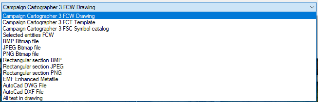
These are the export formats available through "Save as..." on FT
And these are the formats availabe in save as on CC3
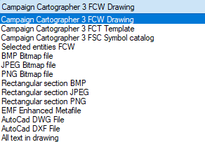
There are a few vector formats at the bottom of both these lists, but none are SVG. Maybe you could find an online converter for one of the AutoCad formats? I've never wanted to do this myself, so I can't tell you how successful that may or may not be.


-
Live Mapping: Cosmographer System Map *** NEW second attempt ***
The link at the top will take everyone to the new second attempt at this show this week.
-
Realms Reimagined Rivers
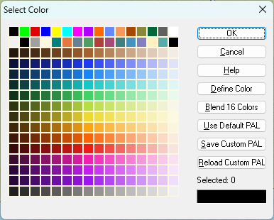
Good question. Because I've used custom palettes on quite a lot of styles, mostly to provide appropriate varicolour options or smooth out the jumps between the colours on the default palette, I've spent a whole lot more time looking at palettes than most people will have done, so I usually know as soon as I open the palette (though I clearly missed it in this case to start with).
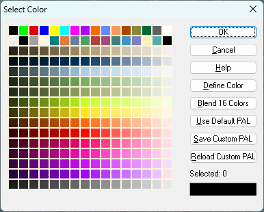
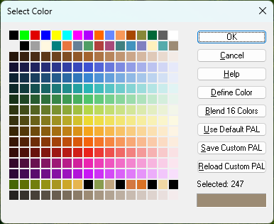
I suspect the best way of finding out is to click "Use Default PAL" while watching to see if the colours change in the grid.
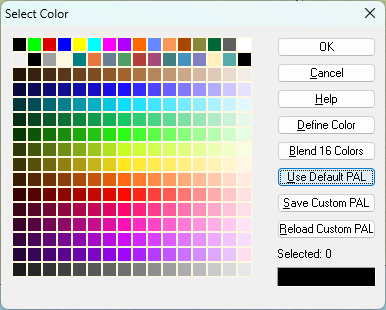
This first one is a commonly used custom pal (mostly on my styles), while the second is what you see if you click that default button. Notice how the lime green and yellow colours jump out at you in the default pal.
Other palettes can be very different, especially the one attached to Herwin Weilink (below) and styles based on it.
And the one I'm adjusting to give better varicolour hill colours for CC4 Overland in the last colour row.
To change this last palette back to the default one would be disastrous for the varicolour hills.


-
Realms Reimagined Rivers
You're welcome, SkidAce. I just hope I didn't cause too much of a headache with the wrong answer first.
-
Live Mapping: Cosmographer System Map *** NEW second attempt ***
This week in Live Mapping, Ralf will be creating a star system map in Cosmographer's Traveller System style.
Come along and join in the chat live on Youtube here:
https://www.youtube.com/live/eM6dB2b1IBM
(The correct date and time for your area are shown in the left column of the main forum page)
This thread will not be monitored during the show, but is a good place to discuss the show either before or after the event.

