


Loopysue
Loopysue
About
- Username
- Loopysue
- Joined
- Visits
- 10,418
- Last Active
- Roles
- Member, ProFantasy
- Points
- 10,163
- Birthday
- June 29, 1966
- Location
- Dorset, England, UK
- Real Name
- Sue Daniel (aka 'Mouse')
- Rank
- Cartographer
- Badges
- 27
Latest Images


-
Creating a Template to simulate the Khorvaire Map
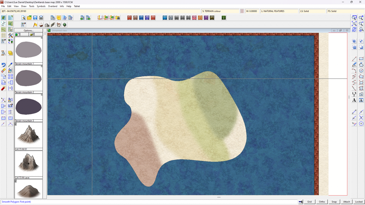
Then when you start adding the colour patches for the terrain you can draw them as far under the sea as you like and they will be masked by the water when you refresh the drawing.
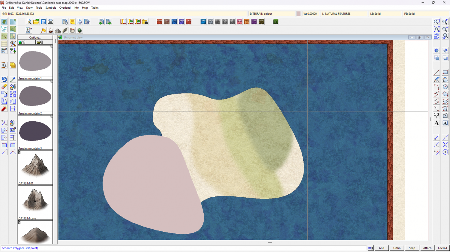
(this is the point at which you might want to make some new drawing tools to add more orangey colours for the desert than the pinkish ones I did)


-
Creating a Template to simulate the Khorvaire Map
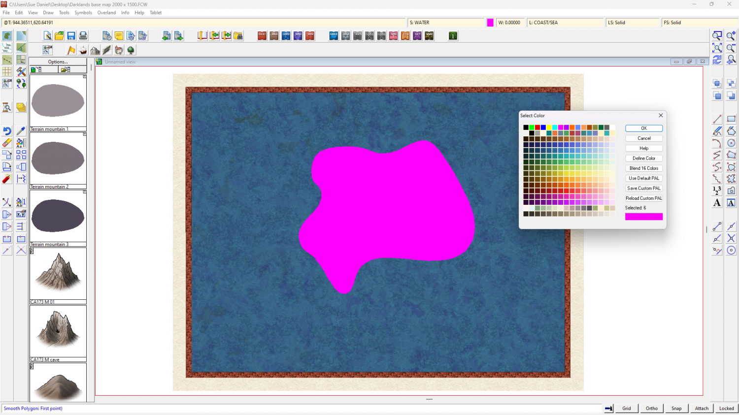
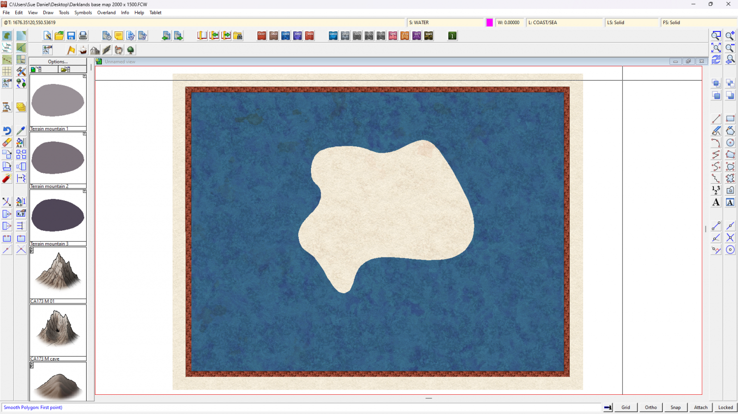
If you want to use the land shape you've already drawn add a rectangle of ocean over the whole map first using one of the ocean drawing tools, then add your land shape to the same sheet and use the change properties tool to turn the fill of that shape to solid and magenta (colour 6). When you refresh the map that will cut a hole in the sea to reveal the land.
-
Creating a Template to simulate the Khorvaire Map
Ah yes, I'd forgotten about that little design flaw of mine.
I couldn't do it easily at the point of creation so I adjusted one by hand so that the centre area is 2000 x 1500.
The way this map is set up the border won't print if you crop to the map border when you export, so you can just ignore it, but if you want it you can export it with the rest of the map by using the Rectangular Section bitmap exports and including the frame in the selection you make.
-
Live Mapping: Dungeon Lights
Hi Everyone! :D
In this week's Live Mapping session Ralf will be adding shadow and light effects to a dungeon map from the ground up, i.e. on a map that was not set up to do it before.
Come and join in the chat live on YouTube here: https://www.youtube.com/watch?v=jpQetrH8yb4
Or watch it right here on the forum if you prefer.


-
Creating a Template to simulate the Khorvaire Map
The reversal of land and sea only happened because I wanted to be able to use very soft wide blends between colours on the land without having to obey the coastline.
It's actually the way water is usually done in a city map, so think of it as being an extremly large planetary city map.
EDIT: and if you get stuck at all just shout again. Things might not be as simple as I've described, or work the way I imagine they will, but we will get there in the end.
