Loopysue
Loopysue
About
- Username
- Loopysue
- Joined
- Visits
- 10,354
- Last Active
- Roles
- Member, ProFantasy
- Points
- 10,103
- Birthday
- June 29, 1966
- Location
- Dorset, England, UK
- Real Name
- Sue Daniel (aka 'Mouse')
- Rank
- Cartographer
- Badges
- 27
Latest Images


-
Dungeon Level Symbols - Celtic Revival Room by Room
Love the mouse!


-
Live Mapping: Sector and Subsector Maps
In live mapping this week, Ralf will be taking a look at Cosmographer 3 and its sector and subsector map styles, including the Traveller sector import function.
Come along and join the chat live on YouTube here:
https://www.youtube.com/watch?v=SDCFdPUjY4c
Or if you miss the live show you can watch it here on the forum.
This thread is not monitored during the show, but is a place where you can chat about it or ask further questions if you missed it live.


-
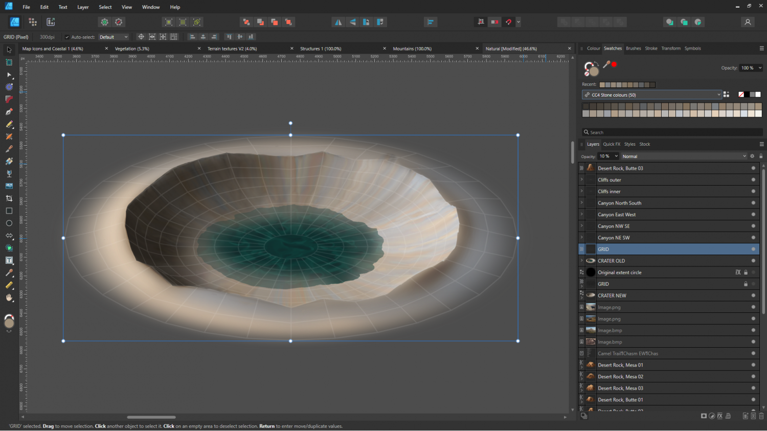
CC4 Overland Development Thread
Is this one better?


-
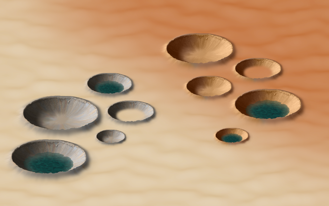
CC4 Overland Development Thread
I gave in to temptation and warped a copy of the inner crater to the new grid. Looks like I also still have craters on the brain.
Oh well, I might as well carry on...

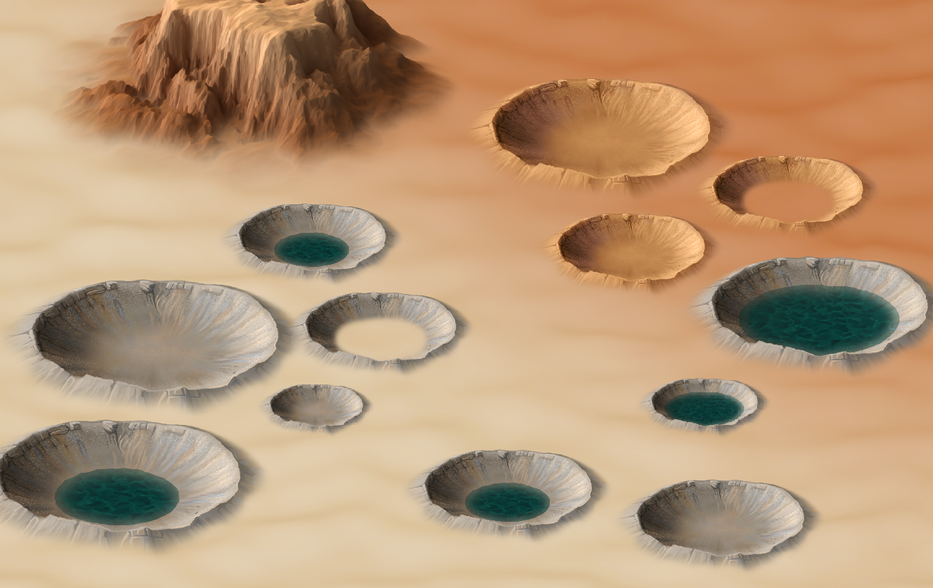
-
CC4 Overland Development Thread
We have craters now :)