


Loopysue
Loopysue
About
- Username
- Loopysue
- Joined
- Visits
- 10,411
- Last Active
- Roles
- Member, ProFantasy
- Points
- 10,161
- Birthday
- June 29, 1966
- Location
- Dorset, England, UK
- Real Name
- Sue Daniel (aka 'Mouse')
- Rank
- Cartographer
- Badges
- 27
Latest Images


-
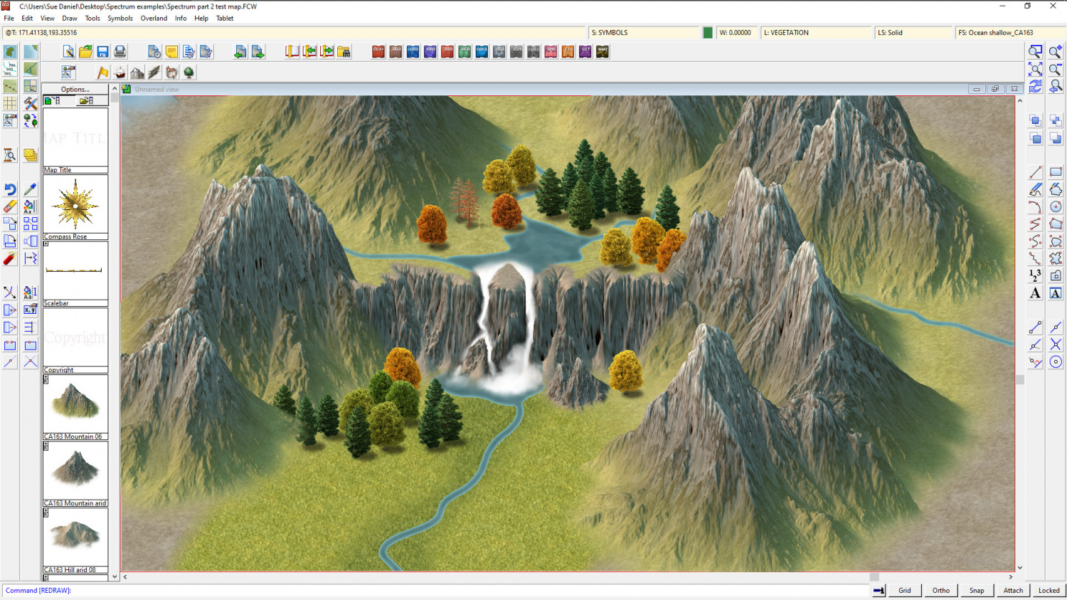
Project Spectrum - Part 2
Aw, Quenten!
There really is nothing to it, though. You just draw raggedy white lines down where you think the water would fall (usually in the cracks in the rockface), then take the blurring tool and work little circles of blur into it where you think there would be spray.
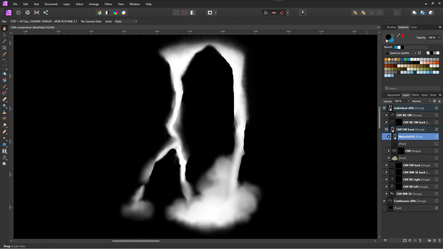
This is the fall so zoomed in it's pixelated. As you can see its just a white scribble that's been blurred in a few places. Most blurring tools end up creating linear marks at this tiny scale, which you can use to your advantage with a waterfall - note the linear marks in the falls where I have moved the blurring tool fractionally from side to side.
Then you come back with a nice sharp eraser and take out the white where the rockface protrudes in front of where the water is falling. Not all of it. Just some very prominent bits of rock. And then you are done.
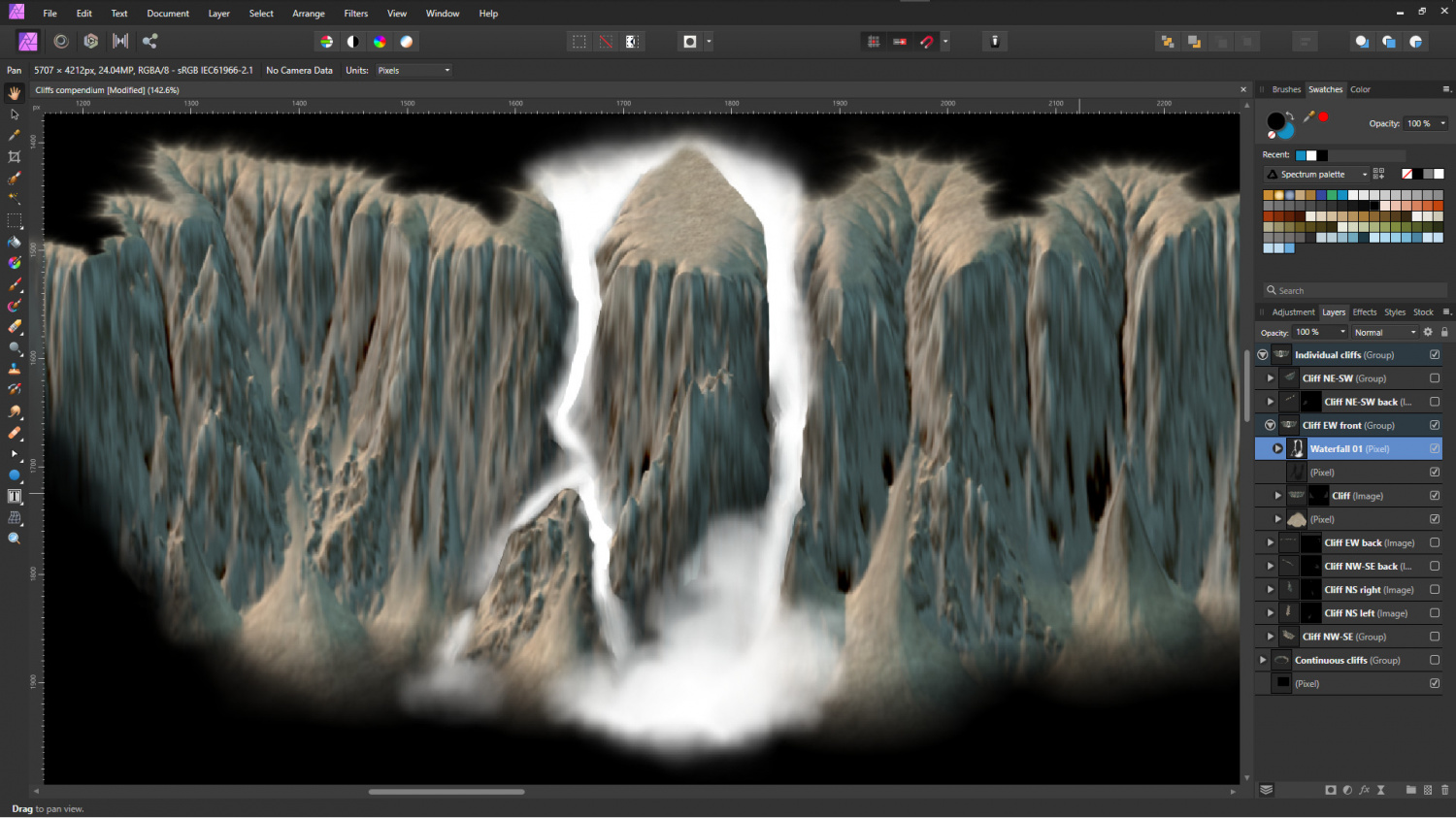
This is the fall on its own - showing how simple it really is. You've just got to be a bit patient with yourself and think about the shape of things as you work. Be the water falling down that cliff. Well... not literally, but in your mind, of course.
The other big 'secret' is to use your background.
If you've taken all that time and trouble to create a nice cliff to put this thing on, allow some of it to show through. Don't just cover it with a massive sheet of water. Most falls are more modest than Niagra, which is an impressive but artistically rather plain looking extreme of the phenomena in my opinion. Smaller more jagged falls that bounce around in the crevices are much more interesting to study.
So where the blurring ends up making the white bit you drew go transparent, don't fret. Just use it. It's like one of Bob Ross's happy little accidents.
Oh, and don't forget that it all goes crash at the bottom if it didn't higher up, so you can go a bit wild with the blur tool down there.
The optional extra is a layer behind the white of the waterfall set to "Glow and 50% opacity (in this case) just to paint and blur a few dabs of black to make the rock around the fall look wet. Be careful with that, though, it can really overcook things and make the whole thing look wrong. The other two falls in the set don't have this layer.
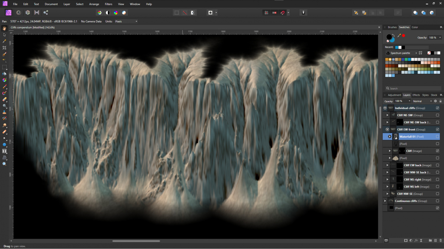
To complete the set here is the cliff before the waterfall is drawn. Maybe you can extract from these images whatever I've forgotten to say?
I just happened to chose the two cracks in the rockface that I did. I could just as easily have chosen another two, or done several/all of them. You could open a copy of any of the VH cliff symbols and practice in GIMP (though I recommend something with a much better blurring tool than GIMP, like Affinity Photo as above)


-
Project Spectrum - Part 2
Thank you - though the falls were by far the easiest part. They are just white scribbles done in AP on top of the finished cliff image, and took me about 5 minutes to do right at the end.
With me I think the last one for tonight is about a certain anxiety that it might actually be rubbish and I was just wishful thinking it into perfection. It has the same feeling of mild panic attached to it as suddenly realising half way around the supermarket that I might not have properly locked the front door on my flat, or sometimes I think I might have left my car lights on :P
With time quite short now for getting things done for November's issue (they have to be on Ralf's desk by mid October so that he can do all the technical stuff that to my relatively non-technical mind appears to be magic), I think the lava flows and falls will have to wait until the next time.
-
Project Spectrum - Part 2
I lied, but this is definitely the last one tonight. I just had to check that the waterfalls worked properly before I called them done.
![[Deleted User]](https://secure.gravatar.com/avatar/c75d9a245b74d9c59be0999ea81ca541/?default=https%3A%2F%2Fvanillicon.com%2F92add7f8c954488718110edc4896ad39_200.png&rating=g&size=200)


 and 1 other.
 -
Project Spectrum - Part 2
Maybe eventually. I'll have to add that to a wish list for the future, but there's no reason why not :)
-
Project Spectrum - Part 2
Last one for the evening. There's a full set of ice cliffs to go with the rock cliffs.
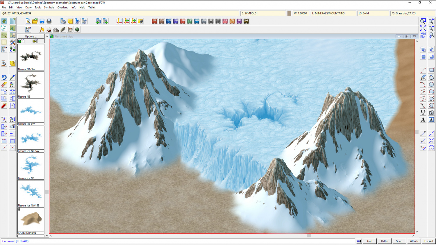
It's a little tricky nudging things around to make it work properly but you can get a glacier effect if you try.


