


Loopysue
Loopysue
About
- Username
- Loopysue
- Joined
- Visits
- 10,354
- Last Active
- Roles
- Member, ProFantasy
- Points
- 10,108
- Birthday
- June 29, 1966
- Location
- Dorset, England, UK
- Real Name
- Sue Daniel (aka 'Mouse')
- Rank
- Cartographer
- Badges
- 27
Latest Images


-
The Lakes of Michigami (Jerry's Map) - WIP thread
Something a bit like this?

I took the lazy option with the coastline and ran TRACED on the mask from the heightmap so that it matched the bitmap I'm using of the entire area as a guide for where to put the mountains and hills, but I think the Old Mission Peninsula is more of an island than a peninsula the way it appears in the original map. I will have a closer look at that one but this is just a taster to see if you like the style for the map.

-
The Lakes of Michigami (Jerry's Map) - WIP thread
After thinking about this for some time I think I might change style to use Ancient Realms style from the 2014 Cartographer's Annual. This style has several qualities that make it suitable for small scale mapping of very large areas like this one. Firstly there is a good collection of attractive mountains and hills, the fills are about the same colour and tone as the fills in your original map, Jerry, the woodlands are a fill rather than millions of very tiny individual tree symbols, and there are those very attractive circular points of interest markers that will be really handy for things like the salt mine, where they would be too small to show as other than a dot in other styles.
I know you won't see this for a while, so I will mock up a small section of the map for you.

-
The Lakes of Michigami (Jerry's Map) - WIP thread
You're awesome, Jerry. Thank you for letting me have a go with your map like this :)
-
The Lakes of Michigami (Jerry's Map) - WIP thread
Hi Everyone :)
This is a WIP thread showing the completion of a map that was started a while back by Jerry Thiel. Jerry has done a vast amount of work for the Community Atlas, but sadly owing to Motor Neurone Disease is no longer able to map. I offered to finish a map of his choice for him, and Jerry sent me the FCW for a map based on the Michigan area south of the Great Lakes where he grew up. I also asked if Jerry wanted this to be a private thing, or if he wished me to do a WIP thread. Jerry chose the WIP thread option, so here we go...
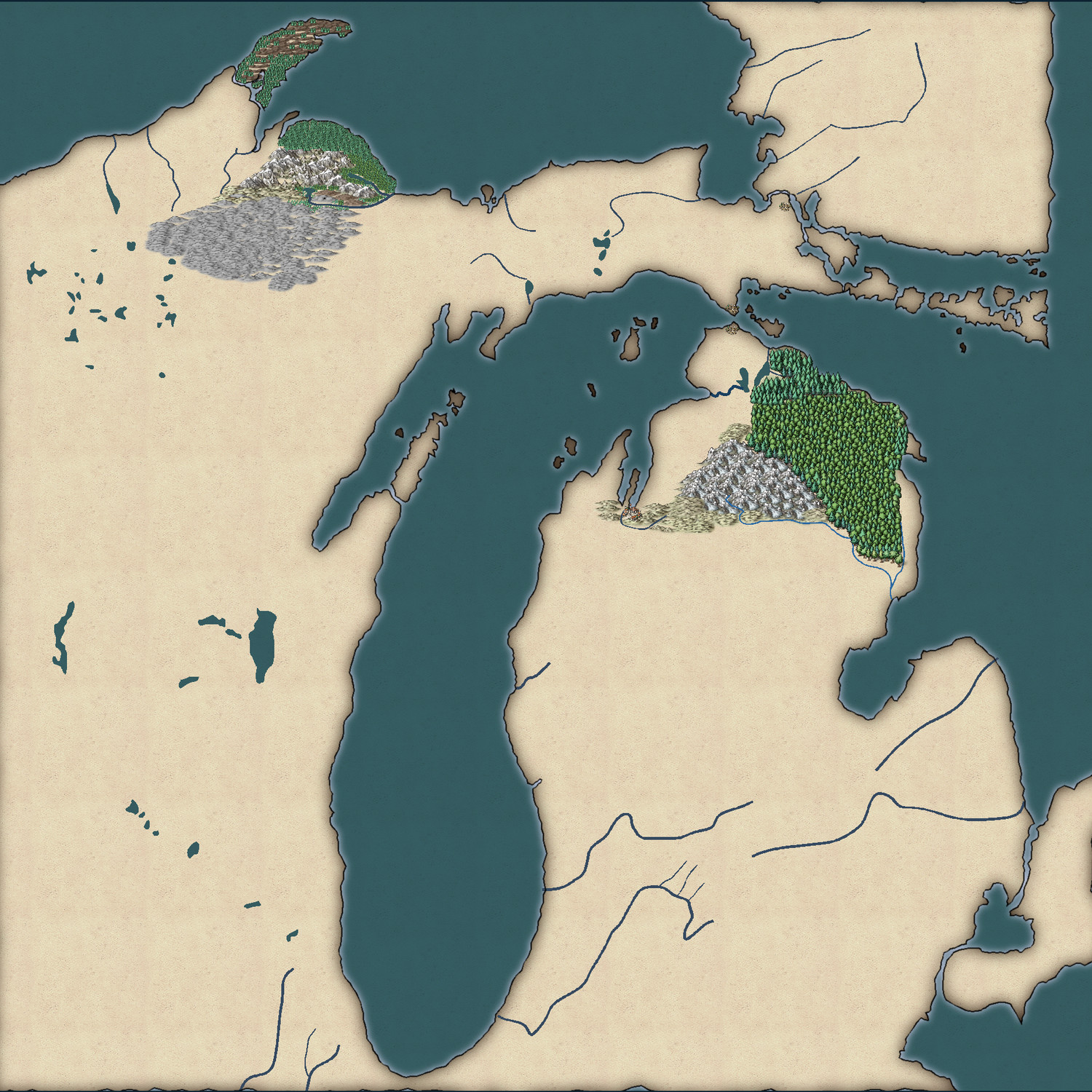
The map (which I have temporarily named "Jerry's Map") is based on the Michigan area around the Great Lakes of North America.
This is what Jerry had to say about the continuation of his map:
"Use any style you want. I was planning on a fantasy world. The big village would have been called "City of the Grand Traverse." The early French explorers called the passage across the large bay from the peninsula tip east, the Grand Traverse, as it shortened their canoe voyage significantly.
The two villages facing each other on the Upper and Lower Peninsulas I pictured as the capitols of two antagonistic city-states.
The narrow peninsula running north from GT Is called Old Mission Peninsula after a small mission church built to service the local Indian reservation. The northern tip of the on the 45 latitude and there is an Indian legend that warriors would gather there on the summer solstice to shoot at the sun to cause it to turn back to the south so that it couldn't escape to leave the world in eternal darkness."
Jerry - please feel free to comment and guide as we go. It is, after all, your map I'm working on :)
![[Deleted User]](https://secure.gravatar.com/avatar/c75d9a245b74d9c59be0999ea81ca541/?default=https%3A%2F%2Fvanillicon.com%2F92add7f8c954488718110edc4896ad39_200.png&rating=g&size=200)


-
Opening multiple instances of CC3+ on a Mac with OS Catalina
If you mean like this
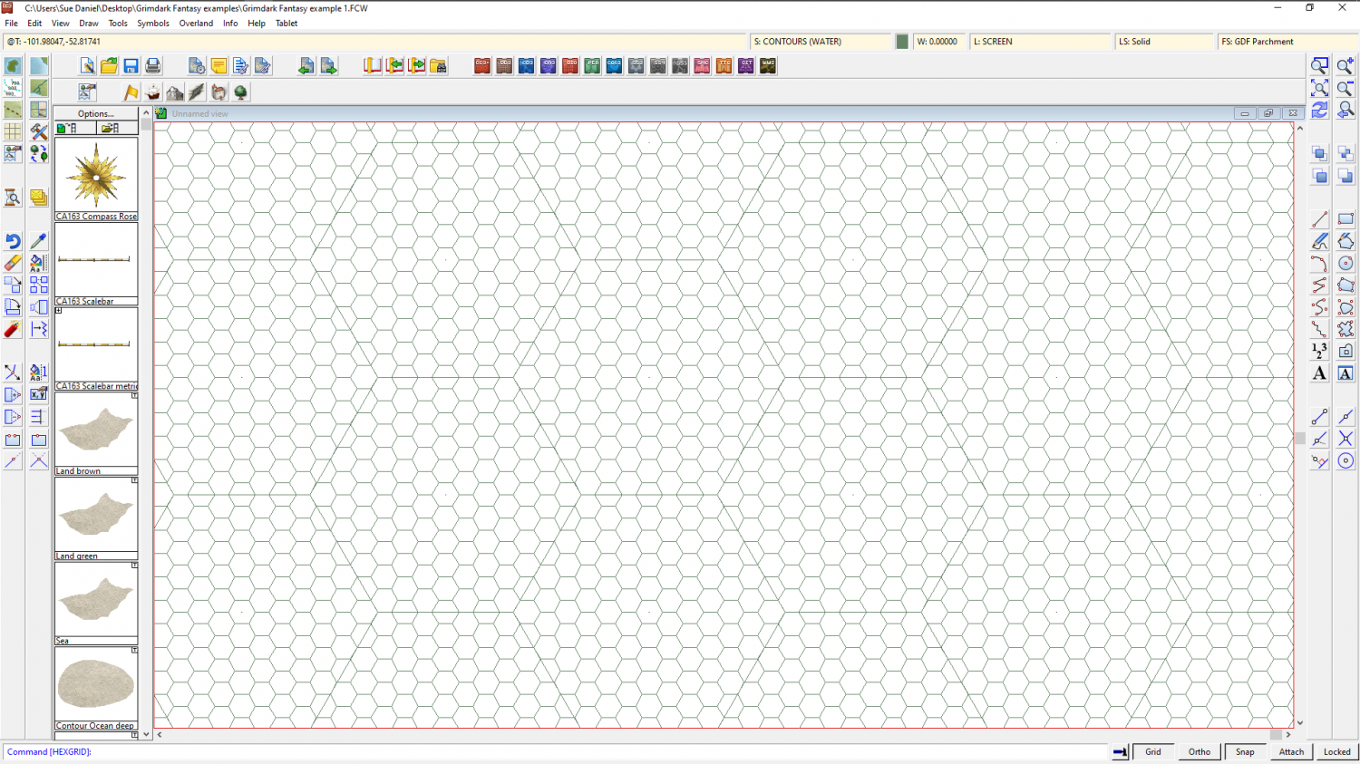
That's just a matter of which snap point you pick to start your grid. If you get the wrong one just hit ESC and try again.
Don't forget that you don't have to have your grids perfectly matched with the edges of the map, because the overlap will be hidden by the screen and frame of the map. It is highly unlikely that your map will be exactly and perfectly a whole number of hexes in either direction, but that is perfectly normal. If you are really intent on trying to align the whole grid system on the map, try for just one of the corners (which equates to 2 adjacent sides). More than that is a bit extreme.
