Loopysue
Loopysue
About
- Username
- Loopysue
- Joined
- Visits
- 10,354
- Last Active
- Roles
- Member, ProFantasy
- Points
- 10,108
- Birthday
- June 29, 1966
- Location
- Dorset, England, UK
- Real Name
- Sue Daniel (aka 'Mouse')
- Rank
- Cartographer
- Badges
- 27
Latest Images


-
How would you create a fantasy port/harbour rpg battlemap?
You're welcome :)
To enable drawing outside the map border with any given drawing tool you will have to edit the drawing tool and uncheck the checkbox called "Restrict to map border". The procedure is as follows. Click the crossed hammer and pencil button on the left, click the Advanced button at the bottom of the Select drawing tool dialog, pick the drawing tool you want to edit from the list in the Custom drawing tools dialog, uncheck the aforementioned checkbox, save the tool and OK to draw your shape.
Some people frown on saving the altered tool and think it is better to miss out the Save and just click OK to draw with the tool unlimited. The tool will then revert to being restricted to the map border the next time you use it. It depends on whether you find you are always having to do this or not.
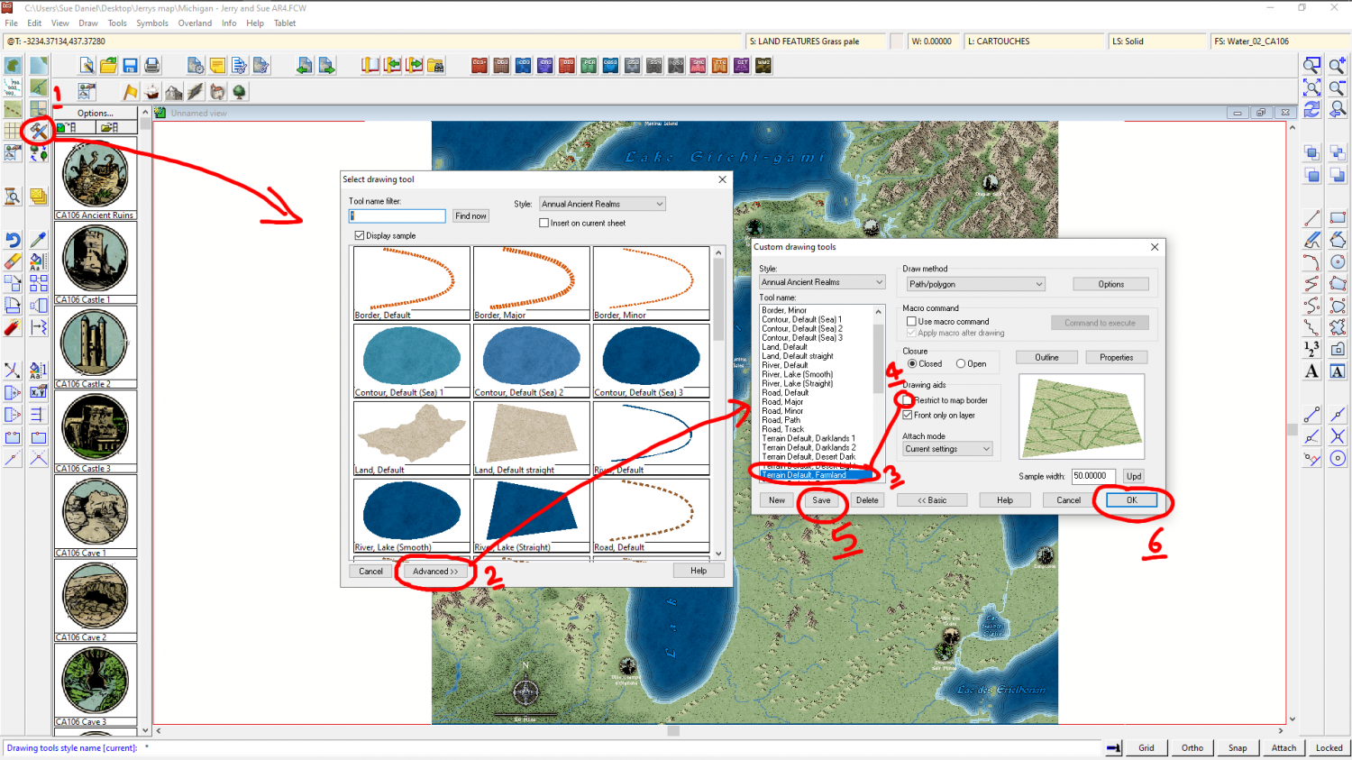
This is a very simple tool edit. For more complex and permanent edits most of us would pick the tool and then use the New button to generate a separate drawing tool while preserving the original in its original state.

-
How would you create a fantasy port/harbour rpg battlemap?
That's a really great map - well done :)
Just so you know for future reference:
A sheet called SCREEN usually has a masking white polygon designed to hide symbols that fall partly outside the rectangular extent of your map so that it looks better on the monitor. If you have symbols poking out all the way around the map it can also help to visually define the edges of the map. The white polygon on this sheet is also quite often on a layer called SCREEN, so that it can be frozen and largely ignored, since freezing it prevents it from being selected. The screen entity is also really useful when you are doing what you describe you are about to do with adding patches of muddier water to the existing water. Your new sheet will presumably have an Edge Fade, Inner sheet effect on it to blend the two textures together. So then it becomes necessary to extend the patches on that new sheet beyond the edge of the map so that your texture patches don't fade in from the edge with straight lines and corners. Don't worry if you have deleted the sheet, just add a new SCREEN sheet and draw a white shape around your map using the snap grid to position it precisely. A lazier way is to create a new map of the same size and just copy and paste the screen to your existing map, which will also create the SCREEN sheet for you.
A sheet called FRAME (or close variations) usually has any decorative framework, which may also be on a layer by the same name for the same reasons as described above for the screen.
A layer (not a sheet but a layer) called MAP BORDER is critical for controlling many types of bitmap output, and the four bounding lines on this layer should be left alone. It is normally frozen, but sometimes there are templates where this is not the case. The four lines on this layer are normally located on the BACKGROUND sheet, and are bright green.
I hope that helps :)
-
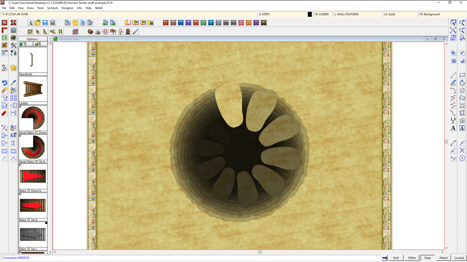
WIP Commission, Ancient Tombs
Would something like this help?


-
The Lakes of Michigami (Jerry's Map) - WIP thread
Thank you, @Raiko :)
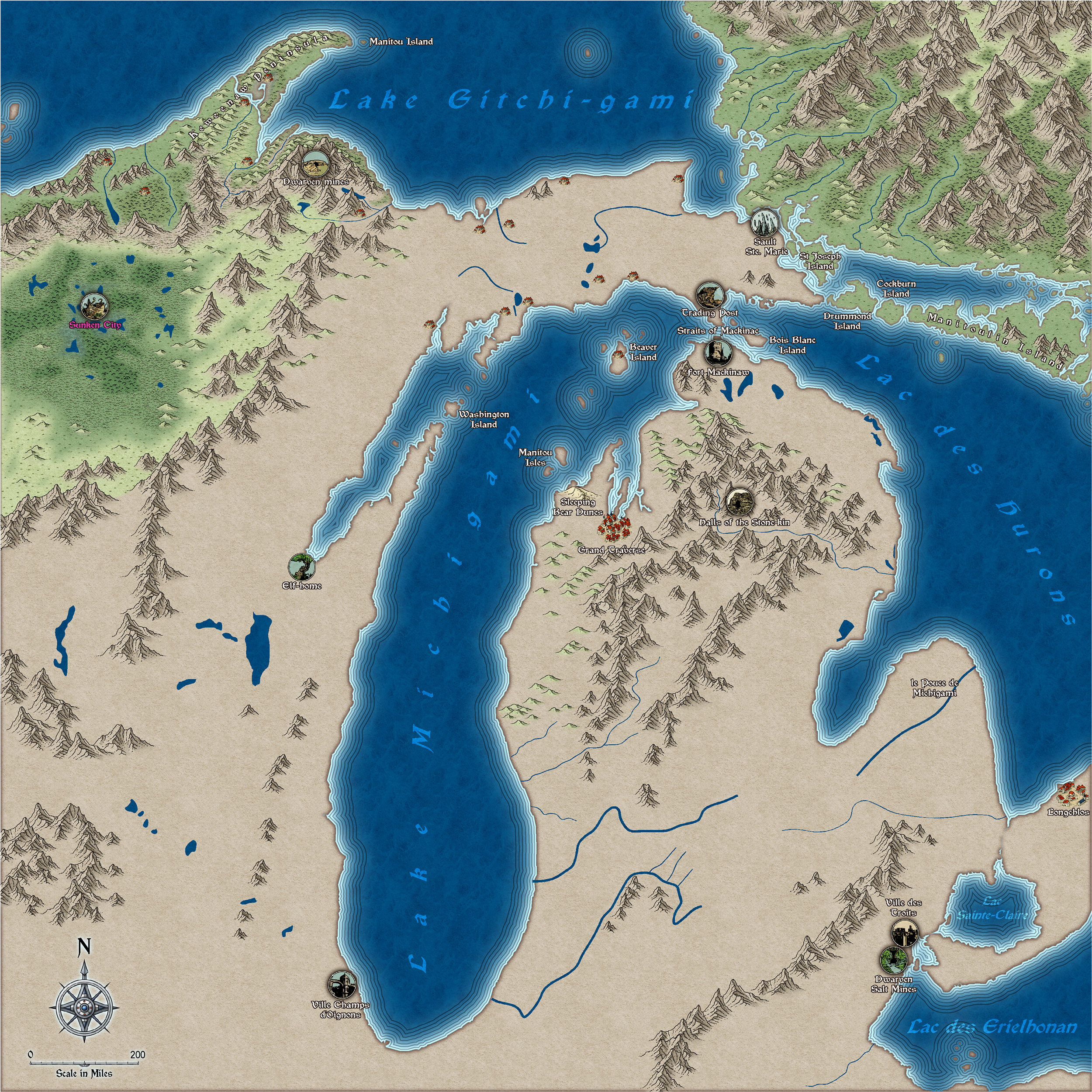
@mahler - thanks :) I have no idea. I think this is probably too small a scale to show anything but the location of the settlements. Maybe Jerry will have the answer for that when the larger scale city maps are drawn.
I've done a bit more work - adjusted the river system according to the US Geological Survey maps and then adjusted the mountain ranges and terrain around them. The locations labelled in pink are only vague suggestions from me, and may not appear in the final map.
And I've just noticed that by repairing the shoreline where it was missing bits (I did a trace from a heightmap from Tangram if you remember), the labelling of the water bodies in the south east now needs a bit of attention.
![[Deleted User]](https://secure.gravatar.com/avatar/c75d9a245b74d9c59be0999ea81ca541/?default=https%3A%2F%2Fvanillicon.com%2F92add7f8c954488718110edc4896ad39_200.png&rating=g&size=200)
-
The Lakes of Michigami (Jerry's Map) - WIP thread
I'm really loving this style. I can't think why I never tried it before. But if I had you might not have had Spectrum.
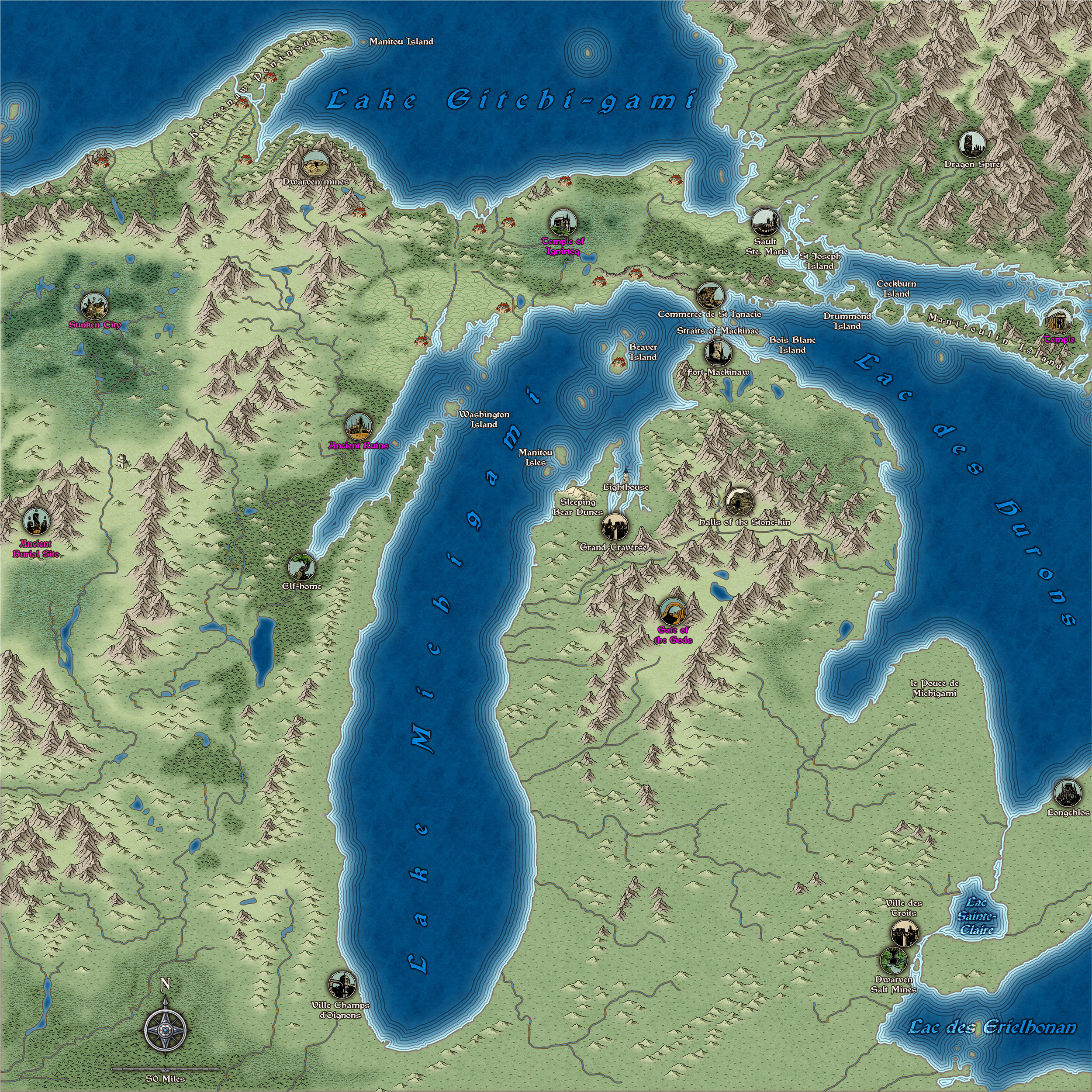
Here is a bit more work. I've added quite a few more places from Jerry's notes, and attempted to sort out that north east block of higher land. I know it's not really a mountain rage, so I can take it out again if you don't like it, Jerry :)
This image is 2/3 full size and slightly more compressed than is usual for a jpg, so apologies if there are any artefacts.