


Loopysue
Loopysue
About
- Username
- Loopysue
- Joined
- Visits
- 10,354
- Last Active
- Roles
- Member, ProFantasy
- Points
- 10,104
- Birthday
- June 29, 1966
- Location
- Dorset, England, UK
- Real Name
- Sue Daniel (aka 'Mouse')
- Rank
- Cartographer
- Badges
- 27
Latest Images


-
Live Mapping: Roof Shading
You're welcome :)
There are a couple of other tips you might want to bear in mind that I don't think were mentioned in the live stream.
The biggest one is about the tone of the colours in the image part of the symbol. If you look at the PF assets you will see that the majority of roofs have mid tone colours. These work best with map files since the shading and highlighting will never take the colour past 0,0,0 (black), or 255, 255, 255 (white). Where there are black lines, such as the ink lines in the SS5 roof images, it's best to erase the map file to prevent strange side effects in the finished symbol. Ralf demonstrated how to do this using a selection mask in the video. The point of mentioning it again here is to say that very dark or very light roof images won't necessarily look as fabulous as you thought they would.
Another reasonably important tip is to try and give the image reasonably sharp edges if you can at the resolution you create them. This will reduce the likelihood of any ghosting around the edges in your maps.


-
Live Mapping: Roof Shading
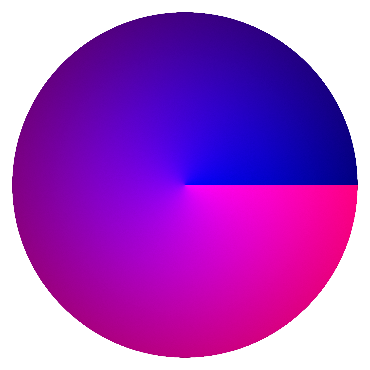
I used Blender back in the day, but you can do the same in a bitmap editor with radial and spherical gradients.
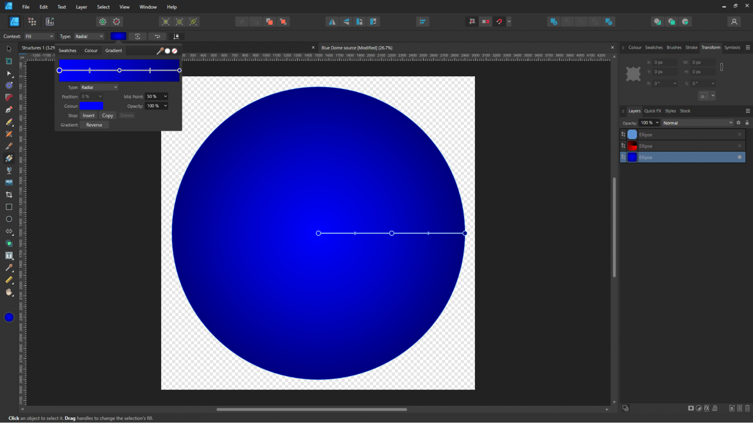
These are the 2 layers used for a dome shader in Affinity Designer - 2 gradient shaded circles.
The blue element is the pitch of the roof, created with a spherical gradient. The brighter the blue is the more flat it is, so the top of the dome is very bright blue (255), while the base of the dome is very dark (128).
The red element is a radial gradient from black to red, like this:
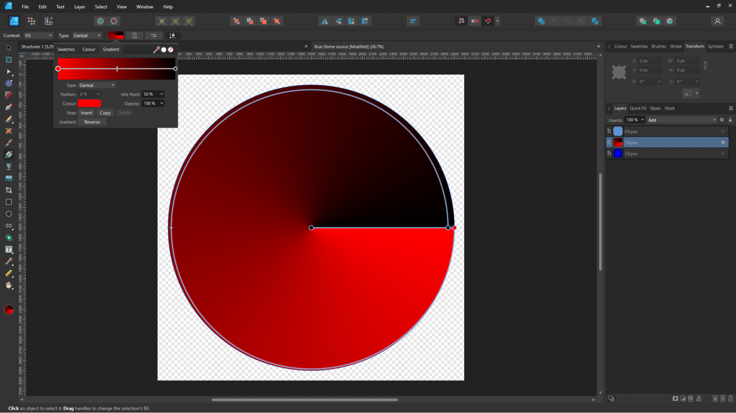
The red layer is 'added' to the blue layer using the Add blend mode setting on that layer, so that where the red is black nothing is added.
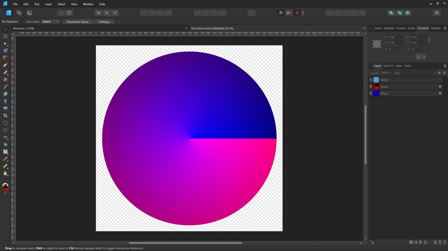
I think I may have uploaded this before, but here it is again if you want it.
I have added the necessary 1 green to the blue layer, so if you use this png as part of a map file it should also work as varicolour.


-
Inclination not working?
Thanks :)
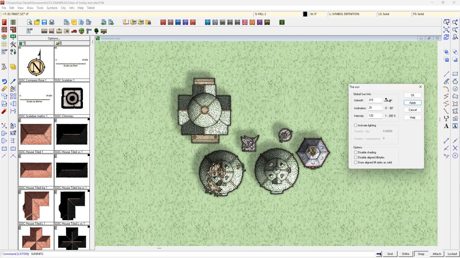
I was just about to say the same thing, but since Remy has already said it here are some screen shots illustrating those points.
Point 1: 2 shots, starting with the default inclination settings and then showing a really low sun such as shortly before sunset. The shaded side of the rooftops darkens.
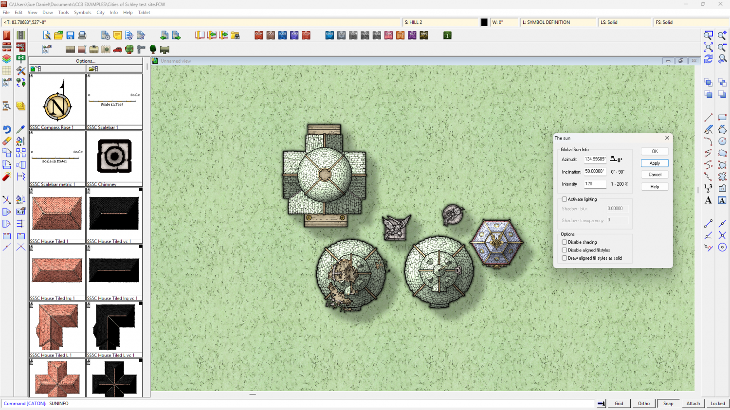
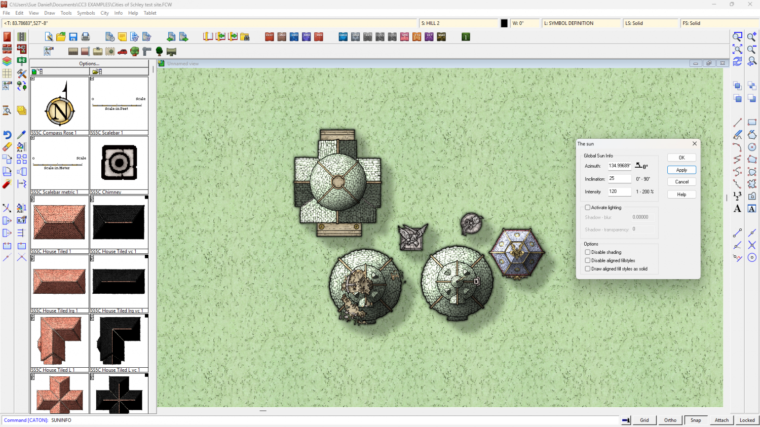
Point 2: (Actually shown above at the same time). The Activate lighting panel is completely turned off with no effect in this map where there are no dungeon lights present, or the necessary sheet effects.
Point 3: The shadows on the buildings are "Wall Shadow, Directional" type, and respond to the Azimuth settings correctly if I reverse the angle from 135 to 315.
-
Border Templates
You have to be a member of the Cartographer's Guild to see those, but I get what you are saying. It wouldn't be right to snatch them and paste them here either, I don't think.
So your second look is a very lose general description. I would experiment with various combinations of shapes, colours and effects and see what you come up with, using sheets above the SCREEN and being mindful of where the thin green line of the MAP BORDER lies to include the decoration.

-
Aligning two separate maps when you are unable to see the one at the back
If I were doing this I would first make sure the source maps covered an identical area by trimming them together in an image editor (PS, Affinity Photo, GIMP - take your pick). Then I would turn on the snap grid and import them one after the other, using the same snap points to define their extent. Once they are in CC3 you can scale them together, so keeping the alignment you've already set up.
There are probably many other ways you can do it. This is just the way I would do it.


