


Loopysue
Loopysue
About
- Username
- Loopysue
- Joined
- Visits
- 10,354
- Last Active
- Roles
- Member, ProFantasy
- Points
- 10,103
- Birthday
- June 29, 1966
- Location
- Dorset, England, UK
- Real Name
- Sue Daniel (aka 'Mouse')
- Rank
- Cartographer
- Badges
- 27
Latest Images


-
Hi there, I am a game designer
Hi Paolo, and welcome to the forum :)
Start by installing CC3+, then install the most recent CC3+ Update, and then all the add-ons in no particular order. Finally, run the most recent update installer again at the end.
Most but not all of the installers are set up to open CC3+ at the end of the installation process. If that is the case please let it do so. However, always close CC3+ down afterwards and never try to install anything with the app open.
If you run into difficulties just shout and we will help.


-
Graphic Drawing Tablet & CC3+ question
Hi and welcome to the forum :)
CC can work with graphics tablets. There are people who can map on screen tablets with CC that I know of. However, I use a mouse when I'm working in CC - even though I use an Intous Pro (that's a non-screen tablet) for all my other work as a ProFantasy asset creator in other apps, like Affinity V2 (no longer available), GIMP, Krita, etc. I don't use Inkscape at all.
-
Making Hex Maps/Templates Which Fit Paper Sizes?
I think the white band is the screen. You asked about it on your other current thread and I suggested a solution for it there - the commands contained in this blog by Remy Monsen should help.
...
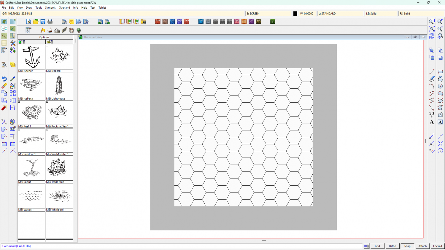
Making and positioning a grid.
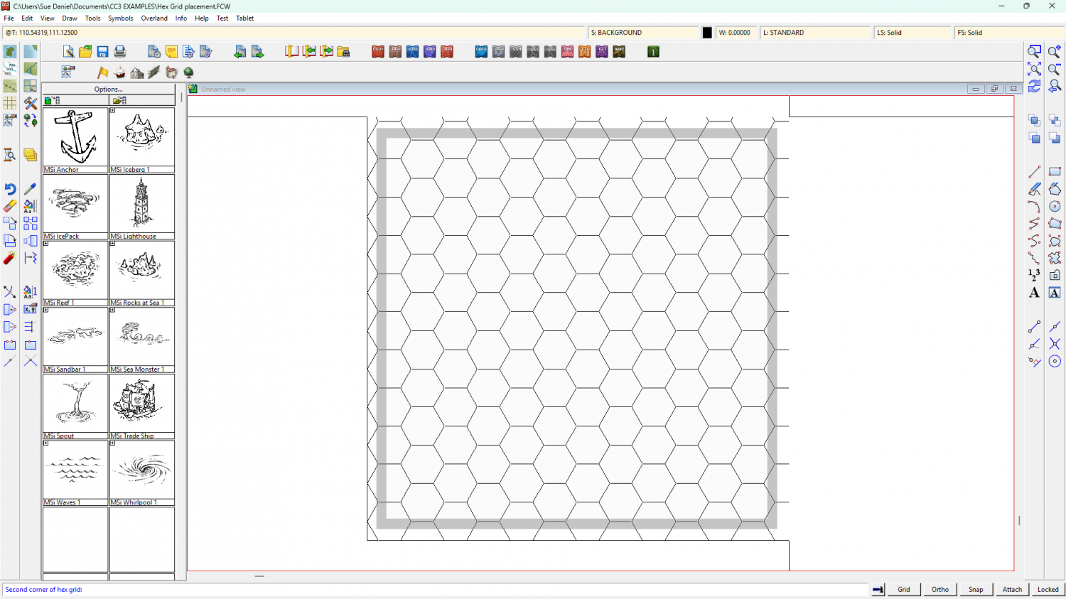
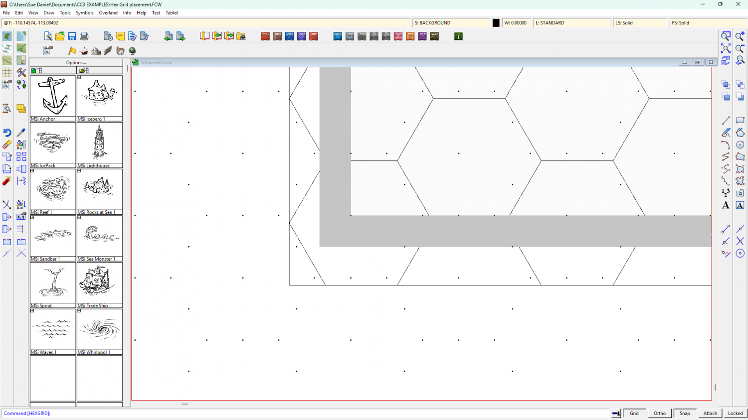
In these example images I have turned the usually invisible white screen object grey to show the extent of the map, and also to illustrate what happens when you use the collar commands.
Make your grid deliberately too large by using the Select points option above the Apply button and place it very approximately in the right place. At this stage you are merely using the map to judge how many hexes you want - a bit like stretching a length of curtain material over a window to see if it will fit. There is no need to worry about accurate placement. Be more concerned that you have enough hexes.
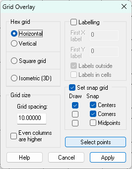
The new grid will have generated its own snap grid, which is useless from our point of view. Next we need to make our own new snap grid and move the drawn grid to match it.
To create a new snap grid right click the Grid button and select New.
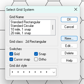
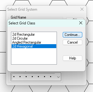
Pick 2D Hexagonal and Continue...
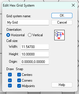
Give your new Grid an appropriate name and adjust the settings to your taste, then OK
Your new snap grid should appear in the drawing window.
To move your drawn grid into alignment with the new snap grid, turn off Snap and turn on Attach. Then use the Move tool and pick up the grid at the corner of one of the hexes. Don't click the outline of the grid, but the side of one of the hexes.
While you have the grid hovering on your cursor mid-move operation, turn Attach off and Snap back on. You should be able to snap the corner of your hex to the right position according to the newly generated snap grid.
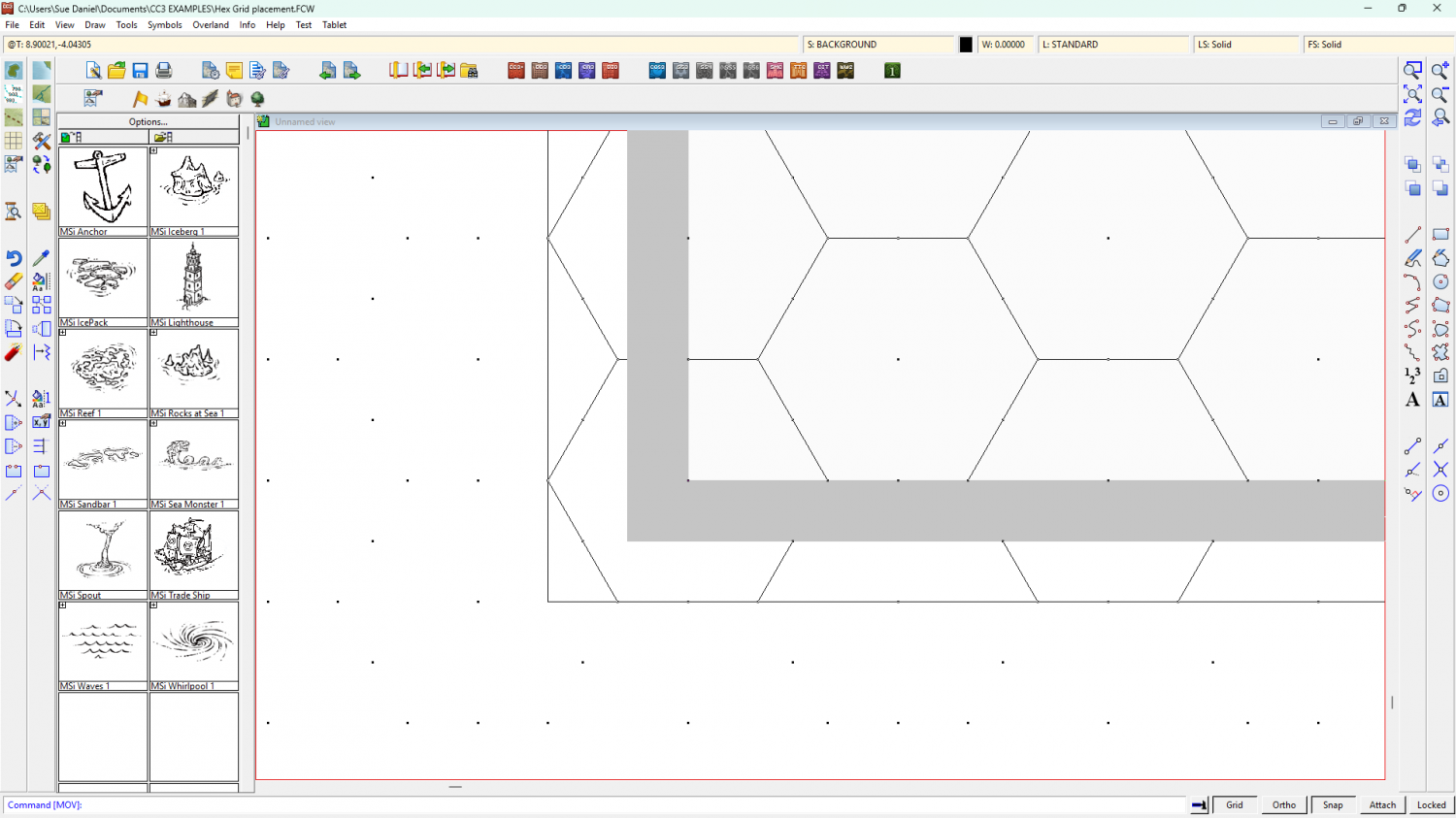
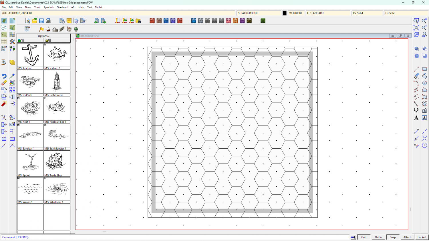
So the drawn grid is now in the right position*, but the screen (grey) is too narrow to cover the grid up.
Use COLLARDEL to delete that screen and COLLARAUTO to generate a new one.
The generated screen will be generously proportioned, but it does the job of hiding all those excess hexes really well. It will automatically be white, but I've turned mine grey again in this shot so you can see it.
I hope this helps.
*Please note that I have no idea if I'm showing the correct position as you described it, but only that the drawn hex grid is now perfectly aligned to the new snap grid.

-
Change Default Sea Colour
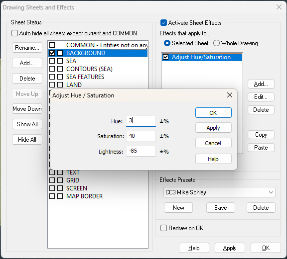
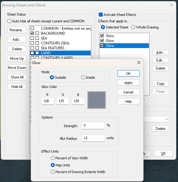
Do you mean something like this?
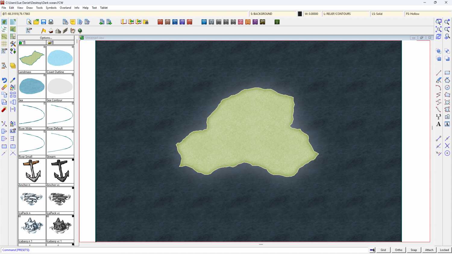
I notice that the land in that image is also very dark. I can see a potential problem arising if you want to remake this map with everything darker than this relatively pale style, since it's very difficult to make the symbols darker. If that's where you are going with this map it might be better to chose a darker style to start with. However, no other overland style has such an extensive range of symbols as the Mike Schley Overland style.
I hid the COASTLINE sheet and added effects to the BACKGROUND sheet and the LAND sheet. I haven't deleted any existing effects.
Here is the FCW if you want to look at what I've done.


-
Node Spikes
SIMPLIFY should do the job, but you must do it to the land mass as well as the coastline, or they may not match perfectly afterwards.
I don't recommend using Explode for any reason other than to disassemble a multipoly. That's a complex polygon made up of several single polygons fused into one entity such that a large polygon may have a hole in it. Since these are rare, and usually a result of exporting contours from Fractal Terrains to a CC drawing, Explode is hardly ever used. There are many other more suitable tools.

