


Loopysue
Loopysue
About
- Username
- Loopysue
- Joined
- Visits
- 10,354
- Last Active
- Roles
- Member, ProFantasy
- Points
- 10,103
- Birthday
- June 29, 1966
- Location
- Dorset, England, UK
- Real Name
- Sue Daniel (aka 'Mouse')
- Rank
- Cartographer
- Badges
- 27
Latest Images


-
Move installation seat?
If you decide to go the commercial route in the future you can always uninstall it from 'the other PC' (whichever one you chose), and carry on - or you could get a second set of licences if you want to keep both.
If you have any other questions or end up in a situation that doesn't seem to be covered by the EULA, please contact the General Manager or use the Licencing Questions contact from this page. We're always here and happy to help.

-
Move installation seat?
The Description of Rights and Limitations in the EULA indicates how many PCs you can have the software installed on at any one time. This should answer the question for you. https://www.profantasy.com/service/license.asp
On the surface of it, it sounds to me like you should be ok having it installed on both machines, but I dont' know your exact circumstances or how you will be using the app.
-
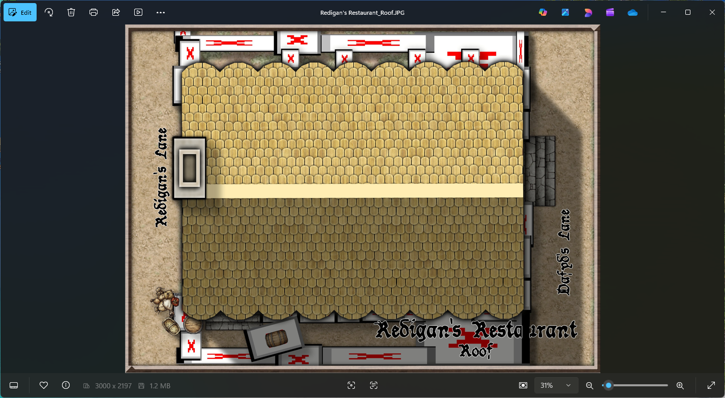
Community Atlas - Torstan Holy Head District - Redigan's Restaurant - a joint collaboration
I'm only getting it on renders that need more than one pass. Otherwise it's fine.
You might be experiencing the same thing as Ricko a couple of days ago.
Check your EXPORTSETMPP value. If it's only 4 million type "40000000" (40 million), hit ENTER, and try again.

-
Community Atlas - Torstan Holy District - Happy Fiddler's Inn - a joint collaboration.
It looks like a seam between separate passes of the export where the sheet effects are wider than a single pass. CC only sees the effect if the polygon or symbol causing it is visible in the same pass.
Type EXPORTSETMPPP and hit ENTER on your keyboard. In the command line you will find the default setting, which I believe is 4000000 (4 million). Type 40000000 (40 million) and hit ENTER. Then try another export.
The "MPPP" part of that command refers to the maximum pixels per pass, so you are increasing the depth of each pass by a factor of 10. This should get rid of most if not all of those artefacts.

-
Symbols Catalogue Wonky
It's important that none of the Profantasy assets are moved or renamed, but I don't think that's what you are talking about.
Are all your custom symbols in folders that live inside the "ProgramData\Profantasy\CC3Plus\Symbols" folder? Possibly in a subfolder of the Symbols folder called User (or some such appropriate name for things that are not part of Profantasy's asset collection)?
EDIT: If they are and that's all correct, have you moved the FSC (the symbol catalogues you made) relative to the symbols - ie, moved them to a different position in the folder hierarchy. That will also break the references.

