


Loopysue
Loopysue
About
- Username
- Loopysue
- Joined
- Visits
- 10,354
- Last Active
- Roles
- Member, ProFantasy
- Points
- 10,108
- Birthday
- June 29, 1966
- Location
- Dorset, England, UK
- Real Name
- Sue Daniel (aka 'Mouse')
- Rank
- Cartographer
- Badges
- 27
Latest Images


-
forest fill tool
You can't change the scale of the forests you've already placed. You will have to delete or undo them.
Check the scale of the single trees you've placed, using the List option in the Info menu.
Then open the Drawing Properties dialog and alter the default symbol scale to match the scale of the single trees, and place your forests again. (This shot shows the default symbol scale for the style I am working on at the moment is 1).
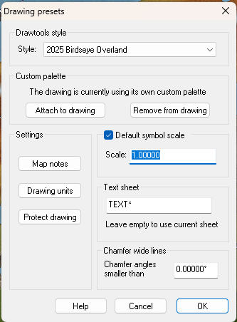
Don't forget to change the default symbol scale back to what it was before you altered it once you have done your forests.

-
Birdseye Continental - style development thread
Well, different tastes... :)
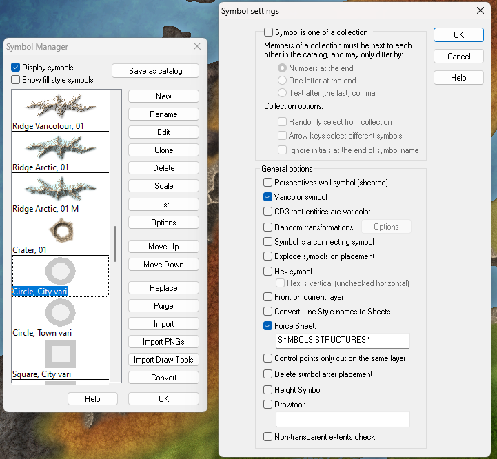
Anyone can make their own or modify the existing. These are really easy to do. If you want the outer ring to be lighter rather than darker you just add a new layer called VARICOLOR+3, and edit the symbols to place the larger circle/square/triangle on the new layer, then save.
Currently, the darker outer ring is on VARICOLOR-3, with the centre on VARICOLOR0 (that's actually a zero, but the forum font makes it look like a lower case 'o').

It means the centre is the colour you picked in the palette, while the outer ring is 3 shades darker.
I didn't bother to do stars, since they were more spike than colour at the given size and didn't show up well, but there's nothing stopping anyone from creating a simple one-colour star shape and putting it on VARICOLORo.
To make them work as varicolour symbols, all the newly created vector symbols must then have the Varicolor symbol option checked in the General options box.

-
Dragon sheet
Try multipolying the shapes of your design together. That will bring the inlay fill into alignment throughout the pattern and make it look a whole lot less busy.
-
making dungeon hall and cave seamless
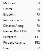
Have you tried moving the end node of the cave wall section, and while moving it using F9 to snap to the closest node/point on the corridor end?
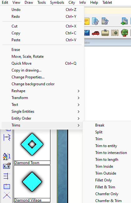
Or, if you have any experience with the trim tools in the Edit menu, you could try hiding all but the wall sheet(s) and use the tools to trim the ends to each other. Instructions are given in the command line depending on which tool you use.

-
Dragon sheet
LOL! Yes, I used to be much better at drawing dragons...
Many years ago, at art college, I was berated for drawing fantasy creatures by my tutors, so I stopped doing it. And now, 40 years later, I'm not as good at dragons as I could have been if I hadn't listened to them.


