


Loopysue
Loopysue
About
- Username
- Loopysue
- Joined
- Visits
- 10,412
- Last Active
- Roles
- Member, ProFantasy
- Points
- 10,161
- Birthday
- June 29, 1966
- Location
- Dorset, England, UK
- Real Name
- Sue Daniel (aka 'Mouse')
- Rank
- Cartographer
- Badges
- 27
Latest Images


-
Cartographer's Annual 2023 broken zip
Have you tried a fresh download? Maybe this is a recent download anyway. If so, please contact Tech Support for assistance, Steven.

-
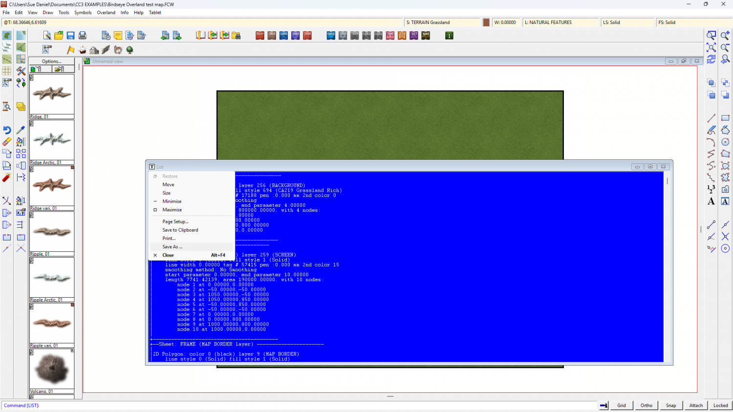
Exporting wall data to a text file
You can do it by hand if what you've done there is generate a List window like this one. Click "List" for a dropdown menu to save as a txt file.


-
Forum vs Product Registration
They're completely separate, Slither, so you will need to register an account if you make a purchase to be able to download your software.
This is the login/register page https://secure.profantasy.com/service/entrance.asp


-
Room for improvement?
They look good to me :)
I am a little concerned about the way the grey tone one will turn out in print. This style isn't designed specifically for BW reproduction and may look a little flat unless the printing quality and the paper are both pretty good. Try printing it out on paper of similar quality first. If it looks bad, try increasing the contrast a little, or even using a tone curve on it in a bitmap editor.

-
shadows in a top-down cave
The first thing I did was hide everything except the sheet with the current Wall Shadow, Point Light Finalize, and the only Wall Shadow, Point Light Setup effects on it (I will call this effects Finalize and Setup from here respectively) - the symbols fireplace sheet. I also moved the light itself to a new sheet called LIGHTS
I saw that you had set the ambient light in the Finalize effect to a pale yellow, so the darkest shadow you could ever get was pale yellow - and so, your entire map was yellow.
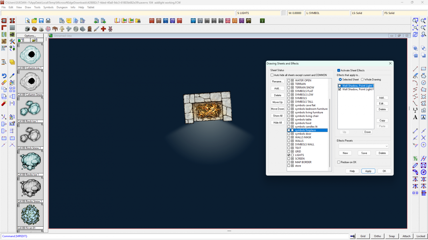
Here I have turned the Shadow Color to the very darkest blue. Now you can see the light properly.
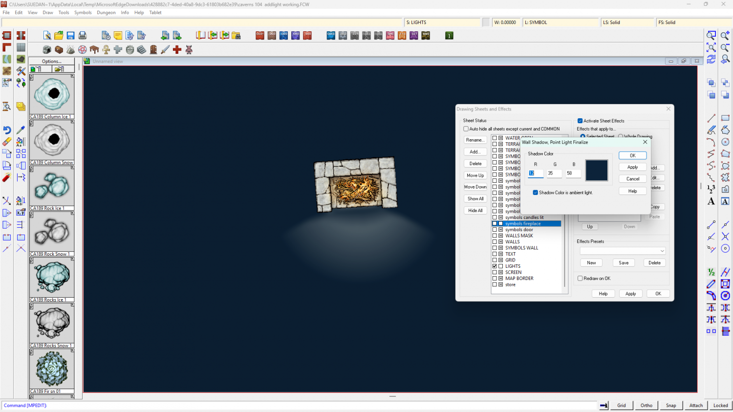
There's still a problem, though. A strange dark halo around the fireplace itself is being caused by the fact that you have a Setup sheet effect on that same sheet. You are (or were before I deactivated it) putting shadows on the same sheet the light was on.
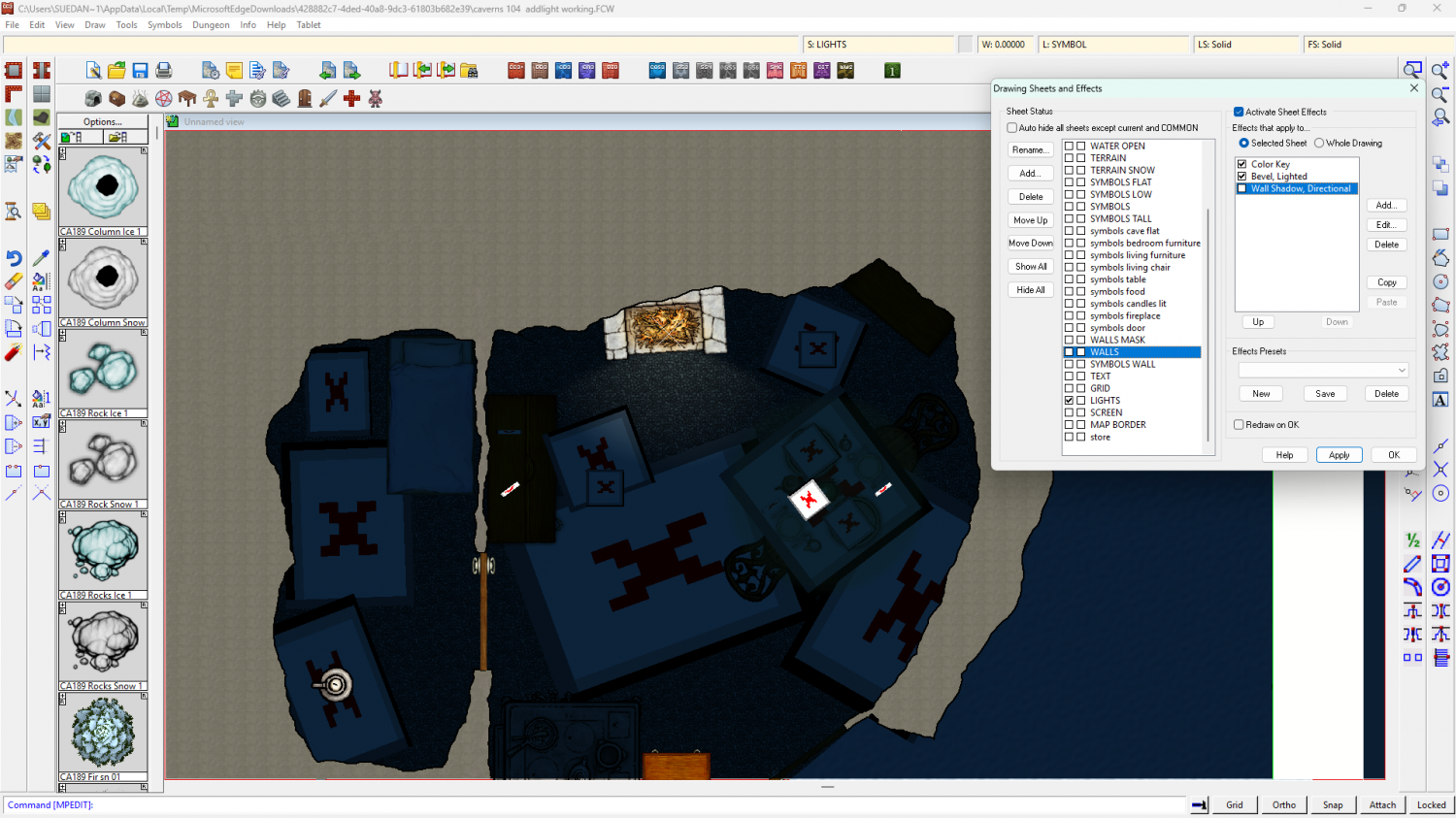
I unhid the rest of the sheets, and discovered that sort of misty grey blurring all over the place was coming from the Wall Shadow, Directional on the WALLS sheet.
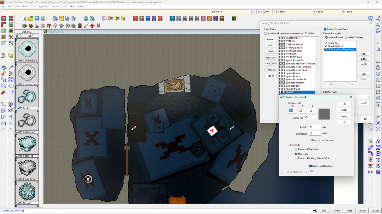
I deactivated that too.
As you can see, the current light in the fireplace area isnt' large enough to cross into the adjoining room, but if you make it large enough (I took the liberty of doing so using numeric edit) you can see there's nothing there to stop it.
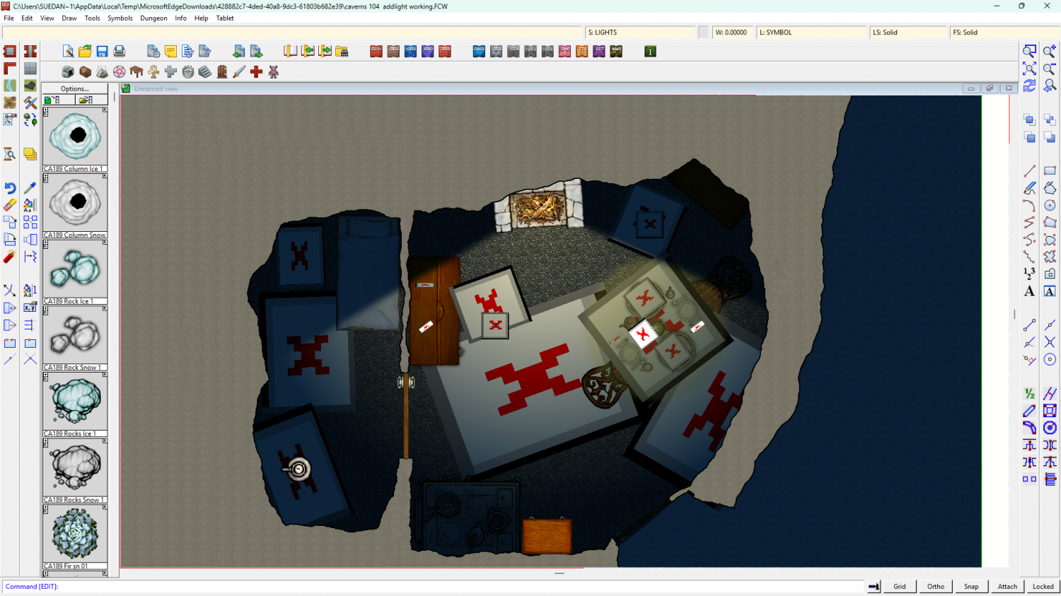
What is needed now is something that is a perfect match for the walls moved further up the list of sheets to be above the Finalize effect on the symbols fireplace sheet, and for there to be a Setup effect on that sheet with the size set to 0 (zero means an infinite shadow that no light can pass).
You could just use the WALLS sheet, but that would cause the wall itself to become dark blue like the rest of the shaded parts of the map. I didn't think you wanted that, so instead I copied the walls to a new sheet I called LIGHT STOPPER, added the required Setup effect, and moved it into position just above the symbols fireplace sheet.
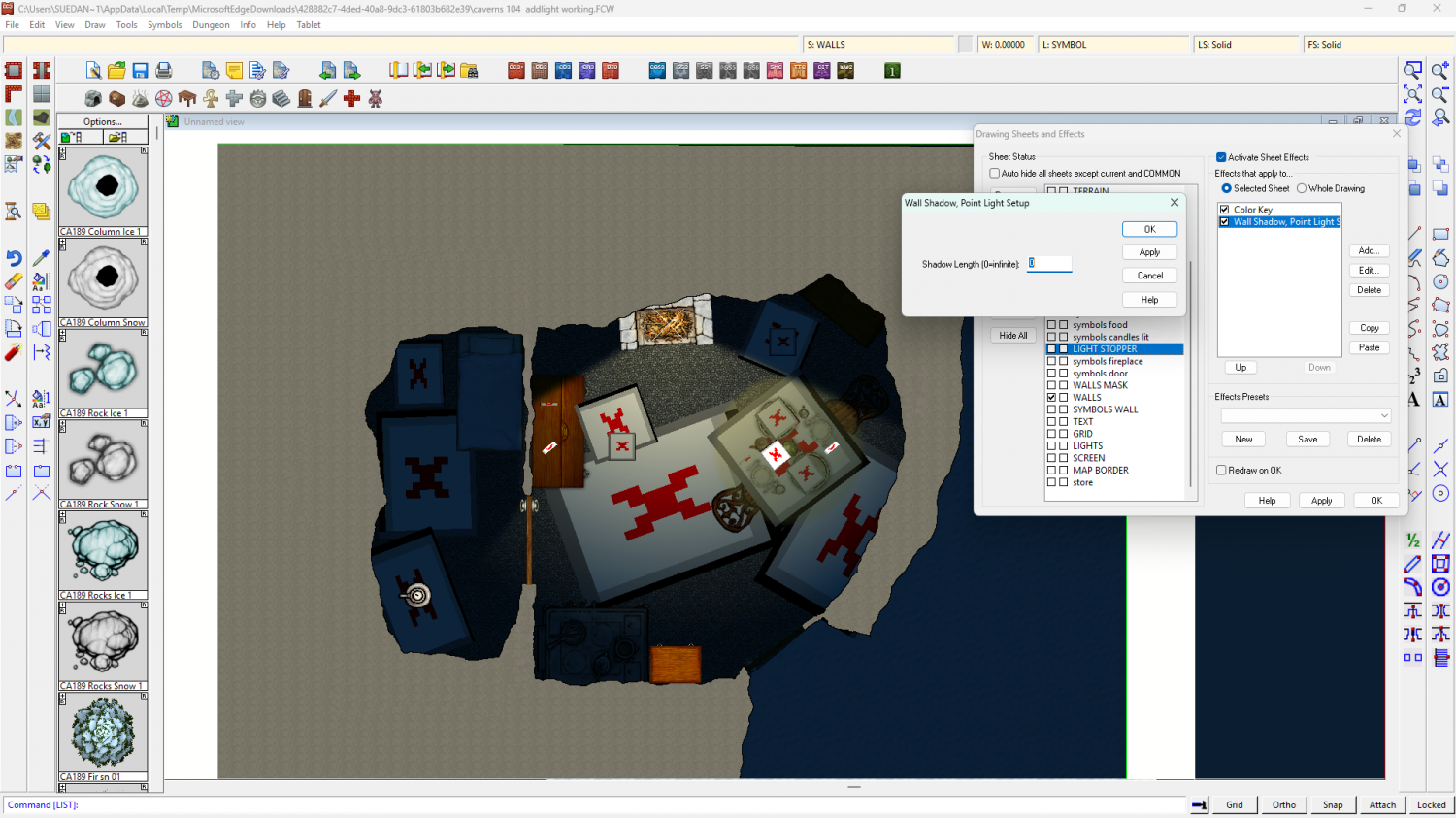
Then I copied the door between the two rooms (which is on the store sheet) to the LIGHT STOPPER sheet to prevent the light getting through underneath it.
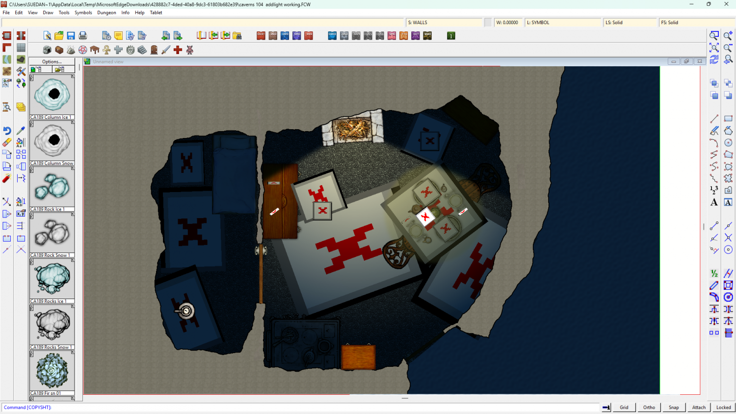
I think this is what you wanted?
I recommend getting rid of the bitmap glow. They don't work well with the lighting.
If you want other sheets to cast shadows according to the light you will need to make sure they are above the symbol fireplace sheet in the sheet list and add a Setup sheet effect to each of them in turn. Deactivate any regular non-lighting shadow effects you happen to have on them. You can control the shadow length by making the Shadow Length variable in each Setup effect greater than the default zero.
If you want to change the colour of the shadow, edit the colour in the Finalize effect on the symbols fireplace sheet.
There's one major drawback here. If you edit the WALLS you will have to delete everything from the SHADOW STOPPER sheet and copy everything from the modified WALLS sheet back onto the SHADOW STOPPER sheet - all of it, including the majenta shapes.

