


Loopysue
Loopysue
About
- Username
- Loopysue
- Joined
- Visits
- 10,354
- Last Active
- Roles
- Member, ProFantasy
- Points
- 10,108
- Birthday
- June 29, 1966
- Location
- Dorset, England, UK
- Real Name
- Sue Daniel (aka 'Mouse')
- Rank
- Cartographer
- Badges
- 27
Latest Images


-
[FT3] Settings to make single-island maps
If you edit the maps I would go to the Editing tab in the World Settings, switch on the Allow Prescale Offset Editing, set a reasonably high Custom editing size (8190 is maximum), click Apply, and then use the Prescale Raise and Lower brushes with extremely low power and nice and large. They are less damaging to the underlying fractal and will give better overall results.

-
Wishlist for CC4
@Aramisdante It's right next to the GRID button. And don't worry - I had to really look for it too.

-
[Solved] Technical problem: Not seeing symbols once selected for moving
Try pressing the tab key while you have the command in operation.
![[Deleted User]](https://secure.gravatar.com/avatar/c75d9a245b74d9c59be0999ea81ca541/?default=https%3A%2F%2Fvanillicon.com%2F92add7f8c954488718110edc4896ad39_200.png&rating=g&size=200)
-
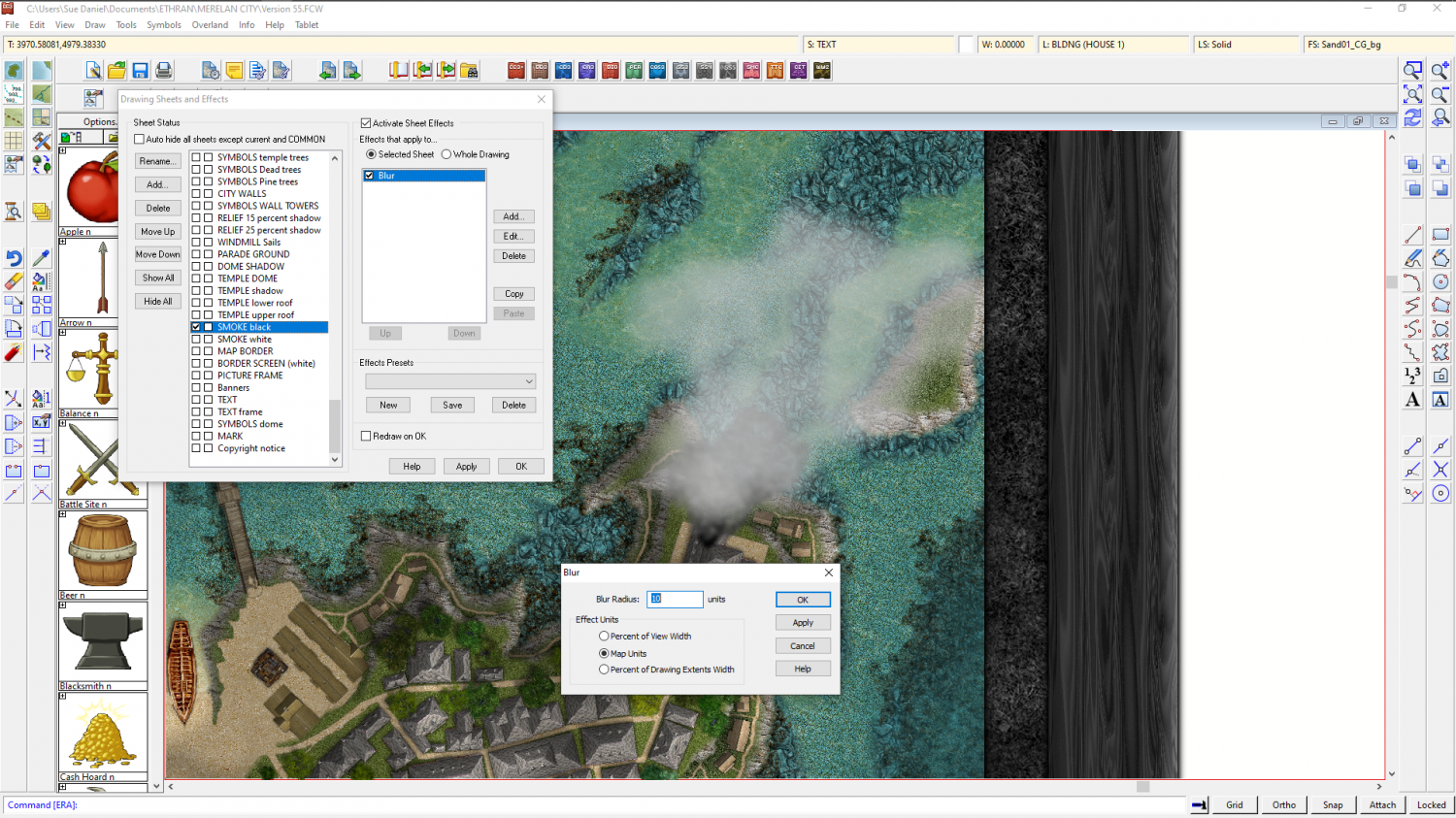
Cloud Cover
It's not generally done, but easy enough.
Add a CLOUD sheet above all but the TEXT sheets, and add a largish blur effect to it. Then either add circles of pale colours (not all white), and/or use the freehand drawing tool with a line width set above zero to scrawl on that sheet in similar off-white colours.
Here is the smoke from a chimney stack done using scribbles and a blur.


-
WIP Commission, Ancient Tombs
That's fair enough - about the towns fitting in a single hex. I would recommend using the smaller symbols though, so that they are clearer. For instance call a hamlet a village, a village a town, and a town a city. That way you never have to fit a whole actual city symbol in such a tiny hex. Squished up symbols look bad.

