


mike robel
mike robel
About
- Username
- mike robel
- Joined
- Visits
- 4,196
- Last Active
- Roles
- Member
- Points
- 435
- Rank
- Surveyor
- Badges
- 6
Latest Images


Reactions
-
1876 Centennial Campaign Map
This is a fairly simple map that shows the movements of the three US Army Columns and the Sioux Village movement from April 1876 - June 26. Obviously, I am only showing the rivers. I will be adding a legend and the north arrow.
There were three columns involved. The Gibbon/Montana Column (Light Blue) leaving from Montana and moving East. The Crook Column (Orange) moving North out of Wyoming, fighting a battle on 17 June, then giving up the field and going back to Wyoming until July. The Terry Column (Black), with Custer commanding the 7th Cavalry (Yellow) moving West from Dakota and Reno's reconnaissance with one 6 Companies of the 7th (Green).
Reno was about 50 miles from the Battle of the Rosebud (the lower 3 black dots) on the 17th, having discovered the Sioux Trail and then turning back due to lack of supplies. He disobeyed orders, but had he not done so, they would not have known where the Indians were.
Terry moved West along the Yellowstone with Gibbon's column aiming to move up at least as far as the Big Horn/Little Bighorn river junction while Custer was supposed to move North along the Little Bighorn, hoping to pin the Sioux between the two forces.
Custer then took the whole Regiment moved down the Rosebud until he picked up the Sioux trail, then disobeyed his orders to attack the Sioux village. Had he followed orders, he would most likely have come across the Rosebud battlefield, but they likely would have lost the Indians again.
The map is very busy. What I am going to do next is show where units are on specific dates so one can see the progress of the various groups on a day by day display so I can display the maps in PowerPoint to show the progress of campaign.
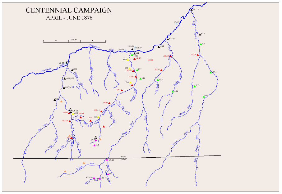
I am not likely to try and put any indications of terrain into the map because I think it will be too busy and I have been without success in trying to do maps with the hashmarks they used at the time to indicate hills..


-
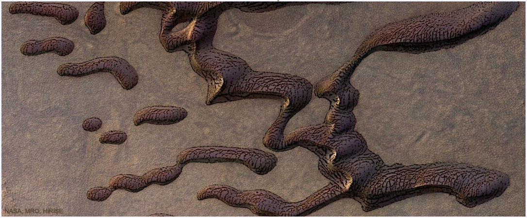
Martian sand dunes
-
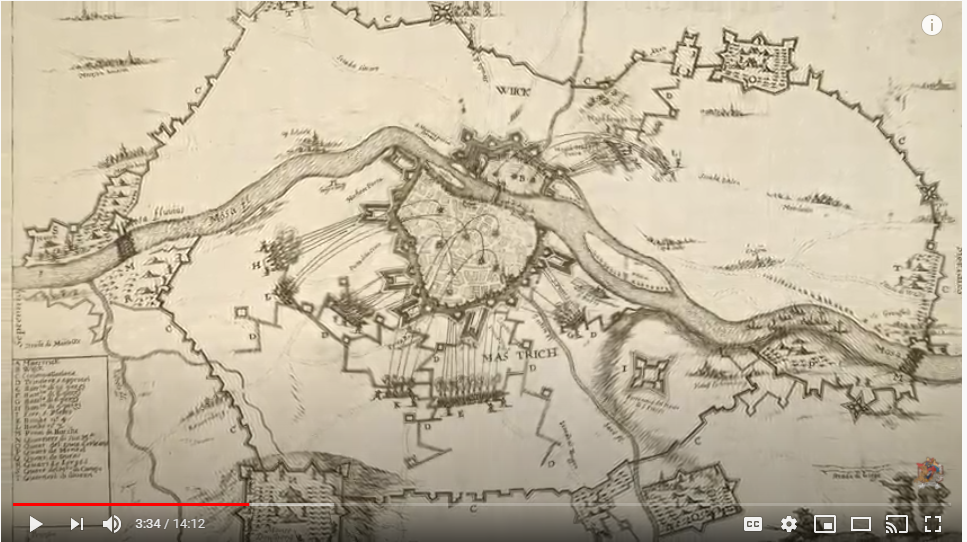
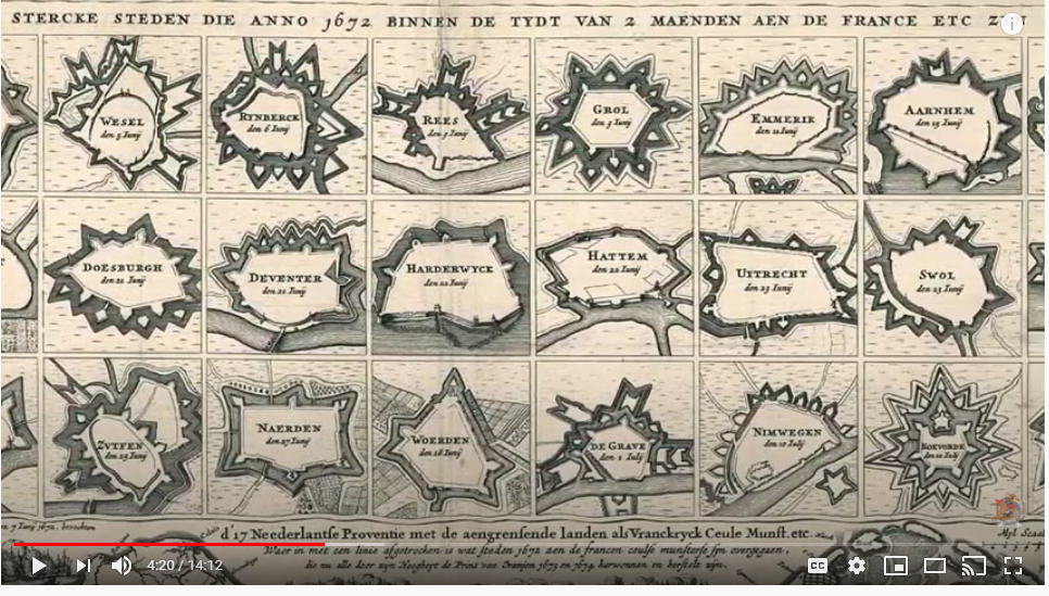
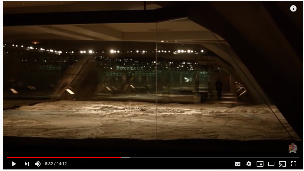
The "Real" Wargame Youtube video
The video at the link has some nice maps and scale models relating to siege warfare. The models, for the most part appear to be period, but some have many figures on them which may result from later updates of the map. The documentary is largely in french, but there are lots of pretty pictures to look at and one can marvel at the craftsmanship of the artificers who created these models to assist in planning and executing the siege.
I think this is the museum website: http://www.museedesplansreliefs.culture.fr/
Some screenshots


![[Deleted User]](https://secure.gravatar.com/avatar/c75d9a245b74d9c59be0999ea81ca541/?default=https%3A%2F%2Fvanillicon.com%2F92add7f8c954488718110edc4896ad39_200.png&rating=g&size=200)


-
Gettysburg
I just finished with all 41 contour levels, ranging from 360 feet to 1180 feet at 20 foot intervals. I like the way this looks, but the contour shades are probably too subtle for me, so I may outline the levels in some brown shade to enable people to see them when printed out. When printed, it will be on a 4 x 4 grid of 11 x 17 (or 12 x 18 or 13 x 19) inch paper with 7/8 inch hexes represent about 300 meters using 5/8 inch counters.
The close up shows the area around the Little and Big Round Top, for those who don't care, where the 20th Maine Regiment stopped the Confederate Army's attack on the Union left, but a lesser known battle on the Union Right went on through the night.
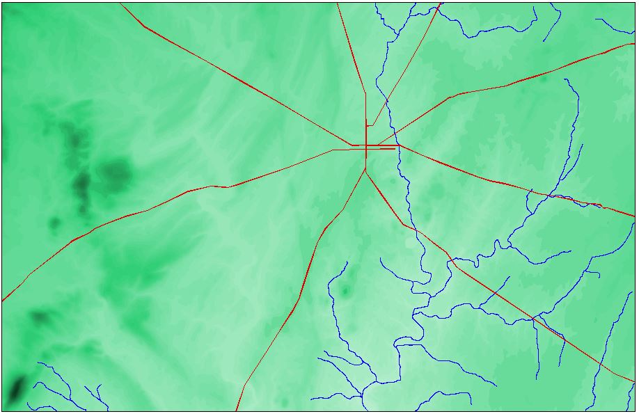
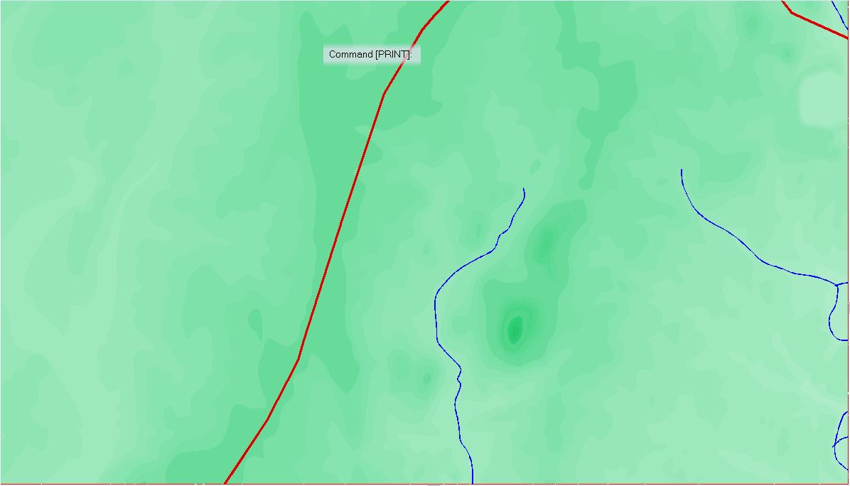
Rivers and Lakes are next. Followed by Roads.
Thanks to @WeathermanSweden for the custom Palettes (again!)


-
Gettysburg
I am in a pause of sorts on my Covering Force Game plus Andre made some awesome palettes of 32 and 48 brown/green colors as well as two that start brown and transition to green or start green and transition to brown that I am itching to try.
After Covering Force will be a game based on Hammer's Slammers (If I ever finish CF. While I was hoping for a (2020) Christmas release, I will now just say a Christmas release and you all can guess which one, if you care to.) and I want to set it in places of historical interest (even though it occurs in the 23rd or 24th Century on different planets). One will be at the Little Bighorn and I decide another would be Gettysburg.
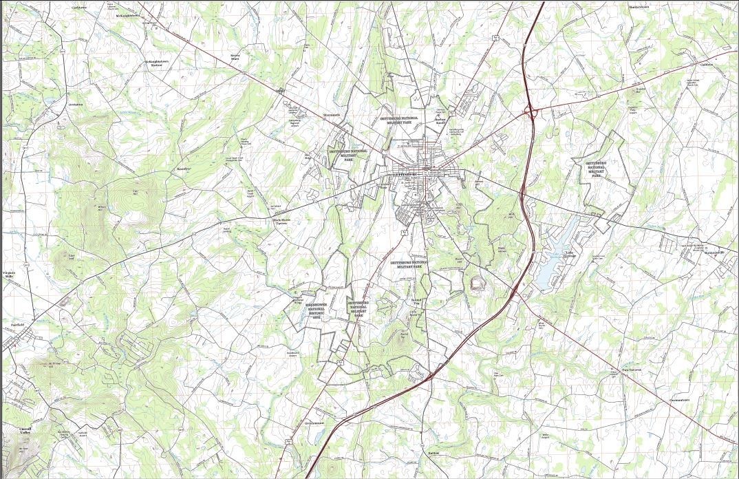
This is a much smaller map, only 2 1:24000 map sheets versus the 12 or so for the Little Bighorn (cause I cover the approaches) or the 9 or so 1:50000 sheets for Covering Force.
The challenge here is the 20 foot contour interval (which is why I needed the large green/brown palettes), my hand-eye coordination, and my color blindness which makes distinguishing fine color graduations difficult. Some of the contours are extremely close together. Unlike German maps, the US maps of the area do not have spot elevations and they follow the normal practice of only listing the height every fifth contour, so following intermediate contours off the map is very challenging. Therefore, instead of building the map from lower to higher, I am going the the other way, which is slower.
Anyway, here is the untouched Gettysburg map (made in 2016). They map is going to be 44 inches x 64 inches in size (yes, I size the map to the physical map I wish to produce), so there is a lack of detail. The grid squares are 1000m on each side.
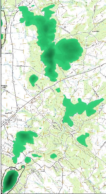
And this is the map thus far. I started at the 1160 elevation on the left, then worked down to 700. Before I move to far to the 600 level, I want to complete the contours on the left side of the map, which is the next step. The Black line marks the boundary of the 700 line and I need to finish filling in to the left side of the map and the bottom left hill.

Next shows a little closer view of the left side of the map. I really like the color interplay, but it is probably too fine for easy wargaming. It may be just too bad. Hahahaha.
and then close ups of the interesting terrain features thus far.


