


Wyvern
Wyvern
About
- Username
- Wyvern
- Joined
- Visits
- 3,266
- Last Active
- Roles
- Member
- Points
- 5,585
- Rank
- Cartographer
- Badges
- 24
Latest Images


-
Best Map Style(s) for Creating a Set of Maps from Large Scale, to Medium, and then Small
I've been enjoying mapping with the earlier CC2 Pro style of options recently (cities need something like the CD3 Vector Shaded option instead, as there isn't a CC2 version for those), and they also provide a near-Schleyian-huge range of vector symbol options, from continental overland right down to dungeon scales. The vector styles are also easier to create additional symbols with, should you need to, as they are straightforward drawings in the main, with a simple colour scheme.

-
[WIP] Community Atlas: Snakeden Swamp, Lizard Isle, Alarius - Dedicated to JimP
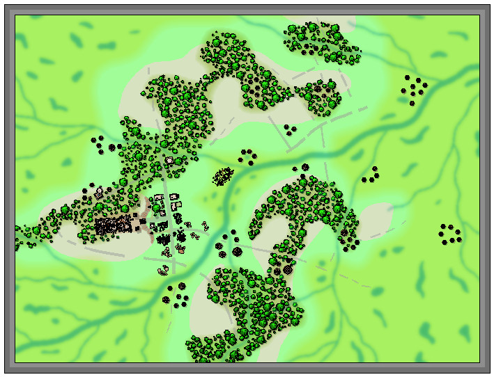
Here we see the first segment of "new" ruins being added, around the originating dice-map segment in the lower centre-left:
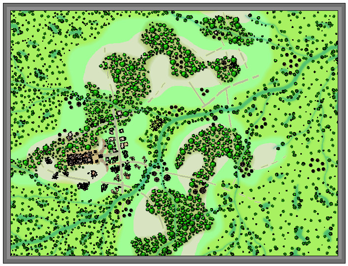
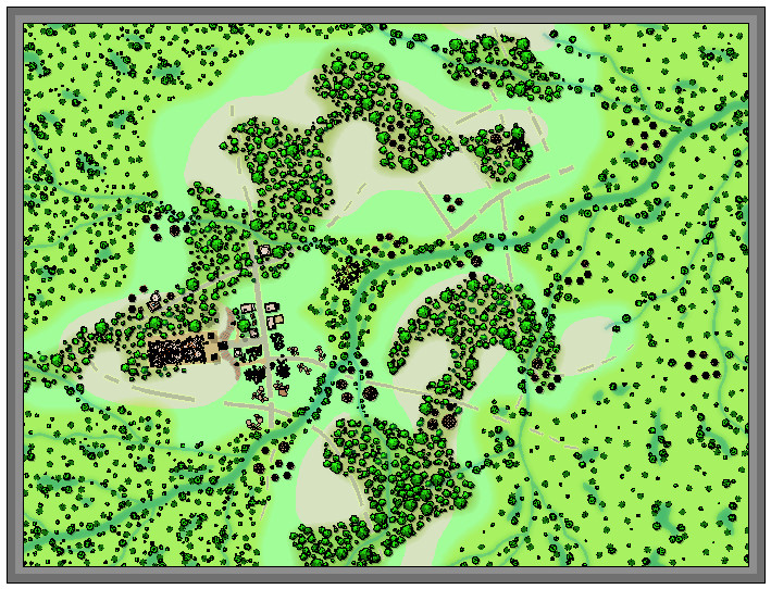
It was at about this point I realised it was growing harder to define the road lines, and where the hill contours were, a problem that worsened when the vegetation scatter began to be added around those previously clearer areas. Thus a lengthy spell of experimentation, changing the effects and colouring involved, followed. That in turn needed more features adding elsewhere, using the central section adjoining that already completed, just to make sure everything still worked OK. The results of all that:
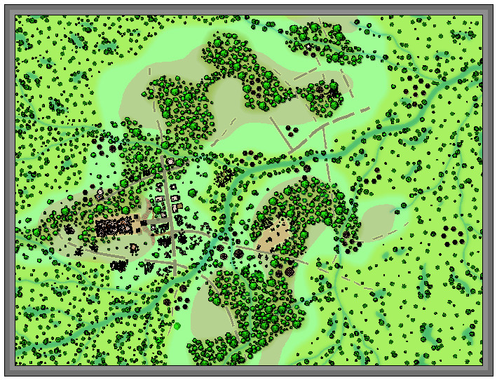
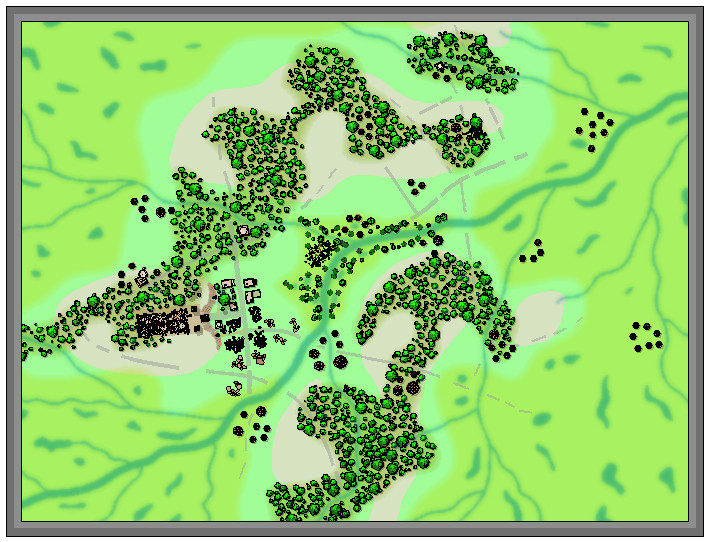
Which only brought up a further issue, as it's obvious that the reduced-resolution images are all looking rather too dark and messy now, especially over those ruined structures. So more experimentation followed with higher-res images and some antialiasing, to get to this degree of clarity (same image as above):
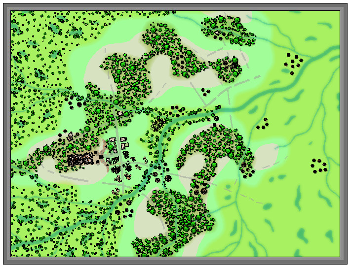
Following all of which, there wasn't much time to do more than a few further additions ahead of today's postings, which is where things are currently:
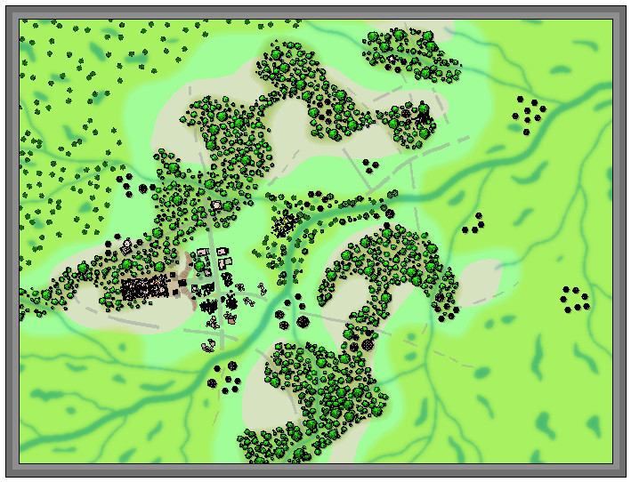
Not too far from completion now, at least, albeit still with the labelling to begin, not to mention those extra streams!


-
[WIP] Community Atlas: Snakeden Swamp, Lizard Isle, Alarius - Dedicated to JimP
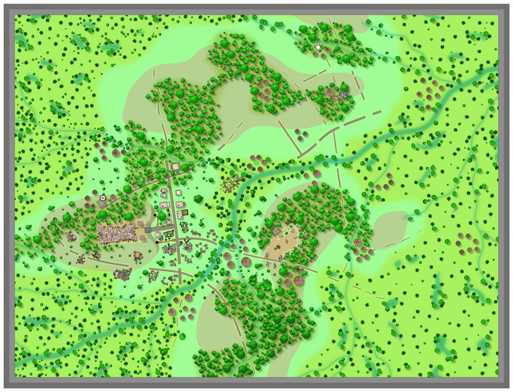
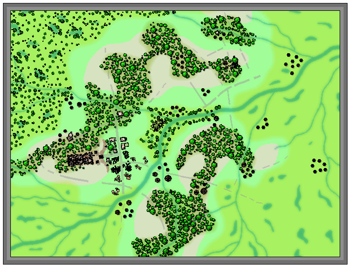
Clearly, something was needed to add further character to the swamps, and the first thing was slotting-in some lakes, ponds and smaller watercourses:
The new river lines were all kept deliberately the same size, and perhaps a little wider than necessary, to try to ensure they'd still be sufficiently visible after adding the vegetation. That latter was to be a mixture of mostly lower (lesser shadow), smaller, patches of greenery, including little-shadowed palm tree symbols to represent stands of swamp reeds, with a scatter of taller, = longer-shadowed, trees. This next shot shows the opening trial of this in the central hollow, although the sharp-eyed may also spot a couple of fresh structures have appeared in the northeastern woods as well, as I'd missed a couple of still-standing places there earlier, hidden among the chaos of my hand-scrawled base map:
Another two screenshots help indicate the general "vegetising" process over the top left swampy region, the first image with just the flattened-palm-tree "reeds", and the second with the remaining bushes and trees:
Two more images illustrate how the remaining regions were similarly filled-in, and how some vegetation scatter was added to the stream-lines linking between the edges of the swamps and woodlands:
I've left the swampland vegetation somewhat sparser on the right side of the map to give some space for possible other features to be added, as I hadn't firmly decided if some of the roads and tracks might be continued into it at this stage, or exactly what structures might be near those there already. Plus I also wanted to add some more stream lines at some stage later on (still haven't done those).
-
Is there a runic font?
So far as I can recall, there isn't a specifically runic font available for use in the Community Atlas list (which includes most of the PF-provided fonts and those from a standard Windows 10 installation), although that isn't fully up-to-date, as it doesn't include fonts provided by ProFantasy in the Annuals from the last few years.
Your best option would be to find a suitable font online, either free or paid-for, depending on exactly what you need the font for, install it, and then use an exploded version of that if you're wanting to submit the map for the Atlas. The fact you can't edit it after exploding it is a disadvantage, although that really depends if it's meant to provide functional labelling (which someone else might wish to amend if they have access to the FCW file), or simply for decoration (such as in a map border frame).

-
What art programs do you use?
I've not used GIMP in a long while, so my thoughts on its later versions are likely biased by the problems others have had with it - some of which may be down to user error, of course!
I'd only used MS Publisher (and a few earlier similar programs) for creating maps, graphs and diagrams prior to CC, and I'm not sure many would think of those as really art programs as such 😁.


