


Monsen
Monsen
About
- Username
- Monsen
- Joined
- Visits
- 723
- Last Active
- Roles
- Administrator
- Points
- 9,029
- Birthday
- May 14, 1976
- Location
- Bergen, Norway
- Website
- https://atlas.monsen.cc
- Real Name
- Remy Monsen
- Rank
- Cartographer
- Badges
- 27
Latest Images


-
A small carpenter store
To set that off I can simply rotate the Grid and the image in opposite directions and will technically not fit anymore
True, but designing things around a grid in the first place tends to have some artificial implementations, like all the corridors being exactly the same width, all rooms being a multiple of 5' (or whatever grid size is used) and so on. This often leads to features being oversized (Corridors in my home is not 5' foot wide for example, even allowing for wall widths). I enjoy the organic feelings of a building not designed to such artificial limits.
The way you did the angled corners for both the fence and the walls, and the nice angled placement of the big table and a lot of other stuff do go a long way to combat this look though.
But please don't let these comments distract from the map. It is a nice and well-made map, and for battlemap use, you often need to allow for some artificiality.
-
A small carpenter store
This is a very nice map.
I guess you are using it for a battle-map though? Personally, I am not too fond when everything lines up with the grid, but that is often a tradeoff when you make battle maps, since it makes things much clearer for combat purposes.

-
Community Atlas 1000th Map Competition - The Winners
The voting for the competition is now over. Thanks for voting for your favorites, and thanks to everyone who participated in the contest.
In total, 30 people voted for their favorite maps, and after tallying up the score, this is the result.
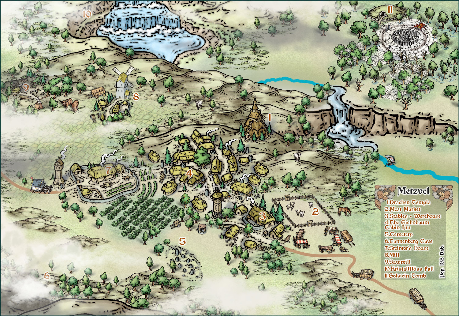
- 1st place ($75 voucher), with 121 points - @Ricko Hasche with Metzvel
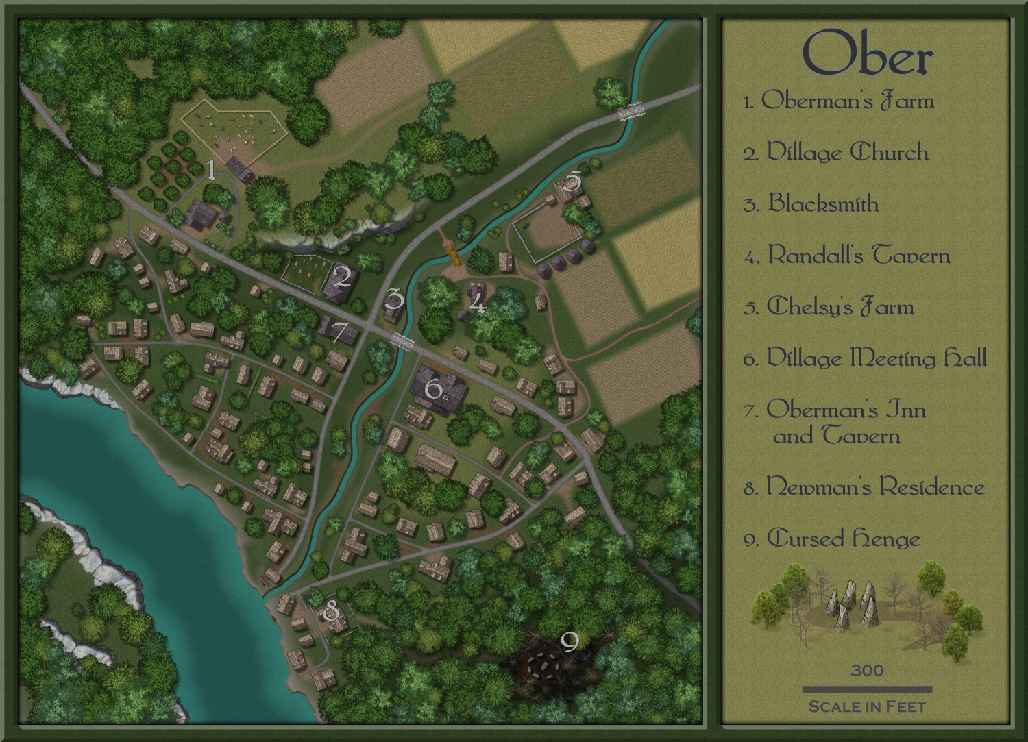
- 2nd place ($50 voucher), with 49 points - @Shessar with Ober
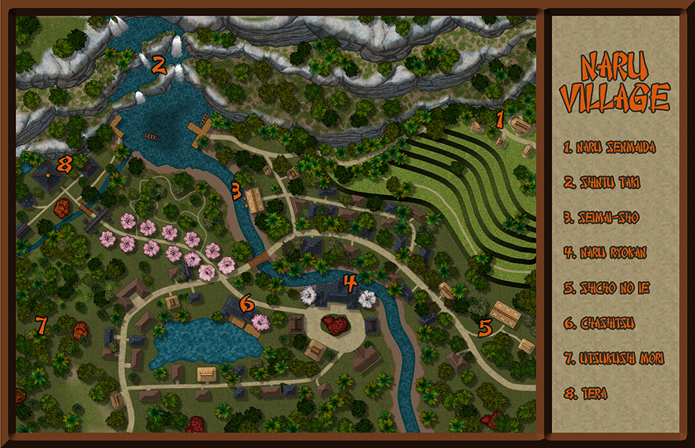
- 3rd place ($25 voucher), with 44 points - @Lorelei with Naru Village
Not far behind, Quenten and Mathieu Gans share 4th place with 35 points.
And of course, part of this competition was also about reaching 1000 maps in the atlas, a great milestone, and one of the maps submitted has been randomly drawn to receive the honor of being the official 1000th map in the atlas.
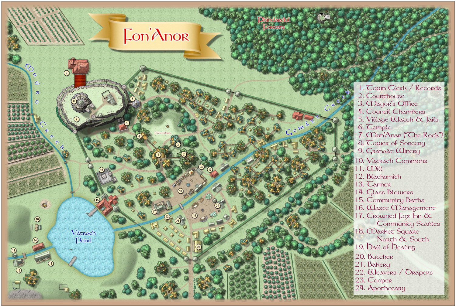
And that honor (and a $50 voucher) goes to @Royal Scribe with Fon'Anor
Thanks again to everyone who contributed. I loved every single map entered into the competition, but we had to declare some winners. But even if you scored dead last, I noticed that every single mapper did end up with several votes, so every single one of you had at least one map that multiple people thought should be in the top three. If anyone wants to see the exact votes, they can go back to the voting topic and check them out.
I'll get the vouchers out in a couple of days, and also hopefully start integrating the maps into the atlas as well, but that will take a little while. I may also need to have you fix things if there are any problems, like invalid bitmaps and such.


 and 7 others.
 -
Community Atlas 1000th map Competition - Please Vote (Even if you didn't participate yourself)
1. Ricko Hasche - Metzvel
2. Royal Scribe - Fon'Anor
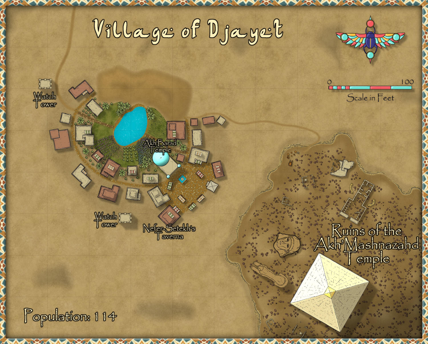
3. Royal Scribe - Village of Djayet
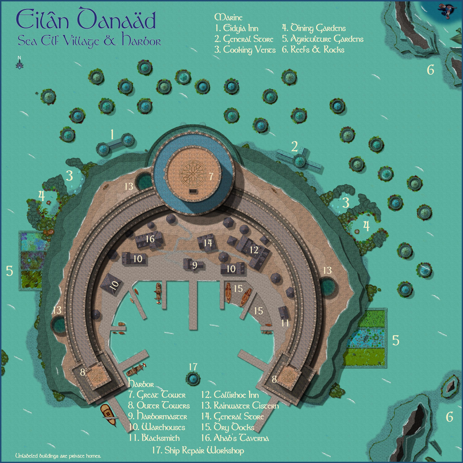
4. Royal Scribe - Eilân Danaäd
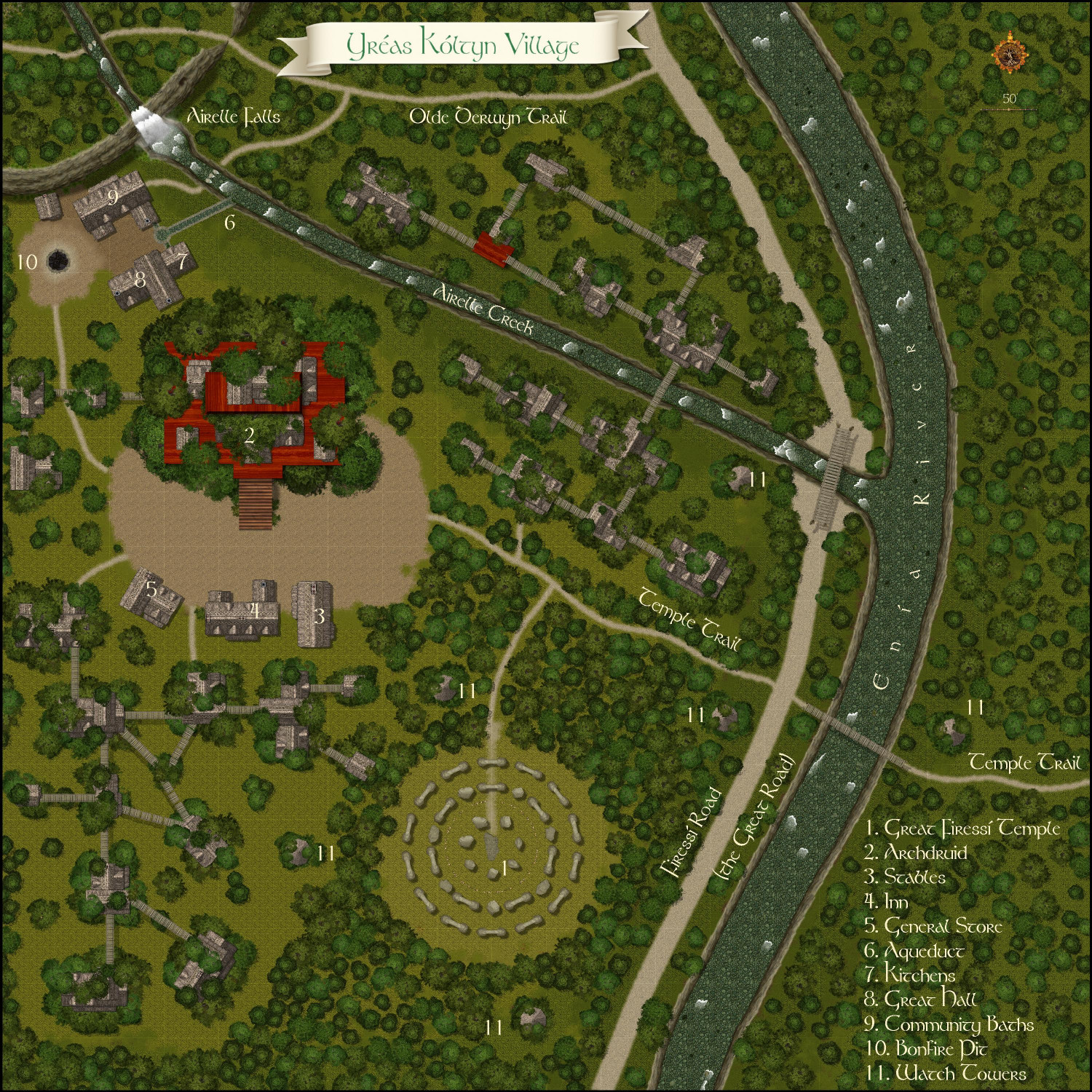
5. Royal Scribe - Yréas Kóltyn Village
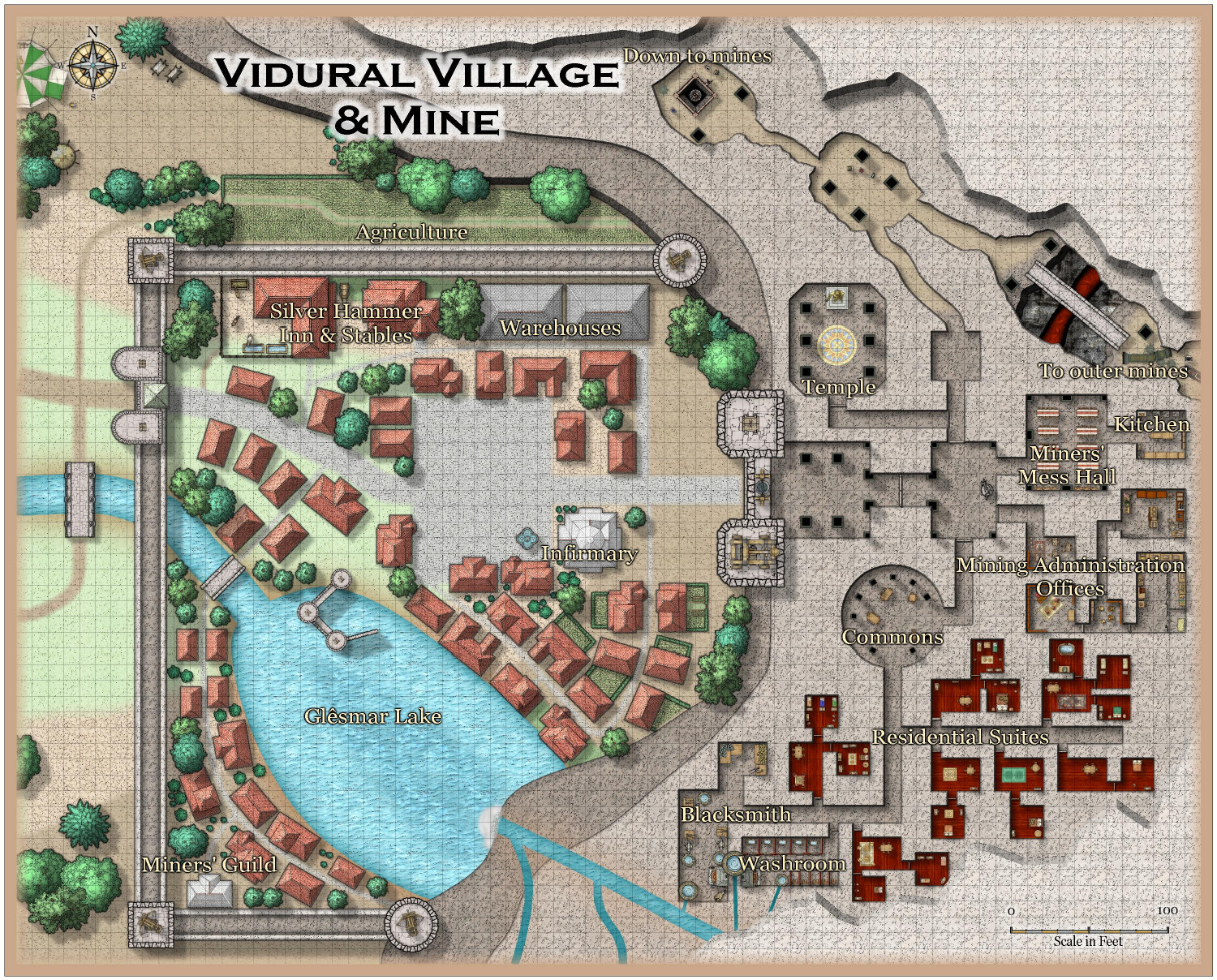
6. Royal Scribe - Vidural Village & Mines
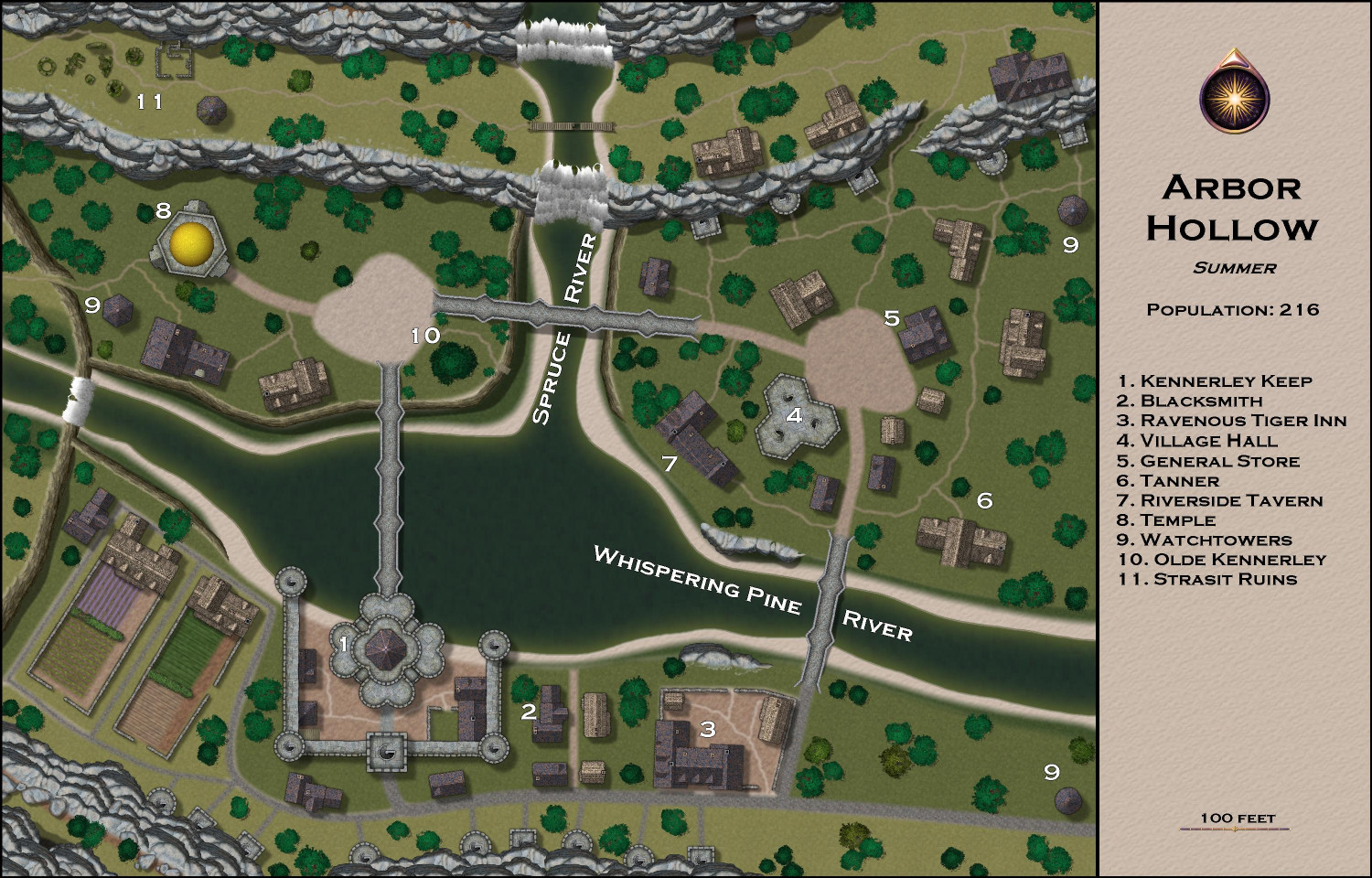
7. Royal Scribe - Arbor Hollow
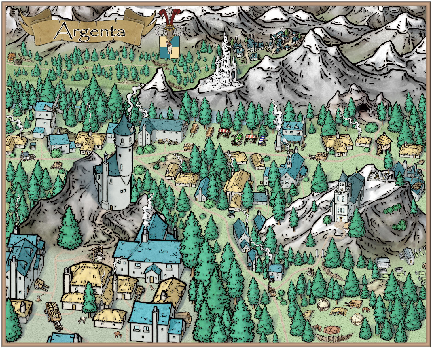
8. Mathieu Gans - Argenta
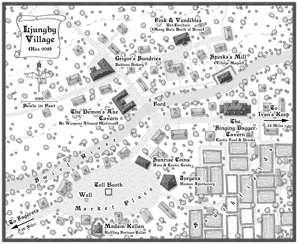
9. Wyvern - Ljungby Village
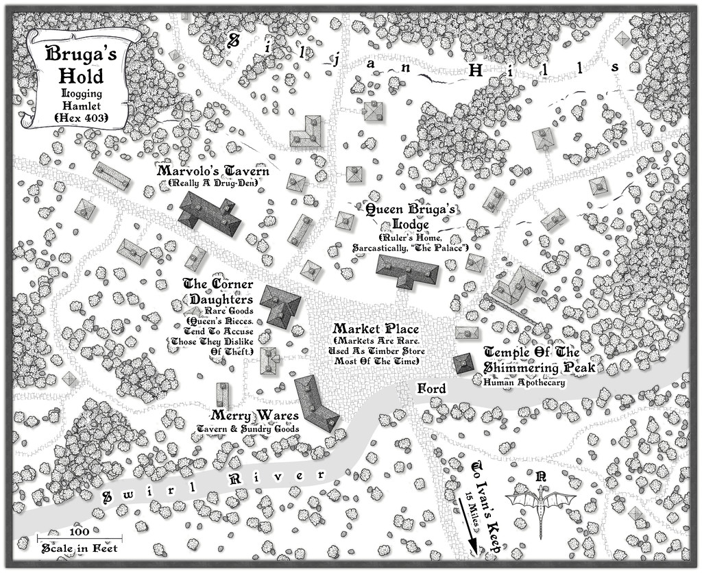
10. Wyvern - Bruga's Hold
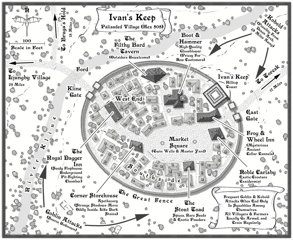
11. Wyvern - Ivan's Keep
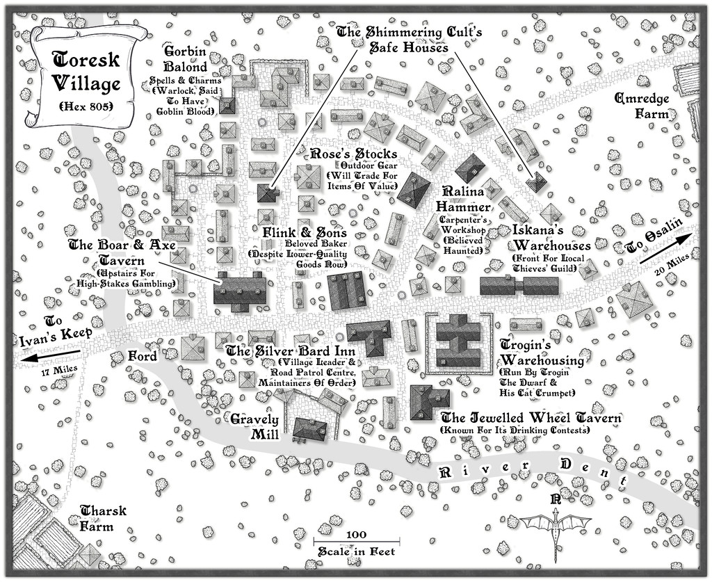
12. Wyvern - The Village of Toresk
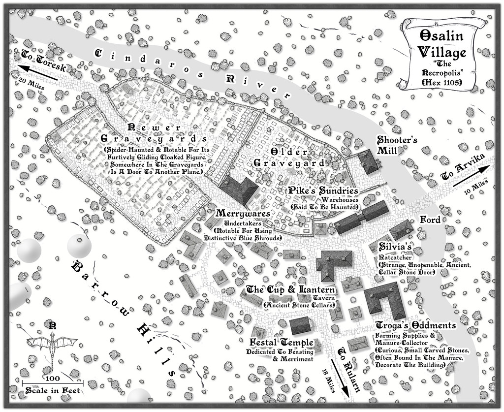
13. Wyvern - Osalin
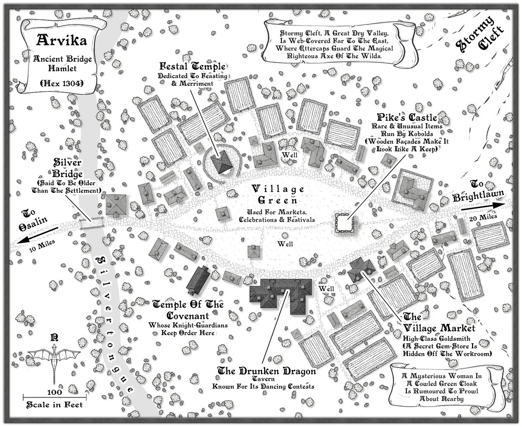
14. Wyvern - Arvika
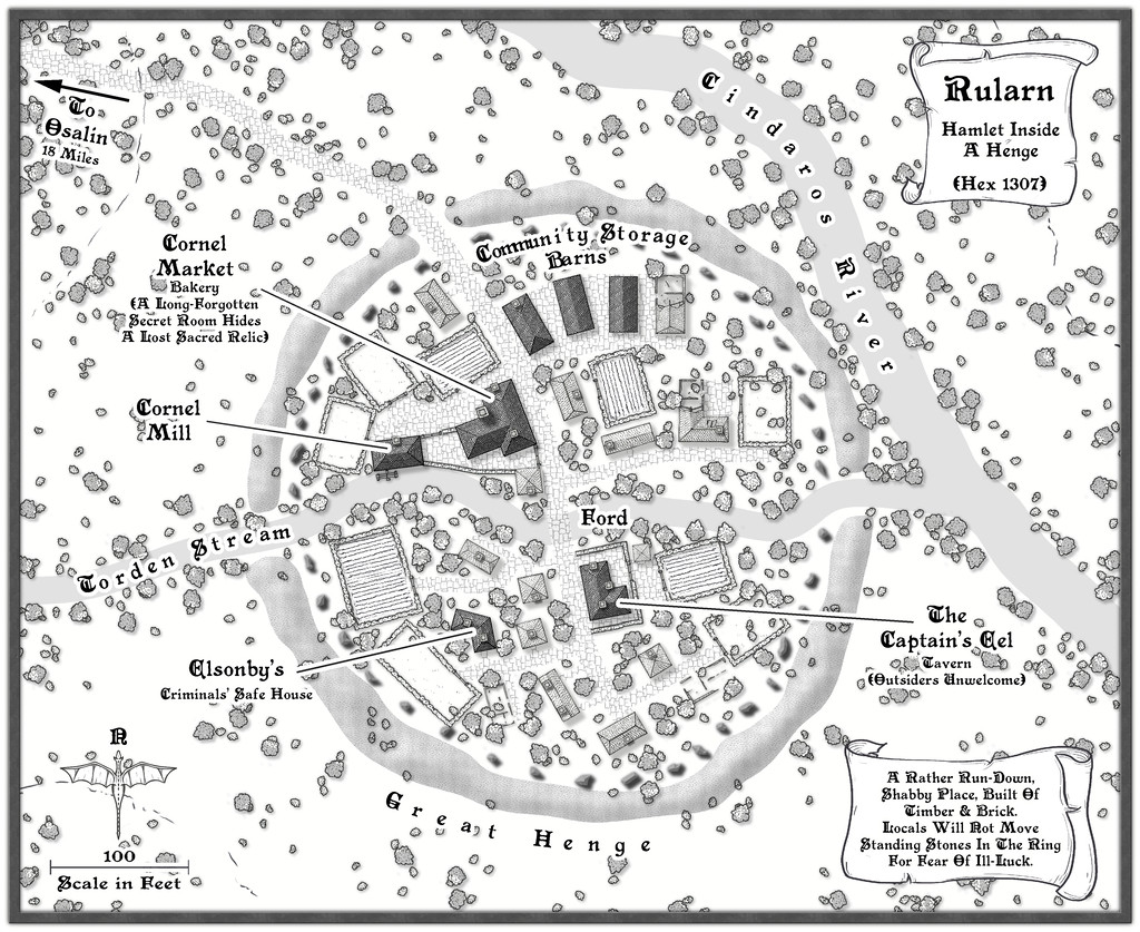
15. Wyvern - Rularn
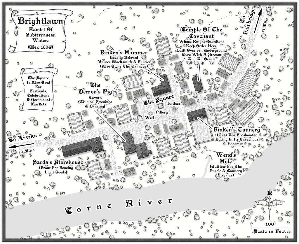
16. Wyvern - Brightlawn
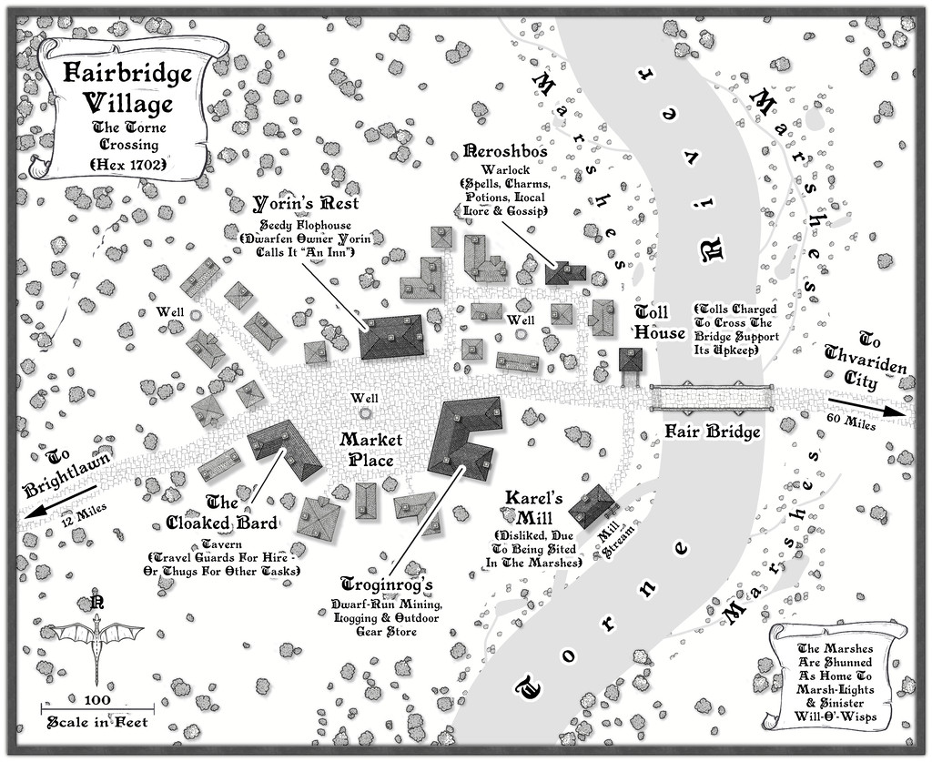
17. Wyvern - Fairbridge
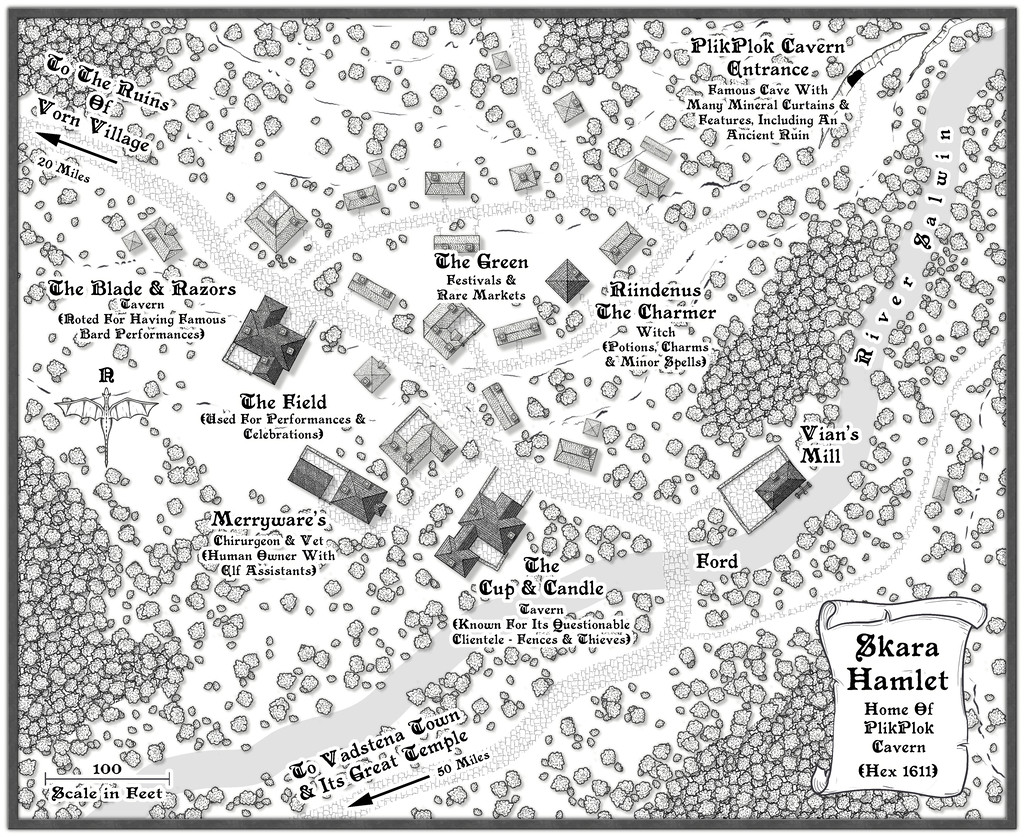
18. Wyvern - Skara
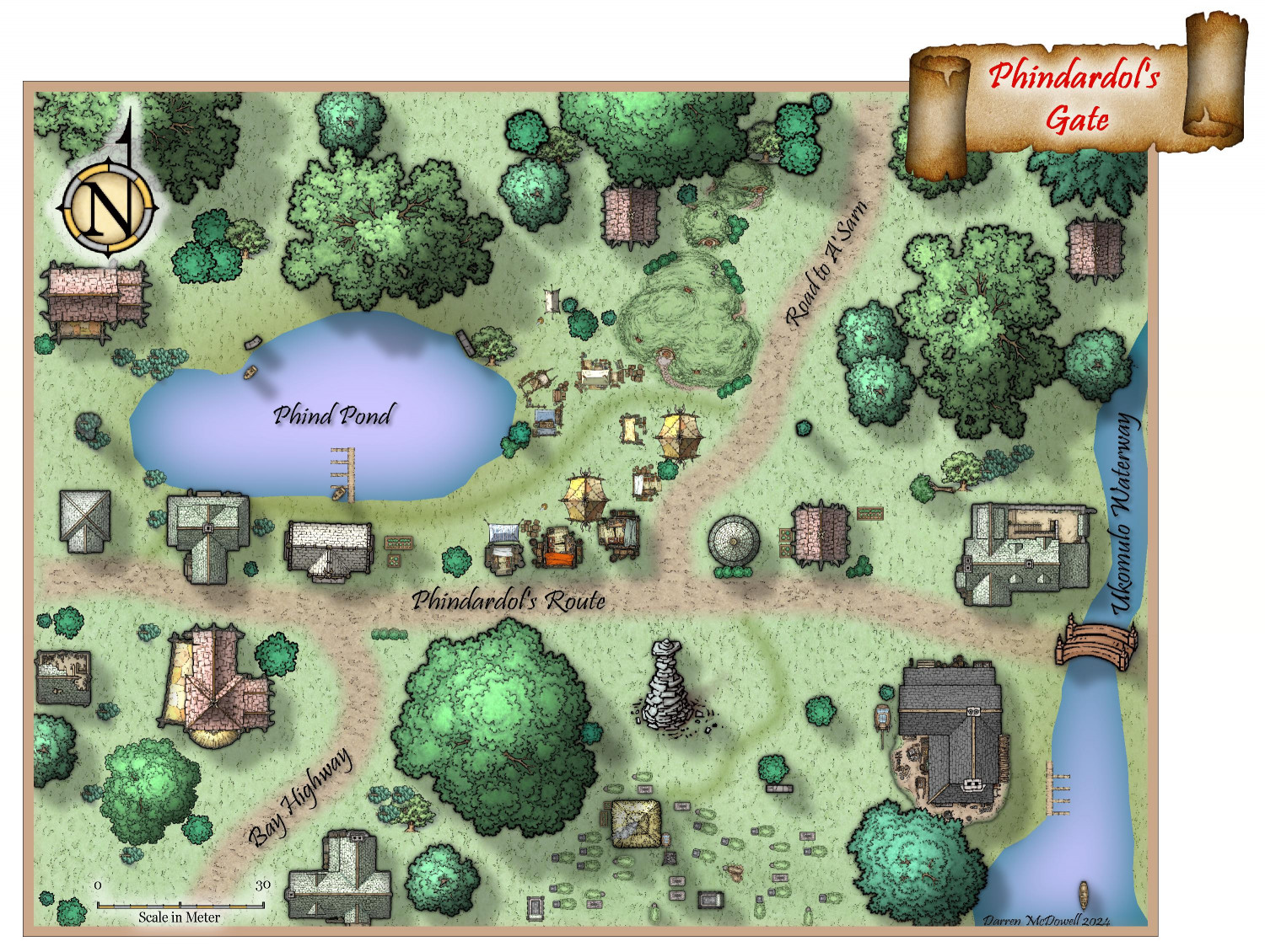
19. Quayuazue - Phindardol's Gate
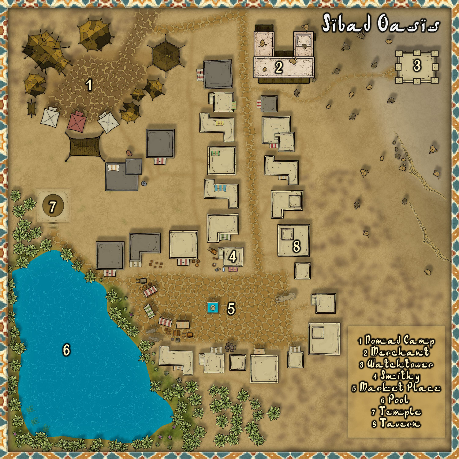
20. cyrion - Sibad Oasis
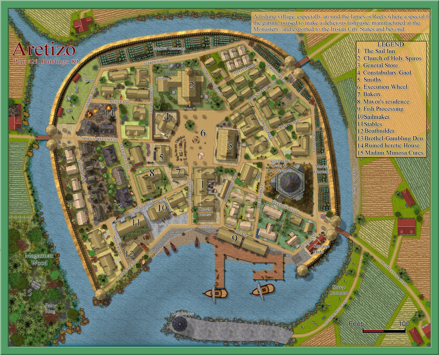
21. Quenten - Aretizo
22. Shessar - Ober
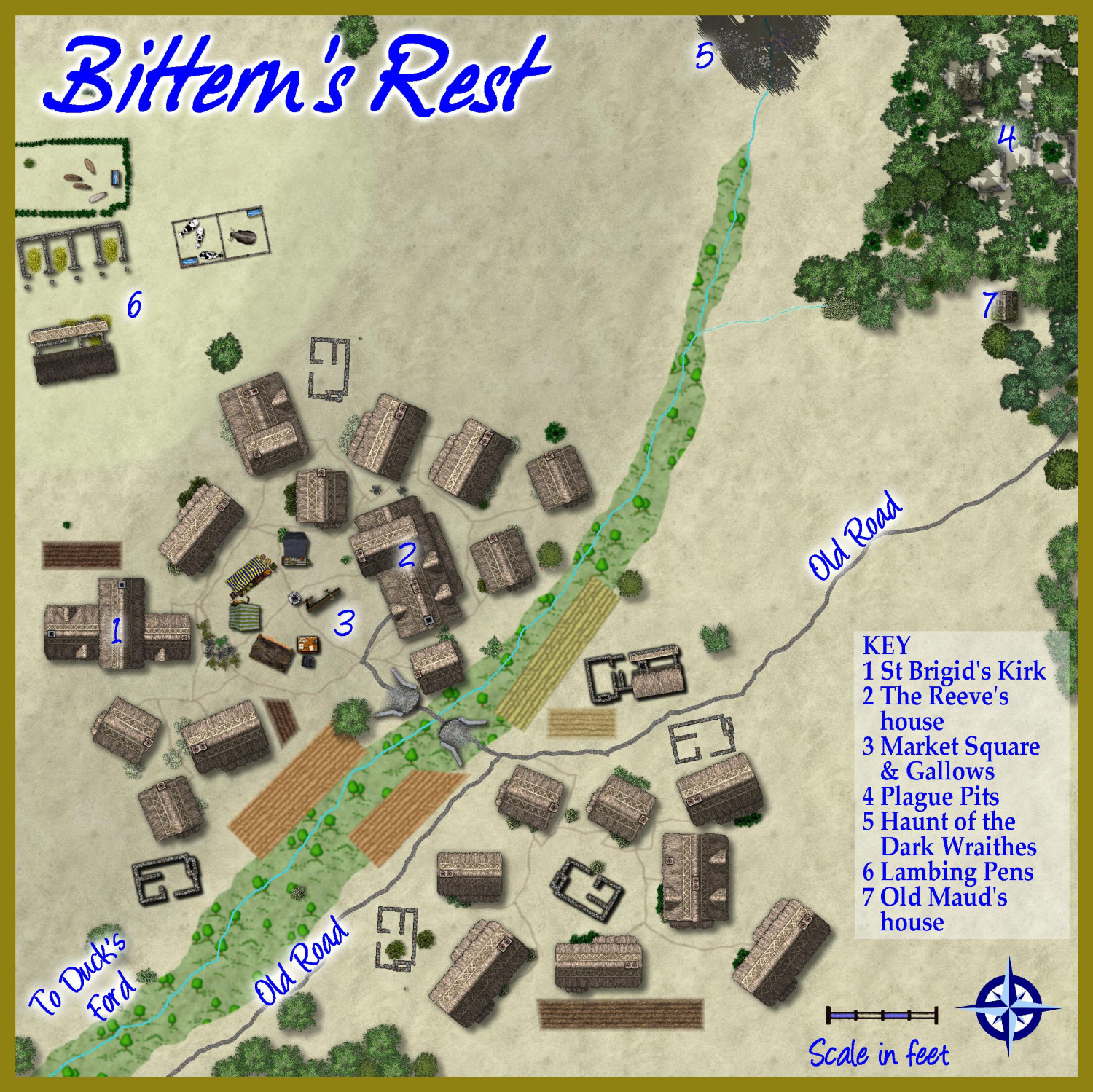
23. HelenAA - Bittern's Rest
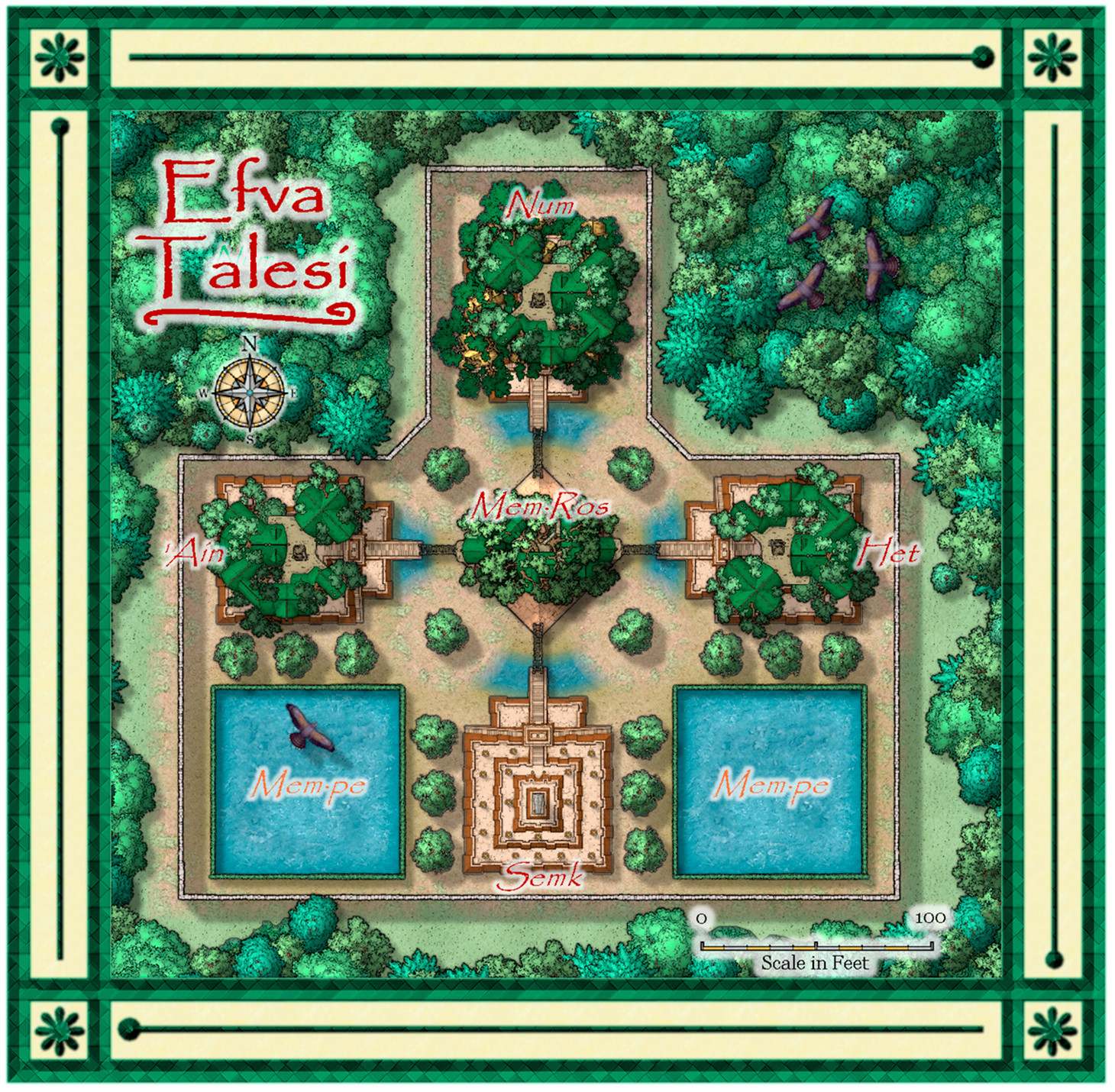
24. Daniel Pereda De Pablo - Efva Talesi
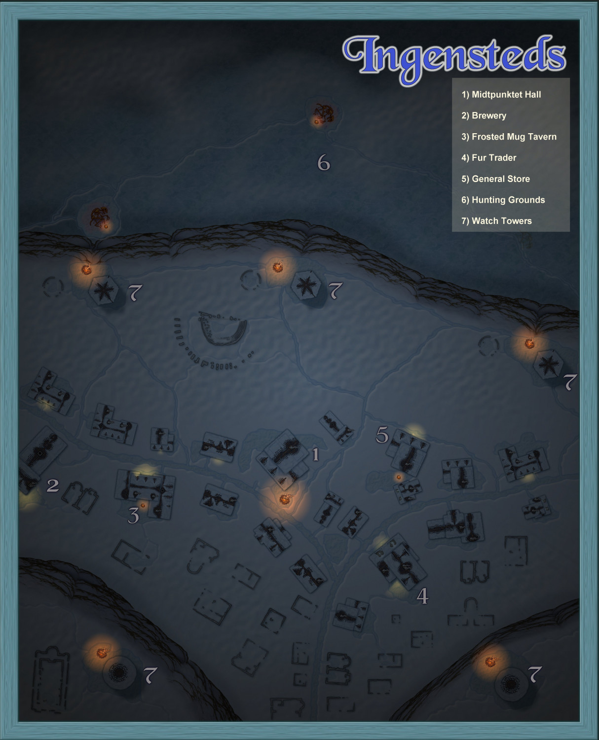
25. Jeff B - Ingensteds
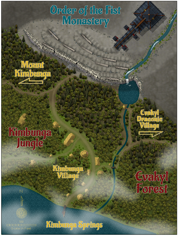
26. MakeWayForJebus - Order of the Fist Monastery
27. Lorelei - Naru Village
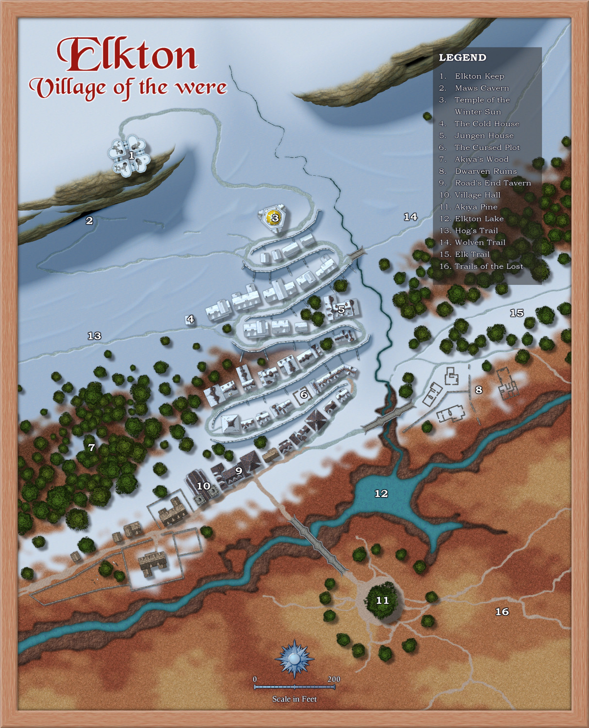
Loopysue - Elkton
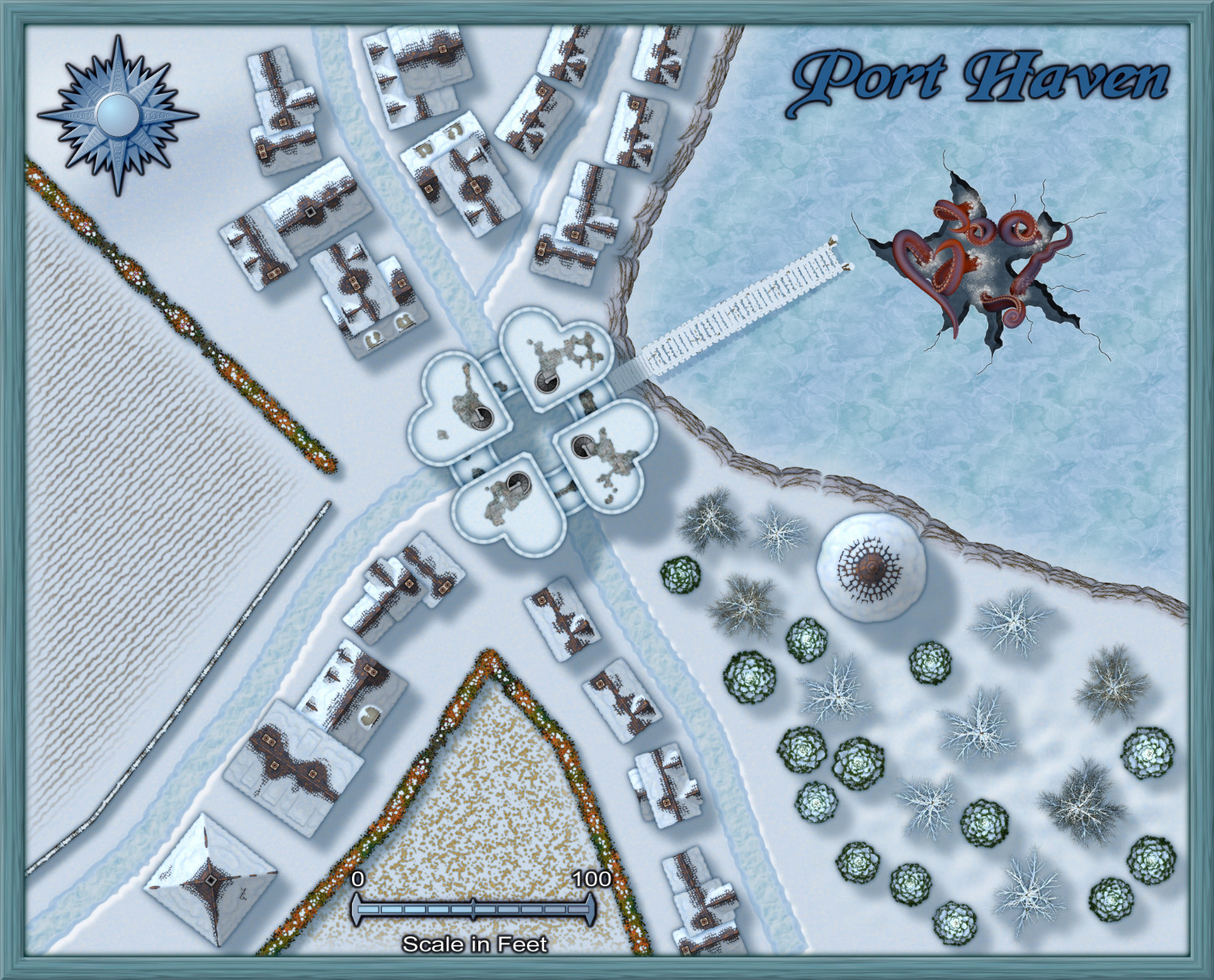
Monsen - Port Haven
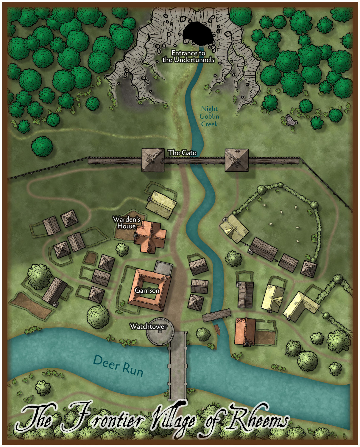
Ralf - The Frontier Village of Rheems

-
[WIP] Atlas Contest (potentially) - Arbor Hollow (summer, autumn, winter, spring)
Would it be possible to have four versions of the same map in the Atlas? My thought is that summer would be the default, but then the other three could be accessed from summer, the way you'd link to different floors of a multistory building).
Sure
It would be silly to have all four for the contest, but would it work to submit one for the contest (probably the default, summer) and then the other three for the Atlas?
Sure

