


Mythal82
Mythal82
About
- Username
- Mythal82
- Joined
- Visits
- 781
- Last Active
- Roles
- Member
- Points
- 366
- Rank
- Traveler
- Badges
- 3
Latest Images

Reactions
-
[WIP] Port City Map - Watabou to Ferraris Style
I’m tracing over the png - it takes a little time (the above was an evening’s work, off and on) but I didn’t really have another option since I wanted the layers of relief in the map (which means editing the block layouts to avoid houses going over cliffs, etc).
In terms of the methodology I’m following:
- Trace the water features
- Informed by the Watabou blocks (but not limited by them) decide on my contouring and insert the contours.
- Add farm land to the outskirts (I tried a little visual trick here where the highest elevation farms are all bigger than the handful of mid-elevation, just to emphasise the idea that the highest elevation is closer to the eye)
- Add other non-urban features. I made some edits to the terrain sheet edge fades, since for a map of this scale the defaults looked a bit too crisp for my liking.
- Duplicate the buildings layer, once for each district (I’m using my own districts, not the ones Watabou generated). Add a colorisation effect to each (different colour for each district) and edit the inner glow effects to match that district’s colour.
- Trace urban blocks, making adjustments for the contouring and what that means for cliff side roads, etc. Also Watabou sometimes places blocks over the edge of water, so trimming to avoid that.
- Once all urban blocks are traced, move blocks in bulk to the correct district sheet.
- Add final urban features - city walls, fortress, piers.
I’ll post updated WIPs in the thread, let you know how it goes ^_^


-
[WIP] Port City Map - Watabou to Ferraris Style
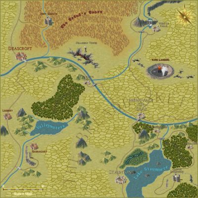
So my current project is taking a Watabou City Generator map of a port city metropolis, and adapting it to the Ferraris annual style. The challenge here's two-fold. First, I want to make a tiered city, with the sea-facing docks in the basin, the urban settlement mid-tier, and the farmsteads and suburbs at the highest level. Second, it needs to be a large, abstract city which can believably hold 35-40,000 people - so detailed-building city styles like the MS (which is my general go-to) are just too detailed.
This is the Watabou-generated 35,000-population port city I opted to use as a basis (14,000ft by 7,400ft):
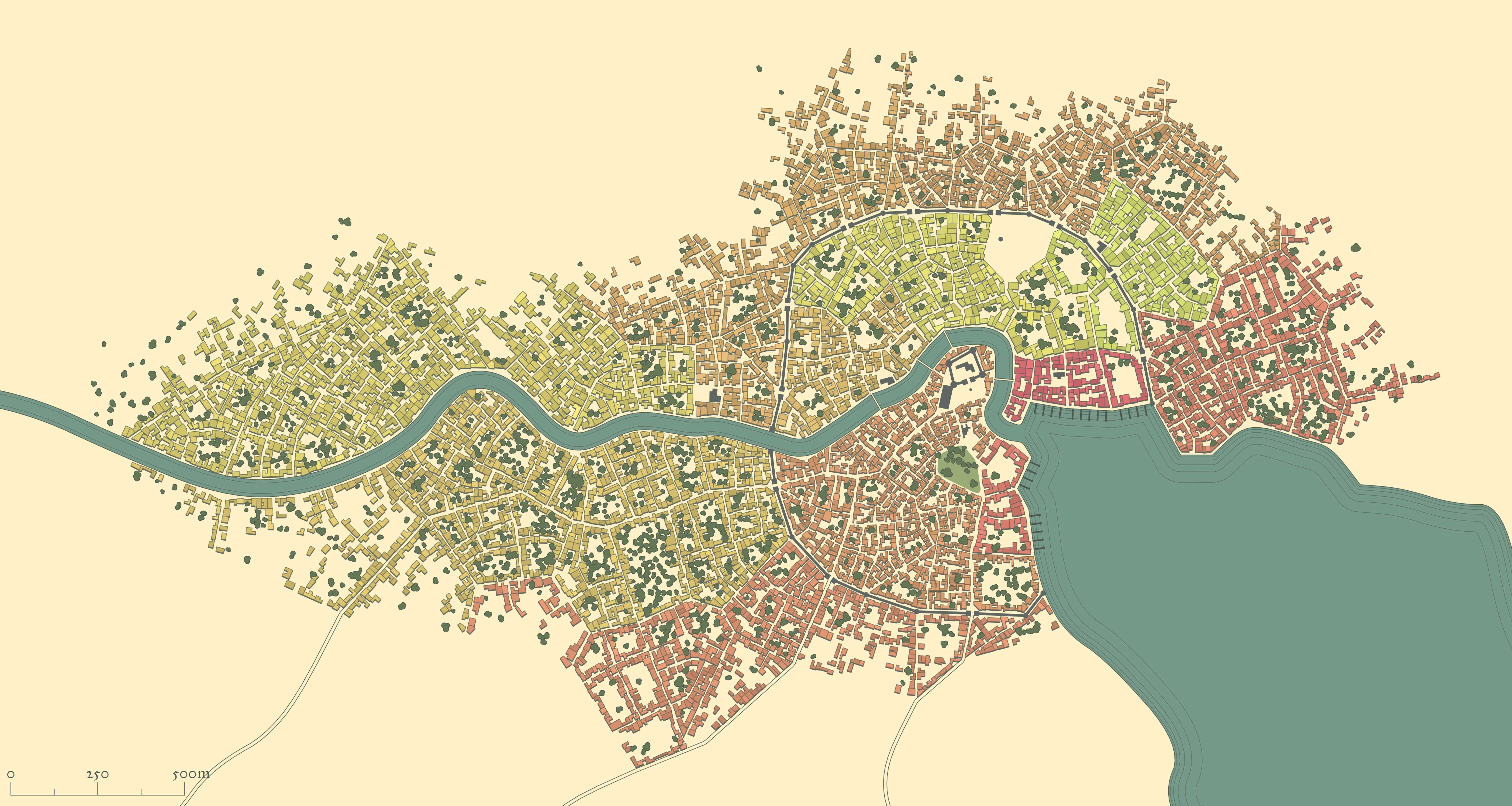
And here's what I've got so far as a WIP:
You'll notice a little splash of green in the middle - that was just proof-of-concept for using Colorize effects and layers for buildings to differentiate between the city's various districts - deep green for the riverside docks, light green for the farmsteads, red for the military district, etc.
All input gratefully received!


 and 4 others.
 -
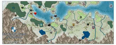
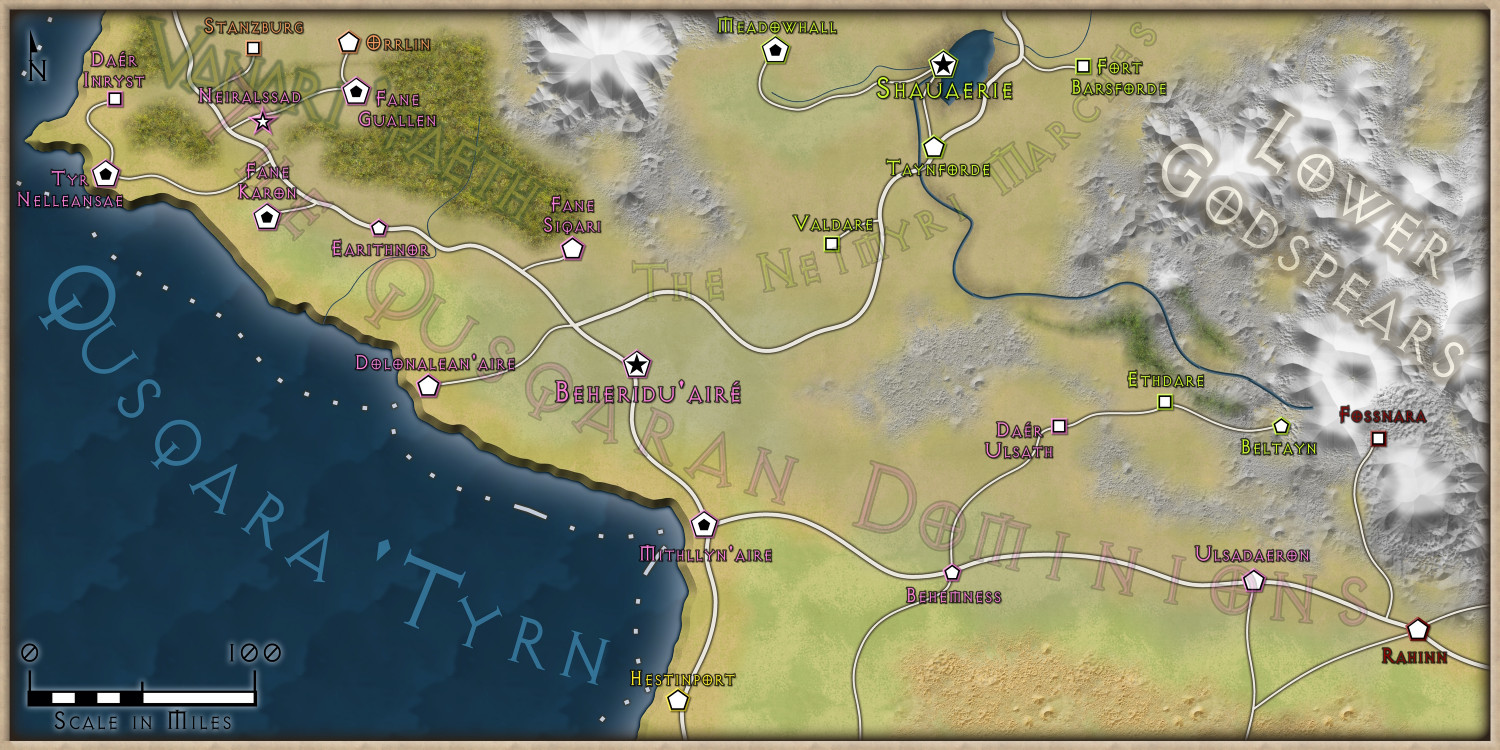
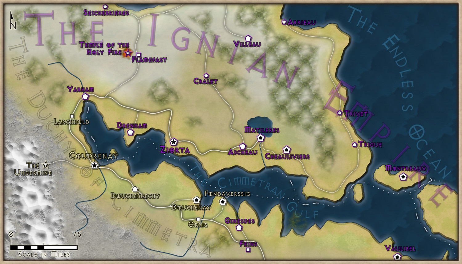
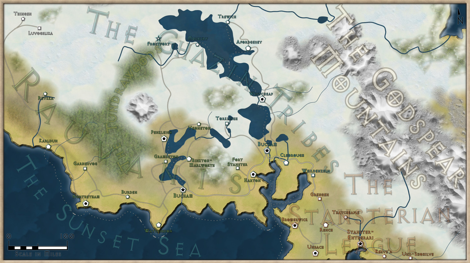
[WIP] Continent Map using CC3+ MS Overland and other resources
So, here's the finished set of maps. I couldn't really think of a better way to include the nation names than the transparent text, but I've tried to make it less intrusive - though it's still slightly 'busy' on the Stansterian League map. And the fractalisation definitely helped the overall look! Thanks so much for the advice, and feedback gratefully received


-
Annual 2023
I’d love to see a Steampunk Overland and Steampunk/Gnomish City in next year’s annual.
-
[WIP] Continent Map using CC3+ MS Overland and other resources
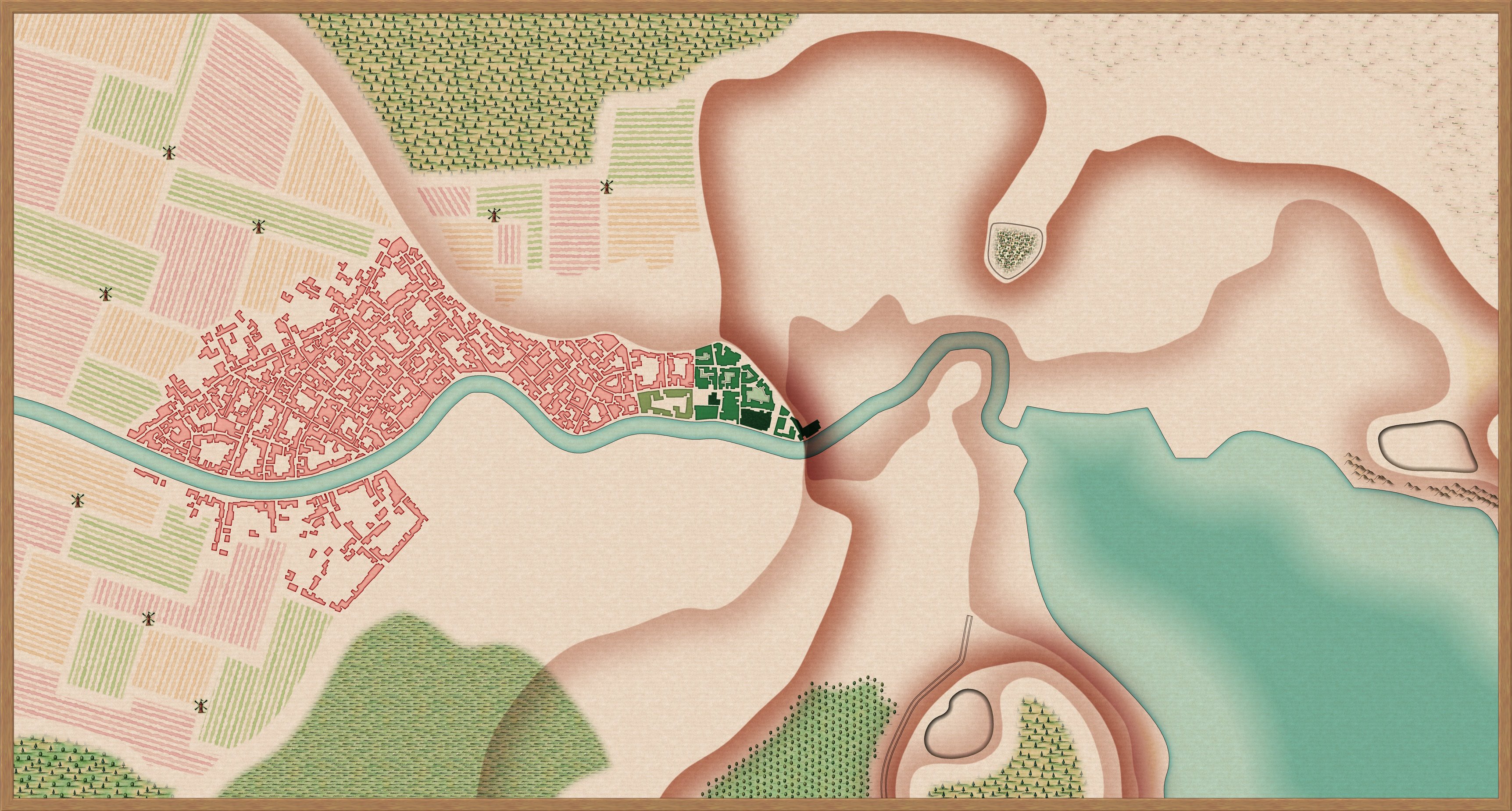
Tried something new for the cliffs - a few fractal lines with various blurs and drop shadows, and a blurred beach region to emphasise the difference in terrain. I think it looks a little more like a cliffside now?
![[Deleted User]](https://secure.gravatar.com/avatar/c75d9a245b74d9c59be0999ea81ca541/?default=https%3A%2F%2Fvanillicon.com%2F92add7f8c954488718110edc4896ad39_200.png&rating=g&size=200)

