


mike robel
mike robel
About
- Username
- mike robel
- Joined
- Visits
- 4,196
- Last Active
- Roles
- Member
- Points
- 435
- Rank
- Surveyor
- Badges
- 6
Latest Images


Reactions
-
Ok, weird question. Someone has asked me to buy one digital copy of one of my maps...
Well, you could call Kinkos and see how much they charge for the map.
I recently bought a custom map from mytopo.com of the Little Bighorn area that was about 4x5 feet with grid lines and elevation shadows for 29.95. Satellite photographs are more, around 100. A combination contour map was 79.95 and was nice to look at, but hard to read.
Incredibly to me, the. Company lets you download a full size PDF and save it so you can print it yourself. So does the national geologic service and their maps run 9-15 bucks.
For physical objects, there is an informal rule of thumb of three times the cost of materials
One has to think of the amount of time you put into it.
My daughter charges people by the square inch for paintings. 0.50 for her friends and 1.00 for others. Larger paintings can be more.
You can go to the wargame vault. They printout digital maps and you can see what they charge.
I find it difficult to price my games because volume is low and I am not well known.
Hope this helps.

-
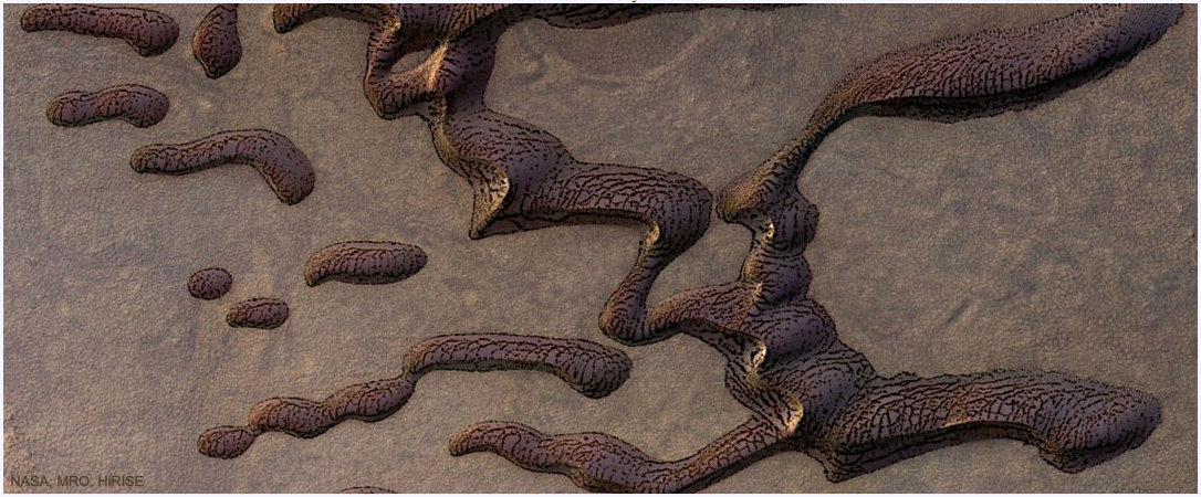
Martian sand dunes
-
WIP: BD-like - a process output extravaganza
@Lillhans Geeze. You are a genius. I have trouble enough just trying to duplicate topographical maps for wargames. It's a good thing contour lines are not straight or gentle curves, cause I can't draw straight lines without a ruler or graceful curves with a French curve, even assuming I don't slip. Exceptional and very artistic work.
I also wish I could punch Like, Awesome (a word which is overused today), and Insightful all in the same post.

-
isometric contours
I just use the smooth polygon tool to outline the contour and then fill it with green or brown shades with the contour line being the same color as the fill. To me, darker contour areas represent higher elevation. @Loopysue likes them the to represent lower elevations, but to me it looks like you are looking down a hole. This is a portion of the first map I ever made with CC3.
This is a desert region in California so the ground is brown while green indicates forest or orange groves in this case.


-
a large city, I have been putting off, now started
That's all really nice work Jim. As a lover of large maps, I really like it. I want to make topographic isomorphic maps, but my imagination just doesn't work in creating them. I also have thought about trying to make the large maps out of the individual map sheets, but I find the trapezoidal nature of grid "squares" and alignment of features to be a real bear, particularly when I have to 'cut' the map portion out of the full map sheet.
I keep lusting after a large format scanner, but I can't justify it and a laser cutter might be more effective for my work, but they cost too much for a hobby, too. Sigh.
-
Topographical map of the Ice bed of Antarctica
While there may be some way to get topographical data from those maps, I don't know where one would start or have any idea about how to do it..
That said, you apparently go to OpenMap.com/DE and get a bootable map that allows access to data. I'm away from my computer right now and will have to check the link and update it if I'm wrong.

-
Creating a Template to simulate the Khorvaire Map
@Loopysue I continue to be totally impressed by your skills and your most helpful assistance to budding cartographers!
Well Done!


-
Game Maps
While this isn't really a show and tell topic, I think it belongs here more than the other categories. This is a blog entry on Boardgamegeek.com in which the author talks about the game maps he likes along with some details. Perhaps it can serve for inspiration. Many different styles and a few look like they may have been done with CC.
enjoy

-
Topographical map of the Ice bed of Antarctica
Choppinlt: Apparently, you can download data from that site. I have no idea how. If so, perhaps it can be manipulated via Fractal Terrain 3, which went beyond my desire to master. I found it very frustrating, even when following the tutorials.
This thread https://forum.profantasy.com/discussion/9720/ft3-to-cc3-mapping-issues#latest has some details. In the end, I gave up on FT3 - it wasn't an expensive gamble for me - and decided to just use Brute Force and Ignorance to work my way through using CC3. BFI has its own reward.
-
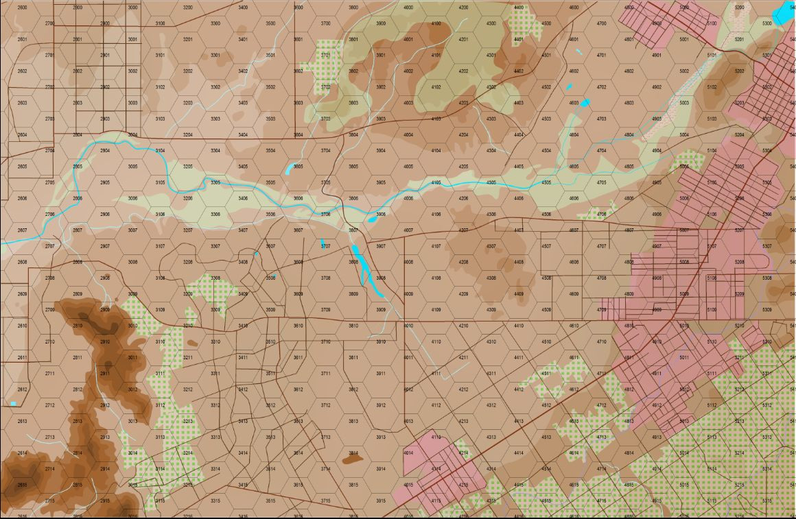
Here I go again ...
Photos of the map to date in its more operational environment, on the game table with some counters and dice for size relationships. The Hexes are 3km from side to side, about 4 cm, and the game pieces are 1/2in. Sorry for the mixed units.
I think the map looks better in the photos than it does on the monitor or even when I printed it out and looked at them sheet by sheet.
I tried to load the Bitmap FIlls from the WWII Area Maps to change the forest green to the deciduous and pine fills, but they came out much difference in appearance, so I I'm trying to figure out what I did wrong. They were just a blob with none of the texture. Nor have I enabled the contour levels with an outline. I am getting closer.

