mike robel
mike robel
About
- Username
- mike robel
- Joined
- Visits
- 4,136
- Last Active
- Roles
- Member
- Points
- 435
- Rank
- Surveyor
- Badges
- 6
Reactions
-
Here I go again ...
In case anyone is interested, and even if you are not, here are some shots of the US unit counters, their combat power values, and one of the status sheets player will use to keep track of their units. Note no values are on the counters to increase the fog of war, and you won't be able to tell how far gone the unit is from the counters during play.
Much is still in flux and development so there is not a 1:1 match between the three sheets. Units and values may vary. -
Here I go again ...
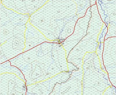
With Monsen's help and repeated strikes to the frontal armor of the brain case with ego-piercing discarding sabot, I selected a forest bitmap file that pleased me and also gives something of the same look and feel of the Google Earth view of the battle area. Of course with the transparent effect, the forest looks more brown than green which could be remadied by changing them to green, which would lead to other issues.
On the other hand, in the game, the battle occurs in August, so maybe brown is okay.
I have not highlighted the contour lines with an edge color yet. That will probably be the last thing I do.
I am still simplifying the road and water nets and I amy thin out the small copses some and I need to continue to refine the mobility index dots in the hex centers.
Still, I'm pleased. -
Troy Map for Game
-
Sinister Sewers - Style Development Thread (CA207)
-
Have any of you ever printed your maps?
I've not mounted them on the wall, but they can take up my wargaming table. This was a 4 sheet map (each sheet was 17 x 11 inches) and took up most of the space at 1:50,000 scale. Sometimes I have to use 2 tables to hold the map.
This next map covers the region my Regiment operated in Germany during the Cold War. It actually covers more than my map table can hold. It too is 1:50,000. Each hex = 3km.
https://forum.profantasy.com/discussion/9781/here-i-go-again#latest
-
CC4 Overland Development Thread
Thanks very much for the offer. I'll think about it when I do a new map. Mapping is currently at a stand still anyway.
Edit: I understand the drawing tools (if that is even the right thing to describe it) that allow one to backspace when a line goes astray are different from the polygon tools and since I use the polygon tools for contours, rivers, roads, and maybe some other things I just think of them as contour line tools. Obviously my contour lines using the drawing tool have perhaps hundreds of points and when I inevitably make a mistake my recourse is to delete it and start over. Obviously, it is very demoralizing.
It seems to me that being able when composing either a line or polygon, the backspacing capability without everyone having to make a "special" tool would be good for everybody. But I probably don't understand all details about doing so.
My hands as well as my eyes make it harder to draw with precision.
Thank you for your very kind author, I hit the save/send button before my thought was fully composed. Perhaps before I start with my next map, I will take you up on the offer to learn to compose that specialized catalog feature to draw my contour/polygon lines.
P.S. I had to buy a new computer and thus far I have not attempted to load CC3+, the annuals, or my work on the new computer.
-
CC4 Overland Development Thread
The main thing that occurs to me is to be able to use the backspace button (or something else) to back up if you have an issue with the drawing. Some of the programs (?) have this ability, but they are limited in the number of contours (usually 4 or 5) provided. I think you told me, but it could have been anyone on the forum, that this was relatively 'easy' to add, but I never figured it out, so when I had a mistake, I was forced to go back and redo the whole contour line.
Another useful thing would be to have all the symbols that are used by contour maps to be in a single symbol catalog. I tried a number of times to compose such a thing, but in the end, I just made a list of where to go for a particular symbol.
Several people gave me advice how to do the above, but I could never make it work.
On the other hand, things might have been much easier if I had a tablet with a pen instead of using a mouse. Very hard on the the thumb, especially when it was broken in bayonet drill. It still pains me 50 years or so later. :)
-
CC4 Overland Development Thread
-
Printing maps from PDF?
In my map making, which sometimes requires large maps, I have been known to use everything from 8.5 x 11 up to 13 x 19 inches, with and without overlapping. Sometimes I may do the map in several different sizes Hexes as a method to provide less clutter on the map with unit pieces. I also do something sort of weird with the Fit to Page or Scale Factor. Frequently, I make map hexes where 1 hex is 1 km along the verticle axis, the same as a 1:50,000 map sheet, but I have also done 1:100,000 maps, and occasionally 1:250,000 maps.
-
Napoleonic Battle Maps


